Directions to Padaria Bamp (Angra Dos Reis) with public transportation
The following transit lines have routes that pass near Padaria Bamp
 Bus: 230, T10, T11, T20, T21.
- Ferry: ANGRA DOS REIS - ILHA GRANDE, ANGRA DOS REIS - ILHA GRANDE.
How to get to Padaria Bamp by bus?
Click on the bus route to see step by step directions with maps, line arrival times and updated time schedules.
From Big Mix Distribuidora, Cunhambebe
25 minFrom Andorinha Lanches, Jacuecanga
61 minFrom Bracuí, Cunhambebe
77 minFrom Vila Da Petrobras, Jacuecanga
44 minFrom Monsuaba, Jacuecanga
56 minFrom Praia do Sol- Monsuaba, Jacuecanga
56 minFrom Ruínas do Engenho do Bracuhy, Cunhambebe
74 minFrom Pontal - Angra dos Reis, Cunhambebe
42 minFrom Condominio Praia do Engenho, Cunhambebe
61 minFrom Iate Clube Angra dos Reis, Cunhambebe
42 min
Bus stops near Padaria Bamp in Angra Dos Reis
Ferry station near Padaria Bamp in Angra Dos Reis
- Estação Santa Luzia (Angra Dos Reis) ⛴, 7 min walk,VIEW
Bus lines to Padaria Bamp in Angra Dos Reis
- C01, Centro (Circular),VIEW
- C01B, Circular (via Pestalozzi),VIEW
- C03, Marinas,VIEW
- C03B, Marinas (via Balneário),VIEW
- C05, Retiro,VIEW
- C05B, Retiro (via Balneário),VIEW
- T10, Divisa Mangaratiba,VIEW
- T11, Ponta Leste (via Jacuecanga),VIEW
- T20, Parque Mambucaba (via Praia Brava / Vila Histórica),VIEW
- T21, Frade,VIEW
- T21B, Praia Brava,VIEW
- T21C, Frade (via Itinga),VIEW
- 102, Caputera (via Jacuecanga),VIEW
- 103, Camorim,VIEW
- 104, Monsuaba,VIEW
- 106, Jacuecanga (via Balneário),VIEW
- B106, Jacuecanga (via Morro da Cruz),VIEW
- 202, Frade (via Sertãozinho / Beira Rio),VIEW
- 203, Serra D'Água,VIEW
- 204, Ariró,VIEW
What are the closest stations to Padaria Bamp?
The closest stations to Padaria Bamp are:
- Desembarque Centro / Largo Da Lapa is 12 meters away, 1 min walk.
- Ponto De Embarque 11 - Lapa is 66 meters away, 1 min walk.
- Ponto De Embarque 07 - Praça Do Porto is 194 meters away, 3 min walk.
- Ponto 01 - Santa Luzia is 417 meters away, 6 min walk.
- Estação Santa Luzia (Angra Dos Reis) ⛴ is 467 meters away, 7 min walk.
Which bus lines stop near Padaria Bamp?
These bus lines stop near Padaria Bamp: 230, T10, T11, T20, T21.
What’s the nearest bus station to Padaria Bamp in Angra Dos Reis?
The nearest bus stations to Padaria Bamp in Angra Dos Reis are Desembarque Centro / Largo Da Lapa and Ponto De Embarque 11 - Lapa. The closest one is a 1 min walk away.
What’s the nearest ferry station to Padaria Bamp in Angra Dos Reis?
The nearest ferry station to Padaria Bamp in Angra Dos Reis is Estação Santa Luzia (Angra Dos Reis) ⛴. It’s a 7 min walk away.
What time is the first bus to Padaria Bamp in Angra Dos Reis?
The T20 is the first bus that goes to Padaria Bamp in Angra Dos Reis. It stops nearby at 4:50 AM.
What time is the last bus to Padaria Bamp in Angra Dos Reis?
The T11 is the last bus that goes to Padaria Bamp in Angra Dos Reis. It stops nearby at 2:01 AM.
What time is the first ferry to Padaria Bamp in Angra Dos Reis?
The ANGRA DOS REIS - ILHA GRANDE is the first ferry that goes to Padaria Bamp in Angra Dos Reis. It stops nearby at 8:35 AM.
What time is the last ferry to Padaria Bamp in Angra Dos Reis?
The ANGRA DOS REIS - ILHA GRANDE is the last ferry that goes to Padaria Bamp in Angra Dos Reis. It stops nearby at 6:30 PM.
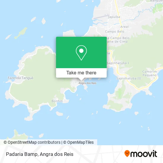
See Padaria Bamp, Angra Dos Reis, on the map
Public Transit to Padaria Bamp in Angra Dos Reis
Wondering how to get to Padaria Bamp in Angra Dos Reis? Moovit helps you find the best way to get to Padaria Bamp with step-by-step directions from the nearest public transit station.
Moovit provides free maps and live directions to help you navigate through your city. View schedules, routes, timetables, and find out how long does it take to get to Padaria Bamp in real time.
Looking for the nearest stop or station to Padaria Bamp? Check out this list of stops closest to your destination: Desembarque Centro / Largo Da Lapa; Ponto De Embarque 11 - Lapa; Ponto De Embarque 07 - Praça Do Porto; Ponto 01 - Santa Luzia; Estação Santa Luzia (Angra Dos Reis) ⛴.
Bus: 230, T10, T11, T20, T21, C01, C01B, C03, C03B, C05, C04, C04B, B203, 105.Ferry: ANGRA DOS REIS - ILHA GRANDE, ANGRA DOS REIS - ILHA GRANDE.
Want to see if there’s another route that gets you there at an earlier time? Moovit helps you find alternative routes or times. Get directions from and directions to Padaria Bamp easily from the Moovit App or Website.
We make riding to Padaria Bamp easy, which is why over 1.5 million users, including users in Angra Dos Reis, trust Moovit as the best app for public transit. You don’t need to download an individual bus app or train app, Moovit is your all-in-one transit app that helps you find the best bus time or train time available.
For information on prices of bus, costs and ride fares to Padaria Bamp, please check the Moovit app.
Use the app to navigate to popular places including to the airport, hospital, stadium, grocery store, mall, coffee shop, school, college, and university.
Padaria Bamp Address: Rua Doutor Bastos, 33 Centro Angra dos Reis-RJ 23900-080 street in Angra Dos Reis
- Museu de Arte Sacra-Angra dos Reis,
- A Pereira Pescado,
- Caeirinha Bar,
- Angratex Comercio de Roupas,
- Ponto Certo Informática e Celulares,
- Angra Frio,
- R. M. Campos -,
- Joluel Comércio e Serviços,
- Sonia S Amendola,
- Cppm Consultor Previdenciário Paulo Moreira,
- Mundo Animal de Angra Comércio de Racoes,
- Rafa Pesca e Nautica,
- Galeria JL,
- Sabor na Brasa- Angra,
- Djalma de Carvalho Reis,
- Mercado e Distribuidora Demar de Angra,
- Varejão das Carnes Six Brother,
- Acougue Mercearia Shopping das Carnes de Angra,
- Akilar,
- Ggsmodas
Places Near Padaria Bamp (Angra Dos Reis)
- Rua Cônegos Bittencourt, Angra Dos Reis,
- Centro Histórico de Paraty, Parati,
- Rua Prefeito João Gregório Galindo, Cunhambebe,
- Avenida Almirante Jair Carneiro Toscano de Brito 110, Angra Dos Reis,
- praia jabaquara - parati, Parati,
- Rodovia Procurador Haroldo Fernandes Duarte, Km 513,5 s / n, Cunhambebe,
- Avenida Antônio Bertholdo da Silva Jordão 7346, Jacuecanga,
- Mambucaba, Mambucaba,
- Rodovia BR 101, Km 533 s/n, Mambucaba,
- Garatucaia, Angra Dos Reis,
- Praia do Laboratório, Angra Dos Reis,
- Vila Galé Eco Resort De Angra, Angra Dos Reis,
- Alambique Engenho D'Ouro, Parati,
- Cachoeira do Tobogã, Parati,
- Praia de Paraty Mirim, Parati,
- Condominio Laranjeiras, Parati Mirim,
- Vila Residencial De Mambucaba, Mambucaba,
- Rua Prefeito João Gregório Galindo 2487, Angra Dos Reis,
- BR 101, Km 508 s/n, Cunhambebe,
- Verolme, Jacuecanga
How to get to popular places in Angra dos Reis with public transit
Get around Angra Dos Reis by public transit!
Traveling around Angra Dos Reis has never been so easy. See step by step directions as you travel to any attraction, street or major public transit station. View bus and train schedules, arrival times, service alerts and detailed routes on a map, so you know exactly how to get to anywhere in Angra Dos Reis.
When traveling to any destination around Angra Dos Reis use Moovit's Live Directions with Get Off Notifications to know exactly where and how far to walk, how long to wait for your line, and how many stops are left. Moovit will alert you when it's time to get off — no need to constantly re-check whether yours is the next stop.
Wondering how to use public transit in Angra Dos Reis or how to pay for public transit in Angra Dos Reis? Moovit public transit app can help you navigate your way with public transit easily, and at minimum cost. It includes public transit fees, ticket prices, and costs. Looking for a map of Angra Dos Reis public transit lines? Moovit public transit app shows all public transit maps in Angra Dos Reis with all Bus and Ferry routes and stops on an interactive map.
Angra dos Reis has 2 transit type(s), including: Bus and Ferry, operated by several transit agencies, including Viação Senhor do Bonfim, Colitur Transportes Rodoviários, Cooparatyense (Vans), Costa Verde Transportes, Barcas Rio, Objetiva Tour, Vilanova Tour, Rodoviário Oceano, BusUFF and Colitur (Tarifa Zero - Paraty)