See Parkfairfax, Virginia, Alexandria, on the map
Directions to Parkfairfax, Virginia (Alexandria) with public transportation
The following transit lines have routes that pass near Parkfairfax, Virginia
 Bus:
Bus: - Metro:
How to get to Parkfairfax, Virginia by bus?
Click on the bus route to see step by step directions with maps, line arrival times and updated time schedules.
How to get to Parkfairfax, Virginia by metro?
Click on the metro route to see step by step directions with maps, line arrival times and updated time schedules.
Bus stations near Parkfairfax, Virginia in Alexandria
- Valley Dr + Preston Rd,2 min walk,
- Valley Dr And Preston Rd,3 min walk,
- Martha Custis Dr & Preston Rd,5 min walk,
Metro stations near Parkfairfax, Virginia in Alexandria
- Pentagon City Metro Station,10 min walk,
Bus lines to Parkfairfax, Virginia in Alexandria
- 36B,Mark Center Via W Glebe Rd & Park Place,
- 104,Pentagon Metro Via Cameron Mills Rd & Parkfairfax,
- 22A,East To Pentagon,
- 36A,Mark Center Via W Glebe Rd & Menokin Dr,
What are the closest stations to Parkfairfax, Virginia?
The closest stations to Parkfairfax, Virginia are:
- Valley Dr + Preston Rd is 162 yards away, 2 min walk.
- Valley Dr And Preston Rd is 162 yards away, 3 min walk.
- Martha Custis Dr & Preston Rd is 400 yards away, 5 min walk.
- Pentagon City Metro Station is 837 yards away, 10 min walk.
Which bus lines stop near Parkfairfax, Virginia?
These bus lines stop near Parkfairfax, Virginia: 104, 22A, 23B.
Which metro lines stop near Parkfairfax, Virginia?
These metro lines stop near Parkfairfax, Virginia: METRORAIL BLUE LINE, METRORAIL YELLOW LINE.
What’s the nearest metro station to Parkfairfax, Virginia in Alexandria?
The nearest metro station to Parkfairfax, Virginia in Alexandria is Pentagon City Metro Station. It’s a 10 min walk away.
What’s the nearest bus stop to Parkfairfax, Virginia in Alexandria?
The nearest bus stop to Parkfairfax, Virginia in Alexandria is Valley Dr + Preston Rd. It’s a 2 min walk away.
What time is the first metro to Parkfairfax, Virginia in Alexandria?
The METRORAIL YELLOW LINE is the first metro that goes to Parkfairfax, Virginia in Alexandria. It stops nearby at 5:05 AM.
What time is the last metro to Parkfairfax, Virginia in Alexandria?
The METRORAIL YELLOW LINE is the last metro that goes to Parkfairfax, Virginia in Alexandria. It stops nearby at 12:35 AM.
What time is the first bus to Parkfairfax, Virginia in Alexandria?
The 36A is the first bus that goes to Parkfairfax, Virginia in Alexandria. It stops nearby at 6:14 AM.
What time is the last bus to Parkfairfax, Virginia in Alexandria?
The 36B is the last bus that goes to Parkfairfax, Virginia in Alexandria. It stops nearby at 11:45 PM.
How much is the metro fare to Parkfairfax, Virginia?
The metro fare to Parkfairfax, Virginia costs about $2.00 - $6.00.
See Parkfairfax, Virginia, Alexandria, on the map
Public Transit to Parkfairfax, Virginia in Alexandria
Wondering how to get to Parkfairfax, Virginia in Alexandria, United States? Moovit helps you find the best way to get to Parkfairfax, Virginia with step-by-step directions from the nearest public transit station.
Moovit provides free maps and live directions to help you navigate through your city. View schedules, routes, timetables, and find out how long does it take to get to Parkfairfax, Virginia in real time.
Looking for the nearest stop or station to Parkfairfax, Virginia? Check out this list of stops closest to your destination: Valley Dr + Preston Rd; Valley Dr And Preston Rd; Martha Custis Dr & Preston Rd; Pentagon City Metro Station.
Bus:Metro:
Want to see if there’s another route that gets you there at an earlier time? Moovit helps you find alternative routes or times. Get directions from and directions to Parkfairfax, Virginia easily from the Moovit App or Website.
We make riding to Parkfairfax, Virginia easy, which is why over 1.5 million users, including users in Alexandria, trust Moovit as the best app for public transit. You don’t need to download an individual bus app or train app, Moovit is your all-in-one transit app that helps you find the best bus time or train time available.
For information on prices of bus and metro, costs and ride fares to Parkfairfax, Virginia, please check the Moovit app.
Use the app to navigate to popular places including to the airport, hospital, stadium, grocery store, mall, coffee shop, school, college, and university.
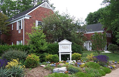
Parkfairfax, Virginia Address: Alexandria, VA 22302 street in Alexandria
Attractions near Parkfairfax, Virginia
Beaumont House Design,Parkfairfax,Out the Box Ministries,Millie Rose Clay C,Martha Custis and Gunst Rd,Eli Residential Group,Parkfairfax,Vibe Design,Laura Schoppa,Frontier Security Strategies,Junk Removal Alexandria Pros,Theatre Signatur,Bus Boys and Poets,Choice Movers,Tomar Research Inc.,Harris Teeter,ATM,Lohfeld Consulting,Virginia Norment Interiors,ConvergenceHow to get to popular attractions in Alexandria with public transit
Manassas, VA, Manassas,Hyatt Regency Baltimore Inner Harbor, Baltimore,Green Lantern, Washington,Centreville, VA, Fairfax County,The Greene Turtle Sports Bar & Grille, Washington,Fogo de Chao, Washington,Anne Arundel Community College, Anne Arundel County,Lost Society, Washington,Looney's Pub, Baltimore,Sticky Rice, Washington,Hank's Oyster Bar, Washington,AU – Kerwin Hall, Washington,Little Havana, Baltimore,Biergarten Haus, Washington,Honey Pig Gooldaegee Korean Grill, Fairfax County,AMC Owings Mills 17, Baltimore County,Dundalk, Maryland, Baltimore County,Bluejacket Brewery, Washington,Buffalo Wild Wings, Anne Arundel County,The Ugly Mug, WashingtonGet around Alexandria by public transit!
Traveling around Alexandria has never been so easy. See step by step directions as you travel to any attraction, street or major public transit station. View bus and train schedules, arrival times, service alerts and detailed routes on a map, so you know exactly how to get to anywhere in Alexandria.
When traveling to any destination around Alexandria use Moovit's Live Directions with Get Off Notifications to know exactly where and how far to walk, how long to wait for your line, and how many stops are left. Moovit will alert you when it's time to get off — no need to constantly re-check whether yours is the next stop.
Wondering how to use public transit in Alexandria or how to pay for public transit in Alexandria? Moovit public transit app can help you navigate your way with public transit easily, and at minimum cost. It includes public transit fees, ticket prices, and costs. Looking for a map of Alexandria public transit lines? Moovit public transit app shows all public transit maps in Alexandria with all bus or metro routes and stops on an interactive map.
Alexandria has 2 transit type(s), including: bus or metro, operated by several transit agencies, including WMATA, WMATA, Montgomery County Ride On, Fairfax Connector, TheBus, DC Circulator, MDOT MTA, Marc, MDOT MTA, MDOT MTA, Virginia Railway Express (VRE), PRTC, DASH - Alexandria, Arlington Transit (ART) and DC Streetcar