Directions to Parque Nacional Cahuita (Talamanca) with public transportation
The following transit lines have routes that pass near Parque Nacional Cahuita
How to get to Parque Nacional Cahuita by bus?
Click on the bus route to see step by step directions with maps, line arrival times and updated time schedules.
Bus stop near Parque Nacional Cahuita in Talamanca
- Terminal Cahuita, Talamanca, 5 min walk,
Bus lines to Parque Nacional Cahuita in Talamanca
- LIMÓN - MANZANILLO, Terminal Playa Manzanillo, Diagonal A Soda Maxis,
- LIMÓN - SIXAOLA, Terminal De Mepe,
- SAN JOSÉ - MANZANILLO, Terminal Mepe,
- SAN JOSÉ - SIXAOLA, Terminal Sixaola, Talamanca,
What are the closest stations to Parque Nacional Cahuita?
The closest stations to Parque Nacional Cahuita are:
- Terminal Cahuita, Talamanca is 349 meters away, 5 min walk.
Which bus lines stop near Parque Nacional Cahuita?
These bus lines stop near Parque Nacional Cahuita: LIMÓN - MANZANILLO, LIMÓN - SIXAOLA, SAN JOSÉ - SIXAOLA.
What’s the nearest bus station to Parque Nacional Cahuita in Talamanca?
The nearest bus station to Parque Nacional Cahuita in Talamanca is Terminal Cahuita, Talamanca. It’s a 5 min walk away.
What time is the first bus to Parque Nacional Cahuita in Talamanca?
The SAN JOSÉ - SIXAOLA is the first bus that goes to Parque Nacional Cahuita in Talamanca. It stops nearby at 6:05 AM.
What time is the last bus to Parque Nacional Cahuita in Talamanca?
The LIMÓN - SIXAOLA is the last bus that goes to Parque Nacional Cahuita in Talamanca. It stops nearby at 9:02 PM.
See Parque Nacional Cahuita, Talamanca, on the map
Public Transit to Parque Nacional Cahuita in Talamanca
Wondering how to get to Parque Nacional Cahuita in Talamanca, Costa Rica? Moovit helps you find the best way to get to Parque Nacional Cahuita with step-by-step directions from the nearest public transit station.
Moovit provides free maps and live directions to help you navigate through your city. View schedules, routes, timetables, and find out how long does it take to get to Parque Nacional Cahuita in real time.
Looking for the nearest stop or station to Parque Nacional Cahuita? Check out this list of stops closest to your destination: Terminal Cahuita.
Bus: LIMÓN - MANZANILLO, LIMÓN - SIXAOLA, SAN JOSÉ - SIXAOLA, SAN JOSÉ - MANZANILLO.
Want to see if there’s another route that gets you there at an earlier time? Moovit helps you find alternative routes or times. Get directions from and directions to Parque Nacional Cahuita easily from the Moovit App or Website.
We make riding to Parque Nacional Cahuita easy, which is why over 1.5 million users, including users in Talamanca, trust Moovit as the best app for public transit. You don’t need to download an individual bus app or train app, Moovit is your all-in-one transit app that helps you find the best bus time or train time available.
For information on prices of bus, costs and ride fares to Parque Nacional Cahuita, please check the Moovit app.
Use the app to navigate to popular places including to the airport, hospital, stadium, grocery store, mall, coffee shop, school, college, and university.
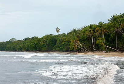
Parque Nacional Cahuita Address: 36 Cahuita, 70403 Cahuita street in Talamanca
Places Near Parque Nacional Cahuita (Talamanca)
How to get to popular places in San José with public transit
Get around Talamanca by public transit!
Traveling around Talamanca has never been so easy. See step by step directions as you travel to any attraction, street or major public transit station. View bus and train schedules, arrival times, service alerts and detailed routes on a map, so you know exactly how to get to anywhere in Talamanca.
When traveling to any destination around Talamanca use Moovit's Live Directions with Get Off Notifications to know exactly where and how far to walk, how long to wait for your line, and how many stops are left. Moovit will alert you when it's time to get off — no need to constantly re-check whether yours is the next stop.
Wondering how to use public transit in Talamanca or how to pay for public transit in Talamanca? Moovit public transit app can help you navigate your way with public transit easily, and at minimum cost. It includes public transit fees, ticket prices, and costs. Looking for a map of Talamanca public transit lines? Moovit public transit app shows all public transit maps in Talamanca with all Bus, Train and Ferry routes and stops on an interactive map.
San José has 3 transit type(s), including: Bus, Train and Ferry, operated by several transit agencies, including Transmasoma S.A., Autotransportes Raro S.A., Transcesa S.A., Autotransportes Desamparados S.A., Autobuses Unidos de Coronado S.A., VTA, Autotransportes Moravia S.A., Universidad de Costa Rica, Empresa Guadalupe LTDA, Autotransportes Sabana Cementerio S.A., Consorcio Operativo del Este S.A., CONATRA S.A., Lared LTDA, Buses INA Uruca S.A. (BIUSA) and Transportes Cubero Bonilla de Cirrí LTDA