Directions to Parque O'Higgins station (Santiago) with public transit
The following transit lines have routes that pass near Parque O'Higgins
How to get to Parque O'Higgins station by Micro?
Click on the Micro route to see step by step directions with maps, line arrival times and updated time schedules.
How to get to Parque O'Higgins station by metro?
Click on the metro route to see step by step directions with maps, line arrival times and updated time schedules.
Micro stops near Parque O'Higgins in Santiago
- Pa320-Parada / Movistar Arena, 6 min walk,
- Parque O'Higgins Interior, 10 min walk,
- Metro Parque O'Higgins (Av. Tupper Esq. Av. Viel), 12 min walk,
- Pa234-Parada 3 / (M) Parque O'Higgins, 13 min walk,
- Pa435-Parada 4 / (M) Parque O'Higgins, 13 min walk,
- Av. Viel Esq. Santiago, 17 min walk,
- Avenida Viel - Esq. Victoria, 20 min walk,
Metro stations near Parque O'Higgins in Santiago
- Rondizzoni, 19 min walk,
- Presidente Pedro Aguirre Cerda, 27 min walk,
- Parque Almagro, 32 min walk,
Micro lines to Parque O'Higgins station in Santiago
- 121, Mapocho,
- VSA, Plaza Jorge Montt,
- BUIN MAIPO, Buin (Los Magnolios) - Term. San Borja (por Panamericana),
- BUSES PAINE, Paine (Chada) - Term. San Borja (por Panamericana),
- BUSES PAINE, Paine (Aculeo) - Term. San Borja (por Panamericana),
- BUSES PAINE, Paine (Culitrín) - Term. San Borja (por Panamericana),
- BUSES PAINE, Paine (La Paloma) - Term. San Borja (por Panamericana),
- LARAPINTA, Lampa (Valle de la Luna) - Santiago Centro (por Lo Echevers),
- 125, (M) U. De Chile,
- 302, (M) Santa Ana,
- 302N, La Pintana,
- 506, Maipu - Peñalolen,
- 506E, Maipu - Peñalolen,
- 506V, Villa El Abrazo - Peñalolen,
- 507, Enea - Av Grecia,
- 507C, (M) Parque O'Higgins - Peñalolen,
- 510, Pudahuel Sur - Rio Claro,
- BUIN MAIPO, Terminal San Francisco,
- TRANSBER, Calera De Tango-San Francisco (Via Autop. Central),
- TRANSBER, Calera De Tango (Santa Ines)-San Francisco (Via Autop. Central),
What are the closest stations to Parque O'Higgins?
The closest stations to Parque O'Higgins are:
- Pa320-Parada / Movistar Arena is 426 meters away, 6 min walk.
- Parque O'Higgins Interior is 707 meters away, 10 min walk.
- Metro Parque O'Higgins (Av. Tupper Esq. Av. Viel) is 931 meters away, 12 min walk.
- Pa234-Parada 3 / (M) Parque O'Higgins is 950 meters away, 13 min walk.
- Pa435-Parada 4 / (M) Parque O'Higgins is 982 meters away, 13 min walk.
- Av. Viel Esq. Santiago is 1255 meters away, 17 min walk.
- Rondizzoni is 1477 meters away, 19 min walk.
- Avenida Viel - Esq. Victoria is 1485 meters away, 20 min walk.
- Presidente Pedro Aguirre Cerda is 2048 meters away, 27 min walk.
- Parque Almagro is 2454 meters away, 32 min walk.
Which Micro lines stop near Parque O'Higgins?
These Micro lines stop near Parque O'Higgins: 121, 506, 506E, 507, I01.
Which metro line stops near Parque O'Higgins?
L2 (Dirección Hospital El Pino)
What’s the nearest metro station to Parque O'Higgins in Santiago?
The nearest metro station to Parque O'Higgins in Santiago is Rondizzoni. It’s a 19 min walk away.
What’s the nearest Micro station to Parque O'Higgins in Santiago?
The nearest Micro station to Parque O'Higgins in Santiago is Pa320-Parada / Movistar Arena. It’s a 6 min walk away.
What time is the first metro to Parque O'Higgins in Santiago?
The L6 is the first metro that goes to Parque O'Higgins in Santiago. It stops nearby at 6:05 AM.
What time is the last metro to Parque O'Higgins in Santiago?
The L3 is the last metro that goes to Parque O'Higgins in Santiago. It stops nearby at 11:20 PM.
What time is the first Micro to Parque O'Higgins in Santiago?
The 302N is the first Micro that goes to Parque O'Higgins in Santiago. It stops nearby at 3:06 AM.
What time is the last Micro to Parque O'Higgins in Santiago?
The 506 is the last Micro that goes to Parque O'Higgins in Santiago. It stops nearby at 3:36 AM.
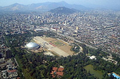
See Parque O'Higgins, Santiago, on the map
Public Transit to Parque O'Higgins in Santiago
How to get to Parque O'Higgins in Santiago, Chile?
It’s easy with Moovit. Type in your street address and Moovit’s route finder will locate the fastest way to get you there! Not sure where to get off on the street? Download the Moovit App to find live directions (including where to get off on Parque O'Higgins), see timetables and get the estimated arrival times for your favorite Micro or metro lines.
Looking for the nearest stop or station to Parque O'Higgins? Check out this list of closest stops available to your destination: Pa320-Parada / Movistar Arena; Parque O'Higgins Interior; Metro Parque O'Higgins (Av. Tupper Esq. Av. Viel); Pa234-Parada 3 / (M) Parque O'Higgins; Pa435-Parada 4 / (M) Parque O'Higgins; Av. Viel Esq. Santiago; Rondizzoni; Avenida Viel - Esq. Victoria; Presidente Pedro Aguirre Cerda; Parque Almagro.
Micro: 121, 506, 506E, 507, I01, VSA, BUIN MAIPO, BUSES PAINE, BUSES PAINE, BUSES PAINE, BUSES PAINE.Metro: L2, L6, L3.
Download the Moovit App to see the current schedule and routes available for Santiago. No need to install a special bus app to check the bus time or a train app to get train time. Moovit is the only all-in-one transit app that helps you get where you need to go.
We make riding on public transit to Parque O'Higgins easy, which is why over 1.5 million users, including users in Santiago trust Moovit as the best app for public transit.
Use the app to navigate to popular places including to the airport, hospital, stadium, grocery store, mall, coffee shop, school, college, and university.
Location: Santiago
Streets near Parque O'Higgins, Santiago
Get around Santiago by public transit!
Traveling around Santiago has never been so easy. See step by step directions as you travel to any attraction, street or major public transit station. View bus and train schedules, arrival times, service alerts and detailed routes on a map, so you know exactly how to get to anywhere in Santiago.
When traveling to any destination around Santiago use Moovit's Live Directions with Get Off Notifications to know exactly where and how far to walk, how long to wait for your line, and how many stops are left. Moovit will alert you when it's time to get off — no need to constantly re-check whether yours is the next stop.
Wondering how to use public transit in Santiago or how to pay for public transit in Santiago? Moovit public transit app can help you navigate your way with public transit easily, and at minimum cost. It includes public transit fees, ticket prices, and costs. Looking for a map of Santiago public transit lines? Moovit public transit app shows all public transit maps in Santiago with all Micro, Metro, Light Rail and Funicular routes and stops on an interactive map.
Santiago has 4 transit type(s), including: Micro, Metro, Light Rail and Funicular, operated by several transit agencies, including Metro de Santiago, Bus Rural, Bus Aeropuerto, Ascensor, Bus Vecinal, EFE Trenes de Chile, Las Condes, Red Metropolitana de Movilidad, Bus de Acercamiento Aeropuerto, Buses Colina, FlixBus-cl, Bupesa, Flota Talagante and Buses Buin Maipo