Directions to Parqyt (Brookline) with public transportation
The following transit lines have routes that pass near Parqyt
 Bus: 15, 57, 66, 85, GREEN LINE B SHUTTLE.
- Train: FRAMINGHAM/WORCESTER.
- Subway: GREEN LINE B, GREEN LINE C.
How to get to Parqyt by bus?
Click on the bus route to see step by step directions with maps, line arrival times and updated time schedules.
From Melrose Wakefield Hospital, Malden
101 minFrom Best Buy, Boston
69 minFrom Marina Bay, Quincy
147 minFrom Lasell College, Newton
62 minFrom Lemuel Shattuck Hospital, Boston
51 minFrom The Lawn on D, Boston
58 minFrom Malden Catholic High School, Malden
78 minFrom Waltham, MA, Waltham
60 minFrom Suffolk Downs, Boston
83 minFrom Hyatt Regency-Boston Harbor (Hyatt Harborside At Boston's Logan International Airport Hotel Boston), Boston
58 min
How to get to Parqyt by train?
Click on the train route to see step by step directions with maps, line arrival times and updated time schedules.
How to get to Parqyt by subway?
Click on the subway route to see step by step directions with maps, line arrival times and updated time schedules.
From Melrose Wakefield Hospital, Malden
58 minFrom Best Buy, Boston
49 minFrom Lasell College, Newton
74 minFrom Lemuel Shattuck Hospital, Boston
57 minFrom The Lawn on D, Boston
54 minFrom Suffolk Downs, Boston
59 minFrom Hyatt Regency-Boston Harbor (Hyatt Harborside At Boston's Logan International Airport Hotel Boston), Boston
63 min
Bus stops near Parqyt in Brookline
Subway stations near Parqyt in Brookline
Bus lines to Parqyt in Brookline
- 57, Kenmore - Watertown Yard,VIEW
- GREEN LINE B SHUTTLE, Boston College - Back Bay (Shuttle),VIEW
- GREEN LINE B SHUTTLE, Washington Street - Blandford Street,VIEW
- GREEN LINE B SHUTTLE, Boston College - Babcock Street,VIEW
- GREEN LINE B SHUTTLE, Babcock Street - Blandford Street,VIEW
- GREEN LINE B SHUTTLE, Babcock Street - Copley,VIEW
- GREEN LINE B SHUTTLE, Boston College - Blandford Street,VIEW
- GREEN LINE B SHUTTLE, Babcock Street - Kenmore,VIEW
- GREEN LINE B SHUTTLE, Washington Street - Kenmore,VIEW
- GREEN LINE B SHUTTLE, Babcock Street - Back Bay via Copley (Shuttle),VIEW
- GREEN LINE B SHUTTLE, Babcock Street - Back Bay,VIEW
- SHUTTLE, Boston College - Kenmore (Shuttle),VIEW
- GREEN LINE C SHUTTLE, Saint Mary's Street (Shuttle),VIEW
- SHUTTLE, Cleveland Circle (Shuttle),VIEW
- COMM AVE, Agganis Way,VIEW
- 1 BU (CHARLES RIVER-MEDICAL CAMPUS), Comm Ave @ Buick St,VIEW
- 47, Broadway,VIEW
- 85, Ruggles,VIEW
What are the closest stations to Parqyt?
The closest stations to Parqyt are:
- Commonwealth Ave @ Babcock St is 19 yards away, 1 min walk.
- Babcock Street is 31 yards away, 1 min walk.
- Hawes Street is 78 yards away, 2 min walk.
- Kent Street is 141 yards away, 2 min walk.
- Hawes Street - 1089 Beacon St is 147 yards away, 2 min walk.
- Agganis Way is 448 yards away, 6 min walk.
- Commonwealth Ave @ University Rd is 827 yards away, 10 min walk.
Which bus lines stop near Parqyt?
These bus lines stop near Parqyt: 15, 57, 66, 85.
Which train line stops near Parqyt?
FRAMINGHAM/WORCESTER (#525 | Worcester)
Which subway line stops near Parqyt?
GREEN LINE B (Boston College)
What’s the nearest subway station to Parqyt in Brookline?
The nearest subway station to Parqyt in Brookline is Babcock Street. It’s a 1 min walk away.
What’s the nearest bus station to Parqyt in Brookline?
The nearest bus station to Parqyt in Brookline is Commonwealth Ave @ Babcock St. It’s a 1 min walk away.
What time is the first subway to Parqyt in Brookline?
The GREEN LINE C is the first subway that goes to Parqyt in Brookline. It stops nearby at 5:11 AM.
What time is the last subway to Parqyt in Brookline?
The GREEN LINE B is the last subway that goes to Parqyt in Brookline. It stops nearby at 2:20 AM.
What time is the first bus to Parqyt in Brookline?
The 57 is the first bus that goes to Parqyt in Brookline. It stops nearby at 4:42 AM.
What time is the last bus to Parqyt in Brookline?
The 57 is the last bus that goes to Parqyt in Brookline. It stops nearby at 2:17 AM.
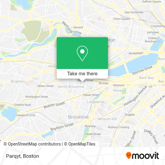
See Parqyt, Brookline, on the map
Public Transit to Parqyt in Brookline
Wondering how to get to Parqyt in Brookline? Moovit helps you find the best way to get to Parqyt with step-by-step directions from the nearest public transit station.
Moovit provides free maps and live directions to help you navigate through your city. View schedules, routes, timetables, and find out how long does it take to get to Parqyt in real time.
Looking for the nearest stop or station to Parqyt? Check out this list of stops closest to your destination: Commonwealth Ave @ Babcock St; Babcock Street; Hawes Street; Kent Street; Hawes Street - 1089 Beacon St; Agganis Way; Commonwealth Ave @ University Rd.
Bus: 15, 57, 66, 85, GREEN LINE B SHUTTLE, GREEN LINE B SHUTTLE, GREEN LINE B SHUTTLE, GREEN LINE B SHUTTLE, GREEN LINE C SHUTTLE, SHUTTLE, COMM AVE.Train: FRAMINGHAM/WORCESTER.Subway: GREEN LINE B, GREEN LINE C.
Want to see if there’s another route that gets you there at an earlier time? Moovit helps you find alternative routes or times. Get directions from and directions to Parqyt easily from the Moovit App or Website.
We make riding to Parqyt easy, which is why over 1.7 million users, including users in Brookline, trust Moovit as the best app for public transit. You don’t need to download an individual bus app or train app, Moovit is your all-in-one transit app that helps you find the best bus time or train time available.
For information on prices of bus, subway and train, costs and ride fares to Parqyt, please check the Moovit app.
Use the app to navigate to popular places including to the airport, hospital, stadium, grocery store, mall, coffee shop, school, college, and university.
Parqyt Address: 62 Egmont St street in Brookline
- Knyvet Square,
- Dexter Park,
- Dexter Park (Dexter 6 Hallway),
- Winthrop Park,
- 175-185 Freeman Street Parking,
- St Paul St,
- Video Transfer,
- USPS Collection Box - Blue Box,
- Amory Tennis Courts,
- 900 Commonwealth Avenue,
- Amazon Hub Locker+ (Boston),
- Gymit (Gym It),
- Specialized Housing,
- Taco Bell,
- New England College of Optometry Center for Eye Care,
- Occupational Health Center,
- Neco Center For Eye Care - Commonwealth,
- MBTA St. Paul Street Station (B Train),
- Amazon@Boston,
- Commonwealth Ave
Places Near Parqyt (Brookline)
- Td Garden, Boston,
- Prudential Center, Boston,
- Boston Medical Center, Boston,
- Quincy Market, Boston,
- Boston Convention & Exhibition Center, Boston,
- Castle Island, Boston,
- Boston Children's Hospital, Boston,
- Faneuil Hall, Boston,
- Seaport District, Boston,
- Leader Bank Pavilion (Leader Bank Pavillion), Boston,
- North End, Boston,
- Mgm Music Hall, Boston,
- Cheers, Boston,
- Wang Theater, Boston,
- Isabella Stewart Gardner Museum, Boston,
- Boston Common, Boston,
- Wilbur Theatre, Boston,
- Massachusetts General Hospital, Boston,
- House Of Blues, Boston,
- Museum Of Science, Boston
How to get to popular places in Boston with public transit
Get around Brookline by public transit!
Traveling around Brookline has never been so easy. See step by step directions as you travel to any attraction, street or major public transit station. View bus and train schedules, arrival times, service alerts and detailed routes on a map, so you know exactly how to get to anywhere in Brookline.
When traveling to any destination around Brookline use Moovit's Live Directions with Get Off Notifications to know exactly where and how far to walk, how long to wait for your line, and how many stops are left. Moovit will alert you when it's time to get off — no need to constantly re-check whether yours is the next stop.
Wondering how to use public transit in Brookline or how to pay for public transit in Brookline? Moovit public transit app can help you navigate your way with public transit easily, and at minimum cost. It includes public transit fees, ticket prices, and costs. Looking for a map of Brookline public transit lines? Moovit public transit app shows all public transit maps in Brookline with all Bus, Train, Subway and Ferry routes and stops on an interactive map.
Boston has 4 transit type(s), including: Bus, Train, Subway and Ferry, operated by several transit agencies, including MBTA, Southeastern Regional Transit Authority, MetroWest Regional Transit Authority, Rhode Island Public Transit Authority, WRTA, Lowell Regional Transit Authority, Merrimack Valley Transit, Montachusett Regional Transit Authority, Cape Cod Regional Transit Authority, Brockton Area Transit Authority, Martha's Vineyard Transit Authority, the WAVE - Nantucket Regional Transit Authority, GATRA, Cape Ann Transportation Authority and Massport