Directions to Pastel Nail Studio (Boston) with public transportation
The following transit lines have routes that pass near Pastel Nail Studio
How to get to Pastel Nail Studio by bus?
Click on the bus route to see step by step directions with maps, line arrival times and updated time schedules.
From Mass Ave, Cambridge
50 minFrom The Mall At Chestnut Hill, Newton
84 minFrom Malden Catholic High School, Malden
106 minFrom Brookline, MA, Brookline
47 minFrom Beth Israel Deaconess Hospital-Milton, Milton
86 minFrom Milton, MA, Milton
96 minFrom Canobie Lake Park, Chelsea
54 minFrom New Balance, Boston
73 minFrom Market Basket, Revere
78 minFrom Watertown, MA, Watertown Town
55 min
How to get to Pastel Nail Studio by train?
Click on the train route to see step by step directions with maps, line arrival times and updated time schedules.
How to get to Pastel Nail Studio by subway?
Click on the subway route to see step by step directions with maps, line arrival times and updated time schedules.
Bus stop near Pastel Nail Studio in Boston
- Broadway Station - Red Line, 1 min walk,VIEW
Subway stations near Pastel Nail Studio in Boston
Train station near Pastel Nail Studio in Boston
- South Station, 13 min walk,VIEW
Bus lines to Pastel Nail Studio in Boston
- 9, Copley - City Point,VIEW
- 11, Chauncy & Summer - City Point,VIEW
- 47, Broadway - Central Square,VIEW
- RED LINE SHUTTLE, Kendall/MIT - Broadway via Pearl Street,VIEW
- RED LINE SHUTTLE, JFK/UMass - Broadway,VIEW
- RED LINE SHUTTLE, Braintree - Broadway,VIEW
- RED LINE SHUTTLE, Harvard - JFK/UMass via Congress Street,VIEW
- RED LINE SHUTTLE, Harvard - Broadway,VIEW
- RED LINE SHUTTLE, North Quincy - Broadway (Shuttle),VIEW
- RED LINE SHUTTLE, Quincy Center - Broadway (Express),VIEW
- RED LINE SHUTTLE, Quincy Center - Broadway (Shuttle),VIEW
- RED LINE SHUTTLE, JFK/UMass - Park Street,VIEW
- RED LINE SHUTTLE, Kendall/MIT - JFK/UMass,VIEW
- RED LINE SHUTTLE, Kendall/MIT - Broadway via Downtown Crossing,VIEW
- RED LINE SHUTTLE, Ashmont - Park Street via Post Office,VIEW
- RED LINE SHUTTLE, JFK/UMass - Park Street via Post Office,VIEW
- RED LINE SHUTTLE, North Quincy - Broadway,VIEW
- RED LINE SHUTTLE, Harvard - JFK/UMass via State Street,VIEW
- RED LINE SHUTTLE, JFK/UMass - Kendall/MIT (Shuttle),VIEW
- RED LINE SHUTTLE, Ashmont - Broadway (Shuttle),VIEW
What are the closest stations to Pastel Nail Studio?
The closest stations to Pastel Nail Studio are:
- Broadway Station - Red Line is 33 yards away, 1 min walk.
- Chinatown is 195 yards away, 3 min walk.
- Boylston is 748 yards away, 9 min walk.
- South Station is 1040 yards away, 13 min walk.
Which bus lines stop near Pastel Nail Studio?
These bus lines stop near Pastel Nail Studio: 11, 47, 9.
Which train lines stop near Pastel Nail Studio?
These train lines stop near Pastel Nail Studio: FRAMINGHAM/WORCESTER, NEWBURYPORT/ROCKPORT.
Which subway line stops near Pastel Nail Studio?
RED LINE (Ashmont/Braintree)
What’s the nearest subway station to Pastel Nail Studio in Boston?
The nearest subway station to Pastel Nail Studio in Boston is Chinatown. It’s a 3 min walk away.
What’s the nearest train station to Pastel Nail Studio in Boston?
The nearest train station to Pastel Nail Studio in Boston is South Station. It’s a 13 min walk away.
What’s the nearest bus station to Pastel Nail Studio in Boston?
The nearest bus station to Pastel Nail Studio in Boston is Broadway Station - Red Line. It’s a 1 min walk away.
What time is the first subway to Pastel Nail Studio in Boston?
The GREEN LINE D is the first subway that goes to Pastel Nail Studio in Boston. It stops nearby at 5:09 AM.
What time is the last subway to Pastel Nail Studio in Boston?
The GREEN LINE E is the last subway that goes to Pastel Nail Studio in Boston. It stops nearby at 2:16 AM.
What time is the first train to Pastel Nail Studio in Boston?
The PROVIDENCE/STOUGHTON is the first train that goes to Pastel Nail Studio in Boston. It stops nearby at 4:20 AM.
What time is the last train to Pastel Nail Studio in Boston?
The LAKE SHORE LIMITED is the last train that goes to Pastel Nail Studio in Boston. It stops nearby at 8:32 PM.
What time is the first bus to Pastel Nail Studio in Boston?
The SLW is the first bus that goes to Pastel Nail Studio in Boston. It stops nearby at 4:19 AM.
What time is the last bus to Pastel Nail Studio in Boston?
The 47 is the last bus that goes to Pastel Nail Studio in Boston. It stops nearby at 1:33 AM.
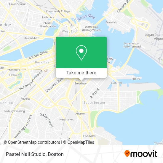
See Pastel Nail Studio, Boston, on the map
Public Transit to Pastel Nail Studio in Boston
Wondering how to get to Pastel Nail Studio in Boston? Moovit helps you find the best way to get to Pastel Nail Studio with step-by-step directions from the nearest public transit station.
Moovit provides free maps and live directions to help you navigate through your city. View schedules, routes, timetables, and find out how long does it take to get to Pastel Nail Studio in real time.
Looking for the nearest stop or station to Pastel Nail Studio? Check out this list of stops closest to your destination: Broadway Station - Red Line; Chinatown; Boylston; South Station.
Bus: 11, 47, 9, RED LINE SHUTTLE, RED LINE SHUTTLE.Train: FRAMINGHAM/WORCESTER, NEWBURYPORT/ROCKPORT, COMMUTER RAIL SHUTTLE, FAIRMOUNT LINE SHUTTLE, FRANKLIN LINE SHUTTLE, KINGSTON LINE SHUTTLE, SL1.Subway: RED LINE, ORANGE LINE, GREEN LINE B, GREEN LINE C, GREEN LINE D, GREEN LINE E.
Want to see if there’s another route that gets you there at an earlier time? Moovit helps you find alternative routes or times. Get directions from and directions to Pastel Nail Studio easily from the Moovit App or Website.
We make riding to Pastel Nail Studio easy, which is why over 1.7 million users, including users in Boston, trust Moovit as the best app for public transit. You don’t need to download an individual bus app or train app, Moovit is your all-in-one transit app that helps you find the best bus time or train time available.
For information on prices of bus, subway and train, costs and ride fares to Pastel Nail Studio, please check the Moovit app.
Use the app to navigate to popular places including to the airport, hospital, stadium, grocery store, mall, coffee shop, school, college, and university.
Pastel Nail Studio Address: 11 W Broadway street in Boston
- MBTA Broadway Station,
- Six House,
- Cambria Hotel Boston Downtown South Boston,
- Bayberry Management,
- West Broadway Quarters,
- Broadway Station MBTA,
- Moonshine 152,
- James F. Walsh Square,
- Cambria Hotel,
- Cambria Hotel Boston, Downtown-South Boston (The Cambria Boston Downtown),
- Sims Barber Lab (Sim's Barber Lab),
- Mbta Cabot Yard Cng Compressor Building,
- James M. Kelly Bridge,
- Boston Taxi Drivers Association Affiliate of Usw,
- Ulta Beauty,
- MBTA #815 Providence Train,
- Enterprise Rent-A-Car,
- City Of Boston Credit Union,
- Rondo's Submarine Sandwiches,
- Fox & the Knife
Places Near Pastel Nail Studio (Boston)
- Td Garden, Boston,
- Boston Common, Boston,
- Boston Children's Hospital, Boston,
- Seaport District, Boston,
- House Of Blues, Boston,
- Boston Medical Center, Boston,
- Quincy Market, Boston,
- Isabella Stewart Gardner Museum, Boston,
- Wang Theater, Boston,
- Wilbur Theatre, Boston,
- Prudential Center, Boston,
- Leader Bank Pavilion (Leader Bank Pavillion), Boston,
- North End, Boston,
- Faneuil Hall, Boston,
- Castle Island, Boston,
- Museum Of Science, Boston,
- Mgm Music Hall, Boston,
- Cheers, Boston,
- Boston Convention & Exhibition Center, Boston,
- Massachusetts General Hospital, Boston
How to get to popular places in Boston with public transit
Get around Boston by public transit!
Traveling around Boston has never been so easy. See step by step directions as you travel to any attraction, street or major public transit station. View bus and train schedules, arrival times, service alerts and detailed routes on a map, so you know exactly how to get to anywhere in Boston.
When traveling to any destination around Boston use Moovit's Live Directions with Get Off Notifications to know exactly where and how far to walk, how long to wait for your line, and how many stops are left. Moovit will alert you when it's time to get off — no need to constantly re-check whether yours is the next stop.
Wondering how to use public transit in Boston or how to pay for public transit in Boston? Moovit public transit app can help you navigate your way with public transit easily, and at minimum cost. It includes public transit fees, ticket prices, and costs. Looking for a map of Boston public transit lines? Moovit public transit app shows all public transit maps in Boston with all Bus, Train, Subway and Ferry routes and stops on an interactive map.
Boston has 4 transit type(s), including: Bus, Train, Subway and Ferry, operated by several transit agencies, including MBTA, Southeastern Regional Transit Authority, MetroWest Regional Transit Authority, Rhode Island Public Transit Authority, WRTA, Lowell Regional Transit Authority, Merrimack Valley Transit, Montachusett Regional Transit Authority, Cape Cod Regional Transit Authority, Brockton Area Transit Authority, Martha's Vineyard Transit Authority, the WAVE - Nantucket Regional Transit Authority, GATRA, Cape Ann Transportation Authority and Massport