How to get to Patsy's by bus?
Click on the bus route to see step by step directions with maps, line arrival times and updated time schedules.
From Walmart Supercenter, Worcester
181 minFrom Dcu Center, Worcester
124 minFrom Worcester, MA, Worcester
122 minFrom Polar Park, Worcester
123 minFrom Palladium, Worcester
127 minFrom Registry Of Motor Vehicles (Rmv) Branch Office, Worcester
126 minFrom St Vincent Hospital TH Medical, Worcester
122 minFrom South High Community School, Worcester
219 min
Bus stops near Patsy's in Boston
Bus lines to Patsy's in Boston
What are the closest stations to Patsy's?
The closest stations to Patsy's are:
- N Main / Dorset is 779 yards away, 10 min walk.
- N Main / Van Dyke is 962 yards away, 12 min walk.
Which bus line stops near Patsy's?
G2 (Dwight / Benton Via Belmont)
What’s the nearest bus station to Patsy's in Boston?
The nearest bus station to Patsy's in Boston is N Main / Dorset. It’s a 10 min walk away.
What time is the first bus to Patsy's in Boston?
The G2 is the first bus that goes to Patsy's in Boston. It stops nearby at 5:06 AM.
What time is the last bus to Patsy's in Boston?
The G2 is the last bus that goes to Patsy's in Boston. It stops nearby at 9:48 PM.
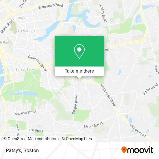
See Patsy's, Boston, on the map
Public Transit to Patsy's in Boston
Wondering how to get to Patsy's in Boston? Moovit helps you find the best way to get to Patsy's with step-by-step directions from the nearest public transit station.
Moovit provides free maps and live directions to help you navigate through your city. View schedules, routes, timetables, and find out how long does it take to get to Patsy's in real time.
Looking for the nearest stop or station to Patsy's? Check out this list of stops closest to your destination: N Main / Dorset; N Main / Van Dyke.
Bus: G2, X90.
Want to see if there’s another route that gets you there at an earlier time? Moovit helps you find alternative routes or times. Get directions from and directions to Patsy's easily from the Moovit App or Website.
We make riding to Patsy's easy, which is why over 1.7 million users, including users in Boston, trust Moovit as the best app for public transit. You don’t need to download an individual bus app or train app, Moovit is your all-in-one transit app that helps you find the best bus time or train time available.
For information on prices of bus, costs and ride fares to Patsy's, please check the Moovit app.
Use the app to navigate to popular places including to the airport, hospital, stadium, grocery store, mall, coffee shop, school, college, and university.
Patsy's Address: 600 N Main St street in Boston
- East Longmeadow Locksmith Store,
- Andrew Bonavita DMD PC,
- Jelly on My Belly 3D 4d HD Ultrasound Studio,
- LB Homes Group,
- Competitive Edge,
- The North Face,
- Amazon Locker-Keshav,
- WM M Martin Dr,
- Baumshells,
- Torito Mexican Restaurant,
- Trio's Pizzeria,
- Fogueira Portuguese Brazilian Steakhouse,
- International Brotherhood of Electrical Workers,
- Refresh,
- Main&Gerrard,
- N. Main&Rosemont,
- East Longmeadow Vegetables,
- Ajm Enterprises,
- Baumshells,
- Damiano's New York Style Pizza & Calzones
Places Near Patsy's (Boston)
- Leader Bank Pavilion (Leader Bank Pavillion), Boston,
- House Of Blues, Boston,
- Quincy Market, Boston,
- Wang Theater, Boston,
- Boston Medical Center, Boston,
- Massachusetts General Hospital, Boston,
- Museum Of Science, Boston,
- Td Garden, Boston,
- Cheers, Boston,
- Boston Convention & Exhibition Center, Boston,
- Boston Common, Boston,
- Wilbur Theatre, Boston,
- Castle Island, Boston,
- Boston Children's Hospital, Boston,
- North End, Boston,
- Isabella Stewart Gardner Museum, Boston,
- Faneuil Hall, Boston,
- Seaport District, Boston,
- Prudential Center, Boston,
- Mgm Music Hall, Boston
How to get to popular places in Boston with public transit
Get around Boston by public transit!
Traveling around Boston has never been so easy. See step by step directions as you travel to any attraction, street or major public transit station. View bus and train schedules, arrival times, service alerts and detailed routes on a map, so you know exactly how to get to anywhere in Boston.
When traveling to any destination around Boston use Moovit's Live Directions with Get Off Notifications to know exactly where and how far to walk, how long to wait for your line, and how many stops are left. Moovit will alert you when it's time to get off — no need to constantly re-check whether yours is the next stop.
Wondering how to use public transit in Boston or how to pay for public transit in Boston? Moovit public transit app can help you navigate your way with public transit easily, and at minimum cost. It includes public transit fees, ticket prices, and costs. Looking for a map of Boston public transit lines? Moovit public transit app shows all public transit maps in Boston with all Bus, Train, Subway and Ferry routes and stops on an interactive map.
Boston has 4 transit type(s), including: Bus, Train, Subway and Ferry, operated by several transit agencies, including MBTA, Southeastern Regional Transit Authority, MetroWest Regional Transit Authority, Rhode Island Public Transit Authority, WRTA, Lowell Regional Transit Authority, Merrimack Valley Transit, Montachusett Regional Transit Authority, Cape Cod Regional Transit Authority, Brockton Area Transit Authority, Martha's Vineyard Transit Authority, the WAVE - Nantucket Regional Transit Authority, GATRA, Cape Ann Transportation Authority and Massport