Directions to Peabody Terrace (Cambridge) with public transportation
The following transit lines have routes that pass near Peabody Terrace
How to get to Peabody Terrace by bus?
Click on the bus route to see step by step directions with maps, line arrival times and updated time schedules.
How to get to Peabody Terrace by train?
Click on the train route to see step by step directions with maps, line arrival times and updated time schedules.
How to get to Peabody Terrace by subway?
Click on the subway route to see step by step directions with maps, line arrival times and updated time schedules.
Subway stations near Peabody Terrace in Cambridge
- Boston Univ. East, 2 min walk,
- Harvard Square, 22 min walk,
Bus stations near Peabody Terrace in Cambridge
- Western Ave @ Putnam Ave, 5 min walk,
- Mt Auburn St @ Putnam Ave, 8 min walk,
Bus lines to Peabody Terrace in Cambridge
- 64, Oak Square,
- 70, Cedarwood,
- 1, Harvard,
What are the closest stations to Peabody Terrace?
The closest stations to Peabody Terrace are:
- Boston Univ. East is 119 yards away, 2 min walk.
- Western Ave @ Putnam Ave is 369 yards away, 5 min walk.
- Mt Auburn St @ Putnam Ave is 615 yards away, 8 min walk.
- Harvard Square is 1763 yards away, 22 min walk.
Which bus lines stop near Peabody Terrace?
These bus lines stop near Peabody Terrace: 1, 501, 64, 70.
Which train lines stop near Peabody Terrace?
These train lines stop near Peabody Terrace: FITCHBURG, FRAMINGHAM/WORCESTER.
Which subway line stops near Peabody Terrace?
RED LINE
What’s the nearest subway station to Peabody Terrace in Cambridge?
The nearest subway station to Peabody Terrace in Cambridge is Boston Univ. East. It’s a 2 min walk away.
What’s the nearest bus stop to Peabody Terrace in Cambridge?
The nearest bus stop to Peabody Terrace in Cambridge is Western Ave @ Putnam Ave. It’s a 5 min walk away.
What time is the first subway to Peabody Terrace in Cambridge?
The GREEN LINE B is the first subway that goes to Peabody Terrace in Cambridge. It stops nearby at 5:17 AM.
What time is the last subway to Peabody Terrace in Cambridge?
The GREEN LINE B is the last subway that goes to Peabody Terrace in Cambridge. It stops nearby at 1:21 AM.
What time is the first bus to Peabody Terrace in Cambridge?
The 70 is the first bus that goes to Peabody Terrace in Cambridge. It stops nearby at 4:29 AM.
What time is the last bus to Peabody Terrace in Cambridge?
The 1 is the last bus that goes to Peabody Terrace in Cambridge. It stops nearby at 1:22 AM.
How much is the bus fare to Peabody Terrace?
The bus fare to Peabody Terrace costs about $1.70.
How much is the subway fare to Peabody Terrace?
The subway fare to Peabody Terrace costs about $2.40.
See Peabody Terrace, Cambridge, on the map
Public Transit to Peabody Terrace in Cambridge
Wondering how to get to Peabody Terrace in Cambridge, United States? Moovit helps you find the best way to get to Peabody Terrace with step-by-step directions from the nearest public transit station.
Moovit provides free maps and live directions to help you navigate through your city. View schedules, routes, timetables, and find out how long does it take to get to Peabody Terrace in real time.
Looking for the nearest stop or station to Peabody Terrace? Check out this list of stops closest to your destination: Boston Univ. East; Western Ave @ Putnam Ave; Mt Auburn St @ Putnam Ave; Harvard Square.
Bus: 1, 501, 64, 70.Train: FITCHBURG, FRAMINGHAM/WORCESTER.Subway: RED LINE, GREEN LINE B.
Want to see if there’s another route that gets you there at an earlier time? Moovit helps you find alternative routes or times. Get directions from and directions to Peabody Terrace easily from the Moovit App or Website.
We make riding to Peabody Terrace easy, which is why over 1.5 million users, including users in Cambridge, trust Moovit as the best app for public transit. You don’t need to download an individual bus app or train app, Moovit is your all-in-one transit app that helps you find the best bus time or train time available.
For information on prices of bus, subway and train, costs and ride fares to Peabody Terrace, please check the Moovit app.
Use the app to navigate to popular places including to the airport, hospital, stadium, grocery store, mall, coffee shop, school, college, and university.
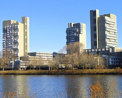
Peabody Terrace Address: Memorial Drive street in Cambridge
Attractions near Peabody Terrace
Peabody Terrace,Zipcar,Mather Dining Hall,John Rubin Productions,In An Uber,Cambridge Economic Research,Putnam Park,Putnam Gardens Apartments,Dunster Grille,Blackstone Steam Plant,ATM,Surrey St Market,Soldiers Field Park 7-13,Sunflower of Peace,John W. Weeks Bridge,Cambridge Hospital Outreach,Weeks Memorial Bridge,Charles River,Doris Cole Faia Architecture / Planning,Cambridge Community CenterHow to get to popular attractions in Cambridge with public transit
Lechmere Station, Cambridge,MIT Lincoln Laboratory, Lexington,Harvard Museum Of Natural History, Cambridge,Milton, MA, Milton,Beth Israel Deaconess Hospital-Milton, Milton,The Langham Boston, Boston,Bunker Hill, Boston,Matthews Arena, Boston,Wayland,Swampscott, MA, Swampscott,West Roxbury VA Medical Center, Boston,MBTA Stoughton Station (South-West Lot),330 Brookline Ave, Boston,Concord, MA,Boston Children's Hospital, Boston,Astrazeneca Bos / Garage#1, Waltham,Cambria Hotel, Boston,Sconset Bluff Walk, Siasconset,Sheraton, Boston,Suffolk University, BostonGet around Boston by public transit!
Traveling around Boston has never been so easy. See step by step directions as you travel to any attraction, street or major public transit station. View bus and train schedules, arrival times, service alerts and detailed routes on a map, so you know exactly how to get to anywhere in Boston.
When traveling to any destination around Boston use Moovit's Live Directions with Get Off Notifications to know exactly where and how far to walk, how long to wait for your line, and how many stops are left. Moovit will alert you when it's time to get off — no need to constantly re-check whether yours is the next stop.
Wondering how to use public transit in Boston or how to pay for public transit in Boston? Moovit public transit app can help you navigate your way with public transit easily, and at minimum cost. It includes public transit fees, ticket prices, and costs. Looking for a map of Boston public transit lines? Moovit public transit app shows all public transit maps in Boston with all Bus, Train, Subway and Ferry routes and stops on an interactive map.
Boston has 4 transit type(s), including: Bus, Train, Subway and Ferry, operated by several transit agencies, including MBTA, Southeastern Regional Transit Authority, MetroWest Regional Transit Authority, Rhode Island Public Transit Authority, WRTA, Lowell Regional Transit Authority, Merrimack Valley Transit, Montachusett Regional Transit Authority, Cape Cod Regional Transit Authority, Brockton Area Transit Authority, Martha's Vineyard Transit Authority, the WAVE - Nantucket Regional Transit Authority, GATRA, Cape Ann Transportation Authority, Massport