Directions to Pediatric Bone Marrow Failure And Myelodysplastic Syndrome Program (Boston) with public transportation
The following transit lines have routes that pass near Pediatric Bone Marrow Failure And Myelodysplastic Syndrome Program
 Bus: 39, 47, 60, 65, 8.
- Train: FRAMINGHAM/WORCESTER, PROVIDENCE/STOUGHTON.
- Subway: GREEN LINE D, GREEN LINE E.
How to get to Pediatric Bone Marrow Failure And Myelodysplastic Syndrome Program by bus?
Click on the bus route to see step by step directions with maps, line arrival times and updated time schedules.
From Boda Borg, Malden
88 minFrom UMass Boston Campus Center, Boston
56 minFrom Wollaston Beach, Quincy
111 minFrom Malden, MA, Malden
84 minFrom Charlestown Navy Yard, Boston
68 minFrom Georgetown, Massachusetts, Boston
66 minFrom Wellington Station, Medford
73 minFrom Mount Ida College, Newton
77 minFrom Ramada Boston, Boston
59 min
How to get to Pediatric Bone Marrow Failure And Myelodysplastic Syndrome Program by train?
Click on the train route to see step by step directions with maps, line arrival times and updated time schedules.
How to get to Pediatric Bone Marrow Failure And Myelodysplastic Syndrome Program by subway?
Click on the subway route to see step by step directions with maps, line arrival times and updated time schedules.
Subway stations near Pediatric Bone Marrow Failure And Myelodysplastic Syndrome Program in Boston
Bus stops near Pediatric Bone Marrow Failure And Myelodysplastic Syndrome Program in Boston
Bus lines to Pediatric Bone Marrow Failure And Myelodysplastic Syndrome Program in Boston
- 35, Forest Hills - Dedham Mall,VIEW
- 39, Back Bay - Forest Hills,VIEW
- 66, Nubian via Allston - Harvard via Allston,VIEW
- GREEN LINE E SHUTTLE, Heath Street - Park Street,VIEW
- GREEN LINE E SHUTTLE, Heath Street - Prudential,VIEW
- 8, Kenmore via South Bay Center - Harbor Point via South Bay Center,VIEW
- 19, Kenmore - Fields Corner,VIEW
- 47, Broadway - Central Square,VIEW
- 85, Ruggles - Assembly,VIEW
- 9, Copley - City Point,VIEW
- 60, Kenmore - Chestnut Hill Mall,VIEW
- 65, Kenmore - Brighton Center,VIEW
- GREEN LINE D SHUTTLE, Reservoir - Fenway,VIEW
- GREEN LINE D SHUTTLE, Riverside - Fenway,VIEW
- GREEN LINE D SHUTTLE, Newton Highlands - Kenmore,VIEW
- GREEN LINE D SHUTTLE, Newton Highlands - Fenway,VIEW
- GREEN LINE D SHUTTLE, Reservoir - Kenmore,VIEW
- GREEN LINE D SHUTTLE, Brookline Hills - Kenmore,VIEW
- GREEN LINE D SHUTTLE, Newton Highlands - Kenmore via Saint Mary's Street,VIEW
- GREEN LINE D SHUTTLE, Riverside - Kenmore,VIEW
What are the closest stations to Pediatric Bone Marrow Failure And Myelodysplastic Syndrome Program?
The closest stations to Pediatric Bone Marrow Failure And Myelodysplastic Syndrome Program are:
- Fenwood Road is 115 yards away, 2 min walk.
- Huntington Ave @ Fenwood Rd is 128 yards away, 2 min walk.
- Longwood Ave @ Blackfan St is 409 yards away, 5 min walk.
- Brookline Ave @ Longwood Ave is 547 yards away, 7 min walk.
- Ave Louis Pasteur @ Longwood Ave is 591 yards away, 8 min walk.
- Chapel St, Colchester St is 759 yards away, 9 min walk.
Which bus lines stop near Pediatric Bone Marrow Failure And Myelodysplastic Syndrome Program?
These bus lines stop near Pediatric Bone Marrow Failure And Myelodysplastic Syndrome Program: 39, 47, 60, 65, 8, 85, CT3.
Which train lines stop near Pediatric Bone Marrow Failure And Myelodysplastic Syndrome Program?
These train lines stop near Pediatric Bone Marrow Failure And Myelodysplastic Syndrome Program: FRAMINGHAM/WORCESTER, PROVIDENCE/STOUGHTON.
Which subway lines stop near Pediatric Bone Marrow Failure And Myelodysplastic Syndrome Program?
These subway lines stop near Pediatric Bone Marrow Failure And Myelodysplastic Syndrome Program: GREEN LINE D, GREEN LINE E.
What’s the nearest subway station to Pediatric Bone Marrow Failure And Myelodysplastic Syndrome Program in Boston?
The nearest subway station to Pediatric Bone Marrow Failure And Myelodysplastic Syndrome Program in Boston is Fenwood Road. It’s a 2 min walk away.
What’s the nearest bus station to Pediatric Bone Marrow Failure And Myelodysplastic Syndrome Program in Boston?
The nearest bus station to Pediatric Bone Marrow Failure And Myelodysplastic Syndrome Program in Boston is Huntington Ave @ Fenwood Rd. It’s a 2 min walk away.
What time is the first subway to Pediatric Bone Marrow Failure And Myelodysplastic Syndrome Program in Boston?
The GREEN LINE D is the first subway that goes to Pediatric Bone Marrow Failure And Myelodysplastic Syndrome Program in Boston. It stops nearby at 4:55 AM.
What time is the last subway to Pediatric Bone Marrow Failure And Myelodysplastic Syndrome Program in Boston?
The GREEN LINE D is the last subway that goes to Pediatric Bone Marrow Failure And Myelodysplastic Syndrome Program in Boston. It stops nearby at 2:22 AM.
What time is the first bus to Pediatric Bone Marrow Failure And Myelodysplastic Syndrome Program in Boston?
The 66 is the first bus that goes to Pediatric Bone Marrow Failure And Myelodysplastic Syndrome Program in Boston. It stops nearby at 4:53 AM.
What time is the last bus to Pediatric Bone Marrow Failure And Myelodysplastic Syndrome Program in Boston?
The 66 is the last bus that goes to Pediatric Bone Marrow Failure And Myelodysplastic Syndrome Program in Boston. It stops nearby at 2:10 AM.
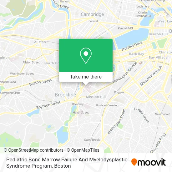
See Pediatric Bone Marrow Failure And Myelodysplastic Syndrome Program, Boston, on the map
Public Transit to Pediatric Bone Marrow Failure And Myelodysplastic Syndrome Program in Boston
Wondering how to get to Pediatric Bone Marrow Failure And Myelodysplastic Syndrome Program in Boston? Moovit helps you find the best way to get to Pediatric Bone Marrow Failure And Myelodysplastic Syndrome Program with step-by-step directions from the nearest public transit station.
Moovit provides free maps and live directions to help you navigate through your city. View schedules, routes, timetables, and find out how long does it take to get to Pediatric Bone Marrow Failure And Myelodysplastic Syndrome Program in real time.
Looking for the nearest stop or station to Pediatric Bone Marrow Failure And Myelodysplastic Syndrome Program? Check out this list of stops closest to your destination: Fenwood Road; Huntington Ave @ Fenwood Rd; Longwood Ave @ Blackfan St; Brookline Ave @ Longwood Ave; Ave Louis Pasteur @ Longwood Ave; Chapel St.
Bus: 39, 47, 60, 65, 8, 85, CT3, 35, 66, GREEN LINE E SHUTTLE, GREEN LINE E SHUTTLE, 19, 9, GREEN LINE D SHUTTLE, GREEN LINE D SHUTTLE, 22, 28, 57.Train: FRAMINGHAM/WORCESTER, PROVIDENCE/STOUGHTON.Subway: GREEN LINE D, GREEN LINE E.
Want to see if there’s another route that gets you there at an earlier time? Moovit helps you find alternative routes or times. Get directions from and directions to Pediatric Bone Marrow Failure And Myelodysplastic Syndrome Program easily from the Moovit App or Website.
We make riding to Pediatric Bone Marrow Failure And Myelodysplastic Syndrome Program easy, which is why over 1.7 million users, including users in Boston, trust Moovit as the best app for public transit. You don’t need to download an individual bus app or train app, Moovit is your all-in-one transit app that helps you find the best bus time or train time available.
For information on prices of bus, subway and train, costs and ride fares to Pediatric Bone Marrow Failure And Myelodysplastic Syndrome Program, please check the Moovit app.
Use the app to navigate to popular places including to the airport, hospital, stadium, grocery store, mall, coffee shop, school, college, and university.
Pediatric Bone Marrow Failure And Myelodysplastic Syndrome Program Address: 450 Brookline Ave street in Boston
- Dana-Farber Cancer Institute,
- Boston Air Conditioning Contractors,
- Jane Carrie Weeks MD,
- Junne Kamihara MD PH.D.,
- Sodexo Corner Deli,
- Yawkey Cafeteria,
- Boston Hemophelia Center,
- David A. Williams MD,
- Andrew L. Hong, MD,
- For Five,
- Vijay G. Sankaran, MD PHD,
- Birgit Knoechel, MD, PHD,
- Dana-Farber Patient Parking & Valet,
- Yawkey Center for Cancer Care (Dana-Farber Cancer Institute),
- Jimmy fund auditorium,
- Longwood Galleria Food Court,
- Sepal,
- Heidi's House of Coffee,
- DUNKIN',
- XI Cha
Places Near Pediatric Bone Marrow Failure And Myelodysplastic Syndrome Program (Boston)
- North End, Boston,
- Massachusetts General Hospital, Boston,
- Boston Medical Center, Boston,
- Wilbur Theatre, Boston,
- Quincy Market, Boston,
- Seaport District, Boston,
- Cheers, Boston,
- Boston Children's Hospital, Boston,
- Prudential Center, Boston,
- Td Garden, Boston,
- Castle Island, Boston,
- Mgm Music Hall, Boston,
- House Of Blues, Boston,
- Isabella Stewart Gardner Museum, Boston,
- Faneuil Hall, Boston,
- Leader Bank Pavilion (Leader Bank Pavillion), Boston,
- Boston Common, Boston,
- Boston Convention & Exhibition Center, Boston,
- Wang Theater, Boston,
- Museum Of Science, Boston
How to get to popular places in Boston with public transit
Get around Boston by public transit!
Traveling around Boston has never been so easy. See step by step directions as you travel to any attraction, street or major public transit station. View bus and train schedules, arrival times, service alerts and detailed routes on a map, so you know exactly how to get to anywhere in Boston.
When traveling to any destination around Boston use Moovit's Live Directions with Get Off Notifications to know exactly where and how far to walk, how long to wait for your line, and how many stops are left. Moovit will alert you when it's time to get off — no need to constantly re-check whether yours is the next stop.
Wondering how to use public transit in Boston or how to pay for public transit in Boston? Moovit public transit app can help you navigate your way with public transit easily, and at minimum cost. It includes public transit fees, ticket prices, and costs. Looking for a map of Boston public transit lines? Moovit public transit app shows all public transit maps in Boston with all Bus, Train, Subway and Ferry routes and stops on an interactive map.
Boston has 4 transit type(s), including: Bus, Train, Subway and Ferry, operated by several transit agencies, including MBTA, Southeastern Regional Transit Authority, MetroWest Regional Transit Authority, Rhode Island Public Transit Authority, WRTA, Lowell Regional Transit Authority, Merrimack Valley Transit, Montachusett Regional Transit Authority, Cape Cod Regional Transit Authority, Brockton Area Transit Authority, Martha's Vineyard Transit Authority, the WAVE - Nantucket Regional Transit Authority, GATRA, Cape Ann Transportation Authority and Massport