How to get to Pemasol Ferragens by bus?
Click on the bus route to see step by step directions with maps, line arrival times and updated time schedules.
From Santa Cruz Da Serra, Duque De Caxias
48 minFrom Hospital Estadual Adão Pereira Nunes, Duque De Caxias
59 minFrom Praia de Mauá, Magé
67 minFrom Outlet Premium Caxias, Duque De Caxias
68 minFrom Petrópolis, Petrópolis
57 minFrom Chácaras Rio-Petrópolis, Duque De Caxias
64 minFrom Jardim Anhangá, Duque De Caxias
44 minFrom Ponto Final TREL - PETRÓPOLIS X PIABETÁ, Petrópolis
40 minFrom Monte do Azeite, Duque De Caxias
49 minFrom Taquara, Duque De Caxias
33 min
How to get to Pemasol Ferragens by train?
Click on the train route to see step by step directions with maps, line arrival times and updated time schedules.
Bus stops near Pemasol Ferragens in Magé
- Rua Gregorio Santana, 51, 2 min walk,VIEW
- Av. Gov. Roberto Silveira 81 - Parque Veneza Magé, 6 min walk,VIEW
- Avenida Governador Roberto Silveira, 1388, 7 min walk,VIEW
- Avenida Roberto Silveira, 132, 7 min walk,VIEW
- Rodoviária De Piabetá (Linhas Municipais), 8 min walk,VIEW
- Rodoviária De Piabetá (Linhas Intermunicipais), 9 min walk,VIEW
Train station near Pemasol Ferragens in Magé
- Fragoso, 28 min walk,VIEW
Bus lines to Pemasol Ferragens in Magé
- TZ07, Capela - Piabetá,VIEW
- TZ13, Piabetá - Fragoso (via Maurimárcia / Pau Grande),VIEW
- 1002, Andorinhas - Piabetá (Via Cachoeira Grande),VIEW
- 1007, Piabetá - Magé (Via Estrada da Conceição),VIEW
- 1017, Piabetá - Parque dos Artistas,VIEW
- 1018, Piabetá - Jardim Esmeralda,VIEW
- 511Q, Imbariê,VIEW
- EXECUTIVO, Piabetá - Penha,VIEW
- 022, Santa Cruz da Serra - Piabetá (Via Parada Angélica),VIEW
- 27M, Morabi - Piabetá (Via Praça de Imbariê),VIEW
- 404I, Caxias - Piabetá (Via Maracanã),VIEW
- 405I, Caxias - Piabetá (Via Lote Xv),VIEW
- 411, Imbariê - Petrópolis (via Piabetá),VIEW
- 413, Nova Campinas - Petrópolis (Via Piabetá),VIEW
- 444L, Piabetá - Penha,VIEW
- 1003, Magé - Pau Grande (Via Fragoso / Piabetá),VIEW
- 1404I (EXECUTIVO), Caxias - Piabetá (Via Maracanã),VIEW
- 1461C, Piabetá - Passeio (Via Imbariê - Expresso),VIEW
- 468C, Piabetá (Parador),VIEW
- 2462C (EXECUTIVO), Piabetá,VIEW
What are the closest stations to Pemasol Ferragens?
The closest stations to Pemasol Ferragens are:
- Rua Gregorio Santana, 51 is 106 meters away, 2 min walk.
- Av. Gov. Roberto Silveira 81 - Parque Veneza Magé is 461 meters away, 6 min walk.
- Avenida Governador Roberto Silveira, 1388 is 502 meters away, 7 min walk.
- Avenida Roberto Silveira, 132 is 522 meters away, 7 min walk.
- Rodoviária De Piabetá (Linhas Municipais) is 545 meters away, 8 min walk.
- Rodoviária De Piabetá (Linhas Intermunicipais) is 643 meters away, 9 min walk.
- Fragoso is 2154 meters away, 28 min walk.
Which bus lines stop near Pemasol Ferragens?
These bus lines stop near Pemasol Ferragens: 022, 1014, 404I, 411.
Which train line stops near Pemasol Ferragens?
EXTENSÃO VILA INHOMIRIM (Vila Inhomirim)
What’s the nearest train station to Pemasol Ferragens in Magé?
The nearest train station to Pemasol Ferragens in Magé is Fragoso. It’s a 28 min walk away.
What’s the nearest bus station to Pemasol Ferragens in Magé?
The nearest bus station to Pemasol Ferragens in Magé is Rua Gregorio Santana, 51. It’s a 2 min walk away.
What time is the first train to Pemasol Ferragens in Magé?
The EXTENSÃO VILA INHOMIRIM is the first train that goes to Pemasol Ferragens in Magé. It stops nearby at 4:45 AM.
What time is the last train to Pemasol Ferragens in Magé?
The EXTENSÃO VILA INHOMIRIM is the last train that goes to Pemasol Ferragens in Magé. It stops nearby at 10:48 PM.
What time is the first bus to Pemasol Ferragens in Magé?
The 468C is the first bus that goes to Pemasol Ferragens in Magé. It stops nearby at 3:30 AM.
What time is the last bus to Pemasol Ferragens in Magé?
The 405I is the last bus that goes to Pemasol Ferragens in Magé. It stops nearby at 2:01 AM.
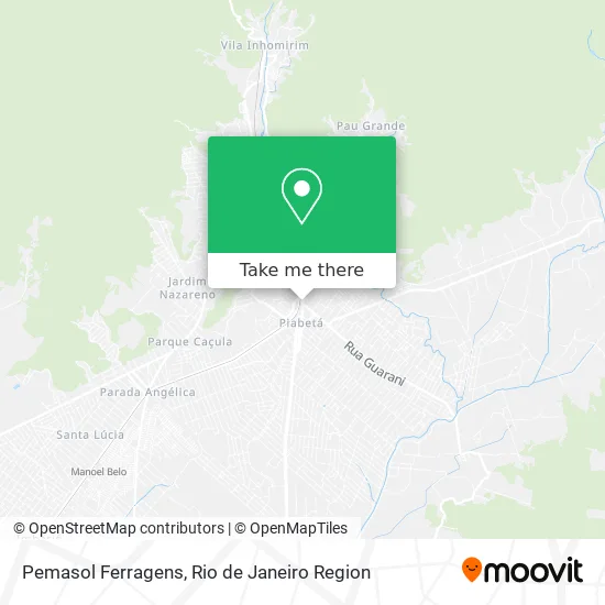
See Pemasol Ferragens, Magé, on the map
Public Transit to Pemasol Ferragens in Magé
Wondering how to get to Pemasol Ferragens in Magé? Moovit helps you find the best way to get to Pemasol Ferragens with step-by-step directions from the nearest public transit station.
Moovit provides free maps and live directions to help you navigate through your city. View schedules, routes, timetables, and find out how long does it take to get to Pemasol Ferragens in real time.
Looking for the nearest stop or station to Pemasol Ferragens? Check out this list of stops closest to your destination: Rua Gregorio Santana; Av. Gov. Roberto Silveira 81 - Parque Veneza Magé; Avenida Governador Roberto Silveira; Avenida Roberto Silveira; Rodoviária De Piabetá (Linhas Municipais); Rodoviária De Piabetá (Linhas Intermunicipais); Fragoso.
Bus: 022, 1014, 404I, 411, TZ07, TZ13, 1002, 1007, 1017, 511Q, EXECUTIVO, 27M, 405I, 468C, 2462C (EXECUTIVO), 3461C, TZ01, TZ05, TZ14, 1015.Train: EXTENSÃO VILA INHOMIRIM.
Want to see if there’s another route that gets you there at an earlier time? Moovit helps you find alternative routes or times. Get directions from and directions to Pemasol Ferragens easily from the Moovit App or Website.
We make riding to Pemasol Ferragens easy, which is why over 1.5 million users, including users in Magé, trust Moovit as the best app for public transit. You don’t need to download an individual bus app or train app, Moovit is your all-in-one transit app that helps you find the best bus time or train time available.
For information on prices of bus and train, costs and ride fares to Pemasol Ferragens, please check the Moovit app.
Use the app to navigate to popular places including to the airport, hospital, stadium, grocery store, mall, coffee shop, school, college, and university.
Pemasol Ferragens Address: Avenida Santos Dumont, 14 Fazenda Sobradinho Magé-RJ 25900-000 street in Magé
- Mundo Verde,
- Iverdan,
- Farmacias Farmax,
- Robson Braga e Carine Oliveira Sociedade de Advogados,
- A Nossa Drogaria de Caxias,
- Contege Contabilidade Técnica Geral,
- Pialab,
- Novolare,
- Imperio Bijuterias,
- Jack Festas,
- CONTEGE CONTABILIDADE TECNICA GERAL,
- Transmarine Transporte de Produtos Maritimos,
- Instituto Embelleze,
- Daher Moda Erotica e Feminina Diferenci,
- I. VERDAN CONTABILIDADE E CONSULTORIA,
- Farmacia Poli Farma L,
- Agua Na Boca Pastelaria,
- D G M Eletro-Móveis,
- Academia Titaes,
- Piabeta-Int-RJ
Places Near Pemasol Ferragens (Magé)
- Praia do Arpoador, Ipanema,
- Avenida Venezuela 134, Saúde,
- Norte Shopping, Cachambi,
- Museu Do Amanhã, Centro,
- Rua Licínio Cardoso, São Francisco Xavier,
- Hospital Municipal Ronaldo Gazolla, Acari,
- Rua Ulysses Guimarães 16, Cidade Nova,
- Hospital Federal Do Andaraí, Andaraí,
- Shopping Downtown, Barra Da Tijuca,
- Shopping Nova América, Del Castilho,
- Avenida Rio Branco, Centro,
- Hospital Federal Cardoso Fontes, Jacarepaguá,
- Shopping RioSul, Botafogo,
- Shopping Rio Sul, Botafogo,
- Feira Livre da Gloria, Glória,
- Rodoviária Novo Rio (Rodoviária do Rio de Janeiro), Santo Cristo,
- Rio De Janeiro,
- Hospital Pedro Ernesto, Vila Isabel,
- Niterói, Niterói,
- Feirão De Malhas, Duque De Caxias
How to get to popular places in Rio de Janeiro Region with public transit
Get around Magé by public transit!
Traveling around Magé has never been so easy. See step by step directions as you travel to any attraction, street or major public transit station. View bus and train schedules, arrival times, service alerts and detailed routes on a map, so you know exactly how to get to anywhere in Magé.
When traveling to any destination around Magé use Moovit's Live Directions with Get Off Notifications to know exactly where and how far to walk, how long to wait for your line, and how many stops are left. Moovit will alert you when it's time to get off — no need to constantly re-check whether yours is the next stop.
Wondering how to use public transit in Magé or how to pay for public transit in Magé? Moovit public transit app can help you navigate your way with public transit easily, and at minimum cost. It includes public transit fees, ticket prices, and costs. Looking for a map of Magé public transit lines? Moovit public transit app shows all public transit maps in Magé with all Bus, Train, Metro, Light Rail, Ferry, Cable Car, Gondola and Funicular routes and stops on an interactive map.
Rio de Janeiro Region has 8 transit type(s), including: Bus, Train, Metro, Light Rail, Ferry, Cable Car, Gondola and Funicular, operated by several transit agencies, including TrensRJ, Metrô Rio, VLT Carioca, Barcas Rio, BRT MOBI-Rio, Auto Viação Alpha, Auto Viação Tijuca, Gire Transportes, Transurb, Viação Nossa Senhora das Graças, Consórcio INTERSUL, Braso Lisboa (Municipal), Caprichosa Auto Ônibus, Auto Viação Três Amigos and Rodoviária Âncora Matias