How to get to Pentapark by bus?
Click on the bus route to see step by step directions with maps, line arrival times and updated time schedules.
From FH 1863, Neckarstadt-Ost/Wohlgelegen
127 minFrom MVV Energie Ladestation, Käfertal
132 minFrom SAP Headquarters, Walldorf
56 minFrom Friedhof Käfertal, Käfertal
135 minFrom GRN-Klinik Schwetzingen, Schwetzingen
54 minFrom Hauptfeuerwache, Berufsfeuerwehr Mannheim, Neckarau
98 minFrom SAP Campus, Walldorf
53 minFrom Möbel Höffner, Schwetzingen
77 minFrom SAP Walldorf P18, Walldorf
57 min
How to get to Pentapark by train?
Click on the train route to see step by step directions with maps, line arrival times and updated time schedules.
Light Rail stations near Pentapark in Bergheim
- Heidelberg, Gneisenaustr. Süd, 1 min walk,VIEW
Bus stops near Pentapark in Bergheim
Bus lines to Pentapark in Bergheim
- AIRPORT BUS, Heidelberg, Nh Collection Ho.,VIEW
- 20, S-Bahnhof Altstadt,VIEW
- 21, Bismarckplatz,VIEW
- 24, Hans-Thoma-Platz,VIEW
- 26, Hans-Thoma-Platz,VIEW
- 28, Mombertplatz,VIEW
- 31, Technologiepark,VIEW
- 31E, Campus Im Neuenh. F.,VIEW
- 36, Ziegelhausen Köpfel,VIEW
- E, Betriebshof,VIEW
- M2, Bismarckplatz,VIEW
- M2, Universitätsplatz,VIEW
- M5, Neuenheimer Feld,VIEW
- 22, Bismarckplatz,VIEW
- 35, Waldorfschule Hd,VIEW
- 35E, Ziegelhausen,VIEW
- E, Bismarckplatz – Montpellierbrücke – HD Hauptbahnhof Süd – Gadamerplatz – Kranichweg/Stotz – Eppelheim Kirchheimer Straße,VIEW
- E, S-Bf Orthopädie - S-Bf Schlierbach/Ziegelhausen - Ziegelhausen Kirche - Hirtenaue - Neckarschule - Bärenbach Süd,VIEW
- M2, Wieblingen Mitte - Betriebshof,VIEW
- 5, Weinheim - Viernheim - Mannheim - Heidelberg - Weinheim,VIEW
What are the closest stations to Pentapark?
The closest stations to Pentapark are:
- Heidelberg, Gneisenaustr. Süd is 11 meters away, 1 min walk.
- Heidelberg, Marriott is 146 meters away, 3 min walk.
- Betriebshof is 343 meters away, 5 min walk.
- Heidelberg, Betriebshof is 357 meters away, 5 min walk.
- Czernybrücke is 396 meters away, 6 min walk.
- Heidelberg, Czernybrücke is 427 meters away, 6 min walk.
Which bus lines stop near Pentapark?
These bus lines stop near Pentapark: 713, 717, 721.
Which train lines stop near Pentapark?
These train lines stop near Pentapark: RB68, S3.
Which light rail lines stop near Pentapark?
These light rail lines stop near Pentapark: 21, 22, RNV 5.
What’s the nearest light rail station to Pentapark in Bergheim?
The nearest light rail station to Pentapark in Bergheim is Heidelberg, Gneisenaustr. Süd. It’s a 1 min walk away.
What’s the nearest bus station to Pentapark in Bergheim?
The nearest bus station to Pentapark in Bergheim is Heidelberg, Marriott. It’s a 3 min walk away.
What time is the first light rail to Pentapark in Bergheim?
The RNV 5 is the first light rail that goes to Pentapark in Bergheim. It stops nearby at 4:24 AM.
What time is the last light rail to Pentapark in Bergheim?
The RNV 5 is the last light rail that goes to Pentapark in Bergheim. It stops nearby at 1:28 AM.
What time is the first bus to Pentapark in Bergheim?
The 35 is the first bus that goes to Pentapark in Bergheim. It stops nearby at 4:49 AM.
What time is the last bus to Pentapark in Bergheim?
The RNV MOONLINER 3 is the last bus that goes to Pentapark in Bergheim. It stops nearby at 1:26 AM.
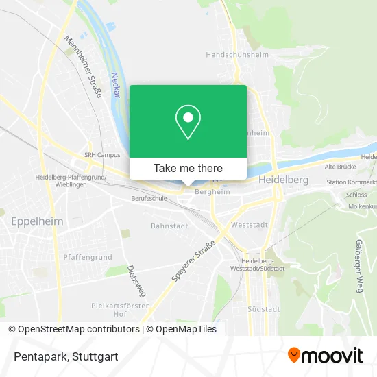
See Pentapark, Bergheim, on the map
Public Transit to Pentapark in Bergheim
Wondering how to get to Pentapark in Bergheim? Moovit helps you find the best way to get to Pentapark with step-by-step directions from the nearest public transit station.
Moovit provides free maps and live directions to help you navigate through your city. View schedules, routes, timetables, and find out how long does it take to get to Pentapark in real time.
Looking for the nearest stop or station to Pentapark? Check out this list of stops closest to your destination: Heidelberg; Heidelberg; Betriebshof; Heidelberg; Czernybrücke; Heidelberg.
Bus: 713, 717, 721, AIRPORT BUS, 22, 35, 35E, 20, 21, 24, 26, 28, E, E, M2, 5, M2, M2, M2, M5, RNV 20, RNV 22, RNV 24.Train: RB68, S3.Light Rail: 21, 22, RNV 5.
Want to see if there’s another route that gets you there at an earlier time? Moovit helps you find alternative routes or times. Get directions from and directions to Pentapark easily from the Moovit App or Website.
We make riding to Pentapark easy, which is why over 1.5 million users, including users in Bergheim, trust Moovit as the best app for public transit. You don’t need to download an individual bus app or train app, Moovit is your all-in-one transit app that helps you find the best bus time or train time available.
For information on prices of bus, train and light rail, costs and ride fares to Pentapark, please check the Moovit app.
Use the app to navigate to popular places including to the airport, hospital, stadium, grocery store, mall, coffee shop, school, college, and university.
Pentapark Address: Vangerowstraße Bergheim, 69115 Heidelberg street in Bergheim
- Tobias Willing,
- Rohrfrei,
- Unzer Group,
- Notariat Heidelberg,
- Uzr*,
- Vrs Tickets H O P,
- Pipo,
- Kostbar Heidel,
- Allegro Microsystems Germany,
- Medizinische Kräftigungstherapie,
- Medaris,
- Heidelberger Payment,
- Restaurant Cantina Business,
- Forum Institut,
- Druckkammerzentrum Heidelberg,
- Bpi-Business Process Integration,
- Evelyn Zeitel - Familienrecht Mediation Coaching,
- Hüllemann Holding,
- Risini Verwaltungs,
- Kostbar
Places Near Pentapark (Bergheim)
- Hauptbahnhof Stuttgart, Stuttgart-Mitte,
- SI-Centrum, Möhringen,
- Mercedes-Benz Museum (Mercedes Museum Stuttgart), Bad Cannstatt,
- Porsche Museum, Zuffenhausen,
- Mercedes-Benz Museum, Bad Cannstatt,
- Geilhaus Haus 33a, Reutlingen-Betzingen,
- Gasometer Pforzheim, Pforzheim,
- FlixBus Haltestelle, Stuttgart,
- Klinikum Stuttgart - Katharinenhospital, Stuttgart-Mitte,
- Hanns-Martin-Schleyer-Halle, Bad Cannstatt,
- Marmorsaal Im Weissenburgpark, Stuttgart-Süd,
- Waldfriedhof, Degerloch,
- Mettingen Eros-Center Puff Laufhaus, Esslingen Am Neckar,
- Gleis 101/102 (tief), Stuttgart-Mitte,
- Wilhelma (U-Bahn Wilhelma), Bad Cannstatt,
- Im Wizemann (Halle), Bad Cannstatt,
- Hanns-Martin-Schleyer-Halle (Stuttgart Hans-Martin-Schleyerhalle), Bad Cannstatt,
- Pariser Platz Stuttgart, Stuttgart-Mitte,
- Porsche-Arena, Bad Cannstatt,
- Schleyerhalle, Bad Cannstatt
How to get to popular places in Stuttgart with public transit
Get around Bergheim by public transit!
Traveling around Bergheim has never been so easy. See step by step directions as you travel to any attraction, street or major public transit station. View bus and train schedules, arrival times, service alerts and detailed routes on a map, so you know exactly how to get to anywhere in Bergheim.
When traveling to any destination around Bergheim use Moovit's Live Directions with Get Off Notifications to know exactly where and how far to walk, how long to wait for your line, and how many stops are left. Moovit will alert you when it's time to get off — no need to constantly re-check whether yours is the next stop.
Wondering how to use public transit in Bergheim or how to pay for public transit in Bergheim? Moovit public transit app can help you navigate your way with public transit easily, and at minimum cost. It includes public transit fees, ticket prices, and costs. Looking for a map of Bergheim public transit lines? Moovit public transit app shows all public transit maps in Bergheim with all Bus, Train, Subway, Light Rail, Ferry, S-Bahn and Funicular routes and stops on an interactive map.
Stuttgart has 7 transit type(s), including: Bus, Train, Subway, Light Rail, Ferry, S-Bahn and Funicular, operated by several transit agencies, including SSB - Stadtbahn, SSB, SSB - Seilbahn / Zacke, S-Bahn Stuttgart, Rhein-Neckar-Verkehr GmbH (rnv), Karlsruher Verkehrsverbund, DB AG, DB Regiobus BW, Arverio Baden-Württemberg GmbH, DB RegioNetz Verkehrs GmbH Westfrankenbahn, DB Regio AG Baden-Württemberg, Südwestdeutsche Verkehrs-AG, DB Regio AG Mitte Region Hessen, DB and Bodensee-Oberschwaben-Bahn
Public transit lines with stations closest to Pentapark in Bergheim
Bus lines with stations closest to Pentapark in Bergheim
Betriebshof
 22Bismarckplatz – Montpellierbrücke – HD Hauptbahnhof Süd – Gadamerplatz – Kranichweg/Stotz – Eppelheim Kirchheimer Straße
- 35(HD Waldorfschule -) Wieblingen Nord - Betriebshof - Bismarckplatz - S-Bf Altstadt - S-Bf Schlierbach/Ziegelhausen - Neckargemünd Bf - Neckargemünd Bildungszentrum
- 35E(HD Waldorfschule -) Wieblingen Nord - Betriebshof - Bismarckplatz - S-Bf Altstadt - S-Bf Schlierbach/Ziegelhausen - Neckargemünd Bf - Neckargemünd Bildungszentrum
Betriebshof
- 20(Sportzentrum Nord –) Schwimmbad – Medizinische Klinik/Chirurgie/Zoo – HD Hauptbahnhof – Seegarten – Friedrich-Ebert-Platz – Rathaus/Bergbahn – S-Bf Altstadt
- 21Hans-Thoma-Platz – Jahnstraße – Campus Bergheim – Seegarten – HD Hauptbahnhof – Jahnstraße – Hans-Thoma-Platz
- 24(Schriesheim Bf –) Handschuhsheim Burgstraße – Hans-Thoma-Platz – Technologiepark – Jahnstraße – Betriebshof - HD Hauptbahnhof – Römerkreis Süd – S-Bf Weststadt/Südstadt – Rohrbach Markt – Rohrbach Süd (– Leimen Friedhof)
- 26Bismarckplatz – Campus Bergheim – Betriebshof - HD Hauptbahnhof Süd – Messplatz – Kirchheim Rathaus – Kirchheim Friedhof
- 28(Sportzentrum Nord –) Schwimmbad – Campus Im Neuenheimer Feld – Betriebshof – HD Hauptbahnhof – S-Bf Weststadt/Südstadt – EMBL – Mombertplatz
Heidelberg, Betriebshof
- 713S-Bf. Pfaffengrund/Wieblingen - Schwetzingen, Bahnhof Bstg B
- 721Neuenheim, Bunsengymnasium Bstg F - Wiesloch-Walldorf, Bf Bstg West2
- RNV 20Neuenheim, Sportzentrum Nord - Heidelberg, S-Bf. Altstadt Bstg C
- RNV 22Heidelberg, Bismarckplatz Bstg A - Eppelheim, Kirchheimer Straße Bstg A
- RNV 24Handschuh., Heiligenbergschule - Rohrbach, Süd