Directions to Pepsi Center WTC (Miguel Hidalgo) with public transportation
The following transit lines have routes that pass near Pepsi Center WTC
How to get to Pepsi Center WTC by bus?
Click on the bus route to see step by step directions with maps, line arrival times and updated time schedules.
How to get to Pepsi Center WTC by metro?
Click on the metro route to see step by step directions with maps, line arrival times and updated time schedules.
Bus stops near Pepsi Center WTC in Miguel Hidalgo
- Oklahoma 56, 5 min walk,
- Filadelfia - Arizona, 5 min walk,
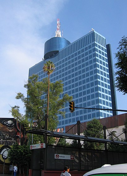
- Polifórum, 6 min walk,
- Viaducto Viaducto (Miguel Alemán), 932, 6 min walk,
- La Federal Calle Filadelfia Nápoles Benito Juárez Cdmx 03810 México, 6 min walk,
- Vermont, 75, 7 min walk,
- Viaducto Viaducto (Miguel Alemán), 890a, 8 min walk,
- Indianapolis, 89, 8 min walk,
Metro stations near Pepsi Center WTC in Miguel Hidalgo
- Chilpancingo, 12 min walk,
- Tacubaya, 14 min walk,
Bus lines to Pepsi Center WTC in Miguel Hidalgo
- 1, Hotel de México,
- RUTA 80, Cuernito,
- 1, Dr. Gálvez - Rojo Gómez,
- 2, Tepalcates - Col. del Valle,
- RUTA 37, Aeropuerto,
- RUTA 27, Hotel México,
- METRO AEROPUERTO - METRO TACUBAYA, Metro Aeropuerto,
- RUTA 2, Esparteco,
- RUTA 54, Observatorío,
- RUTA 100, Nezahualcoyotl,
- 106, Metro Chapultepec,
What are the closest stations to Pepsi Center WTC?
The closest stations to Pepsi Center WTC are:
- Oklahoma 56 is 346 meters away, 5 min walk.
- Filadelfia - Arizona is 370 meters away, 5 min walk.
- Polifórum is 415 meters away, 6 min walk.
- Viaducto Viaducto (Miguel Alemán), 932 is 435 meters away, 6 min walk.
- La Federal Calle Filadelfia Nápoles Benito Juárez Cdmx 03810 México is 456 meters away, 6 min walk.
- Vermont, 75 is 486 meters away, 7 min walk.
- Viaducto Viaducto (Miguel Alemán), 890a is 558 meters away, 8 min walk.
- Indianapolis, 89 is 611 meters away, 8 min walk.
- Chilpancingo is 855 meters away, 12 min walk.
- Tacubaya is 1066 meters away, 14 min walk.
Which bus lines stop near Pepsi Center WTC?
These bus lines stop near Pepsi Center WTC: 1, 2, 369, RUTA 54, RUTA 80.
Which metro lines stop near Pepsi Center WTC?
These metro lines stop near Pepsi Center WTC: 7, 9.
What’s the nearest metro station to Pepsi Center WTC in Miguel Hidalgo?
The nearest metro station to Pepsi Center WTC in Miguel Hidalgo is Chilpancingo. It’s a 12 min walk away.
What’s the nearest bus station to Pepsi Center WTC in Miguel Hidalgo?
The nearest bus stations to Pepsi Center WTC in Miguel Hidalgo are Oklahoma 56 and Filadelfia - Arizona. The closest one is a 5 min walk away.
What time is the first metro to Pepsi Center WTC in Miguel Hidalgo?
The 9 is the first metro that goes to Pepsi Center WTC in Miguel Hidalgo. It stops nearby at 7:00 AM.
What time is the last metro to Pepsi Center WTC in Miguel Hidalgo?
The 7 is the last metro that goes to Pepsi Center WTC in Miguel Hidalgo. It stops nearby at 12:29 AM.
What time is the first bus to Pepsi Center WTC in Miguel Hidalgo?
The 1 is the first bus that goes to Pepsi Center WTC in Miguel Hidalgo. It stops nearby at 4:25 AM.
What time is the last bus to Pepsi Center WTC in Miguel Hidalgo?
The 1 is the last bus that goes to Pepsi Center WTC in Miguel Hidalgo. It stops nearby at 12:45 AM.
See Pepsi Center WTC, Miguel Hidalgo, on the map
Public Transit to Pepsi Center WTC in Miguel Hidalgo
Wondering how to get to Pepsi Center WTC in Miguel Hidalgo, México? Moovit helps you find the best way to get to Pepsi Center WTC with step-by-step directions from the nearest public transit station.
Moovit provides free maps and live directions to help you navigate through your city. View schedules, routes, timetables, and find out how long does it take to get to Pepsi Center WTC in real time.
Looking for the nearest stop or station to Pepsi Center WTC? Check out this list of stops closest to your destination: Oklahoma 56; Filadelfia - Arizona; Polifórum; Viaducto Viaducto (Miguel Alemán); La Federal Calle Filadelfia Nápoles Benito Juárez Cdmx 03810 México; Vermont; Viaducto Viaducto (Miguel Alemán); Indianapolis; Chilpancingo; Tacubaya.
Bus: 1, 2, 369, RUTA 54, RUTA 80, RUTA 37.Metro: 7, 9, 1.
Want to see if there’s another route that gets you there at an earlier time? Moovit helps you find alternative routes or times. Get directions from and directions to Pepsi Center WTC easily from the Moovit App or Website.
We make riding to Pepsi Center WTC easy, which is why over 1.5 million users, including users in Miguel Hidalgo, trust Moovit as the best app for public transit. You don’t need to download an individual bus app or train app, Moovit is your all-in-one transit app that helps you find the best bus time or train time available.
For information on prices of bus and metro, costs and ride fares to Pepsi Center WTC, please check the Moovit app.
Use the app to navigate to popular places including to the airport, hospital, stadium, grocery store, mall, coffee shop, school, college, and university.
Pepsi Center WTC Address: Montecito 38 street in Miguel Hidalgo
Places Near Pepsi Center WTC (Miguel Hidalgo)
How to get to popular places in Ciudad de Mexico with public transit
Get around Miguel Hidalgo by public transit!
Traveling around Miguel Hidalgo has never been so easy. See step by step directions as you travel to any attraction, street or major public transit station. View bus and train schedules, arrival times, service alerts and detailed routes on a map, so you know exactly how to get to anywhere in Miguel Hidalgo.
When traveling to any destination around Miguel Hidalgo use Moovit's Live Directions with Get Off Notifications to know exactly where and how far to walk, how long to wait for your line, and how many stops are left. Moovit will alert you when it's time to get off — no need to constantly re-check whether yours is the next stop.
Wondering how to use public transit in Miguel Hidalgo or how to pay for public transit in Miguel Hidalgo? Moovit public transit app can help you navigate your way with public transit easily, and at minimum cost. It includes public transit fees, ticket prices, and costs. Looking for a map of Miguel Hidalgo public transit lines? Moovit public transit app shows all public transit maps in Miguel Hidalgo with all Bus, Train, Metro, Cable Car and Gondola routes and stops on an interactive map.
Ciudad de Mexico has 5 transit type(s), including: Bus, Train, Metro, Cable Car and Gondola, operated by several transit agencies, including STC (Metro CDMX), Ferrocarriles Suburbanos, Trolebús, Puma Bus, Mexibus, Autobuses / Combis, Tren Ligero, Mexicable, Peseros, Cablebús, Trolebús elevado, Corredores Concesionados, RTP, Metrobús and Tren El Insurgente