Directions to Piazzale Loreto station (Milano) with public transit
The following transit lines have routes that pass near Piazzale Loreto
How to get to Piazzale Loreto station by bus?
Click on the bus route to see step by step directions with maps, line arrival times and updated time schedules.
How to get to Piazzale Loreto station by train?
Click on the train route to see step by step directions with maps, line arrival times and updated time schedules.
How to get to Piazzale Loreto station by metro?
Click on the metro route to see step by step directions with maps, line arrival times and updated time schedules.
How to get to Piazzale Loreto station by light rail?
Click on the light rail route to see step by step directions with maps, line arrival times and updated time schedules.
Bus stops near Piazzale Loreto in Milano
- Loreto M1 M2, 1 min walk,
- Via Pecchio V.le Abruzzi, 3 min walk,
- Via Porpora Via Lulli, 4 min walk,
- P.le Loreto V.le Monza M1 M2, 6 min walk,
- P.le Loreto Via Padova, 8 min walk,
Metro station near Piazzale Loreto in Milano
- Loreto, 1 min walk,
Light Rail stations near Piazzale Loreto in Milano
- Via Venini Via Battaglia, 2 min walk,
Bus lines to Piazzale Loreto station in Milano
- 39, Via Pitteri,
- 55, Loreto M1 M2 > Ist. Sacro Cuore,
- Q55, Lambrate FS M2,
- 81, Centrale FS M2 M3,
- 965, Milano Loreto M1 M2,
- 62, P.ta Romana M3,
- NM2, Cadorna,
- 56, Loreto M1 M2,
- 91, Circolare Sinistra,
- N91, Circolare Sinistra,
- 90, P.le Cuoco,
- N90, Circolare Destra,
- NM1, Duomo,
- 174, Q.re Turro,
What are the closest stations to Piazzale Loreto?
The closest stations to Piazzale Loreto are:
- Loreto M1 M2 is 24 meters away, 1 min walk.
- Loreto is 66 meters away, 1 min walk.
- Via Venini Via Battaglia is 99 meters away, 2 min walk.
- Via Pecchio V.le Abruzzi is 215 meters away, 3 min walk.
- Via Porpora Via Lulli is 299 meters away, 4 min walk.
- P.le Loreto V.le Monza M1 M2 is 452 meters away, 6 min walk.
- P.le Loreto Via Padova is 601 meters away, 8 min walk.
Which bus lines stop near Piazzale Loreto?
These bus lines stop near Piazzale Loreto: 81, 90, 91.
Which train lines stop near Piazzale Loreto?
These train lines stop near Piazzale Loreto: RV, S6, S9.
Which metro lines stop near Piazzale Loreto?
These metro lines stop near Piazzale Loreto: M1, M2.
Which light rail line stops near Piazzale Loreto?
1 (Greco)
What’s the nearest light rail station to Piazzale Loreto in Milano?
The nearest light rail station to Piazzale Loreto in Milano is Via Venini Via Battaglia. It’s a 2 min walk away.
What’s the nearest metro station to Piazzale Loreto in Milano?
The nearest metro station to Piazzale Loreto in Milano is Loreto. It’s a 1 min walk away.
What’s the nearest bus station to Piazzale Loreto in Milano?
The nearest bus station to Piazzale Loreto in Milano is Loreto M1 M2. It’s a 1 min walk away.
What time is the first light rail to Piazzale Loreto in Milano?
The 1 is the first light rail that goes to Piazzale Loreto in Milano. It stops nearby at 5:26 AM.
What time is the last light rail to Piazzale Loreto in Milano?
The 1 is the last light rail that goes to Piazzale Loreto in Milano. It stops nearby at 1:56 AM.
What time is the first metro to Piazzale Loreto in Milano?
The M2 is the first metro that goes to Piazzale Loreto in Milano. It stops nearby at 6:19 AM.
What time is the last metro to Piazzale Loreto in Milano?
The M2 is the last metro that goes to Piazzale Loreto in Milano. It stops nearby at 12:55 AM.
What time is the first bus to Piazzale Loreto in Milano?
The N91 is the first bus that goes to Piazzale Loreto in Milano. It stops nearby at 3:11 AM.
What time is the last bus to Piazzale Loreto in Milano?
The NM1 is the last bus that goes to Piazzale Loreto in Milano. It stops nearby at 3:49 AM.
See Piazzale Loreto, Milano, on the map
Public Transit to Piazzale Loreto in Milano
How to get to Piazzale Loreto in Milano, Italy?
It’s easy with Moovit. Type in your street address and Moovit’s route finder will locate the fastest way to get you there! Not sure where to get off on the street? Download the Moovit App to find live directions (including where to get off on Piazzale Loreto), see timetables and get the estimated arrival times for your favorite bus, metro, light rail or train lines.
Looking for the nearest stop or station to Piazzale Loreto? Check out this list of closest stops available to your destination: Loreto M1 M2; Loreto; Via Venini Via Battaglia; Via Pecchio V.le Abruzzi; Via Porpora Via Lulli; P.le Loreto V.le Monza M1 M2; P.le Loreto Via Padova.
Bus: 81, 90, 91, 39, 55, Q55, 965, 62, NM2, 56, N91, N90.Train: RV, S6, S9.Metro: M1, M2.Light Rail: 1.
Download the Moovit App to see the current schedule and routes available for Milano. No need to install a special bus app to check the bus time or a train app to get train time. Moovit is the only all-in-one transit app that helps you get where you need to go.
We make riding on public transit to Piazzale Loreto easy, which is why over 1.5 million users, including users in Milano trust Moovit as the best app for public transit.
Use the app to navigate to popular places including to the airport, hospital, stadium, grocery store, mall, coffee shop, school, college, and university.
Location: Milano, Milan and Lombardy
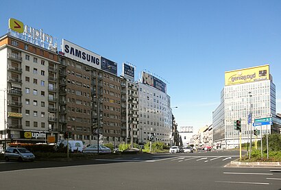
Piazzale Loreto is a major city square in Milan, Italy.Wiki
Streets near Piazzale Loreto, Milano
Get around Milano by public transit!
Traveling around Milano has never been so easy. See step by step directions as you travel to any attraction, street or major public transit station. View bus and train schedules, arrival times, service alerts and detailed routes on a map, so you know exactly how to get to anywhere in Milano.
When traveling to any destination around Milano use Moovit's Live Directions with Get Off Notifications to know exactly where and how far to walk, how long to wait for your line, and how many stops are left. Moovit will alert you when it's time to get off — no need to constantly re-check whether yours is the next stop.
Wondering how to use public transit in Milano or how to pay for public transit in Milano? Moovit public transit app can help you navigate your way with public transit easily, and at minimum cost. It includes public transit fees, ticket prices, and costs. Looking for a map of Milano public transit lines? Moovit public transit app shows all public transit maps in Milano with all Bus, Train, Metro, Light Rail, Ferry, Cable Car, Funicular and Gondola routes and stops on an interactive map.
Milan and Lombardy has 8 transit type(s), including: Bus, Train, Metro, Light Rail, Ferry, Cable Car, Funicular and Gondola, operated by several transit agencies, including ATM, Autoguidovie S.p.A., AirPullman, STAV, Autostradale S.r.l., Terravision, SAI, TiLo, Arriva Cremona, Trenord, Sun S.p.a., SAF Duemila, Arriva Bergamo, Linee Lecco and Trenitalia