Directions to Pinacoteca Agnelli station (Torino) with public transit
The following transit lines have routes that pass near Pinacoteca Agnelli
How to get to Pinacoteca Agnelli station by bus?
Click on the bus route to see step by step directions with maps, line arrival times and updated time schedules.
How to get to Pinacoteca Agnelli station by train?
Click on the train route to see step by step directions with maps, line arrival times and updated time schedules.
How to get to Pinacoteca Agnelli station by metro?
Click on the metro route to see step by step directions with maps, line arrival times and updated time schedules.
Bus stops near Pinacoteca Agnelli in Torino
- Biglieri, 3 min walk,
- Torino - Via Nizza - Lingotto Fiere, 4 min walk,
- Ellero, 5 min walk,
- Baiardi, 7 min walk,
- Lingotto, 9 min walk,
- Torino - Via Nizza Angolo Via Vado, 10 min walk,
Metro station near Pinacoteca Agnelli in Torino
- Lingotto, 9 min walk,
Train station near Pinacoteca Agnelli in Torino
- Torino Lingotto, 24 min walk,
Bus lines to Pinacoteca Agnelli station in Torino
- 14, Pralormo,
- 18, 18 Blu Via Artom,
- 18, Regio Parco Piazza Sofia,
- 24, Basse Lingotto Via Vigliani,
- 34, Ospedali Via Ventimiglia,
- 35, Nichelino Transita Porta Nuova,
- 93 /, Mirafiori Corso Tazzoli (Fca),
- 267, Torino - Terminal Bus Torino Esposizioni,
- 17, Ospedale Di Rivoli -Via Ventimiglia,
- 17 /, C.so Allamano - Via Ventimiglia,
- 42, Limitato Corso Trapani,
- 74, Ospedali Via Ventimiglia,
- M1S, Bengasi,
- 180, Chieri - Matteotti - Poste,
What are the closest stations to Pinacoteca Agnelli?
The closest stations to Pinacoteca Agnelli are:
- Biglieri is 182 meters away, 3 min walk.
- Torino - Via Nizza - Lingotto Fiere is 238 meters away, 4 min walk.
- Ellero is 328 meters away, 5 min walk.
- Baiardi is 491 meters away, 7 min walk.
- Lingotto is 617 meters away, 9 min walk.
- Torino - Via Nizza Angolo Via Vado is 671 meters away, 10 min walk.
- Torino Lingotto is 1810 meters away, 24 min walk.
Which bus lines stop near Pinacoteca Agnelli?
These bus lines stop near Pinacoteca Agnelli: 14, 17, 18, 42.
Which train lines stop near Pinacoteca Agnelli?
These train lines stop near Pinacoteca Agnelli: SFM1, SFM7.
Which metro line stops near Pinacoteca Agnelli?
M1 (Bengasi)
What’s the nearest metro station to Pinacoteca Agnelli in Torino?
The nearest metro station to Pinacoteca Agnelli in Torino is Lingotto. It’s a 9 min walk away.
What’s the nearest train station to Pinacoteca Agnelli in Torino?
The nearest train station to Pinacoteca Agnelli in Torino is Torino Lingotto. It’s a 24 min walk away.
What’s the nearest bus station to Pinacoteca Agnelli in Torino?
The nearest bus station to Pinacoteca Agnelli in Torino is Biglieri. It’s a 3 min walk away.
What time is the first metro to Pinacoteca Agnelli in Torino?
The M1 is the first metro that goes to Pinacoteca Agnelli in Torino. It stops nearby at 6:53 AM.
What time is the last metro to Pinacoteca Agnelli in Torino?
The M1 is the last metro that goes to Pinacoteca Agnelli in Torino. It stops nearby at 9:54 PM.
What time is the first train to Pinacoteca Agnelli in Torino?
The R is the first train that goes to Pinacoteca Agnelli in Torino. It stops nearby at 5:15 AM.
What time is the last train to Pinacoteca Agnelli in Torino?
The R is the last train that goes to Pinacoteca Agnelli in Torino. It stops nearby at 11:34 PM.
What time is the first bus to Pinacoteca Agnelli in Torino?
The 18 is the first bus that goes to Pinacoteca Agnelli in Torino. It stops nearby at 4:13 AM.
What time is the last bus to Pinacoteca Agnelli in Torino?
The 18 is the last bus that goes to Pinacoteca Agnelli in Torino. It stops nearby at 1:36 AM.
See Pinacoteca Agnelli, Torino, on the map
Public Transit to Pinacoteca Agnelli in Torino
Wondering how to get to Pinacoteca Agnelli in Torino, Italy? Moovit helps you find the best way to get to Pinacoteca Agnelli with step-by-step directions from the nearest public transit station.
Moovit provides free maps and live directions to help you navigate through your city. View schedules, routes, timetables, and find out how long does it take to get to Pinacoteca Agnelli in real time.
Looking for the nearest stop or station to Pinacoteca Agnelli? Check out this list of stops closest to your destination: Biglieri; Torino - Via Nizza - Lingotto Fiere; Ellero; Baiardi; Lingotto; Torino - Via Nizza Angolo Via Vado; Torino Lingotto.
Bus: 14, 17, 18, 42, 24, 34, 267, 17 /, 74.Train: SFM1, SFM7, R, R, R, R, R.Metro: M1.
Want to see if there’s another route that gets you there at an earlier time? Moovit helps you find alternative routes or times. Get directions from and directions to Pinacoteca Agnelli easily from the Moovit App or Website.
We make riding to Pinacoteca Agnelli easy, which is why over 1.5 million users, including users in Torino, trust Moovit as the best app for public transit. You don’t need to download an individual bus app or train app, Moovit is your all-in-one transit app that helps you find the best bus time or train time available.
For information on prices of bus, light rail, train and metro, costs and ride fares to Pinacoteca Agnelli, please check the Moovit app.
Use the app to navigate to popular places including to the airport, hospital, stadium, grocery store, mall, coffee shop, school, college, and university.
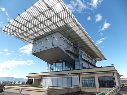
Pinacoteca Agnelli Address: Via Nizza street in Torino
Places Near Pinacoteca Agnelli (Torino)
How to get to popular places in Turin with public transit
Get around Torino by public transit!
Traveling around Torino has never been so easy. See step by step directions as you travel to any attraction, street or major public transit station. View bus and train schedules, arrival times, service alerts and detailed routes on a map, so you know exactly how to get to anywhere in Torino.
When traveling to any destination around Torino use Moovit's Live Directions with Get Off Notifications to know exactly where and how far to walk, how long to wait for your line, and how many stops are left. Moovit will alert you when it's time to get off — no need to constantly re-check whether yours is the next stop.
Wondering how to use public transit in Torino or how to pay for public transit in Torino? Moovit public transit app can help you navigate your way with public transit easily, and at minimum cost. It includes public transit fees, ticket prices, and costs. Looking for a map of Torino public transit lines? Moovit public transit app shows all public transit maps in Torino with all Bus, Train, Metro, Light Rail, Funicular and Gondola routes and stops on an interactive map.
Turin has 6 transit type(s), including: Bus, Train, Metro, Light Rail, Funicular and Gondola, operated by several transit agencies, including GTT Servizio Urbano, GTT Servizio Extraurbano, GTT Servizi Turistici, Asp Asti, A.t.a.p. S.p.a., Hollibus Autoservizi Di Ollino Sergio & C. S.n.c., Bellando Tours S.r.l., Sadem S.p.a., Autostradale S.r.l., Ca.nova S.p.a., S.t.a.c. - Societa' Trasporti Automobilistici Casalesi S.r.l., Vi.mu. - Viaggi F.lli Munaro Di Munaro Lorenzo E Riccardo S.n.c, Sadem E Bouchard (pool), Sadem E Staav (pool) and Vottero Autoservizi