Directions to Plan It Eats (Brookline) with public transportation
The following transit lines have routes that pass near Plan It Eats
 Bus: 47, 57, 85, GREEN LINE D SHUTTLE, GREEN LINE D SHUTTLE.
- Subway: GREEN LINE B, GREEN LINE C, GREEN LINE D.
How to get to Plan It Eats by bus?
Click on the bus route to see step by step directions with maps, line arrival times and updated time schedules.
From Staybridge Suites Boston-Quincy, Quincy
106 minFrom USS Constitution (USS Constitution Museum), Boston
63 minFrom Boston College, Boston
51 minFrom Milton Academy, Milton
110 minFrom Watertown, MA, Watertown Town
54 minFrom SharkNinja Operating LLC, Needham
91 minFrom Sheraton-Needham Hotel (Sheraton Boston Needham Hotel), Needham
87 minFrom Bentley University, Waltham
84 minFrom Courtyard by Marriott Boston Logan Airport, Boston
63 minFrom Downeast Cider, Boston
59 min
How to get to Plan It Eats by subway?
Click on the subway route to see step by step directions with maps, line arrival times and updated time schedules.
Bus stops near Plan It Eats in Brookline
Subway stations near Plan It Eats in Brookline
Bus lines to Plan It Eats in Brookline
- 47, Broadway - Central Square,VIEW
- 85, Ruggles - Assembly,VIEW
- GREEN LINE D SHUTTLE, Riverside - Kenmore (Shuttle),VIEW
- GREEN LINE D SHUTTLE, Reservoir - Fenway,VIEW
- GREEN LINE D SHUTTLE, Reservoir - Kenmore,VIEW
- GREEN LINE D SHUTTLE, Newton Highlands - Kenmore,VIEW
- GREEN LINE D SHUTTLE, Riverside - Kenmore via Saint Mary's Street,VIEW
- GREEN LINE D SHUTTLE, Newton Highlands - Fenway,VIEW
- GREEN LINE D SHUTTLE, Riverside - Fenway,VIEW
- GREEN LINE D SHUTTLE, Brookline Hills - Kenmore,VIEW
- GREEN LINE D SHUTTLE, Newton Highlands - Kenmore via Saint Mary's Street,VIEW
- GREEN LINE D SHUTTLE, Riverside - Kenmore,VIEW
- GREEN LINE D SHUTTLE, Brookline Hills - Back Bay (Shuttle),VIEW
- GREEN LINE C SHUTTLE, Saint Mary's Street (Shuttle),VIEW
- 57, Haymarket Via Kenmore,VIEW
- GREEN LINE D SHUTTLE, Fenway (Shuttle),VIEW
- GREEN LINE C SHUTTLE, Kenmore (Shuttle),VIEW
- SHUTTLE, Cleveland Circle (Shuttle),VIEW
What are the closest stations to Plan It Eats?
The closest stations to Plan It Eats are:
- Park Dr @ Fenway Station SB is 130 yards away, 2 min walk.
- Kent Street is 153 yards away, 2 min walk.
- Park Dr @ Fenway Station NB is 161 yards away, 2 min walk.
- Fenway - Beacon St @ Park Dr is 233 yards away, 3 min walk.
- Fenway is 727 yards away, 9 min walk.
- Saint Mary's Street is 764 yards away, 9 min walk.
- Hawes Street - 1089 Beacon St is 848 yards away, 10 min walk.
- Boston Univ. Central is 989 yards away, 12 min walk.
Which bus lines stop near Plan It Eats?
These bus lines stop near Plan It Eats: 47, 57, 85.
Which subway lines stop near Plan It Eats?
These subway lines stop near Plan It Eats: GREEN LINE B, GREEN LINE C, GREEN LINE D.
What’s the nearest subway station to Plan It Eats in Brookline?
The nearest subway station to Plan It Eats in Brookline is Fenway. It’s a 9 min walk away.
What’s the nearest bus station to Plan It Eats in Brookline?
The nearest bus stations to Plan It Eats in Brookline are Park Dr @ Fenway Station SB, Kent Street and Park Dr @ Fenway Station NB. The closest one is a 2 min walk away.
What time is the first subway to Plan It Eats in Brookline?
The GREEN LINE D is the first subway that goes to Plan It Eats in Brookline. It stops nearby at 4:56 AM.
What time is the last subway to Plan It Eats in Brookline?
The GREEN LINE D is the last subway that goes to Plan It Eats in Brookline. It stops nearby at 2:21 AM.
What time is the first bus to Plan It Eats in Brookline?
The 57 is the first bus that goes to Plan It Eats in Brookline. It stops nearby at 4:44 AM.
What time is the last bus to Plan It Eats in Brookline?
The 57 is the last bus that goes to Plan It Eats in Brookline. It stops nearby at 1:52 AM.
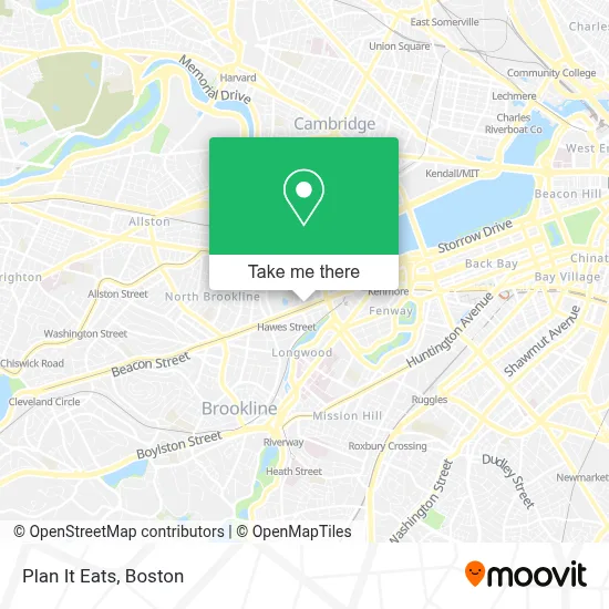
See Plan It Eats, Brookline, on the map
Public Transit to Plan It Eats in Brookline
Wondering how to get to Plan It Eats in Brookline? Moovit helps you find the best way to get to Plan It Eats with step-by-step directions from the nearest public transit station.
Moovit provides free maps and live directions to help you navigate through your city. View schedules, routes, timetables, and find out how long does it take to get to Plan It Eats in real time.
Looking for the nearest stop or station to Plan It Eats? Check out this list of stops closest to your destination: Park Dr @ Fenway Station SB; Kent Street; Park Dr @ Fenway Station NB; Fenway - Beacon St @ Park Dr; Fenway; Saint Mary's Street; Hawes Street - 1089 Beacon St; Boston Univ. Central.
Bus: 47, 57, 85, GREEN LINE D SHUTTLE, GREEN LINE D SHUTTLE, GREEN LINE D SHUTTLE, GREEN LINE C SHUTTLE, GREEN LINE D SHUTTLE.Subway: GREEN LINE B, GREEN LINE C, GREEN LINE D.
Want to see if there’s another route that gets you there at an earlier time? Moovit helps you find alternative routes or times. Get directions from and directions to Plan It Eats easily from the Moovit App or Website.
We make riding to Plan It Eats easy, which is why over 1.7 million users, including users in Brookline, trust Moovit as the best app for public transit. You don’t need to download an individual bus app or train app, Moovit is your all-in-one transit app that helps you find the best bus time or train time available.
For information on prices of bus and subway, costs and ride fares to Plan It Eats, please check the Moovit app.
Use the app to navigate to popular places including to the airport, hospital, stadium, grocery store, mall, coffee shop, school, college, and university.
Plan It Eats Address: 1038 Beacon St street in Brookline
- Temptations Cafe,
- Boston Ayurveda School,
- Bar 'Cino,
- Whole Foods Market,
- Wine Press Brookline,
- H Mart,
- Pine Street Inn,
- Japonaise Bakery and Cafe,
- Dr Yucima Orthodontics,
- LS Back in Action Bik,
- L & L Skincare,
- Dr. Barzi Brookline Dental,
- Biobehavioral Treatment Center,
- Pipe Maintenance,
- Vinfen Brookline,
- Liyin Rice Roll Master,
- Kyuramen - Brookline,
- Baby Cafe,
- Kyo Matcha,
- Brookline Chiropractor
Places Near Plan It Eats (Brookline)
- North End, Boston,
- Wilbur Theatre, Boston,
- Boston Common, Boston,
- Prudential Center, Boston,
- Boston Children's Hospital, Boston,
- Museum Of Science, Boston,
- Cheers, Boston,
- House Of Blues, Boston,
- Mgm Music Hall, Boston,
- Faneuil Hall, Boston,
- Leader Bank Pavilion (Leader Bank Pavillion), Boston,
- Td Garden, Boston,
- Quincy Market, Boston,
- Boston Convention & Exhibition Center, Boston,
- Seaport District, Boston,
- Isabella Stewart Gardner Museum, Boston,
- Boston Medical Center, Boston,
- Wang Theater, Boston,
- Castle Island, Boston,
- Massachusetts General Hospital, Boston
How to get to popular places in Boston with public transit
Get around Brookline by public transit!
Traveling around Brookline has never been so easy. See step by step directions as you travel to any attraction, street or major public transit station. View bus and train schedules, arrival times, service alerts and detailed routes on a map, so you know exactly how to get to anywhere in Brookline.
When traveling to any destination around Brookline use Moovit's Live Directions with Get Off Notifications to know exactly where and how far to walk, how long to wait for your line, and how many stops are left. Moovit will alert you when it's time to get off — no need to constantly re-check whether yours is the next stop.
Wondering how to use public transit in Brookline or how to pay for public transit in Brookline? Moovit public transit app can help you navigate your way with public transit easily, and at minimum cost. It includes public transit fees, ticket prices, and costs. Looking for a map of Brookline public transit lines? Moovit public transit app shows all public transit maps in Brookline with all Bus, Train, Subway and Ferry routes and stops on an interactive map.
Boston has 4 transit type(s), including: Bus, Train, Subway and Ferry, operated by several transit agencies, including MBTA, Southeastern Regional Transit Authority, MetroWest Regional Transit Authority, Rhode Island Public Transit Authority, WRTA, Lowell Regional Transit Authority, Merrimack Valley Transit, Montachusett Regional Transit Authority, Cape Cod Regional Transit Authority, Brockton Area Transit Authority, Martha's Vineyard Transit Authority, the WAVE - Nantucket Regional Transit Authority, GATRA, Cape Ann Transportation Authority and Massport