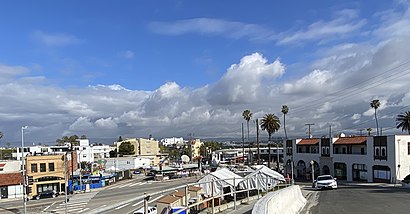
See Playa del Rey, California, Playa Del Rey, La, on the map
Directions to Playa del Rey, California (Playa Del Rey, La) with public transportation
The following transit lines have routes that pass near Playa del Rey, California
 Bus:
Bus:
How to get to Playa del Rey, California by bus?
Click on the bus route to see step by step directions with maps, line arrival times and updated time schedules.
Bus stations near Playa del Rey, California in Playa Del Rey, La
- Pershing NB & Manchester FS,1 min walk,
- Manchester / Pershing,2 min walk,
Bus lines to Playa del Rey, California in Playa Del Rey, La
- 16,Playa Del Rey,
- 115,Norwalk Station C - Line,
What are the closest stations to Playa del Rey, California?
The closest stations to Playa del Rey, California are:
- Pershing NB & Manchester FS is 73 yards away, 1 min walk.
- Manchester / Pershing is 137 yards away, 2 min walk.
Which bus lines stop near Playa del Rey, California?
These bus lines stop near Playa del Rey, California: 115, 3.
What’s the nearest bus stop to Playa del Rey, California in Playa Del Rey, La?
The nearest bus stop to Playa del Rey, California in Playa Del Rey, La is Pershing NB & Manchester FS. It’s a 1 min walk away.
What time is the first bus to Playa del Rey, California in Playa Del Rey, La?
The 115 is the first bus that goes to Playa del Rey, California in Playa Del Rey, La. It stops nearby at 5:39 AM.
What time is the last bus to Playa del Rey, California in Playa Del Rey, La?
The 115 is the last bus that goes to Playa del Rey, California in Playa Del Rey, La. It stops nearby at 10:22 PM.
How much is the bus fare to Playa del Rey, California?
The bus fare to Playa del Rey, California costs about $1.10.
How much is the light rail fare to Playa del Rey, California?
The light rail fare to Playa del Rey, California costs about $1.75.
See Playa del Rey, California, Playa Del Rey, La, on the map
Public Transit to Playa del Rey, California in Playa Del Rey, La
Wondering how to get to Playa del Rey, California in Playa Del Rey, La, United States? Moovit helps you find the best way to get to Playa del Rey, California with step-by-step directions from the nearest public transit station.
Moovit provides free maps and live directions to help you navigate through your city. View schedules, routes, timetables, and find out how long does it take to get to Playa del Rey, California in real time.
Looking for the nearest stop or station to Playa del Rey, California? Check out this list of stops closest to your destination: Pershing NB & Manchester FS; Manchester / Pershing.
Bus:
Want to see if there’s another route that gets you there at an earlier time? Moovit helps you find alternative routes or times. Get directions from and directions to Playa del Rey, California easily from the Moovit App or Website.
We make riding to Playa del Rey, California easy, which is why over 1.5 million users, including users in Playa Del Rey, La, trust Moovit as the best app for public transit. You don’t need to download an individual bus app or train app, Moovit is your all-in-one transit app that helps you find the best bus time or train time available.
For information on prices of bus and light rail, costs and ride fares to Playa del Rey, California, please check the Moovit app.
Get to Playa del Rey, California with public transit and pay for the ride in the Moovit app. In addition to all info you may need for your trip to Playa del Rey, California, including live directions, real-time arrivals and fare prices, you can also buy public transit passes for your rides. No need for cash or paper tickets to get to Playa del Rey, California - everything you need is accessible in the app with a click of the button.
Use the app to navigate to popular places including to the airport, hospital, stadium, grocery store, mall, coffee shop, school, college, and university.
Playa del Rey, California Address: Los Angeles, CA street in Playa Del Rey, La
Attractions near Playa del Rey, California
Jody Lee Communications (Lost Dog Communications),The Shack,Diamond Hottub Service,Buena Vista Auto Detail,Big 10 Inc.,Offices at the Beach,Playa Del Rey Beach,Link Brokerages,Sunridge St,Inn at Playa Del Rey,Hoya Blue Plants,Pixelhappy,Rise Again Physical Therapy,Shell Recharge,Greater Pocatello Association of Realtors(R) Multiple Listing Service,Tower 40 Dockweiler State Beach,Tower 44 Dockweiler State Beach,1 W 63rd Ave Apts,Mr KC Handyman Services,Kasey Kilmer FitnessHow to get to popular attractions in Playa Del Rey, La with public transit
Anaheim GardenWalk, Anaheim,Northridge, CA, Northridge, La,Placentia, CA, Fullerton,Montclair Place, Montclair,Temecula Promenade Mall, Temecula,85°C Bakery Cafe, Irvine,City of Anaheim, Anaheim,Torrance, CA, Torrance,City of Los Angeles, Downtown, La,Monsters, Inc. Mike & Sulley to the Rescue!, Anaheim,It's a Small World, Anaheim,Paradise Pier, Anaheim,Anaheim Packing House, Anaheim,The Ritz-Carlton Laguna Niguel, Dana Point,Sleeping Beauty Castle, Anaheim,Anaheim Marriott, Anaheim,Katella Cast Member Parking Lot (K-Lot), Anaheim,Costco Wholesale, Northridge, La,Upland, CA, Upland,AMC Promenade 16, Woodland Hills, LaGet around Playa Del Rey, La by public transit!
Traveling around Playa Del Rey, La has never been so easy. See step by step directions as you travel to any attraction, street or major public transit station. View bus and train schedules, arrival times, service alerts and detailed routes on a map, so you know exactly how to get to anywhere in Playa Del Rey, La.
When traveling to any destination around Playa Del Rey, La use Moovit's Live Directions with Get Off Notifications to know exactly where and how far to walk, how long to wait for your line, and how many stops are left. Moovit will alert you when it's time to get off — no need to constantly re-check whether yours is the next stop.
Wondering how to use public transit in Playa Del Rey, La or how to pay for public transit in Playa Del Rey, La? Moovit public transit app can help you navigate your way with public transit easily, and at minimum cost. It includes public transit fees, ticket prices, and costs. Looking for a map of Playa Del Rey, La public transit lines? Moovit public transit app shows all public transit maps in Playa Del Rey, La with all bus or light rail routes and stops on an interactive map.
Playa Del Rey, La has 2 transit type(s), including: bus or light rail, operated by several transit agencies, including Metro - Los Angeles, Metro - Los Angeles, Metrolink Trains, METRO, Long Beach Transit, LADOT, OCTA, Foothill Transit, Big Blue Bus, Riverside Transit Agency, LAX FlyAway, Airporter Shuttle, Playa Vista Shuttle, Amtrak and OMNITRANS