Directions to Plg (Boston) with public transportation
The following transit lines have routes that pass near Plg
 Bus: 28, 31, FAIRMOUNT LINE SHUTTLE, 24, 33.
- Train: FAIRMOUNT, FRANKLIN/FOXBORO, PROVIDENCE/STOUGHTON.
- Subway: MATTAPAN LINE.
How to get to Plg by bus?
Click on the bus route to see step by step directions with maps, line arrival times and updated time schedules.
From Leader Bank Pavilion (Leader Bank Pavillion), Boston
84 minFrom Downtown Boston, Boston
66 minFrom Acorn Street, Boston
72 minFrom One Financial Center, Boston
65 minFrom Consulate General of Italy, Boston
67 minFrom Bidmc, Boston
48 minFrom Intercontinental-Boston (Intercontinental Hotel), Boston
70 minFrom Intercontinental Boston Hotel Boston, Boston
70 minFrom Nubian Square Station, Boston
37 minFrom The Westin Boston Seaport District, Boston
77 min
How to get to Plg by train?
Click on the train route to see step by step directions with maps, line arrival times and updated time schedules.
From Leader Bank Pavilion (Leader Bank Pavillion), Boston
55 minFrom Downtown Boston, Boston
36 minFrom Acorn Street, Boston
49 minFrom One Financial Center, Boston
32 minFrom Consulate General of Italy, Boston
32 minFrom Bidmc, Boston
66 minFrom Intercontinental-Boston (Intercontinental Hotel), Boston
35 minFrom Intercontinental Boston Hotel Boston, Boston
35 minFrom Nubian Square Station, Boston
46 minFrom The Westin Boston Seaport District, Boston
46 min
How to get to Plg by subway?
Click on the subway route to see step by step directions with maps, line arrival times and updated time schedules.
From Leader Bank Pavilion (Leader Bank Pavillion), Boston
63 minFrom Downtown Boston, Boston
43 minFrom Acorn Street, Boston
53 minFrom One Financial Center, Boston
39 minFrom Consulate General of Italy, Boston
39 minFrom Bidmc, Boston
70 minFrom Intercontinental-Boston (Intercontinental Hotel), Boston
42 minFrom Intercontinental Boston Hotel Boston, Boston
42 minFrom Nubian Square Station, Boston
64 minFrom The Westin Boston Seaport District, Boston
56 min
Bus stops near Plg in Boston
Subway station near Plg in Boston
- Valley Road, 3 min walk,VIEW
Train station near Plg in Boston
- Blue Hill Avenue, 25 min walk,VIEW
Bus lines to Plg in Boston
- FAIRMOUNT LINE SHUTTLE, South Station (Shuttle),VIEW
- 24, Wakefield Ave,VIEW
- 33, River St & Milton St,VIEW
- 28, Avenue Louis Pasteur Via Ruggles,VIEW
- 29, Jackson Square,VIEW
- 31, Mattapan,VIEW
- 30, Forest Hills,VIEW
- 15, Haymarket Via Fields Corner & Nubian,VIEW
- 245, Quincy Center Via Brook Rd & Alleyne St,VIEW
- 716, Mattapan,VIEW
- MATTAPAN LINE SHUTTLE, Ashmont (Shuttle),VIEW
- MATTAPAN LINE SHUTTLE, Mattapan (Shuttle),VIEW
- RED/MATTAPAN LINE SHUTTLE, JFK (Shuttle),VIEW
What are the closest stations to Plg?
The closest stations to Plg are:
- Blue Hill Avenue is 165 yards away, 3 min walk.
- Valley Road is 220 yards away, 3 min walk.
- River St @ Blue Hill Ave is 372 yards away, 5 min walk.
- Blue Hill Ave @ Babson St is 425 yards away, 6 min walk.
- Cummins Hwy @ River St is 493 yards away, 7 min walk.
- Mattapan is 527 yards away, 7 min walk.
Which bus lines stop near Plg?
These bus lines stop near Plg: 28, 31.
Which train line stops near Plg?
FAIRMOUNT (#1619 | Fairmount)
Which subway line stops near Plg?
MATTAPAN LINE (Mattapan)
What’s the nearest subway station to Plg in Boston?
The nearest subway station to Plg in Boston is Valley Road. It’s a 3 min walk away.
What’s the nearest train station to Plg in Boston?
The nearest train station to Plg in Boston is Blue Hill Avenue. It’s a 25 min walk away.
What’s the nearest bus station to Plg in Boston?
The nearest bus station to Plg in Boston is Blue Hill Avenue. It’s a 3 min walk away.
What time is the first subway to Plg in Boston?
The MATTAPAN LINE is the first subway that goes to Plg in Boston. It stops nearby at 5:00 AM.
What time is the last subway to Plg in Boston?
The MATTAPAN LINE is the last subway that goes to Plg in Boston. It stops nearby at 2:40 AM.
What time is the first train to Plg in Boston?
The FAIRMOUNT is the first train that goes to Plg in Boston. It stops nearby at 4:36 AM.
What time is the last train to Plg in Boston?
The FAIRMOUNT is the last train that goes to Plg in Boston. It stops nearby at 12:08 AM.
What time is the first bus to Plg in Boston?
The 28 is the first bus that goes to Plg in Boston. It stops nearby at 3:10 AM.
What time is the last bus to Plg in Boston?
The 28 is the last bus that goes to Plg in Boston. It stops nearby at 2:34 AM.
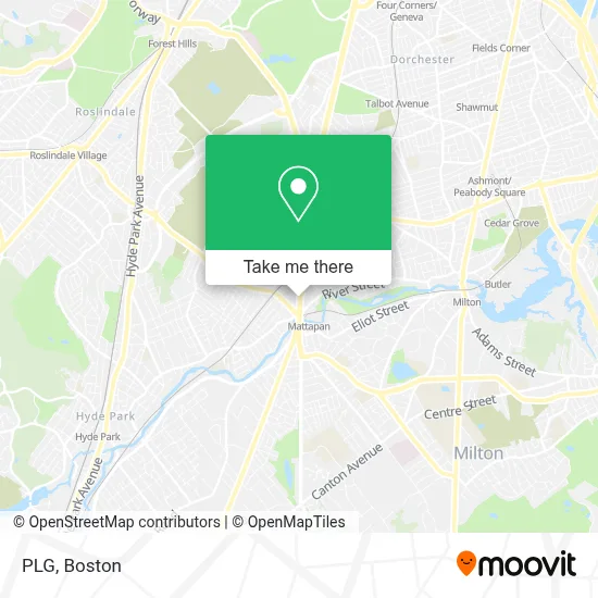
See Plg, Boston, on the map
Public Transit to Plg in Boston
Wondering how to get to Plg in Boston? Moovit helps you find the best way to get to Plg with step-by-step directions from the nearest public transit station.
Moovit provides free maps and live directions to help you navigate through your city. View schedules, routes, timetables, and find out how long does it take to get to Plg in real time.
Looking for the nearest stop or station to Plg? Check out this list of stops closest to your destination: Blue Hill Avenue; Valley Road; River St @ Blue Hill Ave; Blue Hill Ave @ Babson St; Cummins Hwy @ River St; Mattapan.
Bus: 28, 31, FAIRMOUNT LINE SHUTTLE, 24, 33, 29, 30.Train: FAIRMOUNT, FRANKLIN/FOXBORO, PROVIDENCE/STOUGHTON.Subway: MATTAPAN LINE.
Want to see if there’s another route that gets you there at an earlier time? Moovit helps you find alternative routes or times. Get directions from and directions to Plg easily from the Moovit App or Website.
We make riding to Plg easy, which is why over 1.7 million users, including users in Boston, trust Moovit as the best app for public transit. You don’t need to download an individual bus app or train app, Moovit is your all-in-one transit app that helps you find the best bus time or train time available.
For information on prices of subway, bus and train, costs and ride fares to Plg, please check the Moovit app.
Use the app to navigate to popular places including to the airport, hospital, stadium, grocery store, mall, coffee shop, school, college, and university.
Plg Address: 1601 Blue Hill Ave street in Boston
- Mattapan Square Studio,
- MC Appliance Services and Repairs,
- Daily Table,
- Be Energy,
- Enterprise,
- Garland Local Locksmih,
- Boston-Mattapan Square,
- Caribbean Choice and Varieties,
- Kwench Juice Cafe,
- Antoinette Variety Store,
- Jamaicas Best Restaurant,
- 1st Call Response Locksmith,
- Citibank,
- Blue Hill Local Locksmith,
- Snipes USA,
- Ostendorf Law Group,
- Brother's Deli,
- Mattapan Square,
- WESTERN UNION,
- Living Word Church
Places Near Plg (Boston)
- Faneuil Hall, Boston,
- Quincy Market, Boston,
- House Of Blues, Boston,
- Td Garden, Boston,
- Boston Convention & Exhibition Center, Boston,
- North End, Boston,
- Boston Children's Hospital, Boston,
- Prudential Center, Boston,
- Boston Medical Center, Boston,
- Cheers, Boston,
- Castle Island, Boston,
- Leader Bank Pavilion (Leader Bank Pavillion), Boston,
- Wang Theater, Boston,
- Seaport District, Boston,
- Massachusetts General Hospital, Boston,
- Boston Common, Boston,
- Isabella Stewart Gardner Museum, Boston,
- Mgm Music Hall, Boston,
- Museum Of Science, Boston,
- Wilbur Theatre, Boston
How to get to popular places in Boston with public transit
Get around Boston by public transit!
Traveling around Boston has never been so easy. See step by step directions as you travel to any attraction, street or major public transit station. View bus and train schedules, arrival times, service alerts and detailed routes on a map, so you know exactly how to get to anywhere in Boston.
When traveling to any destination around Boston use Moovit's Live Directions with Get Off Notifications to know exactly where and how far to walk, how long to wait for your line, and how many stops are left. Moovit will alert you when it's time to get off — no need to constantly re-check whether yours is the next stop.
Wondering how to use public transit in Boston or how to pay for public transit in Boston? Moovit public transit app can help you navigate your way with public transit easily, and at minimum cost. It includes public transit fees, ticket prices, and costs. Looking for a map of Boston public transit lines? Moovit public transit app shows all public transit maps in Boston with all Bus, Train, Subway and Ferry routes and stops on an interactive map.
Boston has 4 transit type(s), including: Bus, Train, Subway and Ferry, operated by several transit agencies, including MBTA, Southeastern Regional Transit Authority, MetroWest Regional Transit Authority, Rhode Island Public Transit Authority, WRTA, Lowell Regional Transit Authority, Merrimack Valley Transit, Montachusett Regional Transit Authority, Cape Cod Regional Transit Authority, Brockton Area Transit Authority, Martha's Vineyard Transit Authority, the WAVE - Nantucket Regional Transit Authority, GATRA, Cape Ann Transportation Authority and Massport