How to get to Pollería Charo by bus?
Click on the bus route to see step by step directions with maps, line arrival times and updated time schedules.
From Universidad Alfonso X El Sabio (UAX), Villanueva De La Cañada
49 minFrom Universidad Europea De Madrid, Área Metropolitana De Madrid Y Corredor Del Henares
50 minFrom Instituto de Estudios Fiscales, Madrid
49 minFrom Club de Campo Villa de Madrid, Madrid
73 minFrom Hospital Vithas Madrid Aravaca, Área Metropolitana De Madrid Y Corredor Del Henares
47 minFrom Hospital De La Zarzuela, Área Metropolitana De Madrid Y Corredor Del Henares
47 minFrom Hipódromo de la Zarzuela, Madrid
67 minFrom Paseo de Extremadura, Madrid
47 minFrom Rtve Prado Del Rey, Área Metropolitana De Madrid Y Corredor Del Henares
43 minFrom Centro Deportivo Militar La Dehesa, Madrid
101 min
How to get to Pollería Charo by train?
Click on the train route to see step by step directions with maps, line arrival times and updated time schedules.
Bus stops near Pollería Charo in Majadahonda
Train stations near Pollería Charo in Majadahonda
Bus lines to Pollería Charo in Majadahonda
- 650A, C.º Cerro De Los Gamos - Est. El Barrial,VIEW
- 567, Av. Villaviciosa - Urb. El Castillo,VIEW
- 655, Intercambiador De Moncloa (Islas 2 Y 3),VIEW
- 650B, C.º Cerro De Los Gamos - Est. El Barrial,VIEW
- 626, Acanto - Jacinto,VIEW
- 653, Intercambiador De Moncloa (Islas 2 Y 3),VIEW
- 1, Circular (Hospital - Estación FF.CC.),VIEW
- 654, Av. Satélites - Pegaso,VIEW
- 685, J. Rodrigo - Hospital Puerta De Hierro,VIEW
- 2, Circular (Hospital - Estación FF.CC.),VIEW
- 561, Madrid (Aluche) - Pozuelo - Majadahonda - Las Rozas,VIEW
- 561A, Madrid (Aluche) - Pozuelo - Majadahonda - Las Rozas (por Universidad),VIEW
- 561B, Madrid (Aluche) - Pozuelo - Majadahonda - Las Rozas (por Av. Guadarrama),VIEW
- N906, Madrid (Moncloa) - Majadahonda - Pozuelo - Madrid,VIEW
- N901, Princesa - Moncloa,VIEW
- 633, Cañada De Las Merinas - Centro De Salud,VIEW
What are the closest stations to Pollería Charo?
The closest stations to Pollería Charo are:
- Av. Rey Juan Carlos I - El Paular is 24 meters away, 1 min walk.
- Ctra. Pozuelo - Av. Rey Juan Carlos I is 123 meters away, 2 min walk.
- Av. España - Ctra. Pozuelo is 176 meters away, 3 min walk.
- Av. España - Huerto is 210 meters away, 3 min walk.
- Ctra. Pozuelo - Urb. El Paular is 278 meters away, 4 min walk.
- Ctra. Pozuelo - Ins. Nacional De Sanidad is 387 meters away, 6 min walk.
- Majadahonda is 3931 meters away, 51 min walk.
- Las Rozas is 4044 meters away, 52 min walk.
Which bus lines stop near Pollería Charo?
These bus lines stop near Pollería Charo: 561, 561B, 567, 626, 653.
Which train line stops near Pollería Charo?
C10 (Villalba De Guadarrama)
What’s the nearest bus station to Pollería Charo in Majadahonda?
The nearest bus station to Pollería Charo in Majadahonda is Av. Rey Juan Carlos I - El Paular. It’s a 1 min walk away.
What time is the first train to Pollería Charo in Majadahonda?
The C7 is the first train that goes to Pollería Charo in Majadahonda. It stops nearby at 6:24 AM.
What time is the last train to Pollería Charo in Majadahonda?
The C7 is the last train that goes to Pollería Charo in Majadahonda. It stops nearby at 11:55 PM.
What time is the first bus to Pollería Charo in Majadahonda?
The N901 is the first bus that goes to Pollería Charo in Majadahonda. It stops nearby at 3:01 AM.
What time is the last bus to Pollería Charo in Majadahonda?
The N901 is the last bus that goes to Pollería Charo in Majadahonda. It stops nearby at 2:47 AM.
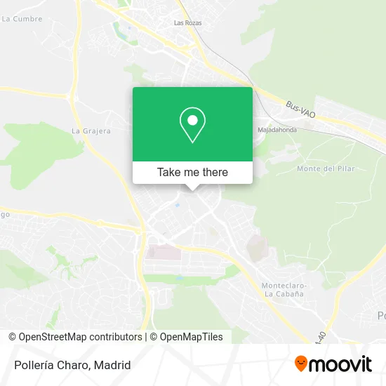
See Pollería Charo, Majadahonda, on the map
Public Transit to Pollería Charo in Majadahonda
Wondering how to get to Pollería Charo in Majadahonda? Moovit helps you find the best way to get to Pollería Charo with step-by-step directions from the nearest public transit station.
Moovit provides free maps and live directions to help you navigate through your city. View schedules, routes, timetables, and find out how long does it take to get to Pollería Charo in real time.
Looking for the nearest stop or station to Pollería Charo? Check out this list of stops closest to your destination: Av. Rey Juan Carlos I - El Paular; Ctra. Pozuelo - Av. Rey Juan Carlos I; Av. España - Ctra. Pozuelo; Av. España - Huerto; Ctra. Pozuelo - Urb. El Paular; Ctra. Pozuelo - Ins. Nacional De Sanidad; Majadahonda; Las Rozas.
Bus: 561, 561B, 567, 626, 653, 650A, 655, 650B, 1, 654, 685.Train: C10, C7, REG.
Want to see if there’s another route that gets you there at an earlier time? Moovit helps you find alternative routes or times. Get directions from and directions to Pollería Charo easily from the Moovit App or Website.
We make riding to Pollería Charo easy, which is why over 1.5 million users, including users in Majadahonda, trust Moovit as the best app for public transit. You don’t need to download an individual bus app or train app, Moovit is your all-in-one transit app that helps you find the best bus time or train time available.
For information on prices of bus, train and metro, costs and ride fares to Pollería Charo, please check the Moovit app.
Use the app to navigate to popular places including to the airport, hospital, stadium, grocery store, mall, coffee shop, school, college, and university.
Pollería Charo Address: Carretera Pozuelo de Alarcón, 24 28220 Majadahonda street in Majadahonda
- Transporteshh,
- Tuco Peluqueros,
- Gubareva Studio,
- Mi Alcampo Barlovento,
- Skin Mad,
- Saneamientos Pozuelo S,
- Mattlen and Brg S.L.,
- Administración Camino,
- María Mania,
- Mn Bold Business,
- Agua Clara,
- Pc Masacon,
- PLK14520 Sestao,
- PLK14812 Las Tablas,
- Cafetería C Politicas,
- Bar Madrid,
- Kozinador,
- Restaurante Las Cabila,
- Pimientas Spav Caterin,
- PLK14450 Las Rosas
Places Near Pollería Charo (Majadahonda)
- Tres Aguas, Alcorcón,
- Mercadillo de Majadahonda, Majadahonda,
- Palacio De Vistalegre, Área Metropolitana De Madrid Y Corredor Del Henares,
- Estadio Wanda Metropolitano, Área Metropolitana De Madrid Y Corredor Del Henares,
- Centro Comercial La Vaguada, Área Metropolitana De Madrid Y Corredor Del Henares,
- Centro Comercial Oasiz Madrid, Área Metropolitana De Madrid Y Corredor Del Henares,
- Plenilunio, Área Metropolitana De Madrid Y Corredor Del Henares,
- Centro Comercial Islazul, Área Metropolitana De Madrid Y Corredor Del Henares,
- Nassica, Área Metropolitana De Madrid Y Corredor Del Henares,
- Calle de López de Hoyos 169, Madrid,
- Estacion de Chamartin, Madrid,
- Hospital Universitario La Paz, Madrid,
- Hospital Universitario Ramón y Cajal, Madrid,
- Centro Comercial La Gavia, Área Metropolitana De Madrid Y Corredor Del Henares,
- Rastro De Madrid, Área Metropolitana De Madrid Y Corredor Del Henares,
- Hospital Clínico Universitario San Carlos, Madrid,
- Plaza Mayor, Madrid,
- Sala La Riviera, Madrid,
- Mendez Alvaro, Madrid,
- Wizink Center, Madrid
How to get to popular places in Madrid with public transit
Get around Majadahonda by public transit!
Traveling around Majadahonda has never been so easy. See step by step directions as you travel to any attraction, street or major public transit station. View bus and train schedules, arrival times, service alerts and detailed routes on a map, so you know exactly how to get to anywhere in Majadahonda.
When traveling to any destination around Majadahonda use Moovit's Live Directions with Get Off Notifications to know exactly where and how far to walk, how long to wait for your line, and how many stops are left. Moovit will alert you when it's time to get off — no need to constantly re-check whether yours is the next stop.
Wondering how to use public transit in Majadahonda or how to pay for public transit in Majadahonda? Moovit public transit app can help you navigate your way with public transit easily, and at minimum cost. It includes public transit fees, ticket prices, and costs. Looking for a map of Majadahonda public transit lines? Moovit public transit app shows all public transit maps in Majadahonda with all Bus, Train, Metro and Light Rail routes and stops on an interactive map.
Madrid has 4 transit type(s), including: Bus, Train, Metro and Light Rail, operated by several transit agencies, including Metro de Madrid, Metro Ligero, Tranvía de Parla, Renfe Cercanías - Servicios de Autobús especiales, Renfe Cercanias, Renfe Cercanías, EMT, Interurbanos, Urbanos de Alcalá de Henares, Urbanos de Alcobendas, Urbanos de Alcorcón, Urbanos de Algete, Urbanos de Aranjuez, Urbanos de Arganda del Rey and Urbanos de Arroyomolinos