Directions to Portugese Baptist Church (Saugus) with public transportation
The following transit lines have routes that pass near Portugese Baptist Church
 Bus: 426, 429, 430, 428.
- Train: NEWBURYPORT/ROCKPORT.
How to get to Portugese Baptist Church by bus?
Click on the bus route to see step by step directions with maps, line arrival times and updated time schedules.
From Mass Eye And Ear, Boston
54 minFrom Winchester, MA, Winchester
89 minFrom Sunrise Shuttle Pick Up, Boston
79 minFrom Boston Logan International Airport (Bos), Boston
75 minFrom Chelsea District Court, Chelsea
62 minFrom Bunker Hill Community College, Boston
63 minFrom East Boston, Boston
72 minFrom Schrafft's Center Shuttle, Boston
50 minFrom Rino's Place, Boston
82 minFrom Somerville, MA, Somerville
76 min
Bus stops near Portugese Baptist Church in Saugus
Train station near Portugese Baptist Church in Saugus
- River Works, 35 min walk,VIEW
Bus lines to Portugese Baptist Church in Saugus
What are the closest stations to Portugese Baptist Church?
The closest stations to Portugese Baptist Church are:
- Central St @ Vermont Ave is 603 yards away, 8 min walk.
- Vine St @ Beech St is 739 yards away, 9 min walk.
- Winter St @ E Denver St is 1670 yards away, 20 min walk.
- River Works is 2940 yards away, 35 min walk.
Which bus lines stop near Portugese Baptist Church?
These bus lines stop near Portugese Baptist Church: 426, 429, 430.
What’s the nearest bus station to Portugese Baptist Church in Saugus?
The nearest bus station to Portugese Baptist Church in Saugus is Central St @ Vermont Ave. It’s a 8 min walk away.
What time is the first train to Portugese Baptist Church in Saugus?
The NEWBURYPORT/ROCKPORT is the first train that goes to Portugese Baptist Church in Saugus. It stops nearby at 5:33 AM.
What time is the last train to Portugese Baptist Church in Saugus?
The NEWBURYPORT/ROCKPORT is the last train that goes to Portugese Baptist Church in Saugus. It stops nearby at 12:13 AM.
What time is the first bus to Portugese Baptist Church in Saugus?
The 429 is the first bus that goes to Portugese Baptist Church in Saugus. It stops nearby at 5:52 AM.
What time is the last bus to Portugese Baptist Church in Saugus?
The 429 is the last bus that goes to Portugese Baptist Church in Saugus. It stops nearby at 10:40 PM.
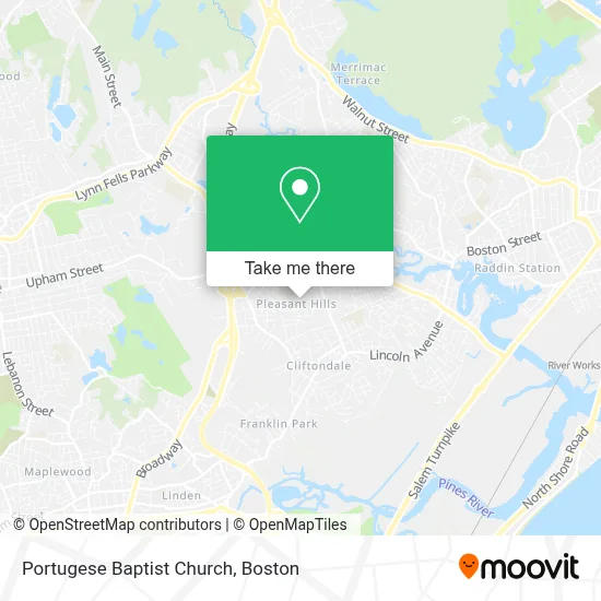
See Portugese Baptist Church, Saugus, on the map
Public Transit to Portugese Baptist Church in Saugus
Wondering how to get to Portugese Baptist Church in Saugus? Moovit helps you find the best way to get to Portugese Baptist Church with step-by-step directions from the nearest public transit station.
Moovit provides free maps and live directions to help you navigate through your city. View schedules, routes, timetables, and find out how long does it take to get to Portugese Baptist Church in real time.
Looking for the nearest stop or station to Portugese Baptist Church? Check out this list of stops closest to your destination: Central St @ Vermont Ave; Vine St @ Beech St; Winter St @ E Denver St; River Works.
Bus: 426, 429, 430, 428.Train: NEWBURYPORT/ROCKPORT.
Want to see if there’s another route that gets you there at an earlier time? Moovit helps you find alternative routes or times. Get directions from and directions to Portugese Baptist Church easily from the Moovit App or Website.
We make riding to Portugese Baptist Church easy, which is why over 1.7 million users, including users in Saugus, trust Moovit as the best app for public transit. You don’t need to download an individual bus app or train app, Moovit is your all-in-one transit app that helps you find the best bus time or train time available.
For information on prices of bus and subway, costs and ride fares to Portugese Baptist Church, please check the Moovit app.
Use the app to navigate to popular places including to the airport, hospital, stadium, grocery store, mall, coffee shop, school, college, and university.
Portugese Baptist Church Address: 47 Adams Ave street in Saugus
- solar movies,
- Superior Image,
- Town of Saugus-Public Health Nurse,
- A 24 Hour Emergency Locksmith,
- Exclusive Precision Barbers,
- Congregation Ahavas Sholom,
- Quality Homecare,
- USA Car Service,
- Kavida Healthcare, Inc.,
- Happy Learners Daycare,
- Greg Tully's Realty Page,
- Alaa Home Services Cleaning,
- Fire Command Systems, Inc.,
- Saugus Locksmith Transponder Keys,
- H Surabian Ronald Attorney at Law,
- Law Office of Charles C. Donoghue,
- Custom Security Services,
- Briggs,
- National Life Insurance,
- Pro Handyman Service
Places Near Portugese Baptist Church (Saugus)
- Mgm Music Hall, Boston,
- Massachusetts General Hospital, Boston,
- Td Garden, Boston,
- Castle Island, Boston,
- Wilbur Theatre, Boston,
- Boston Children's Hospital, Boston,
- Leader Bank Pavilion (Leader Bank Pavillion), Boston,
- Isabella Stewart Gardner Museum, Boston,
- Boston Medical Center, Boston,
- Cheers, Boston,
- Seaport District, Boston,
- Museum Of Science, Boston,
- Boston Convention & Exhibition Center, Boston,
- House Of Blues, Boston,
- Wang Theater, Boston,
- Boston Common, Boston,
- North End, Boston,
- Quincy Market, Boston,
- Faneuil Hall, Boston,
- Prudential Center, Boston
How to get to popular places in Boston with public transit
Get around Saugus by public transit!
Traveling around Saugus has never been so easy. See step by step directions as you travel to any attraction, street or major public transit station. View bus and train schedules, arrival times, service alerts and detailed routes on a map, so you know exactly how to get to anywhere in Saugus.
When traveling to any destination around Saugus use Moovit's Live Directions with Get Off Notifications to know exactly where and how far to walk, how long to wait for your line, and how many stops are left. Moovit will alert you when it's time to get off — no need to constantly re-check whether yours is the next stop.
Wondering how to use public transit in Saugus or how to pay for public transit in Saugus? Moovit public transit app can help you navigate your way with public transit easily, and at minimum cost. It includes public transit fees, ticket prices, and costs. Looking for a map of Saugus public transit lines? Moovit public transit app shows all public transit maps in Saugus with all Bus, Train, Subway and Ferry routes and stops on an interactive map.
Boston has 4 transit type(s), including: Bus, Train, Subway and Ferry, operated by several transit agencies, including MBTA, Southeastern Regional Transit Authority, MetroWest Regional Transit Authority, Rhode Island Public Transit Authority, WRTA, Lowell Regional Transit Authority, Merrimack Valley Transit, Montachusett Regional Transit Authority, Cape Cod Regional Transit Authority, Brockton Area Transit Authority, Martha's Vineyard Transit Authority, the WAVE - Nantucket Regional Transit Authority, GATRA, Cape Ann Transportation Authority and Massport