How to get to Power Dot by bus?
Click on the bus route to see step by step directions with maps, line arrival times and updated time schedules.
How to get to Power Dot by train?
Click on the train route to see step by step directions with maps, line arrival times and updated time schedules.
Bus stops near Power Dot in Villers-Lès-Nancy
Light Rail stations near Power Dot in Villers-Lès-Nancy
- Vélodrome - Callot, 24 min walk,VIEW
Bus lines to Power Dot in Villers-Lès-Nancy
What are the closest stations to Power Dot?
The closest stations to Power Dot are:
- Albert 1er is 12 meters away, 1 min walk.
- Asnée is 208 meters away, 4 min walk.
- Rodin is 404 meters away, 6 min walk.
- Louis Armand is 638 meters away, 9 min walk.
- Remicourt is 674 meters away, 9 min walk.
- Ufr Staps is 1044 meters away, 14 min walk.
- Vélodrome - Callot is 1796 meters away, 24 min walk.
Which bus line stops near Power Dot?
T3 (Campussciences)
Which train line stops near Power Dot?
C50+ (Nancy)
What’s the nearest light rail station to Power Dot in Villers-Lès-Nancy?
The nearest light rail station to Power Dot in Villers-Lès-Nancy is Vélodrome - Callot. It’s a 24 min walk away.
What’s the nearest bus station to Power Dot in Villers-Lès-Nancy?
The nearest bus station to Power Dot in Villers-Lès-Nancy is Albert 1er. It’s a 1 min walk away.
What time is the first light rail to Power Dot in Villers-Lès-Nancy?
The T1 is the first light rail that goes to Power Dot in Villers-Lès-Nancy. It stops nearby at 5:11 AM.
What time is the last light rail to Power Dot in Villers-Lès-Nancy?
The T1 is the last light rail that goes to Power Dot in Villers-Lès-Nancy. It stops nearby at 12:53 AM.
What time is the first bus to Power Dot in Villers-Lès-Nancy?
The 43 is the first bus that goes to Power Dot in Villers-Lès-Nancy. It stops nearby at 3:49 AM.
What time is the last bus to Power Dot in Villers-Lès-Nancy?
The T3 is the last bus that goes to Power Dot in Villers-Lès-Nancy. It stops nearby at 12:47 AM.
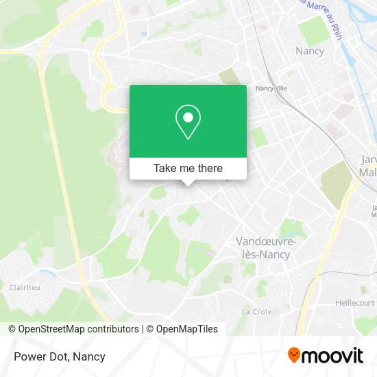
See Power Dot, Villers-Lès-Nancy, on the map
Public Transit to Power Dot in Villers-Lès-Nancy
Wondering how to get to Power Dot in Villers-Lès-Nancy? Moovit helps you find the best way to get to Power Dot with step-by-step directions from the nearest public transit station.
Moovit provides free maps and live directions to help you navigate through your city. View schedules, routes, timetables, and find out how long does it take to get to Power Dot in real time.
Looking for the nearest stop or station to Power Dot? Check out this list of stops closest to your destination: Albert 1er; Asnée; Rodin; Louis Armand; Remicourt; Ufr Staps; Vélodrome - Callot.
Bus: T3, 16, 51, 43, COROL, 52, 17, 30, 66.Train: C50+.
Want to see if there’s another route that gets you there at an earlier time? Moovit helps you find alternative routes or times. Get directions from and directions to Power Dot easily from the Moovit App or Website.
We make riding to Power Dot easy, which is why over 1.5 million users, including users in Villers-Lès-Nancy, trust Moovit as the best app for public transit. You don’t need to download an individual bus app or train app, Moovit is your all-in-one transit app that helps you find the best bus time or train time available.
For information on prices of bus and train, costs and ride fares to Power Dot, please check the Moovit app.
Use the app to navigate to popular places including to the airport, hospital, stadium, grocery store, mall, coffee shop, school, college, and university.
Power Dot Address: 54600 Villers-lès-Nancy street in Villers-Lès-Nancy
- Melteam Potes,
- M Alain Mignon le Narguile,
- Cpc Commercant,
- Match,
- 120 Avenue André Malraux,
- Totalenergies,
- Huet Eddy,
- Dietplus Villers les Nancy,
- Relais Aiguillettes,
- Résidence Le Vert Coteau,
- Wash,
- Match Villers Plein Centre,
- Pharmacie la Clairière,
- L'Hôtel du Château,
- Cegid,
- IZIVIA Fast,
- Place Jeannon L'Arbalètrier,
- Résidence Le Clos Du Roy,
- Résidence École Buissonnière,
- Galsen Events
Places Near Power Dot (Villers-Lès-Nancy)
- Hopital de Brabois CHU, VandUvre-Lès-Nancy,
- Villa Majorelle, Nancy,
- Piscine Nancy Thermal, Nancy,
- Clinique Majorelle, Nancy,
- Hôpital Central, Nancy,
- Cora, Houdemont,
- Kinepolis Nancy, Nancy,
- Dépose-Minute, Nancy,
- E.Leclerc, VandUvre-Lès-Nancy,
- Polyclinique De Gentilly, Nancy,
- Nancy Thermal, Nancy,
- Zénith De Nancy, Maxéville,
- Haut Du Lièvre, Nancy,
- centre d'imagerie jacques callot, Maxéville,
- Tomblaine, Tomblaine,
- Villers-Lès-Nancy, Villers-Lès-Nancy,
- Essey-Lès-Nancy, Essey-Lès-Nancy,
- Maxéville, Maxéville,
- Rue Colette, Nancy,
- Clinique Pasteur, Essey-Lès-Nancy
How to get to popular places in Nancy with public transit
Get around Villers-Lès-Nancy by public transit!
Traveling around Villers-Lès-Nancy has never been so easy. See step by step directions as you travel to any attraction, street or major public transit station. View bus and train schedules, arrival times, service alerts and detailed routes on a map, so you know exactly how to get to anywhere in Villers-Lès-Nancy.
When traveling to any destination around Villers-Lès-Nancy use Moovit's Live Directions with Get Off Notifications to know exactly where and how far to walk, how long to wait for your line, and how many stops are left. Moovit will alert you when it's time to get off — no need to constantly re-check whether yours is the next stop.
Wondering how to use public transit in Villers-Lès-Nancy or how to pay for public transit in Villers-Lès-Nancy? Moovit public transit app can help you navigate your way with public transit easily, and at minimum cost. It includes public transit fees, ticket prices, and costs. Looking for a map of Villers-Lès-Nancy public transit lines? Moovit public transit app shows all public transit maps in Villers-Lès-Nancy with all Bus, Train and Light Rail routes and stops on an interactive map.
Nancy has 3 transit type(s), including: Bus, Train and Light Rail, operated by several transit agencies, including Réseau STAN, SNCF VOYAGEURS and OCEdefault