How to get to Poweredup by bus?
Click on the bus route to see step by step directions with maps, line arrival times and updated time schedules.
Bus stops near Poweredup in Boston
Bus lines to Poweredup in Boston
What are the closest stations to Poweredup?
The closest stations to Poweredup are:
- Park After Cranston is 448 yards away, 6 min walk.
- Haven Opposite Florida is 564 yards away, 7 min walk.
Which bus lines stop near Poweredup?
These bus lines stop near Poweredup: 17, 30.
What’s the nearest bus station to Poweredup in Boston?
The nearest bus station to Poweredup in Boston is Park After Cranston. It’s a 6 min walk away.
What time is the first bus to Poweredup in Boston?
The 30 is the first bus that goes to Poweredup in Boston. It stops nearby at 5:23 AM.
What time is the last bus to Poweredup in Boston?
The 17 is the last bus that goes to Poweredup in Boston. It stops nearby at 10:33 PM.
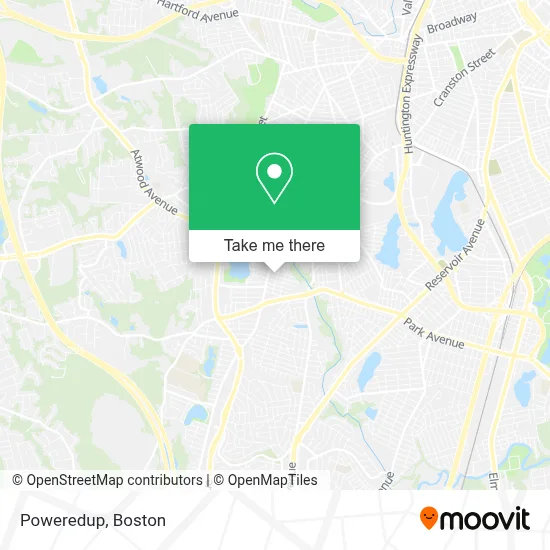
See Poweredup, Boston, on the map
Public Transit to Poweredup in Boston
Wondering how to get to Poweredup in Boston? Moovit helps you find the best way to get to Poweredup with step-by-step directions from the nearest public transit station.
Moovit provides free maps and live directions to help you navigate through your city. View schedules, routes, timetables, and find out how long does it take to get to Poweredup in real time.
Looking for the nearest stop or station to Poweredup? Check out this list of stops closest to your destination: Park After Cranston; Haven Opposite Florida.
Bus: 17, 30, WM.
Want to see if there’s another route that gets you there at an earlier time? Moovit helps you find alternative routes or times. Get directions from and directions to Poweredup easily from the Moovit App or Website.
We make riding to Poweredup easy, which is why over 1.7 million users, including users in Boston, trust Moovit as the best app for public transit. You don’t need to download an individual bus app or train app, Moovit is your all-in-one transit app that helps you find the best bus time or train time available.
For information on prices of bus and train, costs and ride fares to Poweredup, please check the Moovit app.
Use the app to navigate to popular places including to the airport, hospital, stadium, grocery store, mall, coffee shop, school, college, and university.
Poweredup Address: 31 Vermont St street in Boston
- A Celebration of Love Bridal Show,
- Gino's Salon of Hair Design,
- Spark Bridal Outlet,
- United Better Homes,
- Jordan Dehaven Podiatrist,
- J & A General Contractor,
- Cranston Cleaning Services,
- Sarayri Oriental Sweets,
- Rhode Island Homes for Sale,
- Rhode Island Spine & Injury Institute,
- Rhody Wildlife,
- Lifespan,
- Avangelina's Cleaning Services,
- Best Buddies International,
- 1020 Beauty Lounge,
- Ivy Rose,
- Wax in the Heights,
- Nicole Jean Wigs & More,
- Pond Street Baptist Church,
- Allstarteamconstructioncorp
Places Near Poweredup (Boston)
- House Of Blues, Boston,
- Boston Children's Hospital, Boston,
- Leader Bank Pavilion (Leader Bank Pavillion), Boston,
- Prudential Center, Boston,
- North End, Boston,
- Boston Common, Boston,
- Quincy Market, Boston,
- Faneuil Hall, Boston,
- Isabella Stewart Gardner Museum, Boston,
- Wang Theater, Boston,
- Mgm Music Hall, Boston,
- Wilbur Theatre, Boston,
- Cheers, Boston,
- Castle Island, Boston,
- Museum Of Science, Boston,
- Boston Medical Center, Boston,
- Seaport District, Boston,
- Boston Convention & Exhibition Center, Boston,
- Massachusetts General Hospital, Boston,
- Td Garden, Boston
How to get to popular places in Boston with public transit
Get around Boston by public transit!
Traveling around Boston has never been so easy. See step by step directions as you travel to any attraction, street or major public transit station. View bus and train schedules, arrival times, service alerts and detailed routes on a map, so you know exactly how to get to anywhere in Boston.
When traveling to any destination around Boston use Moovit's Live Directions with Get Off Notifications to know exactly where and how far to walk, how long to wait for your line, and how many stops are left. Moovit will alert you when it's time to get off — no need to constantly re-check whether yours is the next stop.
Wondering how to use public transit in Boston or how to pay for public transit in Boston? Moovit public transit app can help you navigate your way with public transit easily, and at minimum cost. It includes public transit fees, ticket prices, and costs. Looking for a map of Boston public transit lines? Moovit public transit app shows all public transit maps in Boston with all Bus, Train, Subway and Ferry routes and stops on an interactive map.
Boston has 4 transit type(s), including: Bus, Train, Subway and Ferry, operated by several transit agencies, including MBTA, Southeastern Regional Transit Authority, MetroWest Regional Transit Authority, Rhode Island Public Transit Authority, WRTA, Lowell Regional Transit Authority, Merrimack Valley Transit, Montachusett Regional Transit Authority, Cape Cod Regional Transit Authority, Brockton Area Transit Authority, Martha's Vineyard Transit Authority, the WAVE - Nantucket Regional Transit Authority, GATRA, Cape Ann Transportation Authority and Massport