Directions to Premier Rentals (Boston) with public transportation
The following transit lines have routes that pass near Premier Rentals
 Bus: 1, 21, 3, 35, 51.
- Train: NORTHEAST REGIONAL, PROVIDENCE/STOUGHTON, ACELA, PROVIDENCE LINE SHUTTLE, PROVIDENCE LINE SHUTTLE.
How to get to Premier Rentals by bus?
Click on the bus route to see step by step directions with maps, line arrival times and updated time schedules.
How to get to Premier Rentals by train?
Click on the train route to see step by step directions with maps, line arrival times and updated time schedules.
Bus stops near Premier Rentals in Boston
Train stations near Premier Rentals in Boston
- Providence, 22 min walk,VIEW
Bus lines to Premier Rentals in Boston
- 6, Prairie Ave/Roger Williams Park Zoo,VIEW
- 20, Elmwood Ave/Airport,VIEW
- 22, Pontiac Ave,VIEW
- 9X, Pascoag Express,VIEW
- 10X, North Scituate Express,VIEW
- 12X, Arctic/RI-117 Express,VIEW
- 59X, North Smithfield/Lincoln Express,VIEW
- 61X, Tiverton/East Bay Express,VIEW
- 65X, Narragansett/Wakefield Express,VIEW
- 95X, Westerly Express,VIEW
- 92, Ri College Via Mt Pleasant Hs,VIEW
- 35, South Attleboro Station Via Newport Ave,VIEW
- 60, Newport Via W Main Rd,VIEW
- 78, Pawtucket Transit Center Via Bev Hill Av,VIEW
- 17, Stop&Shop (Atwood Ave - Cranston),VIEW
- 1, South Attleboro Station Via Hope St,VIEW
- 31, Kennedy Plaza Then Mt Pleasant Hs,VIEW
- 56, Kennedy Plaza Via Chalkstone Ave,VIEW
- R, Broad Street Terminal (Providence),VIEW
- 3, Oakland Beach,VIEW
What are the closest stations to Premier Rentals?
The closest stations to Premier Rentals are:
- Turks Head (Weybosset Before Post Office) is 44 yards away, 1 min walk.
- Westminster After Memorial is 177 yards away, 3 min walk.
- Memorial After Westminster is 210 yards away, 3 min walk.
- Weybosset & Eddy is 213 yards away, 3 min walk.
- Kennedy Plaza (Stop D) is 246 yards away, 3 min walk.
- Dorrance Before Pine is 254 yards away, 4 min walk.
- Kennedy Plaza (Stop C) is 288 yards away, 4 min walk.
- Providence is 1774 yards away, 22 min walk.
Which bus lines stop near Premier Rentals?
These bus lines stop near Premier Rentals: 1, 21, 3, 35, 51, 54, 92.
Which train lines stop near Premier Rentals?
These train lines stop near Premier Rentals: NORTHEAST REGIONAL, PROVIDENCE/STOUGHTON.
What’s the nearest train station to Premier Rentals in Boston?
The nearest train station to Premier Rentals in Boston is Providence. It’s a 22 min walk away.
What’s the nearest bus station to Premier Rentals in Boston?
The nearest bus station to Premier Rentals in Boston is Turks Head (Weybosset Before Post Office). It’s a 1 min walk away.
What time is the first train to Premier Rentals in Boston?
The PROVIDENCE/STOUGHTON is the first train that goes to Premier Rentals in Boston. It stops nearby at 4:10 AM.
What time is the last train to Premier Rentals in Boston?
The NORTHEAST REGIONAL is the last train that goes to Premier Rentals in Boston. It stops nearby at 9:17 AM.
What time is the first bus to Premier Rentals in Boston?
The 54 is the first bus that goes to Premier Rentals in Boston. It stops nearby at 5:13 AM.
What time is the last bus to Premier Rentals in Boston?
The 20 is the last bus that goes to Premier Rentals in Boston. It stops nearby at 1:10 AM.
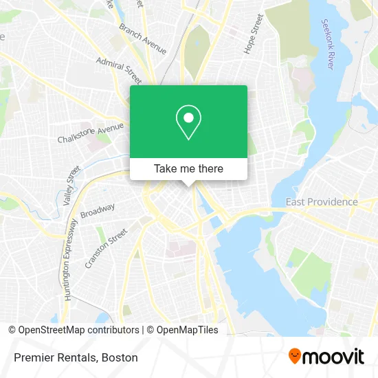
See Premier Rentals, Boston, on the map
Public Transit to Premier Rentals in Boston
Wondering how to get to Premier Rentals in Boston? Moovit helps you find the best way to get to Premier Rentals with step-by-step directions from the nearest public transit station.
Moovit provides free maps and live directions to help you navigate through your city. View schedules, routes, timetables, and find out how long does it take to get to Premier Rentals in real time.
Looking for the nearest stop or station to Premier Rentals? Check out this list of stops closest to your destination: Turks Head (Weybosset Before Post Office); Westminster After Memorial; Memorial After Westminster; Weybosset & Eddy; Kennedy Plaza (Stop D); Dorrance Before Pine; Kennedy Plaza (Stop C); Providence.
Bus: 1, 21, 3, 35, 51, 54, 92, 6, 20, 22, 9X, 10X, 60, 78, 17.Train: NORTHEAST REGIONAL, PROVIDENCE/STOUGHTON, ACELA, PROVIDENCE LINE SHUTTLE, PROVIDENCE LINE SHUTTLE, PROVIDENCE LINE SHUTTLE, FOXBORO EVENT SERVICE.
Want to see if there’s another route that gets you there at an earlier time? Moovit helps you find alternative routes or times. Get directions from and directions to Premier Rentals easily from the Moovit App or Website.
We make riding to Premier Rentals easy, which is why over 1.7 million users, including users in Boston, trust Moovit as the best app for public transit. You don’t need to download an individual bus app or train app, Moovit is your all-in-one transit app that helps you find the best bus time or train time available.
For information on prices of bus and train, costs and ride fares to Premier Rentals, please check the Moovit app.
Use the app to navigate to popular places including to the airport, hospital, stadium, grocery store, mall, coffee shop, school, college, and university.
Premier Rentals Address: 56 Pine St street in Boston
- Rodio & Ursillo,
- ZDS Architecture and Interior Design,
- Arthur Chatfield III Attorney at Law,
- Providence Innovation District Park,
- Dorrance After Pine,
- nude,
- Stonewall Solutions,
- Gaebe Commons,
- Avtek,
- Textron Building Garage,
- Fletcher Building,
- Wolpert & Associates,
- Barton Gilman,
- Dv8 Nightclub and Lounge,
- Hemenway's Restaurant,
- Elizabeth P Santilli Attorney,
- Queen of Hearts and Modern Love,
- KPMG,
- Morgan Stanley,
- Rhode Island Legal Representation Defense Team
Places Near Premier Rentals (Boston)
- Quincy Market, Boston,
- North End, Boston,
- Boston Children's Hospital, Boston,
- Td Garden, Boston,
- Prudential Center, Boston,
- Museum Of Science, Boston,
- Boston Common, Boston,
- Wang Theater, Boston,
- House Of Blues, Boston,
- Seaport District, Boston,
- Wilbur Theatre, Boston,
- Cheers, Boston,
- Faneuil Hall, Boston,
- Boston Medical Center, Boston,
- Mgm Music Hall, Boston,
- Leader Bank Pavilion (Leader Bank Pavillion), Boston,
- Isabella Stewart Gardner Museum, Boston,
- Massachusetts General Hospital, Boston,
- Boston Convention & Exhibition Center, Boston,
- Castle Island, Boston
How to get to popular places in Boston with public transit
Get around Boston by public transit!
Traveling around Boston has never been so easy. See step by step directions as you travel to any attraction, street or major public transit station. View bus and train schedules, arrival times, service alerts and detailed routes on a map, so you know exactly how to get to anywhere in Boston.
When traveling to any destination around Boston use Moovit's Live Directions with Get Off Notifications to know exactly where and how far to walk, how long to wait for your line, and how many stops are left. Moovit will alert you when it's time to get off — no need to constantly re-check whether yours is the next stop.
Wondering how to use public transit in Boston or how to pay for public transit in Boston? Moovit public transit app can help you navigate your way with public transit easily, and at minimum cost. It includes public transit fees, ticket prices, and costs. Looking for a map of Boston public transit lines? Moovit public transit app shows all public transit maps in Boston with all Bus, Train, Subway and Ferry routes and stops on an interactive map.
Boston has 4 transit type(s), including: Bus, Train, Subway and Ferry, operated by several transit agencies, including MBTA, Southeastern Regional Transit Authority, MetroWest Regional Transit Authority, Rhode Island Public Transit Authority, WRTA, Lowell Regional Transit Authority, Merrimack Valley Transit, Montachusett Regional Transit Authority, Cape Cod Regional Transit Authority, Brockton Area Transit Authority, Martha's Vineyard Transit Authority, the WAVE - Nantucket Regional Transit Authority, GATRA, Cape Ann Transportation Authority and Massport