Directions to Proton.Ai (Boston) with public transportation
The following transit lines have routes that pass near Proton.Ai
 Bus: 501, 66, 70, 86, 64.
- Train: FITCHBURG, FRAMINGHAM/WORCESTER.
- Subway: RED LINE, GREEN LINE B.
How to get to Proton.Ai by bus?
Click on the bus route to see step by step directions with maps, line arrival times and updated time schedules.
From Charlestown, Boston
59 minFrom Lasell College, Newton
63 minFrom Winchester, MA, Winchester
94 minFrom Envoy Hotel, Boston
42 minFrom Bova's Bakery, Boston
52 minFrom Legal Harborside, Boston
46 minFrom Lemuel Shattuck Hospital, Boston
62 minFrom Washington St, Boston
78 minFrom Boston Children's Hospital at Waltham, Waltham
54 minFrom Sheraton-Needham Hotel (Sheraton Boston Needham Hotel), Needham
78 min
How to get to Proton.Ai by train?
Click on the train route to see step by step directions with maps, line arrival times and updated time schedules.
From Charlestown, Boston
81 minFrom Lasell College, Newton
45 minFrom Winchester, MA, Winchester
104 minFrom Envoy Hotel, Boston
52 minFrom Bova's Bakery, Boston
62 minFrom Legal Harborside, Boston
64 minFrom Lemuel Shattuck Hospital, Boston
78 minFrom Washington St, Boston
131 minFrom Boston Children's Hospital at Waltham, Waltham
71 min
How to get to Proton.Ai by subway?
Click on the subway route to see step by step directions with maps, line arrival times and updated time schedules.
Bus stops near Proton.Ai in Boston
Subway stations near Proton.Ai in Boston
Bus lines to Proton.Ai in Boston
What are the closest stations to Proton.Ai?
The closest stations to Proton.Ai are:
- Western Ave @ N Harvard St is 143 yards away, 2 min walk.
- N Harvard St @ Western Ave is 161 yards away, 2 min walk.
- Packards Corner is 397 yards away, 6 min walk.
- Cambridge St @ Seattle St is 1627 yards away, 20 min walk.
- Harvard Square is 1690 yards away, 20 min walk.
Which bus lines stop near Proton.Ai?
These bus lines stop near Proton.Ai: 501, 66, 70, 86.
Which train lines stop near Proton.Ai?
These train lines stop near Proton.Ai: FITCHBURG, FRAMINGHAM/WORCESTER.
Which subway line stops near Proton.Ai?
RED LINE (Alewife)
What’s the nearest subway station to Proton.Ai in Boston?
The nearest subway station to Proton.Ai in Boston is Packards Corner. It’s a 6 min walk away.
What’s the nearest bus station to Proton.Ai in Boston?
The nearest bus stations to Proton.Ai in Boston are Western Ave @ N Harvard St and N Harvard St @ Western Ave. The closest one is a 2 min walk away.
What time is the first subway to Proton.Ai in Boston?
The GREEN LINE B is the first subway that goes to Proton.Ai in Boston. It stops nearby at 5:16 AM.
What time is the last subway to Proton.Ai in Boston?
The GREEN LINE B is the last subway that goes to Proton.Ai in Boston. It stops nearby at 2:24 AM.
What time is the first bus to Proton.Ai in Boston?
The 70 is the first bus that goes to Proton.Ai in Boston. It stops nearby at 4:29 AM.
What time is the last bus to Proton.Ai in Boston?
The 66 is the last bus that goes to Proton.Ai in Boston. It stops nearby at 2:31 AM.
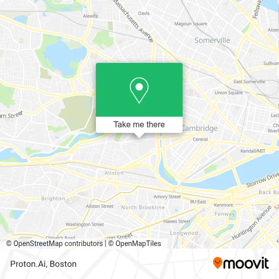
See Proton.Ai, Boston, on the map
Public Transit to Proton.Ai in Boston
Wondering how to get to Proton.Ai in Boston? Moovit helps you find the best way to get to Proton.Ai with step-by-step directions from the nearest public transit station.
Moovit provides free maps and live directions to help you navigate through your city. View schedules, routes, timetables, and find out how long does it take to get to Proton.Ai in real time.
Looking for the nearest stop or station to Proton.Ai? Check out this list of stops closest to your destination: Western Ave @ N Harvard St; N Harvard St @ Western Ave; Packards Corner; Cambridge St @ Seattle St; Harvard Square.
Bus: 501, 66, 70, 86, 64.Train: FITCHBURG, FRAMINGHAM/WORCESTER.Subway: RED LINE, GREEN LINE B.
Want to see if there’s another route that gets you there at an earlier time? Moovit helps you find alternative routes or times. Get directions from and directions to Proton.Ai easily from the Moovit App or Website.
We make riding to Proton.Ai easy, which is why over 1.7 million users, including users in Boston, trust Moovit as the best app for public transit. You don’t need to download an individual bus app or train app, Moovit is your all-in-one transit app that helps you find the best bus time or train time available.
For information on prices of bus, subway and train, costs and ride fares to Proton.Ai, please check the Moovit app.
Use the app to navigate to popular places including to the airport, hospital, stadium, grocery store, mall, coffee shop, school, college, and university.
Proton.Ai Address: 125 Western Ave street in Boston
- Harvard Innovation Lab (Harvard Ilab),
- Spangler Food Court at Harvard Business School,
- Harvard Innovation Launch Lab,
- Harvard University Science And Engineering Complex (Sec),
- Spangler Center,
- Cumnock Fields,
- Harvard Business School,
- Office of University Publisher,
- Air Express Div Rea Express,
- Harvard Business School Taxi Stand,
- Western Ave (western avenue and stadium),
- Charles River Aquatics Masters (Cambridge Masters Swim Club),
- Beren Tennis Center- Harvard University,
- Boston Calling Music Festival,
- Cotting Hall,
- Harvard Stadium (Harvard Softball Field),
- Harvard Stadium,
- Technique Swim Academy,
- Jordan Field,
- O'Donnell Field
Places Near Proton.Ai (Boston)
- Mgm Music Hall, Boston,
- Td Garden, Boston,
- Prudential Center, Boston,
- Castle Island, Boston,
- Seaport District, Boston,
- Boston Common, Boston,
- Cheers, Boston,
- House Of Blues, Boston,
- Wang Theater, Boston,
- Leader Bank Pavilion (Leader Bank Pavillion), Boston,
- Boston Children's Hospital, Boston,
- Museum Of Science, Boston,
- Massachusetts General Hospital, Boston,
- Wilbur Theatre, Boston,
- Faneuil Hall, Boston,
- Boston Convention & Exhibition Center, Boston,
- Quincy Market, Boston,
- Isabella Stewart Gardner Museum, Boston,
- Boston Medical Center, Boston,
- North End, Boston
How to get to popular places in Boston with public transit
Get around Boston by public transit!
Traveling around Boston has never been so easy. See step by step directions as you travel to any attraction, street or major public transit station. View bus and train schedules, arrival times, service alerts and detailed routes on a map, so you know exactly how to get to anywhere in Boston.
When traveling to any destination around Boston use Moovit's Live Directions with Get Off Notifications to know exactly where and how far to walk, how long to wait for your line, and how many stops are left. Moovit will alert you when it's time to get off — no need to constantly re-check whether yours is the next stop.
Wondering how to use public transit in Boston or how to pay for public transit in Boston? Moovit public transit app can help you navigate your way with public transit easily, and at minimum cost. It includes public transit fees, ticket prices, and costs. Looking for a map of Boston public transit lines? Moovit public transit app shows all public transit maps in Boston with all Bus, Train, Subway and Ferry routes and stops on an interactive map.
Boston has 4 transit type(s), including: Bus, Train, Subway and Ferry, operated by several transit agencies, including MBTA, Southeastern Regional Transit Authority, MetroWest Regional Transit Authority, Rhode Island Public Transit Authority, WRTA, Lowell Regional Transit Authority, Merrimack Valley Transit, Montachusett Regional Transit Authority, Cape Cod Regional Transit Authority, Brockton Area Transit Authority, Martha's Vineyard Transit Authority, the WAVE - Nantucket Regional Transit Authority, GATRA, Cape Ann Transportation Authority and Massport