Directions to Providence Metropolitan Ymca (Boston) with public transportation
The following transit lines have routes that pass near Providence Metropolitan Ymca
 Bus: 1, 20, 22, 24L, 6.
- Train: NORTHEAST REGIONAL, PROVIDENCE/STOUGHTON, ACELA, PROVIDENCE LINE SHUTTLE, PROVIDENCE LINE SHUTTLE.
How to get to Providence Metropolitan Ymca by bus?
Click on the bus route to see step by step directions with maps, line arrival times and updated time schedules.
How to get to Providence Metropolitan Ymca by train?
Click on the train route to see step by step directions with maps, line arrival times and updated time schedules.
Bus stops near Providence Metropolitan Ymca in Boston
Train stations near Providence Metropolitan Ymca in Boston
- Providence, 32 min walk,VIEW
Bus lines to Providence Metropolitan Ymca in Boston
What are the closest stations to Providence Metropolitan Ymca?
The closest stations to Providence Metropolitan Ymca are:
- Lockwood Street (Southbound) is 291 yards away, 4 min walk.
- Cahir & Westminster (After Westminster) is 293 yards away, 4 min walk.
- Westminster Before John J Partington is 318 yards away, 4 min walk.
- Point & Prairie (At W Franklin Before Maple) is 385 yards away, 5 min walk.
- Providence is 2624 yards away, 32 min walk.
Which bus lines stop near Providence Metropolitan Ymca?
These bus lines stop near Providence Metropolitan Ymca: 1, 20, 22, 24L, 6, R.
Which train lines stop near Providence Metropolitan Ymca?
These train lines stop near Providence Metropolitan Ymca: NORTHEAST REGIONAL, PROVIDENCE/STOUGHTON.
What’s the nearest bus station to Providence Metropolitan Ymca in Boston?
The nearest bus stations to Providence Metropolitan Ymca in Boston are Lockwood Street (Southbound), Cahir & Westminster (After Westminster) and Westminster Before John J Partington. The closest one is a 4 min walk away.
What time is the first train to Providence Metropolitan Ymca in Boston?
The PROVIDENCE/STOUGHTON is the first train that goes to Providence Metropolitan Ymca in Boston. It stops nearby at 4:10 AM.
What time is the last train to Providence Metropolitan Ymca in Boston?
The NORTHEAST REGIONAL is the last train that goes to Providence Metropolitan Ymca in Boston. It stops nearby at 9:17 AM.
What time is the first bus to Providence Metropolitan Ymca in Boston?
The R is the first bus that goes to Providence Metropolitan Ymca in Boston. It stops nearby at 5:28 AM.
What time is the last bus to Providence Metropolitan Ymca in Boston?
The 20 is the last bus that goes to Providence Metropolitan Ymca in Boston. It stops nearby at 1:05 AM.
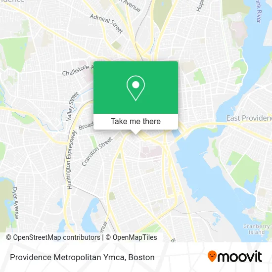
See Providence Metropolitan Ymca, Boston, on the map
Public Transit to Providence Metropolitan Ymca in Boston
Wondering how to get to Providence Metropolitan Ymca in Boston? Moovit helps you find the best way to get to Providence Metropolitan Ymca with step-by-step directions from the nearest public transit station.
Moovit provides free maps and live directions to help you navigate through your city. View schedules, routes, timetables, and find out how long does it take to get to Providence Metropolitan Ymca in real time.
Looking for the nearest stop or station to Providence Metropolitan Ymca? Check out this list of stops closest to your destination: Lockwood Street (Southbound); Cahir & Westminster (After Westminster); Westminster Before John J Partington; Point & Prairie (At W Franklin Before Maple); Providence.
Bus: 1, 20, 22, 24L, 6, R, 17, 18, 19, 31.Train: NORTHEAST REGIONAL, PROVIDENCE/STOUGHTON, ACELA, PROVIDENCE LINE SHUTTLE, PROVIDENCE LINE SHUTTLE, PROVIDENCE LINE SHUTTLE, FOXBORO EVENT SERVICE.
Want to see if there’s another route that gets you there at an earlier time? Moovit helps you find alternative routes or times. Get directions from and directions to Providence Metropolitan Ymca easily from the Moovit App or Website.
We make riding to Providence Metropolitan Ymca easy, which is why over 1.7 million users, including users in Boston, trust Moovit as the best app for public transit. You don’t need to download an individual bus app or train app, Moovit is your all-in-one transit app that helps you find the best bus time or train time available.
For information on prices of bus and train, costs and ride fares to Providence Metropolitan Ymca, please check the Moovit app.
Use the app to navigate to popular places including to the airport, hospital, stadium, grocery store, mall, coffee shop, school, college, and university.
Providence Metropolitan Ymca Address: 371 Pine St street in Boston
- Greater Providence Young MN's Christian,
- MRB Products,
- Rhode Island Coalition for the Homeless,
- GLR Software,
- The Potter's House Church Providence,
- Travelers Aid Housing,
- Platinum Insurance Agency,
- South Side Cooking,
- Mirage Sports Bar & Grill,
- Hagberg, Robert B,
- Animati Treanor Brotheer,
- Thrive,
- Riviera Pizza,
- 270 Broad St Parking,
- Southern Baptist Convention,
- Amazon Locker-Kiet,
- Western Union,
- Am Ci Construction,
- W Clifford St Building 83,
- Classical High School Auditorium
Places Near Providence Metropolitan Ymca (Boston)
- Museum Of Science, Boston,
- Castle Island, Boston,
- Faneuil Hall, Boston,
- Isabella Stewart Gardner Museum, Boston,
- Cheers, Boston,
- Td Garden, Boston,
- Seaport District, Boston,
- Mgm Music Hall, Boston,
- Leader Bank Pavilion (Leader Bank Pavillion), Boston,
- Wang Theater, Boston,
- Boston Medical Center, Boston,
- Wilbur Theatre, Boston,
- Prudential Center, Boston,
- North End, Boston,
- Massachusetts General Hospital, Boston,
- House Of Blues, Boston,
- Boston Convention & Exhibition Center, Boston,
- Boston Common, Boston,
- Quincy Market, Boston,
- Boston Children's Hospital, Boston
How to get to popular places in Boston with public transit
Get around Boston by public transit!
Traveling around Boston has never been so easy. See step by step directions as you travel to any attraction, street or major public transit station. View bus and train schedules, arrival times, service alerts and detailed routes on a map, so you know exactly how to get to anywhere in Boston.
When traveling to any destination around Boston use Moovit's Live Directions with Get Off Notifications to know exactly where and how far to walk, how long to wait for your line, and how many stops are left. Moovit will alert you when it's time to get off — no need to constantly re-check whether yours is the next stop.
Wondering how to use public transit in Boston or how to pay for public transit in Boston? Moovit public transit app can help you navigate your way with public transit easily, and at minimum cost. It includes public transit fees, ticket prices, and costs. Looking for a map of Boston public transit lines? Moovit public transit app shows all public transit maps in Boston with all Bus, Train, Subway and Ferry routes and stops on an interactive map.
Boston has 4 transit type(s), including: Bus, Train, Subway and Ferry, operated by several transit agencies, including MBTA, Southeastern Regional Transit Authority, MetroWest Regional Transit Authority, Rhode Island Public Transit Authority, WRTA, Lowell Regional Transit Authority, Merrimack Valley Transit, Montachusett Regional Transit Authority, Cape Cod Regional Transit Authority, Brockton Area Transit Authority, Martha's Vineyard Transit Authority, the WAVE - Nantucket Regional Transit Authority, GATRA, Cape Ann Transportation Authority and Massport