See Ps55, Staten Island, on the map
Directions to Ps55 (Staten Island) with public transportation
The following transit lines have routes that pass near Ps55
 Bus:
Bus: - Subway:
How to get to Ps55 by bus?
Click on the bus route to see step by step directions with maps, line arrival times and updated time schedules.
Bus stations near Ps55 in Staten Island
- Arden Av/Koch Blvd, 5 min walk,
- Richmond Av/Koch Blvd, 7 min walk,
Subway stations near Ps55 in Staten Island
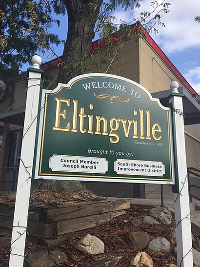
- Eltingville, 14 min walk,
Bus lines to Ps55 in Staten Island
- SIM23, Annadale Via Arden Av,
- SIM1, Soho Houston St Via Church St,
- SIM1C, Eltngvlle Trans Ctr Via Hylan Via Rich,
- SIM7, Eltvlle Trans Ctr Via Hylan Via Richmond,
- SIM10, Eltingville Trans Ctr Via Hylan Via Rich,
- SIM22, Eltingville Via Ar Kill Rd Via Richmond,
- S59, Port Richmond,
- S89, Limited Bayonne 34 St-Hblr Sta Via Rich,
What are the closest stations to Ps55?
The closest stations to Ps55 are:
- Arden Av/Koch Blvd is 350 yards away, 5 min walk.
- Richmond Av/Koch Blvd is 530 yards away, 7 min walk.
- Eltingville is 1141 yards away, 14 min walk.
Which bus lines stop near Ps55?
These bus lines stop near Ps55: S79-SBS, S89, SIM1C, SIM23.
What’s the nearest subway station to Ps55 in Staten Island?
The nearest subway station to Ps55 in Staten Island is Eltingville. It’s a 14 min walk away.
What’s the nearest bus stop to Ps55 in Staten Island?
The nearest bus stop to Ps55 in Staten Island is Arden Av/Koch Blvd. It’s a 5 min walk away.
What time is the first subway to Ps55 in Staten Island?
The SIR is the first subway that goes to Ps55 in Staten Island. It stops nearby at 3:01 AM.
What time is the last subway to Ps55 in Staten Island?
The SIR is the last subway that goes to Ps55 in Staten Island. It stops nearby at 3:07 AM.
What time is the first bus to Ps55 in Staten Island?
The SIM1C is the first bus that goes to Ps55 in Staten Island. It stops nearby at 3:05 AM.
What time is the last bus to Ps55 in Staten Island?
The SIM1C is the last bus that goes to Ps55 in Staten Island. It stops nearby at 3:39 AM.
How much is the train fare to Ps55?
The train fare to Ps55 costs about $2.25 - $14.00.
How much is the bus fare to Ps55?
The bus fare to Ps55 costs about $2.90.
How much is the subway fare to Ps55?
The subway fare to Ps55 costs about $2.90.
See Ps55, Staten Island, on the map
Public Transit to Ps55 in Staten Island
Wondering how to get to Ps55 in Staten Island, United States? Moovit helps you find the best way to get to Ps55 with step-by-step directions from the nearest public transit station.
Moovit provides free maps and live directions to help you navigate through your city. View schedules, routes, timetables, and find out how long does it take to get to Ps55 in real time.
Looking for the nearest stop or station to Ps55? Check out this list of stops closest to your destination: Arden Av/Koch Blvd; Richmond Av/Koch Blvd; Eltingville.
Bus:Subway:
Want to see if there’s another route that gets you there at an earlier time? Moovit helps you find alternative routes or times. Get directions from and directions to Ps55 easily from the Moovit App or Website.
We make riding to Ps55 easy, which is why over 1.5 million users, including users in Staten Island, trust Moovit as the best app for public transit. You don’t need to download an individual bus app or train app, Moovit is your all-in-one transit app that helps you find the best bus time or train time available.
For information on prices of bus, subway and train, costs and ride fares to Ps55, please check the Moovit app.
Use the app to navigate to popular places including to the airport, hospital, stadium, grocery store, mall, coffee shop, school, college, and university.
Ps55 Address: 54 Osborne St Staten Island, NY 10312 street in Staten Island
Attractions near Ps55
PS 55,Public Restroom,Koch Blvd (richmond ave and koch blvd),Swivits Mission,S79 Bus,12roses Boutique,Amboy Rd,amboy road,X24 Atlantic Express,Tekchand Thakurdial, DPM,YMCA,Staten Island South Shore YMCA,Regional Radiology South,Holy Child Gym,Midwood Abstract,The Stein Law Firm,Richmond Ave (richmond avenue amboy road),Annadale,Eltingville, New York,Thomas Lawler SculptorHow to get to popular attractions in Staten Island with public transit
Hair of the Dog, Manhattan,The 13th Step, Manhattan,MTA Subway - Broadway (N/W), Queens,Jackson Heights, NY, Queens,Freehold Raceway Mall, Freehold Township,The Stanton Social, Manhattan,The Plaza Hotel, Manhattan,Jersey Shore University Medical Center, Neptune, Nj,Burger Joint, Manhattan,Time Life, Manhattan,Wingate by Wyndham Manhattan Midtown, Manhattan,Ritz Bar & Lounge, Manhattan,Fette Sau,Avenue, Manhattan,Nathan's Famous,Great Lawn, Manhattan,The Meatball Shop,Jing Fong Restaurant 金豐大酒樓, Manhattan,Red Rooster, Manhattan,Spring Lounge, ManhattanGet around Staten Island by public transit!
Traveling around Staten Island has never been so easy. See step by step directions as you travel to any attraction, street or major public transit station. View bus and train schedules, arrival times, service alerts and detailed routes on a map, so you know exactly how to get to anywhere in Staten Island.
When traveling to any destination around Staten Island use Moovit's Live Directions with Get Off Notifications to know exactly where and how far to walk, how long to wait for your line, and how many stops are left. Moovit will alert you when it's time to get off — no need to constantly re-check whether yours is the next stop.
Wondering how to use public transit in Staten Island or how to pay for public transit in Staten Island? Moovit public transit app can help you navigate your way with public transit easily, and at minimum cost. It includes public transit fees, ticket prices, and costs. Looking for a map of Staten Island public transit lines? Moovit public transit app shows all public transit maps in Staten Island with all bus, subway or train routes and stops on an interactive map.
Staten Island has 3 transit type(s), including: bus, subway or train, operated by several transit agencies, including MTA Subway, Metro-North Railroad, LIRR, PATH, Shore Line East, MTA Bus Company, MTA New York City Transit - Express routes, MTA Bus, NJ Transit, NYC Ferry, NICE bus, Bee-Line Bus, NJ Transit Rail, NJ Transit Rail and Norwalk Transit District