Directions to Queeraoke (Boston) with public transportation
The following transit lines have routes that pass near Queeraoke
 Bus: 39, 42, ORANGE LINE SHUTTLE, ORANGE LINE SHUTTLE, ORANGE LINE SHUTTLE.
- Train: FRANKLIN/FOXBORO, NEEDHAM, PROVIDENCE/STOUGHTON, FAIRMOUNT.
- Subway: ORANGE LINE.
How to get to Queeraoke by bus?
Click on the bus route to see step by step directions with maps, line arrival times and updated time schedules.
From Faneuil Hall Marketplace, Boston
45 minFrom Dubliner, Boston
42 minFrom Edic Pier, Boston
59 minFrom Costco, Dedham
58 minFrom Kkkk, Boston
83 minFrom Harpoon Brewery, Boston
63 minFrom Rino's Place, Boston
82 minFrom Davis Sq, Somerville
87 minFrom Massport Security Badge Office, Boston
51 minFrom Terminal E- Logan International Airport, Boston
51 min
How to get to Queeraoke by train?
Click on the train route to see step by step directions with maps, line arrival times and updated time schedules.
How to get to Queeraoke by subway?
Click on the subway route to see step by step directions with maps, line arrival times and updated time schedules.
Bus stops near Queeraoke in Boston
Subway station near Queeraoke in Boston
- Stony Brook, 5 min walk,VIEW
Train stations near Queeraoke in Boston
Bus lines to Queeraoke in Boston
- 42, Nubian,VIEW
- ORANGE LINE SHUTTLE, Forest Hills - Jackson Square,VIEW
- ORANGE LINE SHUTTLE, Forest Hills - Back Bay (Shuttle),VIEW
- ORANGE LINE SHUTTLE, Forest Hills - Jackson Square (Shuttle),VIEW
- ORANGE LINE SHUTTLE, Forest Hills - Back Bay via Ruggles Busway (Shuttle),VIEW
- ORANGE LINE SHUTTLE, Forest Hills - Ruggles,VIEW
- ORANGE LINE SHUTTLE, Forest Hills - Copley,VIEW
- ORANGE LINE SHUTTLE, Forest Hills - Back Bay via Copley (Shuttle),VIEW
- 16, Andrew via South Bay Center - Forest Hills via South Bay Center,VIEW
- 21, Forest Hills - Ashmont,VIEW
- 31, Forest Hills - Mattapan,VIEW
- 32, Forest Hills - Wolcott Square,VIEW
- 34, Forest Hills - Dedham Mall,VIEW
- 36, Forest Hills - VA Hospital,VIEW
- 38, Forest Hills - Wren St,VIEW
What are the closest stations to Queeraoke?
The closest stations to Queeraoke are:
- Washington St @ Rossmore Rd is 113 yards away, 2 min walk.
- Green Street - Amory St @ Green St is 189 yards away, 3 min walk.
- Stony Brook is 362 yards away, 5 min walk.
- Arborway Opp Courthouse is 893 yards away, 11 min walk.
- Forest Hills is 2147 yards away, 26 min walk.
- Four Corners/Geneva is 3781 yards away, 44 min walk.
Which bus lines stop near Queeraoke?
These bus lines stop near Queeraoke: 39, 42.
Which train lines stop near Queeraoke?
These train lines stop near Queeraoke: FRANKLIN/FOXBORO, NEEDHAM.
Which subway line stops near Queeraoke?
ORANGE LINE (Forest Hills)
What’s the nearest subway station to Queeraoke in Boston?
The nearest subway station to Queeraoke in Boston is Stony Brook. It’s a 5 min walk away.
What’s the nearest train station to Queeraoke in Boston?
The nearest train station to Queeraoke in Boston is Forest Hills. It’s a 26 min walk away.
What’s the nearest bus station to Queeraoke in Boston?
The nearest bus station to Queeraoke in Boston is Washington St @ Rossmore Rd. It’s a 2 min walk away.
What time is the first subway to Queeraoke in Boston?
The ORANGE LINE is the first subway that goes to Queeraoke in Boston. It stops nearby at 5:15 AM.
What time is the last subway to Queeraoke in Boston?
The ORANGE LINE is the last subway that goes to Queeraoke in Boston. It stops nearby at 1:58 AM.
What time is the first train to Queeraoke in Boston?
The FAIRMOUNT is the first train that goes to Queeraoke in Boston. It stops nearby at 6:30 AM.
What time is the last train to Queeraoke in Boston?
The PROVIDENCE/STOUGHTON is the last train that goes to Queeraoke in Boston. It stops nearby at 12:08 AM.
What time is the first bus to Queeraoke in Boston?
The 31 is the first bus that goes to Queeraoke in Boston. It stops nearby at 4:30 AM.
What time is the last bus to Queeraoke in Boston?
The 16 is the last bus that goes to Queeraoke in Boston. It stops nearby at 1:37 AM.
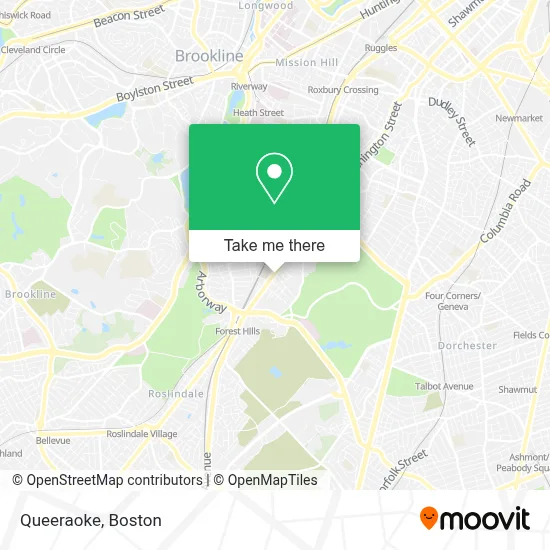
See Queeraoke, Boston, on the map
Public Transit to Queeraoke in Boston
Wondering how to get to Queeraoke in Boston? Moovit helps you find the best way to get to Queeraoke with step-by-step directions from the nearest public transit station.
Moovit provides free maps and live directions to help you navigate through your city. View schedules, routes, timetables, and find out how long does it take to get to Queeraoke in real time.
Looking for the nearest stop or station to Queeraoke? Check out this list of stops closest to your destination: Washington St @ Rossmore Rd; Green Street - Amory St @ Green St; Stony Brook; Arborway Opp Courthouse; Forest Hills; Four Corners/Geneva.
Bus: 39, 42, ORANGE LINE SHUTTLE, ORANGE LINE SHUTTLE, ORANGE LINE SHUTTLE, ORANGE LINE SHUTTLE, ORANGE LINE SHUTTLE, 16, 21, 31, 32, 34.Train: FRANKLIN/FOXBORO, NEEDHAM, PROVIDENCE/STOUGHTON, FAIRMOUNT.Subway: ORANGE LINE.
Want to see if there’s another route that gets you there at an earlier time? Moovit helps you find alternative routes or times. Get directions from and directions to Queeraoke easily from the Moovit App or Website.
We make riding to Queeraoke easy, which is why over 1.7 million users, including users in Boston, trust Moovit as the best app for public transit. You don’t need to download an individual bus app or train app, Moovit is your all-in-one transit app that helps you find the best bus time or train time available.
For information on prices of bus, subway and train, costs and ride fares to Queeraoke, please check the Moovit app.
Use the app to navigate to popular places including to the airport, hospital, stadium, grocery store, mall, coffee shop, school, college, and university.
Queeraoke Address: 3496 Washington St street in Boston
- Midway Cafe,
- Meeting Point (Meeting Place),
- Jp Car Wash,
- Wci,
- Arbor Hospital Outpatient (Arbour Hospital),
- Arbor Hospital Outpatient,
- Southwest Corridor Park,
- Match Middle School (Match Charter Public School),
- Catlabs,
- MBTA Arborway Bus Garage,
- Somali Development Center,
- Atm,
- Boston International High School,
- Community Academy,
- Boston Pilates,
- MBTA Green Street Station,
- Hou,
- Esac,
- Glenn's Gardening & Woodworking,
- Franklin Park - The 99 Steps and Ellicott Arch
Places Near Queeraoke (Boston)
- House Of Blues, Boston,
- Boston Common, Boston,
- Museum Of Science, Boston,
- Wang Theater, Boston,
- Wilbur Theatre, Boston,
- Castle Island, Boston,
- Isabella Stewart Gardner Museum, Boston,
- Faneuil Hall, Boston,
- Mgm Music Hall, Boston,
- Seaport District, Boston,
- Boston Medical Center, Boston,
- Td Garden, Boston,
- Boston Convention & Exhibition Center, Boston,
- North End, Boston,
- Leader Bank Pavilion (Leader Bank Pavillion), Boston,
- Massachusetts General Hospital, Boston,
- Quincy Market, Boston,
- Prudential Center, Boston,
- Boston Children's Hospital, Boston,
- Cheers, Boston
How to get to popular places in Boston with public transit
Get around Boston by public transit!
Traveling around Boston has never been so easy. See step by step directions as you travel to any attraction, street or major public transit station. View bus and train schedules, arrival times, service alerts and detailed routes on a map, so you know exactly how to get to anywhere in Boston.
When traveling to any destination around Boston use Moovit's Live Directions with Get Off Notifications to know exactly where and how far to walk, how long to wait for your line, and how many stops are left. Moovit will alert you when it's time to get off — no need to constantly re-check whether yours is the next stop.
Wondering how to use public transit in Boston or how to pay for public transit in Boston? Moovit public transit app can help you navigate your way with public transit easily, and at minimum cost. It includes public transit fees, ticket prices, and costs. Looking for a map of Boston public transit lines? Moovit public transit app shows all public transit maps in Boston with all Bus, Train, Subway and Ferry routes and stops on an interactive map.
Boston has 4 transit type(s), including: Bus, Train, Subway and Ferry, operated by several transit agencies, including MBTA, Southeastern Regional Transit Authority, MetroWest Regional Transit Authority, Rhode Island Public Transit Authority, WRTA, Lowell Regional Transit Authority, Merrimack Valley Transit, Montachusett Regional Transit Authority, Cape Cod Regional Transit Authority, Brockton Area Transit Authority, Martha's Vineyard Transit Authority, the WAVE - Nantucket Regional Transit Authority, GATRA, Cape Ann Transportation Authority and Massport