Directions to R G Mearn Co Inc (Boston) with public transportation
The following transit lines have routes that pass near R G Mearn Co Inc
 Bus: 1, 15, 41, 45, 47.
- Train: FAIRMOUNT, NEEDHAM, PROVIDENCE/STOUGHTON, FRANKLIN/FOXBORO, ORANGE LINE.
- Subway: ORANGE LINE, RED LINE.
How to get to R G Mearn Co Inc by bus?
Click on the bus route to see step by step directions with maps, line arrival times and updated time schedules.
From Quincy Center Station, Quincy
86 minFrom Quincy, MA, Quincy
89 minFrom Best Western Adams Inn Quincy - Boston, Quincy
62 minFrom Georgetown, Massachusetts, Boston
75 minFrom Academy Of the Pacific Rim Charter Public School, Boston
71 minFrom Brigham and Women's Faulkner Hospital, Boston
46 minFrom Brattle St / Harvard Sq, Cambridge
42 minFrom Hyatt Place Medford, Medford
84 minFrom Terminal B- Logan International Airport, Boston
45 minFrom Massport Security Badge Office, Boston
42 min
How to get to R G Mearn Co Inc by train?
Click on the train route to see step by step directions with maps, line arrival times and updated time schedules.
How to get to R G Mearn Co Inc by subway?
Click on the subway route to see step by step directions with maps, line arrival times and updated time schedules.
From Quincy Center Station, Quincy
41 minFrom Terminal B- Logan International Airport, Boston
69 minFrom Massport Security Badge Office, Boston
49 minFrom Quincy, MA, Quincy
48 minFrom Best Western Adams Inn Quincy - Boston, Quincy
52 minFrom Brigham and Women's Faulkner Hospital, Boston
53 minFrom Brattle St / Harvard Sq, Cambridge
46 minFrom Hyatt Place Medford, Medford
83 min
Bus stops near R G Mearn Co Inc in Boston
Train stations near R G Mearn Co Inc in Boston
Subway station near R G Mearn Co Inc in Boston
- Andrew, 33 min walk,VIEW
Bus lines to R G Mearn Co Inc in Boston
What are the closest stations to R G Mearn Co Inc?
The closest stations to R G Mearn Co Inc are:
- Blue Hill Ave @ Dudley St is 180 yards away, 3 min walk.
- Dudley St @ Magazine St is 259 yards away, 4 min walk.
- Student Residence (815 Albany St) is 430 yards away, 6 min walk.
- Albany St Opp Randall St is 509 yards away, 6 min walk.
- Ruggles is 767 yards away, 9 min walk.
- Uphams Corner is 979 yards away, 12 min walk.
- Andrew is 2759 yards away, 33 min walk.
Which bus lines stop near R G Mearn Co Inc?
These bus lines stop near R G Mearn Co Inc: 1, 15, 41, 45, 47, CT3.
Which train lines stop near R G Mearn Co Inc?
These train lines stop near R G Mearn Co Inc: FAIRMOUNT, NEEDHAM, PROVIDENCE/STOUGHTON.
Which subway lines stop near R G Mearn Co Inc?
These subway lines stop near R G Mearn Co Inc: ORANGE LINE, RED LINE.
What’s the nearest train station to R G Mearn Co Inc in Boston?
The nearest train station to R G Mearn Co Inc in Boston is Ruggles. It’s a 9 min walk away.
What’s the nearest bus station to R G Mearn Co Inc in Boston?
The nearest bus station to R G Mearn Co Inc in Boston is Blue Hill Ave @ Dudley St. It’s a 3 min walk away.
What time is the first subway to R G Mearn Co Inc in Boston?
The ORANGE LINE is the first subway that goes to R G Mearn Co Inc in Boston. It stops nearby at 5:23 AM.
What time is the last subway to R G Mearn Co Inc in Boston?
The RED LINE is the last subway that goes to R G Mearn Co Inc in Boston. It stops nearby at 1:53 AM.
What time is the first train to R G Mearn Co Inc in Boston?
The PROVIDENCE/STOUGHTON is the first train that goes to R G Mearn Co Inc in Boston. It stops nearby at 4:28 AM.
What time is the last train to R G Mearn Co Inc in Boston?
The PROVIDENCE/STOUGHTON is the last train that goes to R G Mearn Co Inc in Boston. It stops nearby at 12:34 AM.
What time is the first bus to R G Mearn Co Inc in Boston?
The 15 is the first bus that goes to R G Mearn Co Inc in Boston. It stops nearby at 3:37 AM.
What time is the last bus to R G Mearn Co Inc in Boston?
The 1 is the last bus that goes to R G Mearn Co Inc in Boston. It stops nearby at 2:40 AM.
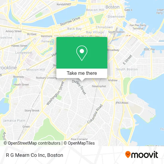
See R G Mearn Co Inc, Boston, on the map
Public Transit to R G Mearn Co Inc in Boston
Wondering how to get to R G Mearn Co Inc in Boston? Moovit helps you find the best way to get to R G Mearn Co Inc with step-by-step directions from the nearest public transit station.
Moovit provides free maps and live directions to help you navigate through your city. View schedules, routes, timetables, and find out how long does it take to get to R G Mearn Co Inc in real time.
Looking for the nearest stop or station to R G Mearn Co Inc? Check out this list of stops closest to your destination: Blue Hill Ave @ Dudley St; Dudley St @ Magazine St; Student Residence (815 Albany St); Albany St Opp Randall St; Ruggles; Uphams Corner; Andrew.
Bus: 1, 15, 41, 45, 47, CT3, ALBANY/E NEWTON STREET.Train: FAIRMOUNT, NEEDHAM, PROVIDENCE/STOUGHTON, FRANKLIN/FOXBORO, ORANGE LINE.Subway: ORANGE LINE, RED LINE.
Want to see if there’s another route that gets you there at an earlier time? Moovit helps you find alternative routes or times. Get directions from and directions to R G Mearn Co Inc easily from the Moovit App or Website.
We make riding to R G Mearn Co Inc easy, which is why over 1.7 million users, including users in Boston, trust Moovit as the best app for public transit. You don’t need to download an individual bus app or train app, Moovit is your all-in-one transit app that helps you find the best bus time or train time available.
For information on prices of bus, subway and train, costs and ride fares to R G Mearn Co Inc, please check the Moovit app.
Use the app to navigate to popular places including to the airport, hospital, stadium, grocery store, mall, coffee shop, school, college, and university.
R G Mearn Co Inc Address: 157 Hampden St street in Boston
- Flying Embers Brewery & Social Club,
- Long Live Roxbury,
- Orchard Gardens School,
- Republic Services,
- Inspired Fitness,
- Vine Street Community Center Council,
- Yes,
- First Stop Laundromat,
- Shop Funny Teacher T-Shirts,
- F.W. Webb Company - Boston,
- Dearborn Stem Academy,
- Trinity Financial,
- St Patrick's Roxbury Parish of Archdiocese of Boston,
- Casa Esperanza, Inc.,
- Allianza Hispana,
- Adam Affordable Locksmith,
- Ruiz Market,
- Gringo Barbershop,
- Orchard Gardens Pilot School ,
- Villa Sombrero Restaurant
Places Near R G Mearn Co Inc (Boston)
- Faneuil Hall, Boston,
- Quincy Market, Boston,
- Massachusetts General Hospital, Boston,
- Cheers, Boston,
- House Of Blues, Boston,
- Castle Island, Boston,
- Wilbur Theatre, Boston,
- Museum Of Science, Boston,
- Seaport District, Boston,
- Boston Children's Hospital, Boston,
- Td Garden, Boston,
- Isabella Stewart Gardner Museum, Boston,
- North End, Boston,
- Boston Medical Center, Boston,
- Mgm Music Hall, Boston,
- Boston Common, Boston,
- Leader Bank Pavilion (Leader Bank Pavillion), Boston,
- Wang Theater, Boston,
- Prudential Center, Boston,
- Boston Convention & Exhibition Center, Boston
How to get to popular places in Boston with public transit
Get around Boston by public transit!
Traveling around Boston has never been so easy. See step by step directions as you travel to any attraction, street or major public transit station. View bus and train schedules, arrival times, service alerts and detailed routes on a map, so you know exactly how to get to anywhere in Boston.
When traveling to any destination around Boston use Moovit's Live Directions with Get Off Notifications to know exactly where and how far to walk, how long to wait for your line, and how many stops are left. Moovit will alert you when it's time to get off — no need to constantly re-check whether yours is the next stop.
Wondering how to use public transit in Boston or how to pay for public transit in Boston? Moovit public transit app can help you navigate your way with public transit easily, and at minimum cost. It includes public transit fees, ticket prices, and costs. Looking for a map of Boston public transit lines? Moovit public transit app shows all public transit maps in Boston with all Bus, Train, Subway and Ferry routes and stops on an interactive map.
Boston has 4 transit type(s), including: Bus, Train, Subway and Ferry, operated by several transit agencies, including MBTA, Southeastern Regional Transit Authority, MetroWest Regional Transit Authority, Rhode Island Public Transit Authority, WRTA, Lowell Regional Transit Authority, Merrimack Valley Transit, Montachusett Regional Transit Authority, Cape Cod Regional Transit Authority, Brockton Area Transit Authority, Martha's Vineyard Transit Authority, the WAVE - Nantucket Regional Transit Authority, GATRA, Cape Ann Transportation Authority and Massport