Directions to R Tech Engenharia e Construcao (Ahu) with public transportation
The following transit lines have routes that pass near R Tech Engenharia e Construcao
How to get to R Tech Engenharia e Construcao by bus?
Click on the bus route to see step by step directions with maps, line arrival times and updated time schedules.
From Alphaville, Pinhais
52 minFrom Detran - Colombo, Colombo
68 minFrom Unibrasil, Tarumã
45 minFrom Novo Mundo, Novo Mundo
39 minFrom UPA 24h - Unidade de Pronto Atendimento Boqueirão, Boqueirão
50 minFrom Avenida Brasília, Capão Raso
48 minFrom Portão, Portão
49 minFrom Rua Almirante Tamandaré, Almirante Tamandaré
39 minFrom Capela Mortuária Jardim Adriana, Colombo
50 minFrom Avenida Brasília, Novo Mundo
45 min
Bus stops near R Tech Engenharia e Construcao in Ahu
Bus lines to R Tech Engenharia e Construcao in Ahu
- 260 MARECHAL HERMES / SANTA EFIGÊNIA, Marechal Floriano Peixoto → Santa Efigênia,VIEW
- 176 PARQUE TANGUÁ, Parque Tanguá → Travessa Nestor de Castro,VIEW
- K01 ITAPERUÇU / GUADALUPE (TAMANDARÉ / MINÉRIOS), Terminal Guadalupe → Itaperuçu,VIEW
- A06 TAMANDARÉ / GUADALUPE (MINÉRIOS), Terminal Guadalupe → Terminal Tamandaré,VIEW
- 169 JARDIM KOSMOS, Travessa Nestor de Castro → Jardim Kosmos,VIEW
- 181 MATEUS LEME, Praça Tiradentes → Capela São Francisco Xavier,VIEW
- 182 ABRANCHES, Praça Tiradentes → Terminal Barreirinha,VIEW
- 183 JARDIM CHAPARRAL, Praça Tiradentes → Jardim Chaparral,VIEW
- 184 VILA SUÍÇA, Praça Tiradentes → Vila Suíça,VIEW
- 189 MAD. ABRANCHES, Praça Rui Barbosa ↺ Abranches (Circular),VIEW
- 207 CABRAL / OSÓRIO, Terminal Cabral → Praça Osório,VIEW
- A07 TAMANDARÉ / PRAÇA 19 (LAMENHA), (Reforço) Praça 19 → Kabel,VIEW
- K71 ITAPERUÇU / PRAÇA 19, Praça 19 → Campo Grande,VIEW
- L71 RIO BRANCO / PRAÇA 19, Praça 19 → Itaperuçu → Rio Branco (Madrugueiro),VIEW
- A72 JARDIM PARAÍSO / PRAÇA 19, Praça 19 → Jardim Paraíso,VIEW
- K72 ITAPERUÇU / PRAÇA 19 (DIRETO), Praça 19 → Itaperuçu,VIEW
- L72 RIO BRANCO / PRAÇA 19 (DIRETO), Praça 19 → Palmeirinhas,VIEW
- A73 JARDIM MARROCOS / PRAÇA 19, Praça 19 → Jardim Marrocos,VIEW
- L79 RIO BRANCO / PRAÇA 19 (VIA TAMANDARÉ), Praça 19 → Itaperuçu / Rio Branco (Madrugueiro),VIEW
- 1560-500, Curitiba → Cerro Azul,VIEW
What are the closest stations to R Tech Engenharia e Construcao?
The closest stations to R Tech Engenharia e Construcao are:
- R. Albano Reis, 244 is 16 meters away, 1 min walk.
- R. Albano Reis, 497 is 209 meters away, 3 min walk.
- R. Mateus Leme, 2523 - Hospital Ônix Mateus Leme is 309 meters away, 5 min walk.
- R. Eurípedes Garcez Do Nascimento, 857 is 325 meters away, 5 min walk.
Which bus lines stop near R Tech Engenharia e Construcao?
These bus lines stop near R Tech Engenharia e Construcao: 260 MARECHAL HERMES / SANTA EFIGÊNIA, A06 TAMANDARÉ / GUADALUPE (MINÉRIOS), A07 TAMANDARÉ / PRAÇA 19 (LAMENHA).
What’s the nearest bus station to R Tech Engenharia e Construcao in Ahu?
The nearest bus station to R Tech Engenharia e Construcao in Ahu is R. Albano Reis, 244. It’s a 1 min walk away.
What time is the first bus to R Tech Engenharia e Construcao in Ahu?
The 189 MAD. ABRANCHES is the first bus that goes to R Tech Engenharia e Construcao in Ahu. It stops nearby at 3:07 AM.
What time is the last bus to R Tech Engenharia e Construcao in Ahu?
The L71 RIO BRANCO / PRAÇA 19 is the last bus that goes to R Tech Engenharia e Construcao in Ahu. It stops nearby at 2:55 AM.
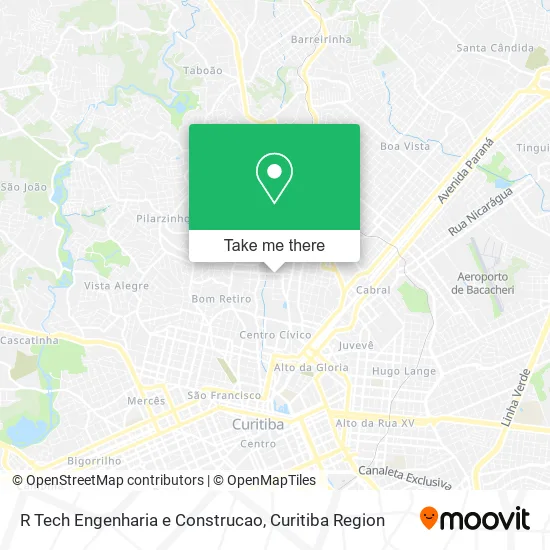
See R Tech Engenharia e Construcao, Ahu, on the map
Public Transit to R Tech Engenharia e Construcao in Ahu
Wondering how to get to R Tech Engenharia e Construcao in Ahu? Moovit helps you find the best way to get to R Tech Engenharia e Construcao with step-by-step directions from the nearest public transit station.
Moovit provides free maps and live directions to help you navigate through your city. View schedules, routes, timetables, and find out how long does it take to get to R Tech Engenharia e Construcao in real time.
Looking for the nearest stop or station to R Tech Engenharia e Construcao? Check out this list of stops closest to your destination: R. Albano Reis; R. Albano Reis; R. Mateus Leme; R. Eurípedes Garcez Do Nascimento.
Bus: 260 MARECHAL HERMES / SANTA EFIGÊNIA, A06 TAMANDARÉ / GUADALUPE (MINÉRIOS), A07 TAMANDARÉ / PRAÇA 19 (LAMENHA), 176 PARQUE TANGUÁ, K01 ITAPERUÇU / GUADALUPE (TAMANDARÉ / MINÉRIOS), 169 JARDIM KOSMOS, 181 MATEUS LEME, 182 ABRANCHES, 266 ESTRIBO AHÚ.
Want to see if there’s another route that gets you there at an earlier time? Moovit helps you find alternative routes or times. Get directions from and directions to R Tech Engenharia e Construcao easily from the Moovit App or Website.
We make riding to R Tech Engenharia e Construcao easy, which is why over 1.5 million users, including users in Ahu, trust Moovit as the best app for public transit. You don’t need to download an individual bus app or train app, Moovit is your all-in-one transit app that helps you find the best bus time or train time available.
For information on prices of bus, costs and ride fares to R Tech Engenharia e Construcao, please check the Moovit app.
Use the app to navigate to popular places including to the airport, hospital, stadium, grocery store, mall, coffee shop, school, college, and university.
R Tech Engenharia e Construcao Address: Rua Vieira dos Santos, 412 Ahu Curitiba-PR 80540-310 street in Ahu
- Rua Albano Reis, 149 - Ahu,
- Creche Castelo do Bosque,
- Ok Serviços Técnicos,
- Just Models Internacional,
- Rua Celeste Santi 90,
- Bazar Água Viva,
- Clube Urca,
- Panqueca e Pirulito Supplies e Cursos Online,
- Ventura de Andrade Sociedade Individual de Advocacia,
- Associação Cwb Basketball,
- Formato Producoes e Comunicação,
- New Wave Gestão e Treinamentos,
- Studio Eme Multidesign,
- Saint Cloud,
- Condomínio Porto,
- Unique Comercial Importadora,
- Rua Marechal Hermes 1651,
- Auditório Irmãs Paulinas,
- Aore Curitiba,
- Rua Albano Reis 458
Places Near R Tech Engenharia e Construcao (Ahu)
- Shopping Estação, Rebouças,
- Hospital do Rocio, Campo,
- Arena Da Baixada - Curitiba,
- Rua General Mário Tourinho, Campina Do Siqueira,
- Hospital Da Cruz Vermelha, Batel,
- Hospital Madalena Sofia, Bairro Alto,
- Campo Largo, Campo,
- Parque Barigui, Mercês,
- Jockey Plaza Shopping Center, Tarumã,
- Rua Martim Afonso 558, Mercês,
- Hospital de Clínicas (HC - UFPR), Centro,
- Jardim Botânico de Curitiba PR, Centro,
- Hospital Nossa Senhora Das Graças, Mercês,
- Hospital Universitário Evangélico de Curitiba, Bigorrilho,
- Pontifícia Universidade Católica do Paraná (PUCPR), Prado Velho,
- Hhhhh, Fazendinha,
- Park Shopping Barigüi, Mossunguê,
- Shopping Palladium, Portão,
- Hospital Angelina Caron, Campina Grande Do Sul,
- Hospital Erasto Gaertner, Jardim Das Américas
How to get to popular places in Curitiba Region with public transit
Get around Ahu by public transit!
Traveling around Ahu has never been so easy. See step by step directions as you travel to any attraction, street or major public transit station. View bus and train schedules, arrival times, service alerts and detailed routes on a map, so you know exactly how to get to anywhere in Ahu.
When traveling to any destination around Ahu use Moovit's Live Directions with Get Off Notifications to know exactly where and how far to walk, how long to wait for your line, and how many stops are left. Moovit will alert you when it's time to get off — no need to constantly re-check whether yours is the next stop.
Wondering how to use public transit in Ahu or how to pay for public transit in Ahu? Moovit public transit app can help you navigate your way with public transit easily, and at minimum cost. It includes public transit fees, ticket prices, and costs. Looking for a map of Ahu public transit lines? Moovit public transit app shows all public transit maps in Ahu with all Bus and Cable Car routes and stops on an interactive map.
Curitiba Region has 2 transit type(s), including: Bus and Cable Car, operated by several transit agencies, including Sistema Integrado de Mobilidade (URBS), Sistema Integrado de Mobilidade (AMEP), URBS (Cartões bancários e Dinheiro), URBS (Cartões bancários / Cartão URBS), AMEP (Cartões bancários / Cartão MetroCard), AMEP (Cartões bancários / Cartão MetroCard / Dinheiro), Viação Colombo (Dinheiro), TRIAR (Cartão TRIAR / Dinheiro), Empresa Curitiba Cerro Azul (Dinheiro), Expresso Nossa Senhora da Penha (Dinheiro), Empresa Campo Alto Tijucas (Dinheiro), Auto Viação São José (Cartão VEM / Dinheiro), BRT S/A (Cartão VEM / Dinheiro), TransPiedade (Cartão Cidadão / Dinheiro) and Oceânica Sul (Cartão Transporte / Dinheiro)