Directions to Rancho Sertanejo (Almirante Tamandaré) with public transportation
The following transit lines have routes that pass near Rancho Sertanejo
How to get to Rancho Sertanejo by bus?
Click on the bus route to see step by step directions with maps, line arrival times and updated time schedules.
From Rua XV de Novembro, Colombo
104 minFrom Rua Almirante Tamandaré 1000, Colombo
101 minFrom Rua Flávio Dallegrave, Boa Vista
52 minFrom Rua Lodovico Geronazzo, Boa Vista
63 minFrom Parque Tanguá, Taboão
41 minFrom Rua Via Veneto, Santa Felicidade
78 minFrom Rua Desembargador Hugo Simas, Vista Alegre
52 minFrom Campina do Arruda, Almirante Tamandaré
51 minFrom Santa Candida, Santa Cândida
70 minFrom Bosque Zaninelli, Pilarzinho
53 min
Bus stops near Rancho Sertanejo in Almirante Tamandaré
- R. Rachel Cândido de Siqueira, 350, 3 min walk,VIEW
- R. Rachel Cândido de Siqueira, 356, 3 min walk,VIEW
- R. Bertolina Kendrick de Oliveira, 586, 6 min walk,VIEW
- Rodovia Dos Minérios (Pr 092) - Jocum, 9 min walk,VIEW
- Terminal Metropolitano Almirante Tamandaré, 9 min walk,VIEW
- R. Domingos Scucato, 300, 10 min walk,VIEW
Bus lines to Rancho Sertanejo in Almirante Tamandaré
- K01 ITAPERUÇU / GUADALUPE (TAMANDARÉ / MINÉRIOS), Itaperuçu → Terminal Guadalupe,VIEW
- A06 TAMANDARÉ / GUADALUPE (MINÉRIOS), Terminal Guadalupe → Terminal Tamandaré,VIEW
- L11 RIO BRANCO / TAMANDARÉ, Terminal Tamandaré → Palmeirinhas (Nodari),VIEW
- A22 TANGUÁ / TAMANDARÉ, Terminal Tamandaré → Tanguá,VIEW
- A07 TAMANDARÉ / PRAÇA 19 (LAMENHA), Jardim Colonial → Terminal Tamandaré,VIEW
- L79 RIO BRANCO / PRAÇA 19 (VIA TAMANDARÉ), Nossa Senhora de Fátima → Praça 19,VIEW
- A21 JARDIM PARAÍSO / TAMANDARÉ, Jardim Paraíso → Terminal Tamandaré,VIEW
- A23 SAN FRANCISCO / JARDIM PARAÍSO, San Francisco → Terminal Tamandaré,VIEW
- K71 ITAPERUÇU / PRAÇA 19, Praça 19 → Campo Grande,VIEW
- L71 RIO BRANCO / PRAÇA 19, Bapka → Palmeirinhas,VIEW
- 1560-500, Cerro Azul → Curitiba,VIEW
- A04 TAMANDARÉ / CABRAL, Terminal Tamandaré → Terminal Cabral,VIEW
- A11 SAN FRANCISCO, Terminal Tamandaré → San Francisco,VIEW
- K11 ITAPERUÇU / TAMANDARÉ, Terminal Tamandaré → Itaperuçu,VIEW
- A18 TAMANDARÉ / CABRAL, Terminal Cabral → Terminal Tamandaré,VIEW
- A89 CACHOEIRA / CURITIBA (TAMANDARÉ / CABRAL), Terminal Tamandaré → Terminal Cabral (Ultima Viagem),VIEW
- I91 TAMANDARÉ / COLOMBO, Colombo (Hospital São Rafael de Arcanjo) → Terminal Tamandaré,VIEW
- A05 MAD. CURITIBA / TAMANDARÉ (VIA GRAZIELA), Praça Rui Barbosa → Tamandaré,VIEW
What are the closest stations to Rancho Sertanejo?
The closest stations to Rancho Sertanejo are:
- R. Rachel Cândido de Siqueira, 350 is 151 meters away, 3 min walk.
- R. Rachel Cândido de Siqueira, 356 is 151 meters away, 3 min walk.
- R. Bertolina Kendrick de Oliveira, 586 is 400 meters away, 6 min walk.
- Rodovia Dos Minérios (Pr 092) - Jocum is 647 meters away, 9 min walk.
- Terminal Metropolitano Almirante Tamandaré is 678 meters away, 9 min walk.
- R. Domingos Scucato, 300 is 704 meters away, 10 min walk.
Which bus lines stop near Rancho Sertanejo?
These bus lines stop near Rancho Sertanejo: A07 TAMANDARÉ / PRAÇA 19 (LAMENHA), A18 TAMANDARÉ / CABRAL, K71 ITAPERUÇU / PRAÇA 19, L11 RIO BRANCO / TAMANDARÉ, L71 RIO BRANCO / PRAÇA 19.
What’s the nearest bus station to Rancho Sertanejo in Almirante Tamandaré?
The nearest bus stations to Rancho Sertanejo in Almirante Tamandaré are R. Rachel Cândido de Siqueira, 350 and R. Rachel Cândido de Siqueira, 356. The closest one is a 3 min walk away.
What time is the first bus to Rancho Sertanejo in Almirante Tamandaré?
The L71 RIO BRANCO / PRAÇA 19 is the first bus that goes to Rancho Sertanejo in Almirante Tamandaré. It stops nearby at 3:21 AM.
What time is the last bus to Rancho Sertanejo in Almirante Tamandaré?
The K71 ITAPERUÇU / PRAÇA 19 is the last bus that goes to Rancho Sertanejo in Almirante Tamandaré. It stops nearby at 3:40 AM.
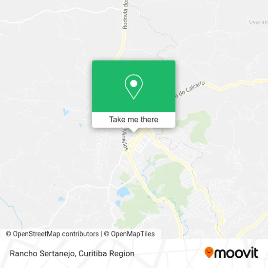
See Rancho Sertanejo, Almirante Tamandaré, on the map
Public Transit to Rancho Sertanejo in Almirante Tamandaré
Wondering how to get to Rancho Sertanejo in Almirante Tamandaré? Moovit helps you find the best way to get to Rancho Sertanejo with step-by-step directions from the nearest public transit station.
Moovit provides free maps and live directions to help you navigate through your city. View schedules, routes, timetables, and find out how long does it take to get to Rancho Sertanejo in real time.
Looking for the nearest stop or station to Rancho Sertanejo? Check out this list of stops closest to your destination: R. Rachel Cândido de Siqueira; R. Rachel Cândido de Siqueira; R. Bertolina Kendrick de Oliveira; Rodovia Dos Minérios (Pr 092) - Jocum; Terminal Metropolitano Almirante Tamandaré; R. Domingos Scucato.
Bus: A07 TAMANDARÉ / PRAÇA 19 (LAMENHA), A18 TAMANDARÉ / CABRAL, K71 ITAPERUÇU / PRAÇA 19, L11 RIO BRANCO / TAMANDARÉ, L71 RIO BRANCO / PRAÇA 19, A21 JARDIM PARAÍSO / TAMANDARÉ, A23 SAN FRANCISCO / JARDIM PARAÍSO, K01 ITAPERUÇU / GUADALUPE (TAMANDARÉ / MINÉRIOS), A06 TAMANDARÉ / GUADALUPE (MINÉRIOS), A22 TANGUÁ / TAMANDARÉ, 1560-500, A04 TAMANDARÉ / CABRAL, A11 SAN FRANCISCO, K11 ITAPERUÇU / TAMANDARÉ, A89 CACHOEIRA / CURITIBA (TAMANDARÉ / CABRAL), A05 MAD. CURITIBA / TAMANDARÉ (VIA GRAZIELA).
Want to see if there’s another route that gets you there at an earlier time? Moovit helps you find alternative routes or times. Get directions from and directions to Rancho Sertanejo easily from the Moovit App or Website.
We make riding to Rancho Sertanejo easy, which is why over 1.5 million users, including users in Almirante Tamandaré, trust Moovit as the best app for public transit. You don’t need to download an individual bus app or train app, Moovit is your all-in-one transit app that helps you find the best bus time or train time available.
For information on prices of bus, costs and ride fares to Rancho Sertanejo, please check the Moovit app.
Use the app to navigate to popular places including to the airport, hospital, stadium, grocery store, mall, coffee shop, school, college, and university.
Rancho Sertanejo Address: Rua João Antônio Zem, 355 Centro Almirante Tamandaré-PR 83501-060 street in Almirante Tamandaré
- Everli do Rocio de Si,
- Centro De Convenções Edson Dalke,
- Copel Almirante Tamandaré,
- Partido Social Democrata Cristao - Psdc Diretorio Almirante Tamandaré / PR,
- Oral Unic Almirante Tamandaré,
- Supermercado Augustus,
- Almir Jose Teixeira de Faria Comunicação Visual,
- J.S Casa de Carnes e Assados,
- Eleve Agro,
- Emporio Divinatu,
- Burger Inc Ltda,
- Banco Santander (Brasil) S.A.,
- Guiguitata Moda Infantil e Juvenil,
- Gessica,
- Castelo Encantado Eventos,
- Pet Shop Manianimal,
- Garagem Central - Centro de Estetica au,
- Potencial Serviços e Telefonia,
- The Best Açaí,
- La Linda
Places Near Rancho Sertanejo (Almirante Tamandaré)
- Hospital Angelina Caron, Campina Grande Do Sul,
- Arena Da Baixada - Curitiba,
- Hospital Da Cruz Vermelha, Batel,
- Rua Martim Afonso 558, Mercês,
- Hospital de Clínicas (HC - UFPR), Centro,
- Campo Largo, Campo,
- Hospital Nossa Senhora Das Graças, Mercês,
- Jockey Plaza Shopping Center, Tarumã,
- Hospital Madalena Sofia, Bairro Alto,
- Jardim Botânico de Curitiba PR, Centro,
- Park Shopping Barigüi, Mossunguê,
- Rua General Mário Tourinho, Campina Do Siqueira,
- Parque Barigui, Mercês,
- Pontifícia Universidade Católica do Paraná (PUCPR), Prado Velho,
- Hhhhh, Fazendinha,
- Hospital Universitário Evangélico de Curitiba, Bigorrilho,
- Shopping Estação, Rebouças,
- Shopping Palladium, Portão,
- Hospital Erasto Gaertner, Jardim Das Américas,
- Hospital do Rocio, Campo
How to get to popular places in Curitiba Region with public transit
Get around Almirante Tamandaré by public transit!
Traveling around Almirante Tamandaré has never been so easy. See step by step directions as you travel to any attraction, street or major public transit station. View bus and train schedules, arrival times, service alerts and detailed routes on a map, so you know exactly how to get to anywhere in Almirante Tamandaré.
When traveling to any destination around Almirante Tamandaré use Moovit's Live Directions with Get Off Notifications to know exactly where and how far to walk, how long to wait for your line, and how many stops are left. Moovit will alert you when it's time to get off — no need to constantly re-check whether yours is the next stop.
Wondering how to use public transit in Almirante Tamandaré or how to pay for public transit in Almirante Tamandaré? Moovit public transit app can help you navigate your way with public transit easily, and at minimum cost. It includes public transit fees, ticket prices, and costs. Looking for a map of Almirante Tamandaré public transit lines? Moovit public transit app shows all public transit maps in Almirante Tamandaré with all Bus and Cable Car routes and stops on an interactive map.
Curitiba Region has 2 transit type(s), including: Bus and Cable Car, operated by several transit agencies, including Sistema Integrado de Mobilidade (URBS), Sistema Integrado de Mobilidade (AMEP), URBS (Cartões bancários e Dinheiro), URBS (Cartões bancários / Cartão URBS), AMEP (Cartões bancários / Cartão MetroCard), AMEP (Cartões bancários / Cartão MetroCard / Dinheiro), Viação Colombo (Dinheiro), TRIAR (Cartão TRIAR / Dinheiro), Empresa Curitiba Cerro Azul (Dinheiro), Expresso Nossa Senhora da Penha (Dinheiro), Empresa Campo Alto Tijucas (Dinheiro), Auto Viação São José (Cartão VEM / Dinheiro), BRT S/A (Cartão VEM / Dinheiro), TransPiedade (Cartão Cidadão / Dinheiro) and Oceânica Sul (Cartão Transporte / Dinheiro)
Public transit lines with stations closest to Rancho Sertanejo in Almirante Tamandaré
Bus lines with stations closest to Rancho Sertanejo in Almirante Tamandaré
R. Rachel Cândido de Siqueira, 350
 K01 ITAPERUÇU / GUADALUPE (TAMANDARÉ / MINÉRIOS)ITAPERUÇU / GUADALUPE (TAMANDARÉ / MINÉRIOS)
- A06 TAMANDARÉ / GUADALUPE (MINÉRIOS)TAMANDARÉ / GUADALUPE (MINÉRIOS)
- L11 RIO BRANCO / TAMANDARÉRIO BRANCO / TAMANDARÉ
- A22 TANGUÁ / TAMANDARÉTANGUÁ / TAMANDARÉ
- A07 TAMANDARÉ / PRAÇA 19 (LAMENHA)TAMANDARÉ / PRAÇA 19 (LAMENHA)