See Raritan High School, Hazlet, Nj, on the map
Directions to Raritan High School (Hazlet, Nj) with public transportation
The following transit lines have routes that pass near Raritan High School
 Bus:
Bus: - Train:
How to get to Raritan High School by bus?
Click on the bus route to see step by step directions with maps, line arrival times and updated time schedules.
How to get to Raritan High School by train?
Click on the train route to see step by step directions with maps, line arrival times and updated time schedules.
Train stations near Raritan High School in Hazlet, Nj
- Hazlet,64 min walk,
Bus stations near Raritan High School in Hazlet, Nj
- Tindall Rd 410' N Of Melrose Ter.,85 min walk,
Bus lines to Raritan High School in Hazlet, Nj
- 834,Red Bank,
What are the closest stations to Raritan High School?
The closest stations to Raritan High School are:
- Hazlet is 5309 yards away, 64 min walk.
- Tindall Rd 410' N Of Melrose Ter. is 7238 yards away, 85 min walk.
Which bus line stops near Raritan High School?
817
Which train line stops near Raritan High School?
NJCL
See Raritan High School, Hazlet, Nj, on the map
Public Transit to Raritan High School in Hazlet, Nj
Wondering how to get to Raritan High School in Hazlet, Nj, United States? Moovit helps you find the best way to get to Raritan High School with step-by-step directions from the nearest public transit station.
Moovit provides free maps and live directions to help you navigate through your city. View schedules, routes, timetables, and find out how long does it take to get to Raritan High School in real time.
Looking for the nearest stop or station to Raritan High School? Check out this list of stops closest to your destination: Hazlet; Tindall Rd 410' N Of Melrose Ter..
Bus:Train:
Want to see if there’s another route that gets you there at an earlier time? Moovit helps you find alternative routes or times. Get directions from and directions to Raritan High School easily from the Moovit App or Website.
We make riding to Raritan High School easy, which is why over 1.5 million users, including users in Hazlet, Nj, trust Moovit as the best app for public transit. You don’t need to download an individual bus app or train app, Moovit is your all-in-one transit app that helps you find the best bus time or train time available.
For information on prices of bus, subway and train, costs and ride fares to Raritan High School, please check the Moovit app.
Use the app to navigate to popular places including to the airport, hospital, stadium, grocery store, mall, coffee shop, school, college, and university.
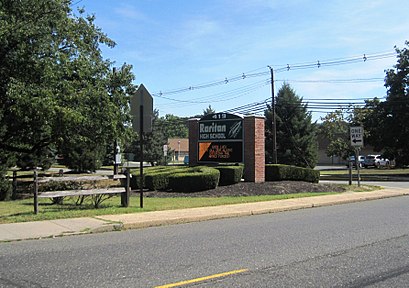
Raritan High School Address: Golden Lane street in Hazlet, Nj
Attractions near Raritan High School
Auto Repair,Cosmetics,Hovnanian K Shoal Harbor,Hazlet Township Public Schools,Raritan Rocket,P-Dog Records,Middle Road Village,Short Shots - Photography by Rosanne P,CR-516,Monmouth Co Voc School-Hazlet,78 Buckingham Ct,North Centerville Chapel,I S S I Inc,Carolyn Garrett Slp,419 Middle Road,3 Shore Haven Rd,5 Golden Ln,Starr Pools,Hazlet Superintendent Of Schls,Middle Rd VillageHow to get to popular attractions in Hazlet, Nj with public transit
The Plaza Hotel, Manhattan,Stout, Manhattan,The Meatball Shop,Wingate by Wyndham Manhattan Midtown, Manhattan,Atlantic City, NJ, Atlantic City, Nj,Planet Fitness, Queens,Hill Country Chicken, Manhattan,24 Hour Fitness, Manhattan,Beauty & Essex, Manhattan,New Jersey Turnpike - Newark, Newark, Nj,Time Life, Manhattan,Smith Haven Mall, Lake Grove, Ny,Peter Luger Steak House,Nan Xiang Xiao Long Bao, Queens,5 Napkin Burger, Manhattan,Fette Sau,The Tippler, Manhattan,Nathan's Famous,Mission Dolores,The Kunjip, ManhattanGet around Hazlet, Nj by public transit!
Traveling around Hazlet, Nj has never been so easy. See step by step directions as you travel to any attraction, street or major public transit station. View bus and train schedules, arrival times, service alerts and detailed routes on a map, so you know exactly how to get to anywhere in Hazlet, Nj.
When traveling to any destination around Hazlet, Nj use Moovit's Live Directions with Get Off Notifications to know exactly where and how far to walk, how long to wait for your line, and how many stops are left. Moovit will alert you when it's time to get off — no need to constantly re-check whether yours is the next stop.
Wondering how to use public transit in Hazlet, Nj or how to pay for public transit in Hazlet, Nj? Moovit public transit app can help you navigate your way with public transit easily, and at minimum cost. It includes public transit fees, ticket prices, and costs. Looking for a map of Hazlet, Nj public transit lines? Moovit public transit app shows all public transit maps in Hazlet, Nj with all bus, subway or train routes and stops on an interactive map.
Hazlet, Nj has 3 transit type(s), including: bus, subway or train, operated by several transit agencies, including MTA Subway, Metro-North Railroad, LIRR, PATH, Shore Line East, MTA Bus Company, MTA New York City Transit - Express routes, MTA Bus, NJ Transit, NYC Ferry, NICE bus, Bee-Line Bus, NJ Transit Rail, NJ Transit Rail and Norwalk Transit District