How to get to Rastro de Vallecas by bus?
Click on the bus route to see step by step directions with maps, line arrival times and updated time schedules.
From Exe Hotel Norte Madrid, Madrid
80 minFrom Plaza Nueva Leganés, Área Metropolitana De Madrid Y Corredor Del Henares
83 minFrom El Cañaveral, Área Metropolitana De Madrid Y Corredor Del Henares
66 minFrom Islazul (Centro Comercial Islazul), Madrid
46 minFrom Quiron Prevencion, Madrid
54 minFrom Mirasierra, Madrid
87 minFrom Avenida de Manoteras 46 bis, Madrid
82 minFrom Fundación Instituto San José, Área Metropolitana De Madrid Y Corredor Del Henares
84 minFrom Hospital HM Sanchinarro, Madrid
72 minFrom Calle Quintana 11-13, Madrid
42 min
How to get to Rastro de Vallecas by train?
Click on the train route to see step by step directions with maps, line arrival times and updated time schedules.
From Exe Hotel Norte Madrid, Madrid
69 minFrom Plaza Nueva Leganés, Área Metropolitana De Madrid Y Corredor Del Henares
52 minFrom Quiron Prevencion, Madrid
58 minFrom Mirasierra, Madrid
64 minFrom Avenida de Manoteras 46 bis, Madrid
57 minFrom Hospital HM Sanchinarro, Madrid
63 minFrom Calle Quintana 11-13, Madrid
44 min
How to get to Rastro de Vallecas by metro?
Click on the metro route to see step by step directions with maps, line arrival times and updated time schedules.
From Exe Hotel Norte Madrid, Madrid
65 minFrom Plaza Nueva Leganés, Área Metropolitana De Madrid Y Corredor Del Henares
79 minFrom Islazul (Centro Comercial Islazul), Madrid
58 minFrom Quiron Prevencion, Madrid
36 minFrom Mirasierra, Madrid
51 minFrom Avenida de Manoteras 46 bis, Madrid
56 minFrom Fundación Instituto San José, Área Metropolitana De Madrid Y Corredor Del Henares
57 minFrom Hospital HM Sanchinarro, Madrid
62 minFrom Calle Quintana 11-13, Madrid
39 min
Bus stops near Rastro de Vallecas in Madrid
Metro stations near Rastro de Vallecas in Madrid
Bus lines to Rastro de Vallecas in Madrid
- 8, Valdebernardo,VIEW
- 56, Numancia,VIEW
- 113, Ciudad Lineal,VIEW
- 141, Buenos Aires,VIEW
- 58, Santa Eugenia,VIEW
- 111, Entrevias,VIEW
- 37, Puente Vallecas,VIEW
- 10, Cibeles,VIEW
- 24, Estacion El Pozo,VIEW
- 54, Congosto,VIEW
- 57, Alto Del Arenal,VIEW
- 136, Madrid Sur,VIEW
- 310, Pacifico,VIEW
- N10, Palomeras,VIEW
- N25, Alonso Martinez,VIEW
What are the closest stations to Rastro de Vallecas?
The closest stations to Rastro de Vallecas are:
- Peña Prieta is 107 meters away, 2 min walk.
- Puente De Vallecas is 382 meters away, 6 min walk.
- Pacífico is 1015 meters away, 14 min walk.
Which bus lines stop near Rastro de Vallecas?
These bus lines stop near Rastro de Vallecas: 10, 113, 37, 56, 8.
Which train lines stop near Rastro de Vallecas?
These train lines stop near Rastro de Vallecas: C10, C5.
Which metro line stops near Rastro de Vallecas?
M-1 (Valdecarros)
What’s the nearest metro station to Rastro de Vallecas in Madrid?
The nearest metro station to Rastro de Vallecas in Madrid is Puente De Vallecas. It’s a 6 min walk away.
What’s the nearest bus station to Rastro de Vallecas in Madrid?
The nearest bus station to Rastro de Vallecas in Madrid is Peña Prieta. It’s a 2 min walk away.
What time is the first metro to Rastro de Vallecas in Madrid?
The M-1 is the first metro that goes to Rastro de Vallecas in Madrid. It stops nearby at 6:05 AM.
What time is the last metro to Rastro de Vallecas in Madrid?
The M-1 is the last metro that goes to Rastro de Vallecas in Madrid. It stops nearby at 2:08 AM.
What time is the first bus to Rastro de Vallecas in Madrid?
The 37 is the first bus that goes to Rastro de Vallecas in Madrid. It stops nearby at 7:00 AM.
What time is the last bus to Rastro de Vallecas in Madrid?
The N25 is the last bus that goes to Rastro de Vallecas in Madrid. It stops nearby at 3:22 AM.
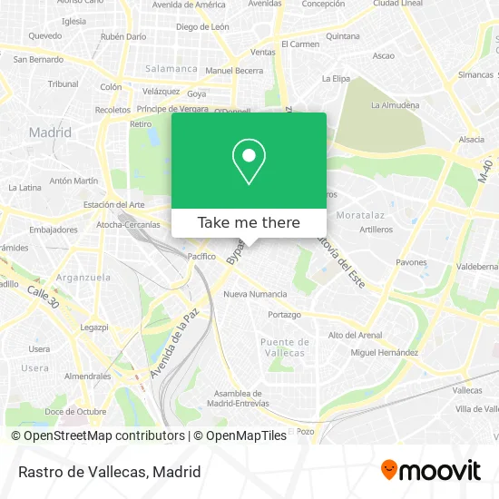
See Rastro de Vallecas, Madrid, on the map
Public Transit to Rastro de Vallecas in Madrid
Wondering how to get to Rastro de Vallecas in Madrid? Moovit helps you find the best way to get to Rastro de Vallecas with step-by-step directions from the nearest public transit station.
Moovit provides free maps and live directions to help you navigate through your city. View schedules, routes, timetables, and find out how long does it take to get to Rastro de Vallecas in real time.
Looking for the nearest stop or station to Rastro de Vallecas? Check out this list of stops closest to your destination: Peña Prieta; Puente De Vallecas; Pacífico.
Bus: 10, 113, 37, 56, 8, 141, 58, 111, 24, 54, 57, 136.Train: C10, C5.Metro: M-1, M-6.
Want to see if there’s another route that gets you there at an earlier time? Moovit helps you find alternative routes or times. Get directions from and directions to Rastro de Vallecas easily from the Moovit App or Website.
We make riding to Rastro de Vallecas easy, which is why over 1.5 million users, including users in Madrid, trust Moovit as the best app for public transit. You don’t need to download an individual bus app or train app, Moovit is your all-in-one transit app that helps you find the best bus time or train time available.
For information on prices of bus, metro and train, costs and ride fares to Rastro de Vallecas, please check the Moovit app.
Use the app to navigate to popular places including to the airport, hospital, stadium, grocery store, mall, coffee shop, school, college, and university.
Rastro de Vallecas Address: Avenida Peña Prieta, 29 28038 Numancia Madrid street in Madrid
- Avenida de Peña Prieta / Calle de los Hermanos Carpi,
- Jamal Erradi Ahmed,
- Rastro Betel Vallecas.,
- David Parra Joyero,
- Avenida de Peña Prieta & Camino de Valderribas,
- Calle Mendívil 1,
- Calle Mendívil 6 - 8,
- Centro de Costuras Cisne,
- Restaurante El Tondero,
- Av de Peña Prieta 21,
- El Mercadito de Peña Prieta Frutas y Verduras,
- Mercadito Pena Prieta,
- Calle de la Sierra de Meira 3,
- Caritas Diocesana de Madrid,
- Avenida de Peña Prieta & Calle Alfonso XIII,
- Nuga Best Vallecas,
- Camino de Valderribas 2,
- Ruiz de León Iluminación y Electricidad,
- Chatarrería Recuperaciones Galán,
- Calle Francisco Iglesias 5
Places Near Rastro de Vallecas (Madrid)
- Plaza Mayor, Madrid,
- Tres Aguas, Alcorcón,
- Centro Comercial La Vaguada, Área Metropolitana De Madrid Y Corredor Del Henares,
- Palacio De Vistalegre, Área Metropolitana De Madrid Y Corredor Del Henares,
- Rastro De Madrid, Área Metropolitana De Madrid Y Corredor Del Henares,
- Estadio Wanda Metropolitano, Área Metropolitana De Madrid Y Corredor Del Henares,
- Hospital Universitario La Paz, Madrid,
- Mendez Alvaro, Madrid,
- Estacion de Chamartin, Madrid,
- Plenilunio, Área Metropolitana De Madrid Y Corredor Del Henares,
- Centro Comercial La Gavia, Área Metropolitana De Madrid Y Corredor Del Henares,
- Nassica, Área Metropolitana De Madrid Y Corredor Del Henares,
- Calle de López de Hoyos 169, Madrid,
- Mercadillo de Majadahonda, Majadahonda,
- Sala La Riviera, Madrid,
- Hospital Universitario Ramón y Cajal, Madrid,
- Hospital Clínico Universitario San Carlos, Madrid,
- Wizink Center, Madrid,
- Centro Comercial Islazul, Área Metropolitana De Madrid Y Corredor Del Henares,
- Centro Comercial Oasiz Madrid, Área Metropolitana De Madrid Y Corredor Del Henares
How to get to popular places in Madrid with public transit
Get around Madrid by public transit!
Traveling around Madrid has never been so easy. See step by step directions as you travel to any attraction, street or major public transit station. View bus and train schedules, arrival times, service alerts and detailed routes on a map, so you know exactly how to get to anywhere in Madrid.
When traveling to any destination around Madrid use Moovit's Live Directions with Get Off Notifications to know exactly where and how far to walk, how long to wait for your line, and how many stops are left. Moovit will alert you when it's time to get off — no need to constantly re-check whether yours is the next stop.
Wondering how to use public transit in Madrid or how to pay for public transit in Madrid? Moovit public transit app can help you navigate your way with public transit easily, and at minimum cost. It includes public transit fees, ticket prices, and costs. Looking for a map of Madrid public transit lines? Moovit public transit app shows all public transit maps in Madrid with all Bus, Train, Metro and Light Rail routes and stops on an interactive map.
Madrid has 4 transit type(s), including: Bus, Train, Metro and Light Rail, operated by several transit agencies, including Metro de Madrid, Metro Ligero, Tranvía de Parla, Renfe Cercanías - Servicios de Autobús especiales, Renfe Cercanias, Renfe Cercanías, EMT, Interurbanos, Urbanos de Alcalá de Henares, Urbanos de Alcobendas, Urbanos de Alcorcón, Urbanos de Algete, Urbanos de Aranjuez, Urbanos de Arganda del Rey and Urbanos de Arroyomolinos