See Regions Hospital, St. Paul, on the map
Directions to Regions Hospital (St. Paul) with public transportation
The following transit lines have routes that pass near Regions Hospital
 Bus:
Bus: - Train:
How to get to Regions Hospital by bus?
Click on the bus route to see step by step directions with maps, line arrival times and updated time schedules.
Bus stations near Regions Hospital in St. Paul
- Westminster St & Cayuga St W,4 min walk,
- Minnehaha Ave & Burr St,19 min walk,
Light Rail stations near Regions Hospital in St. Paul
- 10th Street,13 min walk,
Train stations near Regions Hospital in St. Paul
- St. Paul-Minneapolis,40 min walk,
Bus lines to Regions Hospital in St. Paul
- 71,Concord / Inver Hills / Via Hardman,
- 64,Payne Av / Mplwd Mall / Via N St Paul,
What are the closest stations to Regions Hospital?
The closest stations to Regions Hospital are:
- Westminster St & Cayuga St W is 244 yards away, 4 min walk.
- 10th Street is 1026 yards away, 13 min walk.
- Minnehaha Ave & Burr St is 1602 yards away, 19 min walk.
- St. Paul-Minneapolis is 3421 yards away, 40 min walk.
Which bus lines stop near Regions Hospital?
These bus lines stop near Regions Hospital: 61, 64, 71.
What’s the nearest light rail station to Regions Hospital in St. Paul?
The nearest light rail station to Regions Hospital in St. Paul is 10th Street. It’s a 13 min walk away.
What’s the nearest bus stop to Regions Hospital in St. Paul?
The nearest bus stop to Regions Hospital in St. Paul is Westminster St & Cayuga St W. It’s a 4 min walk away.
What time is the first light rail to Regions Hospital in St. Paul?
The METRO GREEN LINE is the first light rail that goes to Regions Hospital in St. Paul. It stops nearby at 4:27 AM.
What time is the last light rail to Regions Hospital in St. Paul?
The METRO GREEN LINE is the last light rail that goes to Regions Hospital in St. Paul. It stops nearby at 12:12 AM.
What time is the first train to Regions Hospital in St. Paul?
The BOREALIS is the first train that goes to Regions Hospital in St. Paul. It stops nearby at 11:50 AM.
What time is the last train to Regions Hospital in St. Paul?
The EMPIRE BUILDER is the last train that goes to Regions Hospital in St. Paul. It stops nearby at 8:50 AM.
What time is the first bus to Regions Hospital in St. Paul?
The 64 is the first bus that goes to Regions Hospital in St. Paul. It stops nearby at 3:47 AM.
What time is the last bus to Regions Hospital in St. Paul?
The 64 is the last bus that goes to Regions Hospital in St. Paul. It stops nearby at 1:27 AM.
See Regions Hospital, St. Paul, on the map
Public Transit to Regions Hospital in St. Paul
Wondering how to get to Regions Hospital in St. Paul, United States? Moovit helps you find the best way to get to Regions Hospital with step-by-step directions from the nearest public transit station.
Moovit provides free maps and live directions to help you navigate through your city. View schedules, routes, timetables, and find out how long does it take to get to Regions Hospital in real time.
Looking for the nearest stop or station to Regions Hospital? Check out this list of stops closest to your destination: Westminster St & Cayuga St W; 10th Street; Minnehaha Ave & Burr St; St. Paul-Minneapolis.
Bus:Train:
Want to see if there’s another route that gets you there at an earlier time? Moovit helps you find alternative routes or times. Get directions from and directions to Regions Hospital easily from the Moovit App or Website.
We make riding to Regions Hospital easy, which is why over 1.5 million users, including users in St. Paul, trust Moovit as the best app for public transit. You don’t need to download an individual bus app or train app, Moovit is your all-in-one transit app that helps you find the best bus time or train time available.
For information on prices of bus, costs and ride fares to Regions Hospital, please check the Moovit app.
Use the app to navigate to popular places including to the airport, hospital, stadium, grocery store, mall, coffee shop, school, college, and university.
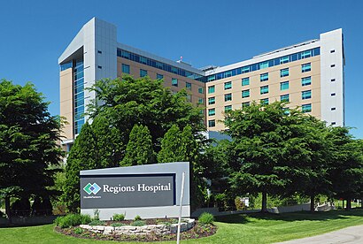
Regions Hospital Address: 401 Phalen Blvd street in St. Paul
Attractions near Regions Hospital
401 Phalen Blvd,Charlene E. McEvoy, MD, Pulmonology & Sleep Medicine - Find A Top Doc,Health Partners Specialty Center,Lee Schuh MD,Happy Homes Back 2 School,Blaze Credit Union - Westminster Administrative Offices,435 Phalen Boulevard,Beacon of Hope: Saint Paul, MN,Entrance I-35E S,Alzheimer's Treatment & Research Center,Pile Drivers Local 1847,L'Orient St & Cayuga St,Anytime Solutions,Evolution Diet Pet Food Corp.,Michel Sales Agency,Lafayette Plaza Apartments,Lafayette Rd & Lafayette Plaza,Carpet Linoleum & Resilient Tile Layers Local 596,Art in Arms,Bob Woller Blacktopping & SoddingHow to get to popular attractions in St. Paul with public transit
Target Photo Studio Royalston, Minneapolis,Coffman Memorial Union Station, Minneapolis,North Minneapolis, Minneapolis,Boston Scientific Building 10, Arden Hills,I-35W and 46th St, Minneapolis,SuperAmerica, Minneapolis,Science Museum Of Minnesota, St. Paul,Shakopee, MN, Shakopee,Ameriprise Financial Center, Minneapolis,Rosedale Center, Roseville,Fairview Community Center, Roseville,North Hennepin Community College, Brooklyn Park,Cottage Grove Park & Ride, Cottage Grove,Hyatt Place Minneapolis / Downtown, Minneapolis,Fairview Clinics – Bloomington, Bloomington,Minnehaha Falls, Minneapolis,Park Nicollet Stilts Building, St. Louis Park,US 169 and Valley View Rd, Edina,I-35W and 98th St, Bloomington,Team Member Entrance Mystic Lake, Prior LakeGet around St. Paul by public transit!
Traveling around St. Paul has never been so easy. See step by step directions as you travel to any attraction, street or major public transit station. View bus and train schedules, arrival times, service alerts and detailed routes on a map, so you know exactly how to get to anywhere in St. Paul.
When traveling to any destination around St. Paul use Moovit's Live Directions with Get Off Notifications to know exactly where and how far to walk, how long to wait for your line, and how many stops are left. Moovit will alert you when it's time to get off — no need to constantly re-check whether yours is the next stop.
Wondering how to use public transit in St. Paul or how to pay for public transit in St. Paul? Moovit public transit app can help you navigate your way with public transit easily, and at minimum cost. It includes public transit fees, ticket prices, and costs. Looking for a map of St. Paul public transit lines? Moovit public transit app shows all public transit maps in St. Paul with all bus routes and stops on an interactive map.
St. Paul has 1 transit type(s), including: bus, operated by several transit agencies, including Metro Transit , Metro Transit, Metro Transit, MVTA, Plymouth Metrolink, SouthWest Transit, Maple Grove, University of Minnesota, Airport (MAC), Amtrak, Mankato Transit System, SMART, Megabus, FlixBus-us and Greyhound-us