Directions to Remedios Circle station (Manila) with public transit
The following transit lines have routes that pass near Remedios Circle
How to get to Remedios Circle station by bus?
Click on the bus route to see step by step directions with maps, line arrival times and updated time schedules.
How to get to Remedios Circle station by train?
Click on the train route to see step by step directions with maps, line arrival times and updated time schedules.
Bus stops near Remedios Circle in Manila
- A.Mabini, Manila, 2 min walk,
- San Andres Market, San Andres / Leveriza Intersection, Manila, 2 min walk,
- Marcelo H. Del Pilar / Sinagoga Intersection, Manila, 3 min walk,
- Gen M Malvar / M Adriatico Intersection, Manila, 4 min walk,
- Pan Pacific Hotel, 4 min walk,
- Remedios / Antonio Vasquez Intersection, Manila, 6 min walk,
Train stations near Remedios Circle in Manila
- Pedro Gil Lrt, 13 min walk,
- San Andres Pnr, 25 min walk,
Bus lines to Remedios Circle station in Manila
- JEEP, BACLARAN - MCU via MABINI,
- JEEP, BACLARAN - QUIAPO,
- JEEP, Blumentrit Vito Cruz via Quiapo Mabini,
- JEEP, Blumentrit Vito Cruz via L Guinto Sta C,
- JEEP, CUBAO - V CRUZ,
- JEEP, Escolta-Libertad via Mabini,
- JEEP, Kamuning - Vito Cruz via E. Rodriguez, Mabini,
- JEEP, MCU-PASAY RTDA, MABINI,
- JEEP, Monumento - Vito C ruz via Rizal Ave., Mabini,
- JEEP, BLUMENTRITT - PASAY RTDA via MABINI,
- JEEP, Libertad MCU via Mabini,
- JEEP, FRISCO-VITO CRUZvia MABINI,
- JEEP, Blumentritt - Vito Cruz via Quiapo, Mabini,
- JEEP, Blumentritt - Libertad via Sta. Cruz, Mabini,
- JEEP, Baclaran - Q.I.via Mabini,
- JEEP, Baclaran - P. Campa via Mabini,
- JEEP, LIBERTAD-PIER SOUTH,
- JEEP, Libertad QI via Mabini,
- JEEP, Baclaran - Divisoria via Mabini,
- JEEP, Blumentrit Mabini via Quiapo,
What are the closest stations to Remedios Circle?
The closest stations to Remedios Circle are:
- A.Mabini, Manila is 104 meters away, 2 min walk.
- San Andres Market, San Andres / Leveriza Intersection, Manila is 128 meters away, 2 min walk.
- Marcelo H. Del Pilar / Sinagoga Intersection, Manila is 195 meters away, 3 min walk.
- Gen M Malvar / M Adriatico Intersection, Manila is 256 meters away, 4 min walk.
- Pan Pacific Hotel is 273 meters away, 4 min walk.
- Remedios / Antonio Vasquez Intersection, Manila is 398 meters away, 6 min walk.
- Pedro Gil Lrt is 979 meters away, 13 min walk.
- San Andres Pnr is 1927 meters away, 25 min walk.
Which bus line stops near Remedios Circle?
JEEP (N. S. Amoranto Sr. Avenue / Biak An Bato Intersection, Quezon City→Senator Gil Puyat Ave / F.B. Harrison Intersection East Bound, Lungsod Ng Pasay)
Which train line stops near Remedios Circle?
LRT 1 (Baclaran)
What’s the nearest train station to Remedios Circle in Manila?
The nearest train station to Remedios Circle in Manila is Pedro Gil Lrt. It’s a 13 min walk away.
What’s the nearest bus station to Remedios Circle in Manila?
The nearest bus stations to Remedios Circle in Manila are A.Mabini, Manila and San Andres Market, San Andres / Leveriza Intersection, Manila. The closest one is a 2 min walk away.
What time is the first train to Remedios Circle in Manila?
The LRT 1 is the first train that goes to Remedios Circle in Manila. It stops nearby at 5:09 AM.
What time is the last train to Remedios Circle in Manila?
The PNR MC is the last train that goes to Remedios Circle in Manila. It stops nearby at 1:16 AM.
What time is the first bus to Remedios Circle in Manila?
The JEEP is the first bus that goes to Remedios Circle in Manila. It stops nearby at 6:00 AM.
What time is the last bus to Remedios Circle in Manila?
The BUS is the last bus that goes to Remedios Circle in Manila. It stops nearby at 1:39 AM.
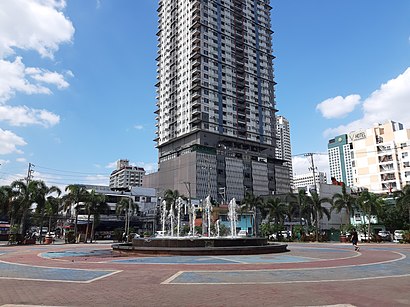
See Remedios Circle, Manila, on the map
Public Transit to Remedios Circle in Manila
How to get to Remedios Circle in Manila, Philippines?
It’s easy with Moovit. Type in your street address and Moovit’s route finder will locate the fastest way to get you there! Not sure where to get off on the street? Download the Moovit App to find live directions (including where to get off on Remedios Circle), see timetables and get the estimated arrival times for your favorite bus or train lines.
Looking for the nearest stop or station to Remedios Circle? Check out this list of closest stops available to your destination: A.Mabini; San Andres Market; Marcelo H. Del Pilar / Sinagoga Intersection; Gen M Malvar / M Adriatico Intersection; Pan Pacific Hotel; Remedios / Antonio Vasquez Intersection; Pedro Gil Lrt; San Andres Pnr.
Bus: JEEP, BUS.Train: LRT 1, PNR MC.
Download the Moovit App to see the current schedule and routes available for Manila. No need to install a special bus app to check the bus time or a train app to get train time. Moovit is the only all-in-one transit app that helps you get where you need to go.
We make riding on public transit to Remedios Circle easy, which is why over 1.5 million users, including users in Manila trust Moovit as the best app for public transit.
Use the app to navigate to popular places including to the airport, hospital, stadium, grocery store, mall, coffee shop, school, college, and university.
Location: Manila
Streets near Remedios Circle, Manila
Get around Manila by public transit!
Traveling around Manila has never been so easy. See step by step directions as you travel to any attraction, street or major public transit station. View bus and train schedules, arrival times, service alerts and detailed routes on a map, so you know exactly how to get to anywhere in Manila.
When traveling to any destination around Manila use Moovit's Live Directions with Get Off Notifications to know exactly where and how far to walk, how long to wait for your line, and how many stops are left. Moovit will alert you when it's time to get off — no need to constantly re-check whether yours is the next stop.
Wondering how to use public transit in Manila or how to pay for public transit in Manila? Moovit public transit app can help you navigate your way with public transit easily, and at minimum cost. It includes public transit fees, ticket prices, and costs. Looking for a map of Manila public transit lines? Moovit public transit app shows all public transit maps in Manila with all Bus and Train routes and stops on an interactive map.
Manila has 2 transit type(s), including: Bus and Train, operated by several transit agencies, including LRTA, LTFRB, MRTC, PNR, P2P, UV Express and BGC Bus