Directions to Resharp (Winthrop Town) with public transportation
The following transit lines have routes that pass near Resharp
 Bus: 120, 450, 712, 713.
- Subway: BLUE LINE.
- Ferry: WINTHROP FERRY, WINTHROP/QUINCY FERRY.
How to get to Resharp by bus?
Click on the bus route to see step by step directions with maps, line arrival times and updated time schedules.
From Lynn, MA, Lynn
69 minFrom Landmark Center, Boston
117 minFrom Hyatt Place Medford, Medford
109 minFrom Isabella Stewart Gardner Museum, Boston
101 minFrom One Post Office Square, Boston
42 minFrom 245 Summer Street, Boston
49 minFrom Saltie Girl, Boston
116 minFrom Kowloon Restaurant, Saugus
126 minFrom The W Hotel Boston, Boston
53 minFrom La Famiglia Giorgio's, Boston
40 min
How to get to Resharp by subway?
Click on the subway route to see step by step directions with maps, line arrival times and updated time schedules.
From Landmark Center, Boston
55 minFrom Hyatt Place Medford, Medford
85 minFrom Isabella Stewart Gardner Museum, Boston
58 minFrom One Post Office Square, Boston
35 minFrom 245 Summer Street, Boston
42 minFrom Saltie Girl, Boston
56 minFrom The W Hotel Boston, Boston
40 minFrom La Famiglia Giorgio's, Boston
38 min
Subway station near Resharp in Winthrop Town
- Beachmont, 1 min walk,VIEW
Bus stop near Resharp in Winthrop Town
- Main St @ Pleasant St, 2 min walk,VIEW
Ferry station near Resharp in Winthrop Town
- Winthrop Landing, 34 min walk,VIEW
What are the closest stations to Resharp?
The closest stations to Resharp are:
- Beachmont is 38 yards away, 1 min walk.
- Main St @ Pleasant St is 163 yards away, 2 min walk.
- Winthrop Landing is 2892 yards away, 34 min walk.
Which bus lines stop near Resharp?
These bus lines stop near Resharp: 120, 450, 712, 713.
Which subway line stops near Resharp?
BLUE LINE (Wonderland)
What’s the nearest subway station to Resharp in Winthrop Town?
The nearest subway station to Resharp in Winthrop Town is Beachmont. It’s a 1 min walk away.
What’s the nearest bus station to Resharp in Winthrop Town?
The nearest bus station to Resharp in Winthrop Town is Main St @ Pleasant St. It’s a 2 min walk away.
What time is the first subway to Resharp in Winthrop Town?
The BLUE LINE is the first subway that goes to Resharp in Winthrop Town. It stops nearby at 5:08 AM.
What time is the last subway to Resharp in Winthrop Town?
The BLUE LINE is the last subway that goes to Resharp in Winthrop Town. It stops nearby at 2:06 AM.
What time is the first bus to Resharp in Winthrop Town?
The 712 is the first bus that goes to Resharp in Winthrop Town. It stops nearby at 4:44 AM.
What time is the last bus to Resharp in Winthrop Town?
The 713 is the last bus that goes to Resharp in Winthrop Town. It stops nearby at 1:06 AM.
What time is the first ferry to Resharp in Winthrop Town?
The WINTHROP FERRY is the first ferry that goes to Resharp in Winthrop Town. It stops nearby at 6:40 AM.
What time is the last ferry to Resharp in Winthrop Town?
The WINTHROP FERRY is the last ferry that goes to Resharp in Winthrop Town. It stops nearby at 9:00 PM.
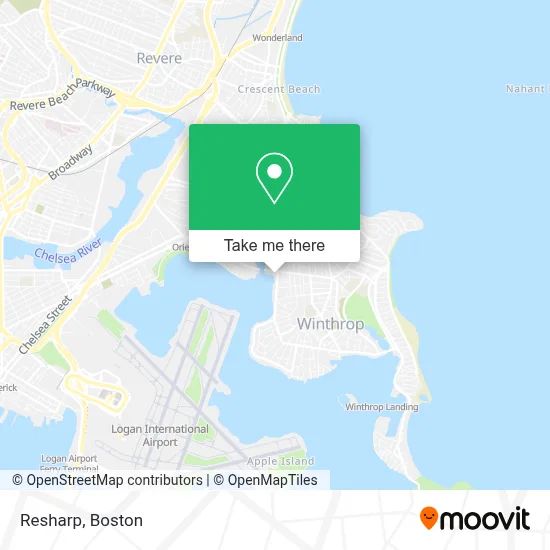
See Resharp, Winthrop Town, on the map
Public Transit to Resharp in Winthrop Town
Wondering how to get to Resharp in Winthrop Town? Moovit helps you find the best way to get to Resharp with step-by-step directions from the nearest public transit station.
Moovit provides free maps and live directions to help you navigate through your city. View schedules, routes, timetables, and find out how long does it take to get to Resharp in real time.
Looking for the nearest stop or station to Resharp? Check out this list of stops closest to your destination: Beachmont; Main St @ Pleasant St; Winthrop Landing.
Bus: 120, 450, 712, 713.Subway: BLUE LINE.Ferry: WINTHROP FERRY, WINTHROP/QUINCY FERRY.
Want to see if there’s another route that gets you there at an earlier time? Moovit helps you find alternative routes or times. Get directions from and directions to Resharp easily from the Moovit App or Website.
We make riding to Resharp easy, which is why over 1.7 million users, including users in Winthrop Town, trust Moovit as the best app for public transit. You don’t need to download an individual bus app or train app, Moovit is your all-in-one transit app that helps you find the best bus time or train time available.
For information on prices of bus and subway, costs and ride fares to Resharp, please check the Moovit app.
Use the app to navigate to popular places including to the airport, hospital, stadium, grocery store, mall, coffee shop, school, college, and university.
Resharp Address: 65 MAIN St street in Winthrop Town
- Belle Isle Lobster & Seafood,
- Vuolo's,
- Beach,
- Mbta Orient Heights Yard,
- Orient Heights Main Parking,
- Print Boston,
- Winthrop Marketplace (Winthrop Market Place),
- Redgate Capital Partners,
- Orient Heights, Massachusetts,
- Belle Isle Section Winthrop Cemetery,
- Logan Glass Company,
- Abiha Enterprises,
- E and S Variety,
- Belle Isle Inlet Buffer I,
- MBTA Suffolk Downs Station,
- Visionary Handyman,
- Belle Isle Marsh,
- Suffolk Downs Zone - Transfer To BOS Airport,
- Winthrop MA USA,
- Winthrop
Places Near Resharp (Winthrop Town)
- North End, Boston,
- Cheers, Boston,
- Boston Children's Hospital, Boston,
- Td Garden, Boston,
- Faneuil Hall, Boston,
- Boston Common, Boston,
- Mgm Music Hall, Boston,
- Boston Convention & Exhibition Center, Boston,
- Quincy Market, Boston,
- Leader Bank Pavilion (Leader Bank Pavillion), Boston,
- House Of Blues, Boston,
- Castle Island, Boston,
- Wilbur Theatre, Boston,
- Seaport District, Boston,
- Wang Theater, Boston,
- Massachusetts General Hospital, Boston,
- Prudential Center, Boston,
- Boston Medical Center, Boston,
- Museum Of Science, Boston,
- Isabella Stewart Gardner Museum, Boston
How to get to popular places in Boston with public transit
Get around Winthrop Town by public transit!
Traveling around Winthrop Town has never been so easy. See step by step directions as you travel to any attraction, street or major public transit station. View bus and train schedules, arrival times, service alerts and detailed routes on a map, so you know exactly how to get to anywhere in Winthrop Town.
When traveling to any destination around Winthrop Town use Moovit's Live Directions with Get Off Notifications to know exactly where and how far to walk, how long to wait for your line, and how many stops are left. Moovit will alert you when it's time to get off — no need to constantly re-check whether yours is the next stop.
Wondering how to use public transit in Winthrop Town or how to pay for public transit in Winthrop Town? Moovit public transit app can help you navigate your way with public transit easily, and at minimum cost. It includes public transit fees, ticket prices, and costs. Looking for a map of Winthrop Town public transit lines? Moovit public transit app shows all public transit maps in Winthrop Town with all Bus, Train, Subway and Ferry routes and stops on an interactive map.
Boston has 4 transit type(s), including: Bus, Train, Subway and Ferry, operated by several transit agencies, including MBTA, Southeastern Regional Transit Authority, MetroWest Regional Transit Authority, Rhode Island Public Transit Authority, WRTA, Lowell Regional Transit Authority, Merrimack Valley Transit, Montachusett Regional Transit Authority, Cape Cod Regional Transit Authority, Brockton Area Transit Authority, Martha's Vineyard Transit Authority, the WAVE - Nantucket Regional Transit Authority, GATRA, Cape Ann Transportation Authority and Massport