Directions to Rich Hall at Boston University with public transportation
The following transit lines have routes that pass near Rich Hall at Boston University
 Bus: 19, 57, 85, 1 BU (CHARLES RIVER-MEDICAL CAMPUS), GREEN LINE B SHUTTLE.
- Train: FRAMINGHAM/WORCESTER.
- Subway: GREEN LINE B.
How to get to Rich Hall at Boston University by bus?
Click on the bus route to see step by step directions with maps, line arrival times and updated time schedules.
From Malden Catholic High School
83 minFrom Boston Children's Museum
53 minFrom North End
56 minFrom Gateway Center
72 minFrom Melrose Wakefield Hospital
106 minFrom Best Western Adams Inn Quincy - Boston
92 minFrom Marina Bay
158 minFrom Hynes Convention Center MBTA Station
47 minFrom 200 Seaport Blvd
53 minFrom Lasell College
59 min
How to get to Rich Hall at Boston University by train?
Click on the train route to see step by step directions with maps, line arrival times and updated time schedules.
How to get to Rich Hall at Boston University by subway?
Click on the subway route to see step by step directions with maps, line arrival times and updated time schedules.
Subway station near Rich Hall at Boston University
- Amory Street, 1 min walk,VIEW
Bus stops near Rich Hall at Boston University
Bus lines to Rich Hall at Boston University
- 1 BU (CHARLES RIVER-MEDICAL CAMPUS), 1 BU (Charles River-Medical Campus),VIEW
- 57, Kenmore - Watertown Yard,VIEW
- GREEN LINE B SHUTTLE, Boston College - Blandford Street,VIEW
- GREEN LINE B SHUTTLE, Washington Street - Blandford Street,VIEW
- GREEN LINE B SHUTTLE, Boston College - Back Bay (Shuttle),VIEW
- GREEN LINE B SHUTTLE, Babcock Street - Copley,VIEW
- GREEN LINE B SHUTTLE, Babcock Street - Blandford Street,VIEW
- GREEN LINE B SHUTTLE, Babcock Street - Kenmore,VIEW
- GREEN LINE B SHUTTLE, Washington Street - Kenmore,VIEW
- GREEN LINE B SHUTTLE, Babcock Street - Back Bay via Copley (Shuttle),VIEW
- GREEN LINE B SHUTTLE, Babcock Street - Back Bay,VIEW
- SHUTTLE, Boston College - Kenmore (Shuttle),VIEW
- COMM AVE, Agganis Way,VIEW
- GREEN LINE B SHUTTLE, Boston College (Shuttle),VIEW
- GREEN LINE B SHUTTLE, Babcock Street (Shuttle),VIEW
- 64, Kendall/MIT,VIEW
- 501, Brighton Via Copley And Cambridge St (Express),VIEW
What are the closest stations to Rich Hall at Boston University?
The closest stations to Rich Hall at Boston University are:
- Amory Street is 17 yards away, 1 min walk.
- Commonwealth Ave @ Buick St is 26 yards away, 1 min walk.
- Comm Ave @ Buick St is 34 yards away, 1 min walk.
- Packard's Corner is 487 yards away, 6 min walk.
- Commonwealth Ave @ Babcock St is 521 yards away, 7 min walk.
- Cambridge St @ Seattle St is 834 yards away, 10 min walk.
Which bus lines stop near Rich Hall at Boston University?
These bus lines stop near Rich Hall at Boston University: 19, 57, 85.
Which train line stops near Rich Hall at Boston University?
FRAMINGHAM/WORCESTER (#521 | Worcester)
Which subway line stops near Rich Hall at Boston University?
GREEN LINE B (Boston College)
What’s the nearest subway station to Rich Hall at Boston University?
The nearest subway station to Rich Hall at Boston University is Amory Street. It’s a 1 min walk away.
What’s the nearest bus station to Rich Hall at Boston University?
The nearest bus stations to Rich Hall at Boston University are Commonwealth Ave @ Buick St and Comm Ave @ Buick St. The closest one is a 1 min walk away.
What time is the first subway to Rich Hall at Boston University?
The GREEN LINE B is the first subway that goes to Rich Hall at Boston University. It stops nearby at 5:16 AM.
What time is the last subway to Rich Hall at Boston University?
The GREEN LINE B is the last subway that goes to Rich Hall at Boston University. It stops nearby at 2:24 AM.
What time is the first bus to Rich Hall at Boston University?
The 57 is the first bus that goes to Rich Hall at Boston University. It stops nearby at 4:41 AM.
What time is the last bus to Rich Hall at Boston University?
The 57 is the last bus that goes to Rich Hall at Boston University. It stops nearby at 2:18 AM.
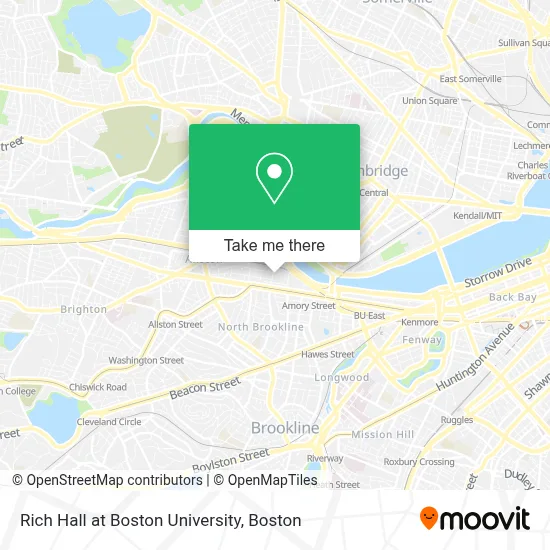
See Rich Hall at Boston University on the map
Public Transportation to Rich Hall at Boston University
Wondering how to get to Rich Hall at Boston University? Moovit helps you find the best way to get to Rich Hall at Boston University with step-by-step directions from the nearest public transit station.
Moovit provides free maps and live directions to help you navigate through your city. View schedules, routes, timetables, and find out how long does it take to get to Rich Hall at Boston University in real time.
Looking for the nearest stop or station to Rich Hall at Boston University? Check out this list of stops closest to your destination: Amory Street; Commonwealth Ave @ Buick St; Comm Ave @ Buick St; Packard's Corner; Commonwealth Ave @ Babcock St; Cambridge St @ Seattle St.
Bus: 19, 57, 85, 1 BU (CHARLES RIVER-MEDICAL CAMPUS), GREEN LINE B SHUTTLE, GREEN LINE B SHUTTLE, GREEN LINE B SHUTTLE, COMM AVE, GREEN LINE B SHUTTLE, GREEN LINE B SHUTTLE, 64, 501.Train: FRAMINGHAM/WORCESTER.Subway: GREEN LINE B.
Want to see if there’s another route that gets you there at an earlier time? Moovit helps you find alternative routes or times. Get directions from and directions to Rich Hall at Boston University easily from the Moovit App or Website.
We make riding to Rich Hall at Boston University easy, which is why over 1.7 million users, including users in Boston, trust Moovit as the best app for public transit. You don’t need to download an individual bus app or train app, Moovit is your all-in-one transit app that helps you find the best bus time or train time available.
For information on prices of subway, bus and train, costs and ride fares to Rich Hall at Boston University, please check the Moovit app.
Use the app to navigate to popular places including to the airport, hospital, stadium, grocery store, mall, coffee shop, school, college, and university.
Rich Hall at Boston University Address: 277 Babcock St street in Boston
- BU Rich Hall Cinema Room,
- Walter Brown Arena,
- Boston University Sleeper Hall (BU Sleeper),
- Boston University Rich Hall (BU Rich),
- Boston University West Campus Dining Hall,
- Sleeper Hall - Boston University,
- 967 Commonwealth Ave,
- Gopchang Story Boston,
- Goodwill Store,
- The Ring Boxing Club,
- FILENE'S BASEMENT,
- Dollar Tree,
- MBTA Bus Route 57,
- Paradise Rock Club,
- Mtlc Music Software & Hardware,
- El Jefes Taqueria,
- Planned Parenthood League Of Massachusetts,
- Paradise Rock Club & Lounge,
- The Goodwill Store (Allston / Brighton),
- Student Village II (Stuvi2)
Places Near Rich Hall at Boston University
- North End, Boston,
- Boston Common, Boston,
- Faneuil Hall, Boston,
- Boston Children's Hospital, Boston,
- Boston Convention & Exhibition Center, Boston,
- Boston Medical Center, Boston,
- Cheers, Boston,
- House Of Blues, Boston,
- Quincy Market, Boston,
- Museum Of Science, Boston,
- Leader Bank Pavilion (Leader Bank Pavillion), Boston,
- Td Garden, Boston,
- Seaport District, Boston,
- Wilbur Theatre, Boston,
- Massachusetts General Hospital, Boston,
- Prudential Center, Boston,
- Isabella Stewart Gardner Museum, Boston,
- Wang Theater, Boston,
- Castle Island, Boston,
- Mgm Music Hall, Boston
How to get to popular places in Boston with public transit
Get around Boston by public transit!
Traveling around Boston has never been so easy. See step by step directions as you travel to any attraction, street or major public transit station. View bus and train schedules, arrival times, service alerts and detailed routes on a map, so you know exactly how to get to anywhere in Boston.
When traveling to any destination around Boston use Moovit's Live Directions with Get Off Notifications to know exactly where and how far to walk, how long to wait for your line, and how many stops are left. Moovit will alert you when it's time to get off — no need to constantly re-check whether yours is the next stop.
Wondering how to use public transit in Boston or how to pay for public transit in Boston? Moovit public transit app can help you navigate your way with public transit easily, and at minimum cost. It includes public transit fees, ticket prices, and costs. Looking for a map of Boston public transit lines? Moovit public transit app shows all public transit maps in Boston with all Bus, Train, Subway and Ferry routes and stops on an interactive map.
Boston has 4 transit type(s), including: Bus, Train, Subway and Ferry, operated by several transit agencies, including MBTA, Southeastern Regional Transit Authority, MetroWest Regional Transit Authority, Rhode Island Public Transit Authority, WRTA, Lowell Regional Transit Authority, Merrimack Valley Transit, Montachusett Regional Transit Authority, Cape Cod Regional Transit Authority, Brockton Area Transit Authority, Martha's Vineyard Transit Authority, the WAVE - Nantucket Regional Transit Authority, GATRA, Cape Ann Transportation Authority and Massport