Directions to Riley Jr James (Boston) with public transportation
The following transit lines have routes that pass near Riley Jr James
 Bus: 109, 85, 92, 93, 105.
- Subway: ORANGE LINE, GREEN LINE B, GREEN LINE C, GREEN LINE D, GREEN LINE E.
How to get to Riley Jr James by bus?
Click on the bus route to see step by step directions with maps, line arrival times and updated time schedules.
From Brighton Music Hall, Boston
45 minFrom Arnold Arboretum, Boston
83 minFrom Harpoon Brewery, Boston
42 minFrom MCPHS University-Boston, Boston
47 minFrom Ramada Boston, Boston
97 minFrom Beth Israel Deaconess Medical Center, West Campus - Farr Building, Boston
46 minFrom Kowloon Restaurant, Saugus
63 minFrom Arnold Arboretum, Boston
92 minFrom Watertown, MA, Watertown Town
53 min
How to get to Riley Jr James by subway?
Click on the subway route to see step by step directions with maps, line arrival times and updated time schedules.
Subway stations near Riley Jr James in Boston
Bus stops near Riley Jr James in Boston
Bus lines to Riley Jr James in Boston
- LOWER MYSTIC LINK, Market Basket/Chelsea Station,VIEW
- 105, Sullivan,VIEW
- 109, Linden Square Via Sullivan,VIEW
- 92, Sullivan,VIEW
- 93, Sullivan Via Navy Yard,VIEW
- 85, Ruggles,VIEW
- 89, Sullivan,VIEW
- 90, Assembly,VIEW
- 91, Central Square,VIEW
- 95, Arlington Center,VIEW
- 101, Malden,VIEW
- 89/93, Haymarket Via Sullivan,VIEW
- GREEN LINE SHUTTLE, Sullivan Square (Shuttle),VIEW
- ORANGE LINE SHUTTLE, State (Shuttle),VIEW
- ORANGE LINE SHUTTLE, North Station (Local Shuttle),VIEW
- ORANGE LINE SHUTTLE, Wellington (Local Shuttle),VIEW
What are the closest stations to Riley Jr James?
The closest stations to Riley Jr James are:
- Lechmere is 192 yards away, 3 min walk.
- Sullivan Square Station is 455 yards away, 6 min walk.
- Alford St @ Mbta Charlestown Garage is 466 yards away, 6 min walk.
- 529 Main St is 588 yards away, 8 min walk.
- Sullivan Square is 619 yards away, 8 min walk.
- Community Collge is 1098 yards away, 13 min walk.
Which bus lines stop near Riley Jr James?
These bus lines stop near Riley Jr James: 109, 85, 92, 93.
Which subway line stops near Riley Jr James?
ORANGE LINE (Oak Grove)
What’s the nearest subway station to Riley Jr James in Boston?
The nearest subway station to Riley Jr James in Boston is Lechmere. It’s a 3 min walk away.
What’s the nearest bus station to Riley Jr James in Boston?
The nearest bus stations to Riley Jr James in Boston are Sullivan Square Station and Alford St @ Mbta Charlestown Garage. The closest one is a 6 min walk away.
What time is the first subway to Riley Jr James in Boston?
The GREEN LINE E is the first subway that goes to Riley Jr James in Boston. It stops nearby at 4:49 AM.
What time is the last subway to Riley Jr James in Boston?
The GREEN LINE E is the last subway that goes to Riley Jr James in Boston. It stops nearby at 2:34 AM.
What time is the first bus to Riley Jr James in Boston?
The 89/93 is the first bus that goes to Riley Jr James in Boston. It stops nearby at 4:44 AM.
What time is the last bus to Riley Jr James in Boston?
The 89 is the last bus that goes to Riley Jr James in Boston. It stops nearby at 1:52 AM.
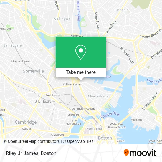
See Riley Jr James, Boston, on the map
Public Transit to Riley Jr James in Boston
Wondering how to get to Riley Jr James in Boston? Moovit helps you find the best way to get to Riley Jr James with step-by-step directions from the nearest public transit station.
Moovit provides free maps and live directions to help you navigate through your city. View schedules, routes, timetables, and find out how long does it take to get to Riley Jr James in real time.
Looking for the nearest stop or station to Riley Jr James? Check out this list of stops closest to your destination: Lechmere; Sullivan Square Station; Alford St @ Mbta Charlestown Garage; 529 Main St; Sullivan Square; Community Collge.
Bus: 109, 85, 92, 93, 105, LOWER MYSTIC LINK, 89, 90, 91, 95.Subway: ORANGE LINE, GREEN LINE B, GREEN LINE C, GREEN LINE D, GREEN LINE E.
Want to see if there’s another route that gets you there at an earlier time? Moovit helps you find alternative routes or times. Get directions from and directions to Riley Jr James easily from the Moovit App or Website.
We make riding to Riley Jr James easy, which is why over 1.7 million users, including users in Boston, trust Moovit as the best app for public transit. You don’t need to download an individual bus app or train app, Moovit is your all-in-one transit app that helps you find the best bus time or train time available.
For information on prices of bus, subway and ferry, costs and ride fares to Riley Jr James, please check the Moovit app.
Use the app to navigate to popular places including to the airport, hospital, stadium, grocery store, mall, coffee shop, school, college, and university.
Riley Jr James Address: 529 Main St street in Boston
- BMC Healthnet Plan,
- Suffolk County da Office,
- Unidine @ Schrafft Center,
- United Rer,
- Schrafft Center,
- Springfield College,
- The Schrafft Center,
- UMass Medical School CHCF,
- A & M Used Auto Parts,
- Sullivan Square,
- Charlestown Working Theater,
- Free Form Fitness Boston Bootcamp,
- Sullivan Square Lot,
- MBTA Charlestown Bus Garage,
- Alford Street Bridge,
- Edward V. Connolly Equipment And Repair Facility,
- PHT,
- DHL,
- Sprint,
- Schrafft's Center Shuttle
Places Near Riley Jr James (Boston)
- Mgm Music Hall, Boston,
- Td Garden, Boston,
- Prudential Center, Boston,
- Castle Island, Boston,
- Seaport District, Boston,
- Boston Common, Boston,
- Cheers, Boston,
- House Of Blues, Boston,
- Wang Theater, Boston,
- Leader Bank Pavilion (Leader Bank Pavillion), Boston,
- Boston Children's Hospital, Boston,
- Museum Of Science, Boston,
- Massachusetts General Hospital, Boston,
- Wilbur Theatre, Boston,
- Faneuil Hall, Boston,
- Boston Convention & Exhibition Center, Boston,
- Quincy Market, Boston,
- Isabella Stewart Gardner Museum, Boston,
- Boston Medical Center, Boston,
- North End, Boston
How to get to popular places in Boston with public transit
Get around Boston by public transit!
Traveling around Boston has never been so easy. See step by step directions as you travel to any attraction, street or major public transit station. View bus and train schedules, arrival times, service alerts and detailed routes on a map, so you know exactly how to get to anywhere in Boston.
When traveling to any destination around Boston use Moovit's Live Directions with Get Off Notifications to know exactly where and how far to walk, how long to wait for your line, and how many stops are left. Moovit will alert you when it's time to get off — no need to constantly re-check whether yours is the next stop.
Wondering how to use public transit in Boston or how to pay for public transit in Boston? Moovit public transit app can help you navigate your way with public transit easily, and at minimum cost. It includes public transit fees, ticket prices, and costs. Looking for a map of Boston public transit lines? Moovit public transit app shows all public transit maps in Boston with all Bus, Train, Subway and Ferry routes and stops on an interactive map.
Boston has 4 transit type(s), including: Bus, Train, Subway and Ferry, operated by several transit agencies, including MBTA, Southeastern Regional Transit Authority, MetroWest Regional Transit Authority, Rhode Island Public Transit Authority, WRTA, Lowell Regional Transit Authority, Merrimack Valley Transit, Montachusett Regional Transit Authority, Cape Cod Regional Transit Authority, Brockton Area Transit Authority, Martha's Vineyard Transit Authority, the WAVE - Nantucket Regional Transit Authority, GATRA, Cape Ann Transportation Authority and Massport