Directions to Rindge Towers (Cambridge) with public transportation
The following transit lines have routes that pass near Rindge Towers
How to get to Rindge Towers by bus?
Click on the bus route to see step by step directions with maps, line arrival times and updated time schedules.
How to get to Rindge Towers by train?
Click on the train route to see step by step directions with maps, line arrival times and updated time schedules.
How to get to Rindge Towers by subway?
Click on the subway route to see step by step directions with maps, line arrival times and updated time schedules.
Bus stops near Rindge Towers in Cambridge
- Rindge Ave @ Russell Field, 2 min walk,
- Alewife, 8 min walk,
Subway stations near Rindge Towers in Cambridge
- Alewife, 7 min walk,
Bus lines to Rindge Towers in Cambridge
- 83, Central Square,
- FITCHBURG LINE SHUTTLE, Littleton/Route 495 - Alewife (Local),
- FITCHBURG LINE SHUTTLE, Littleton/Route 495 - Alewife (Express),
- RED LINE SHUTTLE, Alewife - Park Street,
- RED LINE SHUTTLE, Alewife - Harvard,
- RED LINE SHUTTLE, Alewife - Kendall/MIT via Porter (Express),
- RED LINE SHUTTLE, Alewife - Harvard via Brattle Street,
- RED LINE SHUTTLE, Alewife - Davis,
- RED LINE SHUTTLE, Alewife - Kendall/MIT,
- RED LINE SHUTTLE, Alewife - Harvard via Holyoke Street,
- 62, Alewife - Bedford VA,
- 67, Alewife via Arlington Center - Turkey Hill via Arlington Center,
- 76, Alewife - Lincoln Lab via Hanscom Airport,
- 350, Alewife via Mall Rd - North Burlington via Mall Rd,
- 62/76, Alewife via Hanscom Airport - Bedford VA via Hanscom Airport,
What are the closest stations to Rindge Towers?
The closest stations to Rindge Towers are:
- Rindge Ave @ Russell Field is 105 yards away, 2 min walk.
- Alewife is 566 yards away, 7 min walk.
Which bus lines stop near Rindge Towers?
These bus lines stop near Rindge Towers: 83, 89.
Which train line stops near Rindge Towers?
FITCHBURG LINE
Which subway line stops near Rindge Towers?
RED LINE
What’s the nearest subway station to Rindge Towers in Cambridge?
The nearest subway station to Rindge Towers in Cambridge is Alewife. It’s a 7 min walk away.
What’s the nearest bus stop to Rindge Towers in Cambridge?
The nearest bus stop to Rindge Towers in Cambridge is Rindge Ave @ Russell Field. It’s a 2 min walk away.
See Rindge Towers, Cambridge, on the map
Public Transit to Rindge Towers in Cambridge
Wondering how to get to Rindge Towers in Cambridge, United States? Moovit helps you find the best way to get to Rindge Towers with step-by-step directions from the nearest public transit station.
Moovit provides free maps and live directions to help you navigate through your city. View schedules, routes, timetables, and find out how long does it take to get to Rindge Towers in real time.
Looking for the nearest stop or station to Rindge Towers? Check out this list of stops closest to your destination: Rindge Ave @ Russell Field; Alewife.
Bus: 83, 89, FITCHBURG LINE SHUTTLE, FITCHBURG LINE SHUTTLE, RED LINE SHUTTLE, RED LINE SHUTTLE, RED LINE SHUTTLE.Train: FITCHBURG LINE.Subway: RED LINE.
Want to see if there’s another route that gets you there at an earlier time? Moovit helps you find alternative routes or times. Get directions from and directions to Rindge Towers easily from the Moovit App or Website.
We make riding to Rindge Towers easy, which is why over 1.5 million users, including users in Cambridge, trust Moovit as the best app for public transit. You don’t need to download an individual bus app or train app, Moovit is your all-in-one transit app that helps you find the best bus time or train time available.
For information on prices of bus, subway and train, costs and ride fares to Rindge Towers, please check the Moovit app.
Use the app to navigate to popular places including to the airport, hospital, stadium, grocery store, mall, coffee shop, school, college, and university.
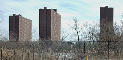
Rindge Towers Address: Rindge Ave. street in Cambridge
Attractions near Rindge Towers
How to get to popular places in Boston with public transit
Get around Cambridge by public transit!
Traveling around Cambridge has never been so easy. See step by step directions as you travel to any attraction, street or major public transit station. View bus and train schedules, arrival times, service alerts and detailed routes on a map, so you know exactly how to get to anywhere in Cambridge.
When traveling to any destination around Cambridge use Moovit's Live Directions with Get Off Notifications to know exactly where and how far to walk, how long to wait for your line, and how many stops are left. Moovit will alert you when it's time to get off — no need to constantly re-check whether yours is the next stop.
Wondering how to use public transit in Cambridge or how to pay for public transit in Cambridge? Moovit public transit app can help you navigate your way with public transit easily, and at minimum cost. It includes public transit fees, ticket prices, and costs. Looking for a map of Cambridge public transit lines? Moovit public transit app shows all public transit maps in Cambridge with all bus, subway or train routes and stops on an interactive map.
Cambridge has 3 transit type(s), including: bus, subway or train, operated by several transit agencies, including MBTA, MBTA, MBTA, Southeastern Regional Transit Authority, MetroWest Regional Transit Authority, Rhode Island Public Transit Authority, WRTA, Lowell Regional Transit Authority, Merrimack Valley Transit, Montachusett Regional Transit Authority, Cape Cod Regional Transit Authority, Brockton Area Transit Authority, Cape Cod Regional Transit Authority, Martha's Vineyard Transit Authority and the WAVE - Nantucket Regional Transit Authority