Directions to Rizzuto's Ice Cream (Boston) with public transportation
The following transit lines have routes that pass near Rizzuto's Ice Cream
 Bus: 111, 43, 504, 93, EZRIDE.
- Train: FAIRMOUNT, FRAMINGHAM/WORCESTER, HAVERHILL, KINGSTON, NEEDHAM.
- Subway: GREEN LINE D, GREEN LINE E, ORANGE LINE, HAVERHILL LINE SHUTTLE, HAVERHILL LINE SHUTTLE.
- Ferry: LOVEJOY - FAN PIER - PIER 10.
How to get to Rizzuto's Ice Cream by bus?
Click on the bus route to see step by step directions with maps, line arrival times and updated time schedules.
From Lower Mills, Boston
97 minFrom Malden, MA, Malden
46 minFrom Uphams Corner, Boston
68 minFrom Brigham and Women's Hospital, Boston
52 minFrom Wollaston Beach, Quincy
134 minFrom Faulkner Hospital, Boston
79 minFrom Arlington, MA, Arlington
66 minFrom Melrose, MA, Melrose
71 minFrom Staybridge Suites Boston-Quincy, Quincy
114 minFrom Hilton Garden Inn Boston Brookline, Brookline
54 min
How to get to Rizzuto's Ice Cream by train?
Click on the train route to see step by step directions with maps, line arrival times and updated time schedules.
How to get to Rizzuto's Ice Cream by subway?
Click on the subway route to see step by step directions with maps, line arrival times and updated time schedules.
From Lower Mills, Boston
46 minFrom Malden, MA, Malden
28 minFrom Uphams Corner, Boston
35 minFrom Brigham and Women's Hospital, Boston
36 minFrom Wollaston Beach, Quincy
50 minFrom Faulkner Hospital, Boston
45 minFrom Staybridge Suites Boston-Quincy, Quincy
34 minFrom Hilton Garden Inn Boston Brookline, Brookline
35 min
Subway station near Rizzuto's Ice Cream in Boston
- Causeway St (East), 2 min walk,VIEW
Bus stops near Rizzuto's Ice Cream in Boston
- N Washington St @ Cooper St, 4 min walk,VIEW
- North Station - Haverhill St @ Causeway St, 4 min walk,VIEW
- North Station, 4 min walk,VIEW
- Congress St @ Sudbury St, 4 min walk,VIEW
- N Washington St @ Medford St, 4 min walk,VIEW
- Haymarket - Congress St @ New Sudbury St, 4 min walk,VIEW
- Sudbury St @ Congress St - Haymarket Sta, 4 min walk,VIEW
- Surface Rd @ Hanover St, 4 min walk,VIEW
- Congress St @ Haymarket Sta, 5 min walk,VIEW
- Haymarket - Congress St Opp Hanover St, 6 min walk,VIEW
Train station near Rizzuto's Ice Cream in Boston
- North Station, 5 min walk,VIEW
Ferry station near Rizzuto's Ice Cream in Boston
- North Station (Lovejoy Wharf), 17 min walk,VIEW
Bus lines to Rizzuto's Ice Cream in Boston
- 92, Sullivan,VIEW
- 93, Sullivan Via Navy Yard,VIEW
- 111, Haymarket,VIEW
- GREEN LINE SHUTTLE, North Station (Shuttle),VIEW
- ORANGE LINE SHUTTLE, North Station (Local Shuttle),VIEW
- ORANGE LINE SHUTTLE, Oak Grove (Express Shuttle),VIEW
- ORANGE LINE SHUTTLE, Oak Grove (Local Shuttle),VIEW
- ORANGE LINE SHUTTLE, Wellington (Express Shuttle),VIEW
- ORANGE LINE SHUTTLE, Sullivan (Shuttle),VIEW
- 4, Design Center,VIEW
- 426, Haymarket Via Cliftondale,VIEW
- 428, Oaklandvale Via Cliftondale (Express),VIEW
- 89/93, Haymarket Via Sullivan,VIEW
- GREEN LINE E SHUTTLE, Government Center - Medford/Tufts (Shuttle),VIEW
- GREEN LINE SHUTTLE, Medford/Tufts - Government Center via Union Square,VIEW
- RED LINE SHUTTLE, Harvard - JFK/UMass via Congress Street,VIEW
- RED LINE SHUTTLE, Harvard - Broadway,VIEW
- RED LINE SHUTTLE, Kendall/MIT - JFK/UMass,VIEW
- RED LINE SHUTTLE, JFK/UMass - Kendall/MIT (Shuttle),VIEW
- 354, Burlington (Express) Via Woburn,VIEW
What are the closest stations to Rizzuto's Ice Cream?
The closest stations to Rizzuto's Ice Cream are:
- Causeway St (East) is 109 yards away, 2 min walk.
- N Washington St @ Cooper St is 248 yards away, 4 min walk.
- North Station - Haverhill St @ Causeway St is 271 yards away, 4 min walk.
- North Station is 279 yards away, 4 min walk.
- Congress St @ Sudbury St is 287 yards away, 4 min walk.
- N Washington St @ Medford St is 295 yards away, 4 min walk.
- Haymarket - Congress St @ New Sudbury St is 304 yards away, 4 min walk.
- Sudbury St @ Congress St - Haymarket Sta is 307 yards away, 4 min walk.
- Surface Rd @ Hanover St is 316 yards away, 4 min walk.
- Congress St @ Haymarket Sta is 351 yards away, 5 min walk.
- Haymarket - Congress St Opp Hanover St is 427 yards away, 6 min walk.
- North Station (Lovejoy Wharf) is 1401 yards away, 17 min walk.
Which bus lines stop near Rizzuto's Ice Cream?
These bus lines stop near Rizzuto's Ice Cream: 111, 43, 504, 93, EZRIDE, SL4, SL5.
Which train lines stop near Rizzuto's Ice Cream?
These train lines stop near Rizzuto's Ice Cream: FAIRMOUNT, FRAMINGHAM/WORCESTER, HAVERHILL, KINGSTON, NEEDHAM.
Which subway lines stop near Rizzuto's Ice Cream?
These subway lines stop near Rizzuto's Ice Cream: GREEN LINE D, GREEN LINE E, ORANGE LINE.
What’s the nearest subway station to Rizzuto's Ice Cream in Boston?
The nearest subway station to Rizzuto's Ice Cream in Boston is Causeway St (East). It’s a 2 min walk away.
What’s the nearest train station to Rizzuto's Ice Cream in Boston?
The nearest train station to Rizzuto's Ice Cream in Boston is North Station. It’s a 5 min walk away.
What’s the nearest bus station to Rizzuto's Ice Cream in Boston?
The nearest bus stations to Rizzuto's Ice Cream in Boston are N Washington St @ Cooper St, North Station - Haverhill St @ Causeway St, North Station, Congress St @ Sudbury St, N Washington St @ Medford St, Haymarket - Congress St @ New Sudbury St, Sudbury St @ Congress St - Haymarket Sta and Surface Rd @ Hanover St. The closest one is a 4 min walk away.
What’s the nearest ferry station to Rizzuto's Ice Cream in Boston?
The nearest ferry station to Rizzuto's Ice Cream in Boston is North Station (Lovejoy Wharf). It’s a 17 min walk away.
What time is the first subway to Rizzuto's Ice Cream in Boston?
The GREEN LINE E is the first subway that goes to Rizzuto's Ice Cream in Boston. It stops nearby at 5:01 AM.
What time is the last subway to Rizzuto's Ice Cream in Boston?
The GREEN LINE E is the last subway that goes to Rizzuto's Ice Cream in Boston. It stops nearby at 2:24 AM.
What time is the first train to Rizzuto's Ice Cream in Boston?
The LOWELL is the first train that goes to Rizzuto's Ice Cream in Boston. It stops nearby at 5:20 AM.
What time is the last train to Rizzuto's Ice Cream in Boston?
The LOWELL is the last train that goes to Rizzuto's Ice Cream in Boston. It stops nearby at 12:34 AM.
What time is the first bus to Rizzuto's Ice Cream in Boston?
The 111 is the first bus that goes to Rizzuto's Ice Cream in Boston. It stops nearby at 4:49 AM.
What time is the last bus to Rizzuto's Ice Cream in Boston?
The 111 is the last bus that goes to Rizzuto's Ice Cream in Boston. It stops nearby at 2:20 AM.
What time is the first ferry to Rizzuto's Ice Cream in Boston?
The LOVEJOY - FAN PIER - PIER 10 is the first ferry that goes to Rizzuto's Ice Cream in Boston. It stops nearby at 6:20 AM.
What time is the last ferry to Rizzuto's Ice Cream in Boston?
The LOVEJOY - FAN PIER - PIER 10 is the last ferry that goes to Rizzuto's Ice Cream in Boston. It stops nearby at 7:35 PM.
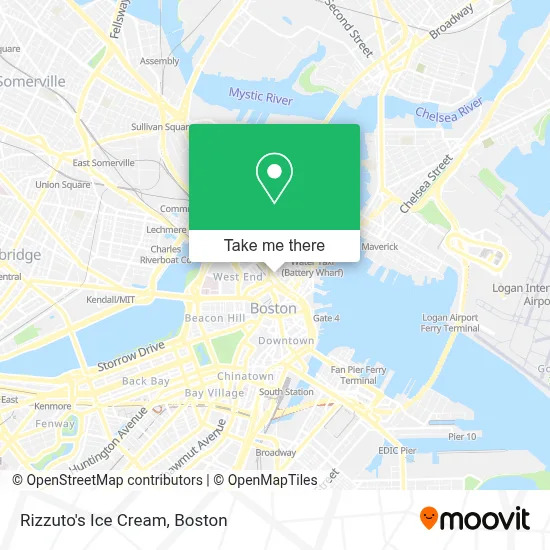
See Rizzuto's Ice Cream, Boston, on the map
Public Transit to Rizzuto's Ice Cream in Boston
Wondering how to get to Rizzuto's Ice Cream in Boston? Moovit helps you find the best way to get to Rizzuto's Ice Cream with step-by-step directions from the nearest public transit station.
Moovit provides free maps and live directions to help you navigate through your city. View schedules, routes, timetables, and find out how long does it take to get to Rizzuto's Ice Cream in real time.
Looking for the nearest stop or station to Rizzuto's Ice Cream? Check out this list of stops closest to your destination: Causeway St (East); N Washington St @ Cooper St; North Station - Haverhill St @ Causeway St; North Station; Congress St @ Sudbury St; N Washington St @ Medford St; Haymarket - Congress St @ New Sudbury St; Sudbury St @ Congress St - Haymarket Sta; Surface Rd @ Hanover St; Congress St @ Haymarket Sta; Haymarket - Congress St Opp Hanover St; North Station (Lovejoy Wharf).
Bus: 111, 43, 504, 93, EZRIDE, SL4, SL5, 92, GREEN LINE SHUTTLE, ORANGE LINE SHUTTLE, ORANGE LINE SHUTTLE, ORANGE LINE SHUTTLE, ORANGE LINE SHUTTLE, ORANGE LINE SHUTTLE.Train: FAIRMOUNT, FRAMINGHAM/WORCESTER, HAVERHILL, KINGSTON, NEEDHAM, FITCHBURG, LOWELL, NEWBURYPORT/ROCKPORT, DOWNEASTER.Subway: GREEN LINE D, GREEN LINE E, ORANGE LINE, HAVERHILL LINE SHUTTLE, HAVERHILL LINE SHUTTLE, LOWELL LINE SHUTTLE, LOWELL LINE SHUTTLE, NEWBURYPORT/ROCKPORT LINE SHUTTLE.Ferry: LOVEJOY - FAN PIER - PIER 10.
Want to see if there’s another route that gets you there at an earlier time? Moovit helps you find alternative routes or times. Get directions from and directions to Rizzuto's Ice Cream easily from the Moovit App or Website.
We make riding to Rizzuto's Ice Cream easy, which is why over 1.7 million users, including users in Boston, trust Moovit as the best app for public transit. You don’t need to download an individual bus app or train app, Moovit is your all-in-one transit app that helps you find the best bus time or train time available.
For information on prices of subway, bus and train, costs and ride fares to Rizzuto's Ice Cream, please check the Moovit app.
Use the app to navigate to popular places including to the airport, hospital, stadium, grocery store, mall, coffee shop, school, college, and university.
Rizzuto's Ice Cream Address: 94 Endicott St street in Boston
- Exit 26/Storrow Drive/N,
- MDAR,
- Northfield,
- Scotch 'n Sirloin Building,
- Mass General Hospital Ellison 18,
- Haymarket Station (Haymarket - Green Line Outbound),
- Haymarket Station,
- City Winery Boston,
- City Winery,
- Haymarket Square,
- Bodega Canal (The Grand Canal),
- Terramia Ristorante,
- Limoncello 2,
- Pizzeria Regina,
- Antico Forno,
- Regina Pizzeria ,
- La Famiglia Giorgio (La Famiglia Ristorante),
- Neptune Oyster,
- Salmagundi,
- La Famiglia Giorgio's
Places Near Rizzuto's Ice Cream (Boston)
- Seaport District, Boston,
- Museum Of Science, Boston,
- Faneuil Hall, Boston,
- Boston Common, Boston,
- Boston Convention & Exhibition Center, Boston,
- Boston Children's Hospital, Boston,
- Leader Bank Pavilion (Leader Bank Pavillion), Boston,
- Td Garden, Boston,
- Wilbur Theatre, Boston,
- House Of Blues, Boston,
- Isabella Stewart Gardner Museum, Boston,
- Wang Theater, Boston,
- Massachusetts General Hospital, Boston,
- Castle Island, Boston,
- Cheers, Boston,
- Boston Medical Center, Boston,
- Prudential Center, Boston,
- Quincy Market, Boston,
- North End, Boston,
- Mgm Music Hall, Boston
How to get to popular places in Boston with public transit
Get around Boston by public transit!
Traveling around Boston has never been so easy. See step by step directions as you travel to any attraction, street or major public transit station. View bus and train schedules, arrival times, service alerts and detailed routes on a map, so you know exactly how to get to anywhere in Boston.
When traveling to any destination around Boston use Moovit's Live Directions with Get Off Notifications to know exactly where and how far to walk, how long to wait for your line, and how many stops are left. Moovit will alert you when it's time to get off — no need to constantly re-check whether yours is the next stop.
Wondering how to use public transit in Boston or how to pay for public transit in Boston? Moovit public transit app can help you navigate your way with public transit easily, and at minimum cost. It includes public transit fees, ticket prices, and costs. Looking for a map of Boston public transit lines? Moovit public transit app shows all public transit maps in Boston with all Bus, Train, Subway and Ferry routes and stops on an interactive map.
Boston has 4 transit type(s), including: Bus, Train, Subway and Ferry, operated by several transit agencies, including MBTA, Southeastern Regional Transit Authority, MetroWest Regional Transit Authority, Rhode Island Public Transit Authority, WRTA, Lowell Regional Transit Authority, Merrimack Valley Transit, Montachusett Regional Transit Authority, Cape Cod Regional Transit Authority, Brockton Area Transit Authority, Martha's Vineyard Transit Authority, the WAVE - Nantucket Regional Transit Authority, GATRA, Cape Ann Transportation Authority and Massport