Directions to Roberto Clemente Park (Boston) with public transportation
The following transit lines have routes that pass near Roberto Clemente Park
 Bus: 47, 8, 85, 55, 19.
- Train: NEEDHAM, FRAMINGHAM/WORCESTER.
- Subway: GREEN LINE D, ORANGE LINE, GREEN LINE C, GREEN LINE B.
How to get to Roberto Clemente Park by bus?
Click on the bus route to see step by step directions with maps, line arrival times and updated time schedules.
From Sommerville Theatre, Somerville
56 minFrom West Roxbury VA Medical Center, Boston
68 minFrom Watertown Mall, Watertown Town
53 minFrom Suffolk Downs, Boston
82 minFrom Hyatt Place Medford, Medford
82 minFrom Beth Israel Deaconess Hospital-Milton, Milton
96 minFrom Brigham and Women's Faulkner Hospital, Boston
48 minFrom MBTA Suffolk Downs Station, Boston
86 minFrom Hampton Inn Boston Logan Airport, Revere
69 min
How to get to Roberto Clemente Park by train?
Click on the train route to see step by step directions with maps, line arrival times and updated time schedules.
How to get to Roberto Clemente Park by subway?
Click on the subway route to see step by step directions with maps, line arrival times and updated time schedules.
From Sommerville Theatre, Somerville
43 minFrom Suffolk Downs, Boston
56 minFrom Hyatt Place Medford, Medford
79 minFrom Beth Israel Deaconess Hospital-Milton, Milton
88 minFrom Brigham and Women's Faulkner Hospital, Boston
48 minFrom MBTA Suffolk Downs Station, Boston
43 minFrom Hampton Inn Boston Logan Airport, Revere
65 min
Bus stops near Roberto Clemente Park in Boston
- Kilmarnock St @ Peterborough St, 1 min walk,VIEW
- Brookline Ave @ Fullerton St, 5 min walk,VIEW
- 132 Brookline Ave Opp Fullerton St, 6 min walk,VIEW
- Brookline Ave Opp Short St, 6 min walk,VIEW
- Park Dr @ Fenway Station SB, 6 min walk,VIEW
- Park Dr @ Fenway Station NB, 7 min walk,VIEW
- Ave Louis Pasteur @ the Fenway, 8 min walk,VIEW
Train station near Roberto Clemente Park in Boston
- Lansdowne, 7 min walk,VIEW
Subway stations near Roberto Clemente Park in Boston
Bus lines to Roberto Clemente Park in Boston
- 55, West Fenway,VIEW
- 8, Kenmore via South Bay Center - Harbor Point via South Bay Center,VIEW
- 19, Kenmore - Fields Corner,VIEW
- 60, Kenmore - Chestnut Hill Mall,VIEW
- 65, Kenmore - Brighton Center,VIEW
- 9, Kenmore Via Boston Latin,VIEW
- 47, Broadway,VIEW
- 85, Ruggles,VIEW
- CT3, Beth Israel (Limited Stops),VIEW
- GREEN LINE D SHUTTLE, Riverside - Kenmore (Shuttle),VIEW
- GREEN LINE D SHUTTLE, Reservoir - Fenway,VIEW
- GREEN LINE D SHUTTLE, Reservoir - Kenmore,VIEW
- GREEN LINE D SHUTTLE, Riverside - Kenmore via Saint Mary's Street,VIEW
- GREEN LINE D SHUTTLE, Newton Highlands - Kenmore,VIEW
- GREEN LINE D SHUTTLE, Riverside - Fenway,VIEW
- GREEN LINE D SHUTTLE, Newton Highlands - Fenway,VIEW
- GREEN LINE D SHUTTLE, Brookline Hills - Kenmore,VIEW
- GREEN LINE D SHUTTLE, Newton Highlands - Kenmore via Saint Mary's Street,VIEW
- GREEN LINE D SHUTTLE, Brookline Hills - Back Bay (Shuttle),VIEW
- GREEN LINE D SHUTTLE, Riverside - Kenmore,VIEW
What are the closest stations to Roberto Clemente Park?
The closest stations to Roberto Clemente Park are:
- Kilmarnock St @ Peterborough St is 71 yards away, 1 min walk.
- Brookline Ave @ Fullerton St is 328 yards away, 5 min walk.
- 132 Brookline Ave Opp Fullerton St is 420 yards away, 6 min walk.
- Lansdowne is 499 yards away, 7 min walk.
- Brookline Ave Opp Short St is 501 yards away, 6 min walk.
- Park Dr @ Fenway Station SB is 502 yards away, 6 min walk.
- Park Dr @ Fenway Station NB is 550 yards away, 7 min walk.
- Ave Louis Pasteur @ the Fenway is 603 yards away, 8 min walk.
- Saint Marys Street is 747 yards away, 9 min walk.
- Fenway is 773 yards away, 11 min walk.
- Blandford Street is 932 yards away, 12 min walk.
Which bus lines stop near Roberto Clemente Park?
These bus lines stop near Roberto Clemente Park: 47, 8, 85.
Which train line stops near Roberto Clemente Park?
NEEDHAM (#620 | South Station)
Which subway lines stop near Roberto Clemente Park?
These subway lines stop near Roberto Clemente Park: GREEN LINE D, ORANGE LINE.
What’s the nearest subway station to Roberto Clemente Park in Boston?
The nearest subway station to Roberto Clemente Park in Boston is Saint Marys Street. It’s a 9 min walk away.
What’s the nearest train station to Roberto Clemente Park in Boston?
The nearest train station to Roberto Clemente Park in Boston is Lansdowne. It’s a 7 min walk away.
What’s the nearest bus station to Roberto Clemente Park in Boston?
The nearest bus station to Roberto Clemente Park in Boston is Kilmarnock St @ Peterborough St. It’s a 1 min walk away.
What time is the first subway to Roberto Clemente Park in Boston?
The GREEN LINE D is the first subway that goes to Roberto Clemente Park in Boston. It stops nearby at 4:55 AM.
What time is the last subway to Roberto Clemente Park in Boston?
The GREEN LINE D is the last subway that goes to Roberto Clemente Park in Boston. It stops nearby at 2:22 AM.
What time is the first train to Roberto Clemente Park in Boston?
The FRAMINGHAM/WORCESTER is the first train that goes to Roberto Clemente Park in Boston. It stops nearby at 4:55 AM.
What time is the last train to Roberto Clemente Park in Boston?
The FRAMINGHAM/WORCESTER is the last train that goes to Roberto Clemente Park in Boston. It stops nearby at 12:06 AM.
What time is the first bus to Roberto Clemente Park in Boston?
The 60 is the first bus that goes to Roberto Clemente Park in Boston. It stops nearby at 5:22 AM.
What time is the last bus to Roberto Clemente Park in Boston?
The 47 is the last bus that goes to Roberto Clemente Park in Boston. It stops nearby at 1:13 AM.
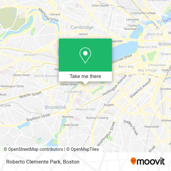
See Roberto Clemente Park, Boston, on the map
Public Transit to Roberto Clemente Park in Boston
Wondering how to get to Roberto Clemente Park in Boston? Moovit helps you find the best way to get to Roberto Clemente Park with step-by-step directions from the nearest public transit station.
Moovit provides free maps and live directions to help you navigate through your city. View schedules, routes, timetables, and find out how long does it take to get to Roberto Clemente Park in real time.
Looking for the nearest stop or station to Roberto Clemente Park? Check out this list of stops closest to your destination: Kilmarnock St @ Peterborough St; Brookline Ave @ Fullerton St; 132 Brookline Ave Opp Fullerton St; Lansdowne; Brookline Ave Opp Short St; Park Dr @ Fenway Station SB; Park Dr @ Fenway Station NB; Ave Louis Pasteur @ the Fenway; Saint Marys Street; Fenway; Blandford Street.
Bus: 47, 8, 85, 55, 19, 60, 65.Train: NEEDHAM, FRAMINGHAM/WORCESTER.Subway: GREEN LINE D, ORANGE LINE, GREEN LINE C, GREEN LINE B.
Want to see if there’s another route that gets you there at an earlier time? Moovit helps you find alternative routes or times. Get directions from and directions to Roberto Clemente Park easily from the Moovit App or Website.
We make riding to Roberto Clemente Park easy, which is why over 1.7 million users, including users in Boston, trust Moovit as the best app for public transit. You don’t need to download an individual bus app or train app, Moovit is your all-in-one transit app that helps you find the best bus time or train time available.
For information on prices of bus, subway and train, costs and ride fares to Roberto Clemente Park, please check the Moovit app.
Use the app to navigate to popular places including to the airport, hospital, stadium, grocery store, mall, coffee shop, school, college, and university.
Roberto Clemente Park Address: 400 Fenway street in Boston
- Roberto Clemente Field (Roberto Clemente Park),
- 200 Brookline,
- Sonder at Pierce Boston ,
- Emmanuel college auditorium,
- Cb2,
- 5 Wits,
- BED BATH & BEYOND - Fenway Park,
- Pierce Boston,
- Fenway Triangle Trilogy Garage,
- The Green,
- MBTA-Fenway (Park Dr @ Fenway Station),
- Sweet Cheeks Q,
- 401 Park,
- Trillium Fenway,
- Pulse,
- Whoop,
- Harvard,
- Saltie Girl,
- Star Market (Shaw's),
- Emmanuel College MA USA
Places Near Roberto Clemente Park (Boston)
- Td Garden, Boston,
- Wang Theater, Boston,
- Museum Of Science, Boston,
- North End, Boston,
- Isabella Stewart Gardner Museum, Boston,
- Faneuil Hall, Boston,
- Boston Medical Center, Boston,
- Wilbur Theatre, Boston,
- Prudential Center, Boston,
- Cheers, Boston,
- Boston Common, Boston,
- Mgm Music Hall, Boston,
- House Of Blues, Boston,
- Massachusetts General Hospital, Boston,
- Quincy Market, Boston,
- Boston Children's Hospital, Boston,
- Boston Convention & Exhibition Center, Boston,
- Seaport District, Boston,
- Leader Bank Pavilion (Leader Bank Pavillion), Boston,
- Castle Island, Boston
How to get to popular places in Boston with public transit
Get around Boston by public transit!
Traveling around Boston has never been so easy. See step by step directions as you travel to any attraction, street or major public transit station. View bus and train schedules, arrival times, service alerts and detailed routes on a map, so you know exactly how to get to anywhere in Boston.
When traveling to any destination around Boston use Moovit's Live Directions with Get Off Notifications to know exactly where and how far to walk, how long to wait for your line, and how many stops are left. Moovit will alert you when it's time to get off — no need to constantly re-check whether yours is the next stop.
Wondering how to use public transit in Boston or how to pay for public transit in Boston? Moovit public transit app can help you navigate your way with public transit easily, and at minimum cost. It includes public transit fees, ticket prices, and costs. Looking for a map of Boston public transit lines? Moovit public transit app shows all public transit maps in Boston with all Bus, Train, Subway and Ferry routes and stops on an interactive map.
Boston has 4 transit type(s), including: Bus, Train, Subway and Ferry, operated by several transit agencies, including MBTA, Southeastern Regional Transit Authority, MetroWest Regional Transit Authority, Rhode Island Public Transit Authority, WRTA, Lowell Regional Transit Authority, Merrimack Valley Transit, Montachusett Regional Transit Authority, Cape Cod Regional Transit Authority, Brockton Area Transit Authority, Martha's Vineyard Transit Authority, the WAVE - Nantucket Regional Transit Authority, GATRA, Cape Ann Transportation Authority and Massport