Directions to Rolê do Alcides (Batel) with public transportation
The following transit lines have routes that pass near Rolê do Alcides
How to get to Rolê do Alcides by bus?
Click on the bus route to see step by step directions with maps, line arrival times and updated time schedules.
From Rua Capitão Leônidas Marques, Uberaba
50 minFrom Praça das Nações, Alto Da Rua XV
34 minFrom Rua Joaquim da Costa Ribeiro, Bairro Alto
57 minFrom Rua Professor João Soares Barcelos, Boqueirão
62 minFrom Terminal Santa Cândida - 200 - Ligeirão Sta.Cândida/Pça. do Japão - 203 - Santa Cândida / Capão Ras, Tingüi
36 minFrom Avenida Vereador Toaldo Túlio 2500, São Braz
34 minFrom Rua João Tobias de Paiva Netto, Cajuru
60 minFrom Avenida Juscelino Kubitschek de Oliveira, Cic
43 minFrom Rua Maestro Carlos Frank, Alto Boqueirão
56 minFrom Rua Cyro Correia Pereira 667, Cic
45 min
Bus stops near Rolê do Alcides in Batel
- Av. Sete De Setembro, 5317, 1 min walk,VIEW
- Av. Visconde de Guarapuava, 5000, 4 min walk,VIEW
- R. Castro Alves, 99, 5 min walk,VIEW
- Av. República Argentina, 220, 6 min walk,VIEW
- Silva Jardim, 6 min walk,VIEW
- Av. Iguaçu, 2700, 8 min walk,VIEW
- Av. do Batel, 1889 (Hospital Santa Cruz), 9 min walk,VIEW
- R. Bispo Dom José, 2100, 9 min walk,VIEW
Bus lines to Rolê do Alcides in Batel
- 265 AHÚ / LOS ANGELES, Los Angeles → Ahú,VIEW
- 860 VILA SANDRA, Praça Rui Barbosa → Vila Sandra,VIEW
- H01 ARAUCÁRIA / GUADALUPE, Terminal Guadalupe → Terminal Araucária,VIEW
- G72 AREIA BRANCA / GUADALUPE, Terminal Guadalupe → Areia Branca,VIEW
- G72 QUITANDINHA / GUADALUPE, Terminal Guadalupe → Quitandinha,VIEW
- H97 ANGÉLICA / GUADALUPE, Terminal Guadalupe → Terminal Angélica,VIEW
- 209 MAD. SANTA CÂNDIDA / CAPÃO RASO, Terminal Santa Cândida → Terminal Capão Raso (via Praça Rui Barbosa),VIEW
- 609 MAD. CIC, Praça Rui Barbosa → Terminal CIC,VIEW
- X08 REFORÇO PINHEIRINHO, Estação Coronel Dulcídio → Terminal Pinheirinho,VIEW
- X49 REFORÇO PORTÃO / CABRAL, Terminal Cabral → Terminal Portão,VIEW
- 203 SANTA CÂNDIDA / CAPÃO RASO, Terminal Santa Cândida → Terminal Capão Raso,VIEW
- 603 PINHEIRINHO / RUI BARBOSA, Terminal Pinheirinho → Praça Rui Barbosa,VIEW
- F71 FAZENDA / GUADALUPE, FAZENDA / GUADALUPE,VIEW
- 670 SÃO JORGE, SÃO JORGE,VIEW
- 671 PORTÃO, PORTÃO,VIEW
- 673 FORMOSA, FORMOSA,VIEW
- 674 NOSSA SENHORA DA LUZ, NOSSA SENHORA DA LUZ,VIEW
- 701 FAZENDINHA, FAZENDINHA,VIEW
- 703 CAIUÁ, CAIUÁ,VIEW
- 706 CAIUÁ - FAZENDINHA / CENTRO, CAIUÁ - FAZENDINHA / CENTRO,VIEW
What are the closest stations to Rolê do Alcides?
The closest stations to Rolê do Alcides are:
- Av. Sete De Setembro, 5317 is 47 meters away, 1 min walk.
- Av. Visconde de Guarapuava, 5000 is 250 meters away, 4 min walk.
- R. Castro Alves, 99 is 286 meters away, 5 min walk.
- Av. República Argentina, 220 is 427 meters away, 6 min walk.
- Silva Jardim is 440 meters away, 6 min walk.
- Av. Iguaçu, 2700 is 577 meters away, 8 min walk.
- Av. do Batel, 1889 (Hospital Santa Cruz) is 651 meters away, 9 min walk.
- R. Bispo Dom José, 2100 is 651 meters away, 9 min walk.
Which bus lines stop near Rolê do Alcides?
These bus lines stop near Rolê do Alcides: 011 INTERBAIRROS I (ANTI-HORÁRIO), 250 LIGEIRÃO NORTE / SUL, 801 CAMPINA DO SIQUEIRA / BATEL, G72 AREIA BRANCA / GUADALUPE.
What’s the nearest bus station to Rolê do Alcides in Batel?
The nearest bus station to Rolê do Alcides in Batel is Av. Sete De Setembro, 5317. It’s a 1 min walk away.
What time is the first bus to Rolê do Alcides in Batel?
The 209 MAD. SANTA CÂNDIDA / CAPÃO RASO is the first bus that goes to Rolê do Alcides in Batel. It stops nearby at 3:01 AM.
What time is the last bus to Rolê do Alcides in Batel?
The 609 MAD. CIC is the last bus that goes to Rolê do Alcides in Batel. It stops nearby at 3:26 AM.
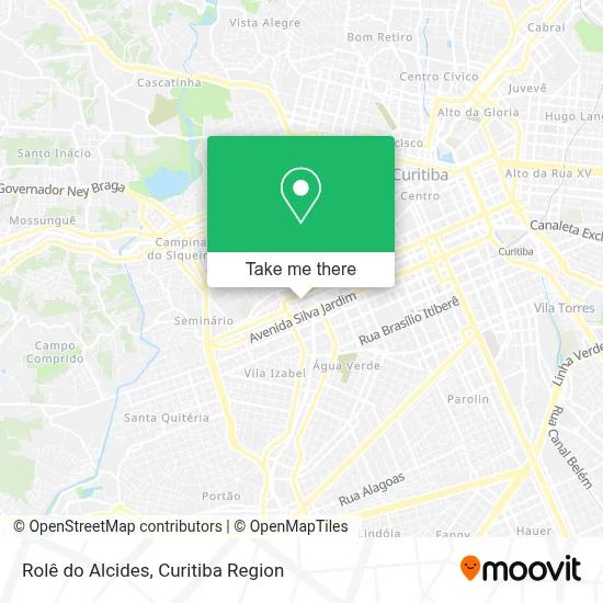
See Rolê do Alcides, Batel, on the map
Public Transit to Rolê do Alcides in Batel
Wondering how to get to Rolê do Alcides in Batel? Moovit helps you find the best way to get to Rolê do Alcides with step-by-step directions from the nearest public transit station.
Moovit provides free maps and live directions to help you navigate through your city. View schedules, routes, timetables, and find out how long does it take to get to Rolê do Alcides in real time.
Looking for the nearest stop or station to Rolê do Alcides? Check out this list of stops closest to your destination: Av. Sete De Setembro; Av. Visconde de Guarapuava; R. Castro Alves; Av. República Argentina; Silva Jardim; Av. Iguaçu; Av. do Batel; R. Bispo Dom José.
Bus: 011 INTERBAIRROS I (ANTI-HORÁRIO), 250 LIGEIRÃO NORTE / SUL, 801 CAMPINA DO SIQUEIRA / BATEL, G72 AREIA BRANCA / GUADALUPE, 265 AHÚ / LOS ANGELES, 860 VILA SANDRA, H01 ARAUCÁRIA / GUADALUPE, G72 QUITANDINHA / GUADALUPE, H97 ANGÉLICA / GUADALUPE, 209 MAD. SANTA CÂNDIDA / CAPÃO RASO, 609 MAD. CIC, X08 REFORÇO PINHEIRINHO, X49 REFORÇO PORTÃO / CABRAL, 203 SANTA CÂNDIDA / CAPÃO RASO, 603 PINHEIRINHO / RUI BARBOSA, F71 FAZENDA / GUADALUPE, 670 SÃO JORGE, 671 PORTÃO, 673 FORMOSA, 674 NOSSA SENHORA DA LUZ.
Want to see if there’s another route that gets you there at an earlier time? Moovit helps you find alternative routes or times. Get directions from and directions to Rolê do Alcides easily from the Moovit App or Website.
We make riding to Rolê do Alcides easy, which is why over 1.5 million users, including users in Batel, trust Moovit as the best app for public transit. You don’t need to download an individual bus app or train app, Moovit is your all-in-one transit app that helps you find the best bus time or train time available.
For information on prices of bus, costs and ride fares to Rolê do Alcides, please check the Moovit app.
Use the app to navigate to popular places including to the airport, hospital, stadium, grocery store, mall, coffee shop, school, college, and university.
Location: Batel, Curitiba Region
- Avenida Sete de Setembro 5368,
- Edifício Comercial Plinio Mattos,
- Rua Bruno Filgueira 369, 4º Andar, Conjunto 404,
- Centro Médico Plinio de Mattos Pessoa,
- Dr João Rodrigo Sarot,
- Receita Exata,
- Consultório Dr Hugo Nakatani,
- Dr. Witold Mikozewski,
- Consulado Honorário da Colômbia,
- Condomínio Residencial Baltimore,
- Rua Carneiro Lobo 468,
- DBM Call Center,
- Reckitt Benckiser (Brasil),
- DHL Global Forwarding,
- Enoteca Decanter-Vinhos,
- Incor Curitiba,
- Clínica Médica da Dor Dr Giublin,
- Neurobrain Instituto - Centro de Dor, Neurologia e Qualidade de Vida,
- Hospital Veterinãrio Batel,
- Ecoclin Clínica de Diagnósticos Ecográficos
Places Near Rolê do Alcides (Batel)
- Pontifícia Universidade Católica do Paraná (PUCPR), Prado Velho,
- Rua Martim Afonso 558, Mercês,
- Park Shopping Barigüi, Mossunguê,
- Campo Largo, Campo,
- Hospital Erasto Gaertner, Jardim Das Américas,
- Hospital Universitário Evangélico de Curitiba, Bigorrilho,
- Hhhhh, Fazendinha,
- Shopping Palladium, Portão,
- Hospital de Clínicas (HC - UFPR), Centro,
- Hospital Nossa Senhora Das Graças, Mercês,
- Hospital Da Cruz Vermelha, Batel,
- Jardim Botânico de Curitiba PR, Centro,
- Rua General Mário Tourinho, Campina Do Siqueira,
- Arena Da Baixada - Curitiba,
- Shopping Estação, Rebouças,
- Hospital Angelina Caron, Campina Grande Do Sul,
- Parque Barigui, Mercês,
- Jockey Plaza Shopping Center, Tarumã,
- Hospital do Rocio, Campo,
- Hospital Madalena Sofia, Bairro Alto
How to get to popular places in Curitiba Region with public transit
Get around Batel by public transit!
Traveling around Batel has never been so easy. See step by step directions as you travel to any attraction, street or major public transit station. View bus and train schedules, arrival times, service alerts and detailed routes on a map, so you know exactly how to get to anywhere in Batel.
When traveling to any destination around Batel use Moovit's Live Directions with Get Off Notifications to know exactly where and how far to walk, how long to wait for your line, and how many stops are left. Moovit will alert you when it's time to get off — no need to constantly re-check whether yours is the next stop.
Wondering how to use public transit in Batel or how to pay for public transit in Batel? Moovit public transit app can help you navigate your way with public transit easily, and at minimum cost. It includes public transit fees, ticket prices, and costs. Looking for a map of Batel public transit lines? Moovit public transit app shows all public transit maps in Batel with all Bus and Cable Car routes and stops on an interactive map.
Curitiba Region has 2 transit type(s), including: Bus and Cable Car, operated by several transit agencies, including Sistema Integrado de Mobilidade (URBS), Sistema Integrado de Mobilidade (AMEP), URBS (Cartões bancários e Dinheiro), URBS (Cartões bancários / Cartão URBS), AMEP (Cartões bancários / Cartão MetroCard), AMEP (Cartões bancários / Cartão MetroCard / Dinheiro), Viação Colombo (Dinheiro), TRIAR (Cartão TRIAR / Dinheiro), Empresa Curitiba Cerro Azul (Dinheiro), Expresso Nossa Senhora da Penha (Dinheiro), Empresa Campo Alto Tijucas (Dinheiro), Auto Viação São José (Cartão VEM / Dinheiro), BRT S/A (Cartão VEM / Dinheiro), TransPiedade (Cartão Cidadão / Dinheiro) and Oceânica Sul (Cartão Transporte / Dinheiro)