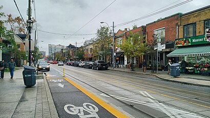
See Roncesvalles Village, Toronto, on the map
Directions to Roncesvalles Village (Toronto) with public transportation
The following transit lines have routes that pass near Roncesvalles Village
 Bus:
Bus: - Train:
- Subway:
- Streetcar:
How to get to Roncesvalles Village by bus?
Click on the bus route to see step by step directions with maps, line arrival times and updated time schedules.
How to get to Roncesvalles Village by train?
Click on the train route to see step by step directions with maps, line arrival times and updated time schedules.
How to get to Roncesvalles Village by subway?
Click on the subway route to see step by step directions with maps, line arrival times and updated time schedules.
Streetcar stations near Roncesvalles Village in Toronto
- Roncesvalles Ave at High Park Blvd South Side,2 min walk,
Bus stations near Roncesvalles Village in Toronto
- Parkside Dr at High Park Blvd,10 min walk,
- King St West at Queen St West,10 min walk,
- King St West at the Queensway,11 min walk,
- St Joseph's Health Centre at 30 the Queensway,11 min walk,
- Lansdowne Ave at Rideau Ave,12 min walk,
Bus lines to Roncesvalles Village in Toronto
- 80,Keele Station,
- 63,Sunnyside Loop,
- 63A,Ossington Station,
- 63B,Ossington Station,
- 63S,Shaw St at King St West North Side,
- 402,Toronto Rehab - Bickle Centre at 130 Dunn Ave,
- 47A,Lansdowne Ave at Queen St West,
- 47B,Lansdowne Ave at Queen St West,
- 47C,Yorkdale Rd at Go Terminal - Yorkdale Station,
What are the closest stations to Roncesvalles Village?
The closest stations to Roncesvalles Village are:
- Roncesvalles Ave at High Park Blvd South Side is 109 meters away, 2 min walk.
- Parkside Dr at High Park Blvd is 717 meters away, 10 min walk.
- King St West at Queen St West is 773 meters away, 10 min walk.
- King St West at the Queensway is 781 meters away, 11 min walk.
- St Joseph's Health Centre at 30 the Queensway is 807 meters away, 11 min walk.
- Lansdowne Ave at Rideau Ave is 900 meters away, 12 min walk.
Which bus lines stop near Roncesvalles Village?
These bus lines stop near Roncesvalles Village: 47B, 47C, 63, 80.
Which train line stops near Roncesvalles Village?
UP
Which subway line stops near Roncesvalles Village?
2
Which Streetcar line stops near Roncesvalles Village?
504A
What’s the nearest Streetcar station to Roncesvalles Village in Toronto?
The nearest Streetcar station to Roncesvalles Village in Toronto is Roncesvalles Ave at High Park Blvd South Side. It’s a 2 min walk away.
What’s the nearest bus stop to Roncesvalles Village in Toronto?
The nearest bus stops to Roncesvalles Village in Toronto are Parkside Dr at High Park Blvd and King St West at Queen St West. The closest one is a 10 min walk away.
What time is the first Streetcar to Roncesvalles Village in Toronto?
The 304 is the first Streetcar that goes to Roncesvalles Village in Toronto. It stops nearby at 3:04 AM.
What time is the last Streetcar to Roncesvalles Village in Toronto?
The 304 is the last Streetcar that goes to Roncesvalles Village in Toronto. It stops nearby at 3:53 AM.
What time is the first bus to Roncesvalles Village in Toronto?
The 47A is the first bus that goes to Roncesvalles Village in Toronto. It stops nearby at 5:00 AM.
What time is the last bus to Roncesvalles Village in Toronto?
The 63S is the last bus that goes to Roncesvalles Village in Toronto. It stops nearby at 2:30 AM.
How much is the subway fare to Roncesvalles Village?
The subway fare to Roncesvalles Village costs about $3.30.
How much is the Streetcar fare to Roncesvalles Village?
The Streetcar fare to Roncesvalles Village costs about $3.30.
How much is the bus fare to Roncesvalles Village?
The bus fare to Roncesvalles Village costs about $3.10.
See Roncesvalles Village, Toronto, on the map
Public Transit to Roncesvalles Village in Toronto
Wondering how to get to Roncesvalles Village in Toronto, Canada? Moovit helps you find the best way to get to Roncesvalles Village with step-by-step directions from the nearest public transit station.
Moovit provides free maps and live directions to help you navigate through your city. View schedules, routes, timetables, and find out how long does it take to get to Roncesvalles Village in real time.
Looking for the nearest stop or station to Roncesvalles Village? Check out this list of stops closest to your destination: Roncesvalles Ave at High Park Blvd South Side; Parkside Dr at High Park Blvd; King St West at Queen St West; King St West at the Queensway; St Joseph's Health Centre at 30 the Queensway; Lansdowne Ave at Rideau Ave.
Bus:Train:Subway:Streetcar:
Want to see if there’s another route that gets you there at an earlier time? Moovit helps you find alternative routes or times. Get directions from and directions to Roncesvalles Village easily from the Moovit App or Website.
We make riding to Roncesvalles Village easy, which is why over 1.5 million users, including users in Toronto, trust Moovit as the best app for public transit. You don’t need to download an individual bus app or train app, Moovit is your all-in-one transit app that helps you find the best bus time or train time available.
For information on prices of subway, bus, Streetcar and train, costs and ride fares to Roncesvalles Village, please check the Moovit app.
Use the app to navigate to popular places including to the airport, hospital, stadium, grocery store, mall, coffee shop, school, college, and university.
Location: Toronto
Attractions near Roncesvalles Village
Village Healing Centre,Fern Avenue Public School,Nikolai Pavlov, RP,Thin Blue Line Cheese Boutique,Super Secret Hideout,Roncesvalles Village,Our Lady Of Mercy Wing,100 Sunnyside Avenue,4L wing st Joseph's,67 Grenadier Road,St. Joseph's Health Centre,30 Sunnyside Ave Toronto, ON M6R 1B5 Sunnyside Avenue,Sorauren Park Field House,Sunnyside Building,St. Joseph's Health Centre,Fracture Clinic St. Joseph Health Centre,Sorauren Avenue Park,St Joseph s Health Centre,Herbcan,Little Flower FloristHow to get to popular attractions in Toronto with public transit
Meadowvale Town Centre, Mississauga,Lawrence Subway Station, Toronto,Burlington GO Station, Burlington,Durham College (Oshawa Campus), Oshawa,Ancaster, Ontario, Hamilton,Starbucks, Toronto,Trinity Common Bus Terminal, Brampton,Kinka Izakaya, Toronto,TTC #511 Bathurst Streetcar, Toronto,Sheppard West Subway Station, Toronto,Appleby GO Station, Burlington,GoodLife Fitness Centres, Toronto,Kitchener, Ontario, Kitchener,Communitech Hub, Kitchener,GoodLife Fitness Centres, Toronto,Newmarket, Ontario, Newmarket,Starbucks, Toronto,Canada's Wonderland, Vaughan,The Junction, Toronto,Pizzeria Libretto, TorontoGet around Toronto by public transit!
Traveling around Toronto has never been so easy. See step by step directions as you travel to any attraction, street or major public transit station. View bus and train schedules, arrival times, service alerts and detailed routes on a map, so you know exactly how to get to anywhere in Toronto.
When traveling to any destination around Toronto use Moovit's Live Directions with Get Off Notifications to know exactly where and how far to walk, how long to wait for your line, and how many stops are left. Moovit will alert you when it's time to get off — no need to constantly re-check whether yours is the next stop.
Wondering how to use public transit in Toronto or how to pay for public transit in Toronto? Moovit public transit app can help you navigate your way with public transit easily, and at minimum cost. It includes public transit fees, ticket prices, and costs. Looking for a map of Toronto public transit lines? Moovit public transit app shows all public transit maps in Toronto with all subway, bus, Streetcar or train routes and stops on an interactive map.
Toronto has 4 transit type(s), including: subway, bus, Streetcar or train, operated by several transit agencies, including TTC, TTC Streetcar, Toronto Subway, GO Transit Bus, GO Transit, Amtrak, York Region Transit, Grand River Transit, Guelph Transit, grt, Hamilton Street Railway, MiWay, Brampton Transit, Burlington Transit and Oakville Transit