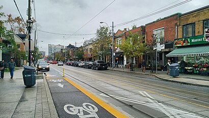
Directions to Roncesvalles Village station (Toronto) with public transit
The following transit lines have routes that pass near Roncesvalles Village
How to get to Roncesvalles Village station by bus?
Click on the bus route to see step by step directions with maps, line arrival times and updated time schedules.
How to get to Roncesvalles Village station by train?
Click on the train route to see step by step directions with maps, line arrival times and updated time schedules.
How to get to Roncesvalles Village station by subway?
Click on the subway route to see step by step directions with maps, line arrival times and updated time schedules.
Bus stops near Roncesvalles Village in Toronto
- Roncesvalles Ave at Grenadier Rd, 2 min walk,
- Parkside Dr at Geoffrey St, 8 min walk,
- Bloor St West at Dundas St West, 12 min walk,
- Lansdowne Ave at Dundas St West, 15 min walk,
Streetcar stations near Roncesvalles Village in Toronto
- Dundas St West at Lansdowne Ave, 14 min walk,
Bus lines to Roncesvalles Village station in Toronto
- 304, Queen St East at Broadview Ave,
- 304A, Distillery Loop,
- 504, Queen St East at Broadview Ave,
- 504A, Dundas West Station,
- 80A, Keele Station,
- 80, Sherway Gardens Rd at Sherway Gate Mall West Side,
- 300A, Pearson Airport Terminal 1 - Ground Level Column R4,
- 300B, Kennedy Station - Platform B,
- 300S, Kipling Station,
- 168, Edna Ave at Dundas St West,
- 402, Toronto Rehab - Bickle Centre at 130 Dunn Ave,
- 47A, Lansdowne Ave at Queen St West,
- 47B, Lansdowne Ave at Queen St West,
- 47C, Lansdowne Ave at Queen St West,
What are the closest stations to Roncesvalles Village?
The closest stations to Roncesvalles Village are:
- Roncesvalles Ave at Grenadier Rd is 60 meters away, 2 min walk.
- Parkside Dr at Geoffrey St is 587 meters away, 8 min walk.
- Bloor St West at Dundas St West is 899 meters away, 12 min walk.
- Dundas St West at Lansdowne Ave is 1044 meters away, 14 min walk.
- Lansdowne Ave at Dundas St West is 1088 meters away, 15 min walk.
Which bus lines stop near Roncesvalles Village?
These bus lines stop near Roncesvalles Village: 168, 40, 47B, 47C, 63, 80.
Which train line stops near Roncesvalles Village?
UP
Which subway line stops near Roncesvalles Village?
2
Which Streetcar lines stop near Roncesvalles Village?
These Streetcar lines stop near Roncesvalles Village: 504A, 505, 506.
What’s the nearest Streetcar station to Roncesvalles Village in Toronto?
The nearest Streetcar station to Roncesvalles Village in Toronto is Dundas St West at Lansdowne Ave. It’s a 14 min walk away.
What’s the nearest bus station to Roncesvalles Village in Toronto?
The nearest bus station to Roncesvalles Village in Toronto is Roncesvalles Ave at Grenadier Rd. It’s a 2 min walk away.
What time is the first Streetcar to Roncesvalles Village in Toronto?
The 304 is the first Streetcar that goes to Roncesvalles Village in Toronto. It stops nearby at 3:02 AM.
What time is the last Streetcar to Roncesvalles Village in Toronto?
The 304 is the last Streetcar that goes to Roncesvalles Village in Toronto. It stops nearby at 3:55 AM.
What time is the first bus to Roncesvalles Village in Toronto?
The 300A is the first bus that goes to Roncesvalles Village in Toronto. It stops nearby at 3:14 AM.
What time is the last bus to Roncesvalles Village in Toronto?
The 300B is the last bus that goes to Roncesvalles Village in Toronto. It stops nearby at 3:37 AM.
How much is the bus fare to Roncesvalles Village?
The bus fare to Roncesvalles Village costs about $3.10.
How much is the subway fare to Roncesvalles Village?
The subway fare to Roncesvalles Village costs about $3.30.
How much is the tram fare to Roncesvalles Village?
The tram fare to Roncesvalles Village costs about $3.30.
See Roncesvalles Village, Toronto, on the map
Public Transit to Roncesvalles Village in Toronto
Wondering how to get to Roncesvalles Village in Toronto, Canada? Moovit helps you find the best way to get to Roncesvalles Village with step-by-step directions from the nearest public transit station.
Moovit provides free maps and live directions to help you navigate through your city. View schedules, routes, timetables, and find out how long does it take to get to Roncesvalles Village in real time.
Looking for the nearest stop or station to Roncesvalles Village? Check out this list of stops closest to your destination: Roncesvalles Ave at Grenadier Rd; Parkside Dr at Geoffrey St; Bloor St West at Dundas St West; Dundas St West at Lansdowne Ave; Lansdowne Ave at Dundas St West.
Bus: 168, 40, 47B, 47C, 63, 80, 304, 304A, 504, 504A, 80A, 300A, 300B, 300S, 402, 47A.Train: UP.Subway: 2.Streetcar: 504A, 505, 506.
Want to see if there’s another route that gets you there at an earlier time? Moovit helps you find alternative routes or times. Get directions from and directions to Roncesvalles Village easily from the Moovit App or Website.
We make riding to Roncesvalles Village easy, which is why over 1.5 million users, including users in Toronto, trust Moovit as the best app for public transit. You don’t need to download an individual bus app or train app, Moovit is your all-in-one transit app that helps you find the best bus time or train time available.
For information on prices of subway, bus, Streetcar and train, costs and ride fares to Roncesvalles Village, please check the Moovit app.
Use the app to navigate to popular places including to the airport, hospital, stadium, grocery store, mall, coffee shop, school, college, and university.
Roncesvalles Village Address: Roncesvalles Village, Toronto, ON, Canada street in Toronto
Places Near Roncesvalles Village (Toronto)
Get around Toronto by public transit!
Traveling around Toronto has never been so easy. See step by step directions as you travel to any attraction, street or major public transit station. View bus and train schedules, arrival times, service alerts and detailed routes on a map, so you know exactly how to get to anywhere in Toronto.
When traveling to any destination around Toronto use Moovit's Live Directions with Get Off Notifications to know exactly where and how far to walk, how long to wait for your line, and how many stops are left. Moovit will alert you when it's time to get off — no need to constantly re-check whether yours is the next stop.
Wondering how to use public transit in Toronto or how to pay for public transit in Toronto? Moovit public transit app can help you navigate your way with public transit easily, and at minimum cost. It includes public transit fees, ticket prices, and costs. Looking for a map of Toronto public transit lines? Moovit public transit app shows all public transit maps in Toronto with all Bus, Train, Subway, Streetcar and Ferry routes and stops on an interactive map.
Toronto has 5 transit type(s), including: Bus, Train, Subway, Streetcar and Ferry, operated by several transit agencies, including TTC, TTC Streetcar, Toronto Subway, GO Transit Bus, GO Transit, Hamilton Street Railway, Grand River Transit, MiWay, Burlington Transit, Guelph Transit, Oakville Transit, Brampton Transit, York Region Transit, UP Express and Barrie Transit