Directions to Rosedale Convenience (Boston) with public transportation
The following transit lines have routes that pass near Rosedale Convenience
 Bus: 16, 23, 22, 26.
- Train: FAIRMOUNT, FRANKLIN/FOXBORO, PROVIDENCE/STOUGHTON, FAIRMOUNT LINE SHUTTLE.
- Subway: RED LINE.
How to get to Rosedale Convenience by bus?
Click on the bus route to see step by step directions with maps, line arrival times and updated time schedules.
From Bow Market, Somerville
91 minFrom Market Basket, Somerville
94 minFrom Charlestown, Boston
82 minFrom Sudbury, Boston
64 minFrom Charles W. Eliot Bridge, Boston
90 minFrom Hampton Inn Boston Seaport District (Hampton Inn-Hampton Inn Boston), Boston
66 minFrom Old Town Trolley Tours of Boston, Boston
55 minFrom World Trade Center MBTA Station - Silver Line, Boston
69 minFrom Mount Ida College, Newton
73 minFrom Schrafft's Center Shuttle, Boston
92 min
How to get to Rosedale Convenience by train?
Click on the train route to see step by step directions with maps, line arrival times and updated time schedules.
How to get to Rosedale Convenience by subway?
Click on the subway route to see step by step directions with maps, line arrival times and updated time schedules.
From Bow Market, Somerville
63 minFrom Market Basket, Somerville
68 minFrom Charlestown, Boston
48 minFrom Sudbury, Boston
37 minFrom Charles W. Eliot Bridge, Boston
61 minFrom Hampton Inn Boston Seaport District (Hampton Inn-Hampton Inn Boston), Boston
49 minFrom Old Town Trolley Tours of Boston, Boston
41 minFrom World Trade Center MBTA Station - Silver Line, Boston
45 minFrom Schrafft's Center Shuttle, Boston
39 min
Bus stops near Rosedale Convenience in Boston
Train stations near Rosedale Convenience in Boston
Subway station near Rosedale Convenience in Boston
- Shawmut, 15 min walk,VIEW
Bus lines to Rosedale Convenience in Boston
What are the closest stations to Rosedale Convenience?
The closest stations to Rosedale Convenience are:
- Washington St @ Park St is 209 yards away, 3 min walk.
- Talbot Ave @ Spencer St is 292 yards away, 4 min walk.
- Talbot Ave @ Centre St is 432 yards away, 6 min walk.
- Four Corners/Geneva is 897 yards away, 11 min walk.
- Talbot Avenue is 1159 yards away, 14 min walk.
- Shawmut is 1282 yards away, 15 min walk.
Which bus lines stop near Rosedale Convenience?
These bus lines stop near Rosedale Convenience: 16, 23.
Which train line stops near Rosedale Convenience?
FAIRMOUNT (#1619 | Fairmount)
Which subway line stops near Rosedale Convenience?
RED LINE (Ashmont/Braintree)
What’s the nearest subway station to Rosedale Convenience in Boston?
The nearest subway station to Rosedale Convenience in Boston is Shawmut. It’s a 15 min walk away.
What’s the nearest train station to Rosedale Convenience in Boston?
The nearest train station to Rosedale Convenience in Boston is Four Corners/Geneva. It’s a 11 min walk away.
What’s the nearest bus station to Rosedale Convenience in Boston?
The nearest bus station to Rosedale Convenience in Boston is Washington St @ Park St. It’s a 3 min walk away.
What time is the first subway to Rosedale Convenience in Boston?
The RED LINE is the first subway that goes to Rosedale Convenience in Boston. It stops nearby at 5:16 AM.
What time is the last subway to Rosedale Convenience in Boston?
The RED LINE is the last subway that goes to Rosedale Convenience in Boston. It stops nearby at 2:03 AM.
What time is the first train to Rosedale Convenience in Boston?
The FAIRMOUNT is the first train that goes to Rosedale Convenience in Boston. It stops nearby at 4:41 AM.
What time is the last train to Rosedale Convenience in Boston?
The FAIRMOUNT is the last train that goes to Rosedale Convenience in Boston. It stops nearby at 12:03 AM.
What time is the first bus to Rosedale Convenience in Boston?
The 23 is the first bus that goes to Rosedale Convenience in Boston. It stops nearby at 4:51 AM.
What time is the last bus to Rosedale Convenience in Boston?
The 23 is the last bus that goes to Rosedale Convenience in Boston. It stops nearby at 2:40 AM.
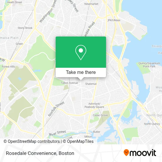
See Rosedale Convenience, Boston, on the map
Public Transit to Rosedale Convenience in Boston
Wondering how to get to Rosedale Convenience in Boston? Moovit helps you find the best way to get to Rosedale Convenience with step-by-step directions from the nearest public transit station.
Moovit provides free maps and live directions to help you navigate through your city. View schedules, routes, timetables, and find out how long does it take to get to Rosedale Convenience in real time.
Looking for the nearest stop or station to Rosedale Convenience? Check out this list of stops closest to your destination: Washington St @ Park St; Talbot Ave @ Spencer St; Talbot Ave @ Centre St; Four Corners/Geneva; Talbot Avenue; Shawmut.
Bus: 16, 23, 22, 26.Train: FAIRMOUNT, FRANKLIN/FOXBORO, PROVIDENCE/STOUGHTON, FAIRMOUNT LINE SHUTTLE.Subway: RED LINE.
Want to see if there’s another route that gets you there at an earlier time? Moovit helps you find alternative routes or times. Get directions from and directions to Rosedale Convenience easily from the Moovit App or Website.
We make riding to Rosedale Convenience easy, which is why over 1.7 million users, including users in Boston, trust Moovit as the best app for public transit. You don’t need to download an individual bus app or train app, Moovit is your all-in-one transit app that helps you find the best bus time or train time available.
For information on prices of bus, subway and train, costs and ride fares to Rosedale Convenience, please check the Moovit app.
Use the app to navigate to popular places including to the airport, hospital, stadium, grocery store, mall, coffee shop, school, college, and university.
Rosedale Convenience Address: 542 Washington St street in Boston
- Faibian/Kenoco,
- Jesus Way Network,
- Sam Mickey Consulting,
- Namels Barbershop,
- We Are Mobile,
- Orthogonal Chiropractic,
- Constable Services,
- Dorchester Division, Boston Municipal Court ,
- Dorchester Center, Massachusetts,
- Lafountain & Wollman P.C.,
- Boston Municipal Court Department, Dorchester Division,
- Spa Parties by Shauna,
- Godfrey Hotel Boston,
- Senior Locksmith,
- Nakri Healing Center,
- USPS,
- Super Laundromat,
- Millennium Avery Condominiums,
- Diva Nail Bar & Beauty,
- BMO Harris Bank
Places Near Rosedale Convenience (Boston)
- Faneuil Hall, Boston,
- Quincy Market, Boston,
- Massachusetts General Hospital, Boston,
- Cheers, Boston,
- House Of Blues, Boston,
- Castle Island, Boston,
- Wilbur Theatre, Boston,
- Museum Of Science, Boston,
- Seaport District, Boston,
- Boston Children's Hospital, Boston,
- Td Garden, Boston,
- Isabella Stewart Gardner Museum, Boston,
- North End, Boston,
- Boston Medical Center, Boston,
- Mgm Music Hall, Boston,
- Boston Common, Boston,
- Leader Bank Pavilion (Leader Bank Pavillion), Boston,
- Wang Theater, Boston,
- Prudential Center, Boston,
- Boston Convention & Exhibition Center, Boston
How to get to popular places in Boston with public transit
Get around Boston by public transit!
Traveling around Boston has never been so easy. See step by step directions as you travel to any attraction, street or major public transit station. View bus and train schedules, arrival times, service alerts and detailed routes on a map, so you know exactly how to get to anywhere in Boston.
When traveling to any destination around Boston use Moovit's Live Directions with Get Off Notifications to know exactly where and how far to walk, how long to wait for your line, and how many stops are left. Moovit will alert you when it's time to get off — no need to constantly re-check whether yours is the next stop.
Wondering how to use public transit in Boston or how to pay for public transit in Boston? Moovit public transit app can help you navigate your way with public transit easily, and at minimum cost. It includes public transit fees, ticket prices, and costs. Looking for a map of Boston public transit lines? Moovit public transit app shows all public transit maps in Boston with all Bus, Train, Subway and Ferry routes and stops on an interactive map.
Boston has 4 transit type(s), including: Bus, Train, Subway and Ferry, operated by several transit agencies, including MBTA, Southeastern Regional Transit Authority, MetroWest Regional Transit Authority, Rhode Island Public Transit Authority, WRTA, Lowell Regional Transit Authority, Merrimack Valley Transit, Montachusett Regional Transit Authority, Cape Cod Regional Transit Authority, Brockton Area Transit Authority, Martha's Vineyard Transit Authority, the WAVE - Nantucket Regional Transit Authority, GATRA, Cape Ann Transportation Authority and Massport