Directions to Rosmarynails (Boston) with public transportation
The following transit lines have routes that pass near Rosmarynails
 Bus: 19, 28, 44, 10, 14.
- Train: FAIRMOUNT, PROVIDENCE/STOUGHTON, FRANKLIN/FOXBORO.
- Subway: ORANGE LINE.
How to get to Rosmarynails by bus?
Click on the bus route to see step by step directions with maps, line arrival times and updated time schedules.
From MGH 50 Staniford Street 3rd flr, Boston
56 minFrom Terrace Room, Paige Hall, Medford
86 minFrom KNL, Cambridge
44 minFrom Ac Hotel Cambridge, Cambridge
94 minFrom Warrior Ice Arena, Boston
56 minFrom I-93 South, Boston
71 minFrom Quincy, MA, Quincy
82 minFrom Tufts University, Medford
85 minFrom Cruiseport Boston's Black Falcon Cruise Terminal, Boston
56 minFrom Canobie Lake Park, Chelsea
84 min
How to get to Rosmarynails by train?
Click on the train route to see step by step directions with maps, line arrival times and updated time schedules.
How to get to Rosmarynails by subway?
Click on the subway route to see step by step directions with maps, line arrival times and updated time schedules.
Bus stops near Rosmarynails in Boston
Subway station near Rosmarynails in Boston
- Stony Brook, 18 min walk,VIEW
Train station near Rosmarynails in Boston
- Uphams Corner, 19 min walk,VIEW
Bus lines to Rosmarynails in Boston
- 10, Townsend & Humboldt,VIEW
- 14, Heath St,VIEW
- 19, Gallivan Blvd,VIEW
- 23, Franklin Park,VIEW
- 28, Avenue Louis Pasteur Via Ruggles,VIEW
- 22, Ashmont,VIEW
- 44, Ruggles,VIEW
- 32, Forest Hills - Wolcott Square,VIEW
- 34, Forest Hills - Dedham Mall,VIEW
- 36, Forest Hills - VA Hospital,VIEW
- 38, Forest Hills - Wren St,VIEW
What are the closest stations to Rosmarynails?
The closest stations to Rosmarynails are:
- Warren St @ Maywood St is 10 yards away, 1 min walk.
- Warren St @ Townsend St is 264 yards away, 4 min walk.
- Walnut Ave @ Dale St is 304 yards away, 4 min walk.
- Humboldt Ave @ Townsend St is 457 yards away, 6 min walk.
- Stony Brook is 1457 yards away, 18 min walk.
- Uphams Corner is 1565 yards away, 19 min walk.
Which bus lines stop near Rosmarynails?
These bus lines stop near Rosmarynails: 19, 28, 44.
Which train lines stop near Rosmarynails?
These train lines stop near Rosmarynails: FAIRMOUNT, PROVIDENCE/STOUGHTON.
Which subway line stops near Rosmarynails?
ORANGE LINE (Forest Hills)
What’s the nearest subway station to Rosmarynails in Boston?
The nearest subway station to Rosmarynails in Boston is Stony Brook. It’s a 18 min walk away.
What’s the nearest train station to Rosmarynails in Boston?
The nearest train station to Rosmarynails in Boston is Uphams Corner. It’s a 19 min walk away.
What’s the nearest bus station to Rosmarynails in Boston?
The nearest bus station to Rosmarynails in Boston is Warren St @ Maywood St. It’s a 1 min walk away.
What time is the first subway to Rosmarynails in Boston?
The ORANGE LINE is the first subway that goes to Rosmarynails in Boston. It stops nearby at 5:18 AM.
What time is the last subway to Rosmarynails in Boston?
The ORANGE LINE is the last subway that goes to Rosmarynails in Boston. It stops nearby at 1:54 AM.
What time is the first train to Rosmarynails in Boston?
The FAIRMOUNT is the first train that goes to Rosmarynails in Boston. It stops nearby at 4:47 AM.
What time is the last train to Rosmarynails in Boston?
The FAIRMOUNT is the last train that goes to Rosmarynails in Boston. It stops nearby at 11:57 PM.
What time is the first bus to Rosmarynails in Boston?
The 28 is the first bus that goes to Rosmarynails in Boston. It stops nearby at 3:18 AM.
What time is the last bus to Rosmarynails in Boston?
The 23 is the last bus that goes to Rosmarynails in Boston. It stops nearby at 2:32 AM.
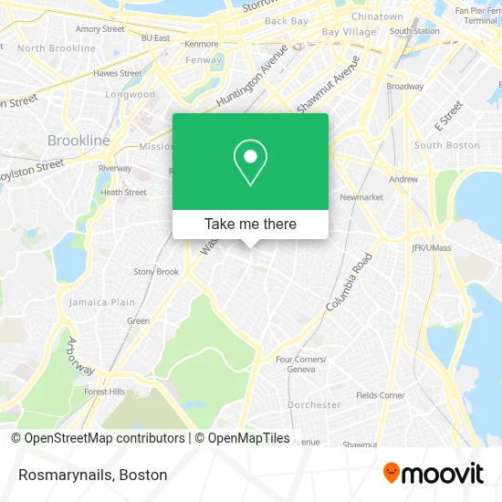
See Rosmarynails, Boston, on the map
Public Transit to Rosmarynails in Boston
Wondering how to get to Rosmarynails in Boston? Moovit helps you find the best way to get to Rosmarynails with step-by-step directions from the nearest public transit station.
Moovit provides free maps and live directions to help you navigate through your city. View schedules, routes, timetables, and find out how long does it take to get to Rosmarynails in real time.
Looking for the nearest stop or station to Rosmarynails? Check out this list of stops closest to your destination: Warren St @ Maywood St; Warren St @ Townsend St; Walnut Ave @ Dale St; Humboldt Ave @ Townsend St; Stony Brook; Uphams Corner.
Bus: 19, 28, 44, 10, 14, 23, 22, 32, 34, 36, 38.Train: FAIRMOUNT, PROVIDENCE/STOUGHTON, FRANKLIN/FOXBORO.Subway: ORANGE LINE.
Want to see if there’s another route that gets you there at an earlier time? Moovit helps you find alternative routes or times. Get directions from and directions to Rosmarynails easily from the Moovit App or Website.
We make riding to Rosmarynails easy, which is why over 1.7 million users, including users in Boston, trust Moovit as the best app for public transit. You don’t need to download an individual bus app or train app, Moovit is your all-in-one transit app that helps you find the best bus time or train time available.
For information on prices of bus, subway and train, costs and ride fares to Rosmarynails, please check the Moovit app.
Use the app to navigate to popular places including to the airport, hospital, stadium, grocery store, mall, coffee shop, school, college, and university.
Rosmarynails Address: 55 Humboldt Ave street in Boston
- Humbolt Apartments,
- Roxbury,
- National Life Insurance Inc,
- Michelle Green Thu,
- Authentic Diva,
- Higginson /Lewis K-8 (Lewis George Middle School),
- Greater Boston,
- Back To the Roots,
- Bethel Pentecostal Church (Bethel Pentcostal Church Uhc),
- Bridge Boston Charter School,
- Warren Gardens Housing Cooperative,
- Popeyes @ Washington Park Mall,
- Roxbury Ymca,
- City of Boston,
- CBHM Research Committee,
- Washington Park Mall,
- Naacp Boston Branch,
- Dollar Max Store,
- Exp/Snipes 3027,
- Popeyes LOUISIANA KITCHEN
Places Near Rosmarynails (Boston)
- Castle Island, Boston,
- Wang Theater, Boston,
- Museum Of Science, Boston,
- Wilbur Theatre, Boston,
- Massachusetts General Hospital, Boston,
- Boston Medical Center, Boston,
- Cheers, Boston,
- Mgm Music Hall, Boston,
- Boston Children's Hospital, Boston,
- Td Garden, Boston,
- House Of Blues, Boston,
- Faneuil Hall, Boston,
- Leader Bank Pavilion (Leader Bank Pavillion), Boston,
- Boston Convention & Exhibition Center, Boston,
- Seaport District, Boston,
- Quincy Market, Boston,
- Prudential Center, Boston,
- North End, Boston,
- Isabella Stewart Gardner Museum, Boston,
- Boston Common, Boston
How to get to popular places in Boston with public transit
Get around Boston by public transit!
Traveling around Boston has never been so easy. See step by step directions as you travel to any attraction, street or major public transit station. View bus and train schedules, arrival times, service alerts and detailed routes on a map, so you know exactly how to get to anywhere in Boston.
When traveling to any destination around Boston use Moovit's Live Directions with Get Off Notifications to know exactly where and how far to walk, how long to wait for your line, and how many stops are left. Moovit will alert you when it's time to get off — no need to constantly re-check whether yours is the next stop.
Wondering how to use public transit in Boston or how to pay for public transit in Boston? Moovit public transit app can help you navigate your way with public transit easily, and at minimum cost. It includes public transit fees, ticket prices, and costs. Looking for a map of Boston public transit lines? Moovit public transit app shows all public transit maps in Boston with all Bus, Train, Subway and Ferry routes and stops on an interactive map.
Boston has 4 transit type(s), including: Bus, Train, Subway and Ferry, operated by several transit agencies, including MBTA, Southeastern Regional Transit Authority, MetroWest Regional Transit Authority, Rhode Island Public Transit Authority, WRTA, Lowell Regional Transit Authority, Merrimack Valley Transit, Montachusett Regional Transit Authority, Cape Cod Regional Transit Authority, Brockton Area Transit Authority, Martha's Vineyard Transit Authority, the WAVE - Nantucket Regional Transit Authority, GATRA, Cape Ann Transportation Authority and Massport