How to get to Rrodriguez Tatto by bus?
Click on the bus route to see step by step directions with maps, line arrival times and updated time schedules.
From Atacadão Coco Verde e Seco, Lorena
49 minFrom Casa da Amizade, Aparecida
31 minFrom Campo Joana D'arc, Lorena
41 minFrom Supermercado Shibata, Aparecida
39 minFrom Escola do Bairro Paiol, Guaratinguetá
35 minFrom Capela Santa Terezinha, Guaratinguetá
27 minFrom Vila Hepacare, Lorena
42 minFrom Jardim Paraíba, Aparecida
42 minFrom Penitenciaria I de Potim, Potim
45 minFrom EEL USP - Campus 2 - Demar, Lorena
58 min
Bus stops near Rrodriguez Tatto in Guaratinguetá
- Rua Coronel Píres Barbosa, 574, 5 min walk,VIEW
- Rua Domingos Rodrigues Alves, 17, 5 min walk,VIEW
- Avenida Juscelino Kubitscheck De Oliveira, 14 - Centro Histórico, Guaratinguetá, 6 min walk,VIEW
- Avenida Juscelino Kubitscheck De Oliveira, 110, 6 min walk,VIEW
- Rua Coronel Pires Barbosa, 195 - Centro Histórico, Guaratinguetá, 6 min walk,VIEW
Bus lines to Rrodriguez Tatto in Guaratinguetá
- L24, Bairro - Centro,VIEW
- L25, Jardim Do Vale (Via Ponte Adhemar De Barros),VIEW
- L26, Rodoviária X Jardim Do Vale,VIEW
- L02, Rodoviária X São Manoel,VIEW
- L03, Rodoviária X Vila Dos Sargentos,VIEW
- L04, Rodoviária X Pingo De Ouro,VIEW
- L05, Rodoviária X Parque São Francisco,VIEW
- L06, Rodoviária X Santa Luzia,VIEW
- L07, Pilões (Via Capituba),VIEW
- L08, Rodoviária X Pedrinhas - Gomeral,VIEW
- L20, Bairro - Centro,VIEW
- L23, Rodoviária X Engenheiro Neiva,VIEW
- L28, Três Garças –Via São Bento,VIEW
- L31, Rodoviária X Cecap São Dimas,VIEW
- L32, Rodoviária <-> Colônia Do Piagui,VIEW
- 5312, Guaratingueta (Terminal Rodoviario De Guaratingueta),VIEW
- 5318, Potim (Loteamento Dos Vieiras),VIEW
- L27, Três Garças Via Vila Rosa / Vista Alegre - Centro,VIEW
- 5316, Guaratingueta (Centro),VIEW
What are the closest stations to Rrodriguez Tatto?
The closest stations to Rrodriguez Tatto are:
- Rua Coronel Píres Barbosa, 574 is 337 meters away, 5 min walk.
- Rua Domingos Rodrigues Alves, 17 is 341 meters away, 5 min walk.
- Avenida Juscelino Kubitscheck De Oliveira, 14 - Centro Histórico, Guaratinguetá is 416 meters away, 6 min walk.
- Avenida Juscelino Kubitscheck De Oliveira, 110 is 418 meters away, 6 min walk.
- Rua Coronel Pires Barbosa, 195 - Centro Histórico, Guaratinguetá is 458 meters away, 6 min walk.
Which bus lines stop near Rrodriguez Tatto?
These bus lines stop near Rrodriguez Tatto: 5312, 5316, 5318, 5319, 5402, L02.
What’s the nearest bus station to Rrodriguez Tatto in Guaratinguetá?
The nearest bus stations to Rrodriguez Tatto in Guaratinguetá are Rua Coronel Píres Barbosa, 574 and Rua Domingos Rodrigues Alves, 17. The closest one is a 5 min walk away.
What time is the first bus to Rrodriguez Tatto in Guaratinguetá?
The L25 is the first bus that goes to Rrodriguez Tatto in Guaratinguetá. It stops nearby at 5:01 AM.
What time is the last bus to Rrodriguez Tatto in Guaratinguetá?
The L25 is the last bus that goes to Rrodriguez Tatto in Guaratinguetá. It stops nearby at 12:33 AM.
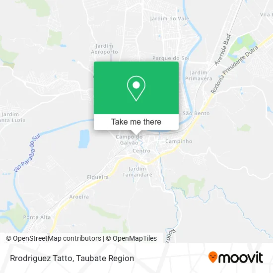
See Rrodriguez Tatto, Guaratinguetá, on the map
Public Transit to Rrodriguez Tatto in Guaratinguetá
Wondering how to get to Rrodriguez Tatto in Guaratinguetá? Moovit helps you find the best way to get to Rrodriguez Tatto with step-by-step directions from the nearest public transit station.
Moovit provides free maps and live directions to help you navigate through your city. View schedules, routes, timetables, and find out how long does it take to get to Rrodriguez Tatto in real time.
Looking for the nearest stop or station to Rrodriguez Tatto? Check out this list of stops closest to your destination: Rua Coronel Píres Barbosa; Rua Domingos Rodrigues Alves; Avenida Juscelino Kubitscheck De Oliveira; Avenida Juscelino Kubitscheck De Oliveira; Rua Coronel Pires Barbosa.
Bus: 5312, 5316, 5318, 5319, 5402, L02, L24, L25, L26, L03, L04, L05, L06, L27.
Want to see if there’s another route that gets you there at an earlier time? Moovit helps you find alternative routes or times. Get directions from and directions to Rrodriguez Tatto easily from the Moovit App or Website.
We make riding to Rrodriguez Tatto easy, which is why over 1.5 million users, including users in Guaratinguetá, trust Moovit as the best app for public transit. You don’t need to download an individual bus app or train app, Moovit is your all-in-one transit app that helps you find the best bus time or train time available.
For information on prices of bus, costs and ride fares to Rrodriguez Tatto, please check the Moovit app.
Use the app to navigate to popular places including to the airport, hospital, stadium, grocery store, mall, coffee shop, school, college, and university.
Rrodriguez Tatto Address: Rua Padre Anchieta, 20 Campo do Galvão Guaratinguetá-SP 12505-090 street in Guaratinguetá
- The Lisatech,
- Salão do Felix,
- Del Shankara,
- Dolce Pet,
- Master Limp Servicos e Seguranca,
- W V Aguas,
- Madri Noivas,
- Teresa Franca de Oliveira Francisco,
- Wl Tecnologia,
- Mxm Barber Studio / Barbearia do Zoio,
- Leticia Luz Cosmeticos,
- Judite Berbix Protese Dentaria,
- Bali Hai - Bar e Creperia,
- Boa Pesca Representações,
- Unhas Delicadas,
- Contigo,
- M P Estetica e Cabelos,
- Guilherme Barbearia,
- Shalom Aparecida,
- Espaco Clinico Trieb
Places Near Rrodriguez Tatto (Guaratinguetá)
- Taubaté Shopping, Taubaté,
- Parque São Luiz, Taubaté,
- Clínica Martinez & Krumenauer- Pindamonhangaba, Pindamonhangaba,
- Cartório Eleitoral da 407° Zona Eleitoral, Taubaté,
- Via Vale Garden Shopppin, Taubaté,
- SESC Taubaté, Taubaté,
- Estrada Velha Guará - Lorena, Guaratinguetá,
- Polo de Estacionamento de Abernessia, Campos Do Jordão,
- Penitenciária Masculina II de Tremembé, Tremembé,
- Rodovia Presidente Dutra, Taubaté - SP, Pindamonhangaba,
- Distrito Industrial do Una, Taubaté,
- Rodoviária Nova Taubaté, Taubaté,
- Distrito Industrial Do Una, Taubaté,
- Piracangaguá, Taubaté,
- Shopping Pátio Pinda, Pindamonhangaba,
- Avenida Arcênio Riemma, Taubaté,
- Avenida Amador Bueno da Veiga, Taubaté,
- Vila Olímpia, Taubaté,
- Via Vale Garden, Taubaté,
- Horto Florestal de Campos do Jordão, Campos Do Jordão
How to get to popular places in Taubate Region with public transit
Get around Guaratinguetá by public transit!
Traveling around Guaratinguetá has never been so easy. See step by step directions as you travel to any attraction, street or major public transit station. View bus and train schedules, arrival times, service alerts and detailed routes on a map, so you know exactly how to get to anywhere in Guaratinguetá.
When traveling to any destination around Guaratinguetá use Moovit's Live Directions with Get Off Notifications to know exactly where and how far to walk, how long to wait for your line, and how many stops are left. Moovit will alert you when it's time to get off — no need to constantly re-check whether yours is the next stop.
Wondering how to use public transit in Guaratinguetá or how to pay for public transit in Guaratinguetá? Moovit public transit app can help you navigate your way with public transit easily, and at minimum cost. It includes public transit fees, ticket prices, and costs. Looking for a map of Guaratinguetá public transit lines? Moovit public transit app shows all public transit maps in Guaratinguetá with all Bus, Light Rail and Gondola routes and stops on an interactive map.
Taubate Region has 3 transit type(s), including: Bus, Light Rail and Gondola, operated by several transit agencies, including ABC TRANSPORTES VALE DO PARAÍBA LTDA., TUG - Transporte Urbano de Guaratinguetá, Utile Urbano (Lorena), BonTur, Estrada de Ferro Campos de Jordão, Viação na Montanha, Viva Pinda, EMTU, Viação Arapeí, Viação Vá de Van and Utile Urbano (Cruzeiro)