Directions to Rua Ferreira de Menezes (Duque De Caxias) with public transportation
The following transit lines have routes that pass near Rua Ferreira de Menezes
 Bus: 125C, 405I, 411, 468C, 470C.
- Train: EXTENSÃO GUAPIMIRIM, EXTENSÃO VILA INHOMIRIM.
How to get to Rua Ferreira de Menezes by bus?
Click on the bus route to see step by step directions with maps, line arrival times and updated time schedules.
From Outlet Premium Rio de Janeiro, Duque De Caxias
36 minFrom Estrada Velha do Pilar, Duque De Caxias
70 minFrom Praia de Mauá, Magé
49 minFrom Outlet Premium Caxias, Duque De Caxias
37 minFrom Campos Elíseos, Duque De Caxias
54 minFrom Xerém, Duque De Caxias
80 minFrom Pilar, Duque De Caxias
62 minFrom Figueira, Duque De Caxias
38 minFrom Caxias- Lote xv, Duque De Caxias
56 minFrom Refinaria Duque de Caxias (REDUC), Duque De Caxias
47 min
How to get to Rua Ferreira de Menezes by train?
Click on the train route to see step by step directions with maps, line arrival times and updated time schedules.
Bus stops near Rua Ferreira de Menezes in Duque De Caxias
Train stations near Rua Ferreira de Menezes in Duque De Caxias
Bus lines to Rua Ferreira de Menezes in Duque De Caxias
- 26M, Caxias,VIEW
- 511Q, Imbariê,VIEW
- 27M, Morabi - Piabetá (Via Praça de Imbariê),VIEW
- 405I, Caxias - Piabetá (Via Lote Xv),VIEW
- 411, Imbariê - Petrópolis (via Piabetá),VIEW
- 413, Nova Campinas - Petrópolis (Via Piabetá),VIEW
- 461C, Raiz da Serra - Central (Via Fragoso),VIEW
- 468C, Piabetá - Central (Via Imbariê),VIEW
- 470C, Taquara - Central (Via Parada Angélica),VIEW
- 1404I (EXECUTIVO), Caxias - Piabetá (Via Maracanã),VIEW
- 1461C, Piabetá - Passeio (Via Imbariê - Expresso),VIEW
- 2462C (EXECUTIVO), Piabetá - Candelária (via Imbariê / Av. Pres. Vargas),VIEW
- 2470C (EXECUTIVO), Taquara - Central (Via Jardim Anhangá - Seletiva),VIEW
- EXECUTIVO, Penha,VIEW
- 23M, Caxias,VIEW
- 404I, Piabetá,VIEW
- 444L, Demillus → Piabetá,VIEW
- 765I, Xerém (Via Pedágio),VIEW
- 3461C, Piabetá,VIEW
- 018, Parada Angélica (Via 25 De Agosto),VIEW
What are the closest stations to Rua Ferreira de Menezes?
The closest stations to Rua Ferreira de Menezes are:
- Rua Ferreira De Menezes 182 is 12 meters away, 1 min walk.
- Av. Coronel Sisson 195 - Rio Imbariê Duque De Caxias is 186 meters away, 3 min walk.
- Avenida Coronel Sisson, 2846-2904 is 192 meters away, 3 min walk.
- Avenida Coronel Sisson, 2845-2903 is 204 meters away, 3 min walk.
- Rua Ipameri, 100-190 is 320 meters away, 5 min walk.
- Manoel Belo is 632 meters away, 9 min walk.
- Parque Estrela is 2634 meters away, 34 min walk.
Which bus lines stop near Rua Ferreira de Menezes?
These bus lines stop near Rua Ferreira de Menezes: 125C, 405I, 411, 468C, 470C, 765I.
Which train lines stop near Rua Ferreira de Menezes?
These train lines stop near Rua Ferreira de Menezes: EXTENSÃO GUAPIMIRIM, EXTENSÃO VILA INHOMIRIM.
What’s the nearest train station to Rua Ferreira de Menezes in Duque De Caxias?
The nearest train station to Rua Ferreira de Menezes in Duque De Caxias is Manoel Belo. It’s a 9 min walk away.
What’s the nearest bus station to Rua Ferreira de Menezes in Duque De Caxias?
The nearest bus station to Rua Ferreira de Menezes in Duque De Caxias is Rua Ferreira De Menezes 182. It’s a 1 min walk away.
What time is the first train to Rua Ferreira de Menezes in Duque De Caxias?
The EXTENSÃO VILA INHOMIRIM is the first train that goes to Rua Ferreira de Menezes in Duque De Caxias. It stops nearby at 5:08 AM.
What time is the last train to Rua Ferreira de Menezes in Duque De Caxias?
The EXTENSÃO VILA INHOMIRIM is the last train that goes to Rua Ferreira de Menezes in Duque De Caxias. It stops nearby at 10:25 PM.
What time is the first bus to Rua Ferreira de Menezes in Duque De Caxias?
The 468C is the first bus that goes to Rua Ferreira de Menezes in Duque De Caxias. It stops nearby at 3:46 AM.
What time is the last bus to Rua Ferreira de Menezes in Duque De Caxias?
The 470C is the last bus that goes to Rua Ferreira de Menezes in Duque De Caxias. It stops nearby at 2:21 AM.
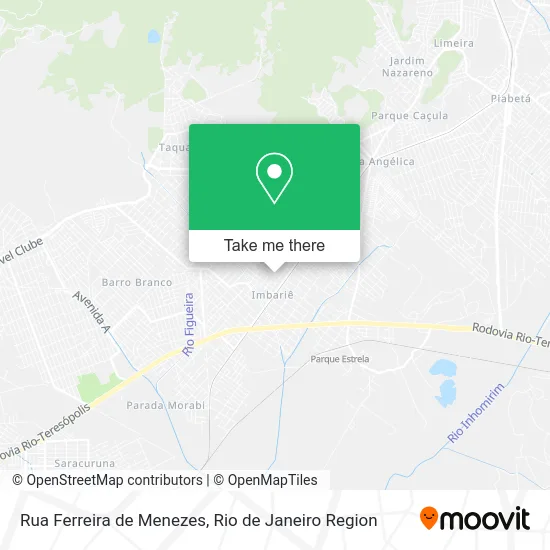
See Rua Ferreira de Menezes, Duque De Caxias, on the map
Public Transit to Rua Ferreira de Menezes in Duque De Caxias
Wondering how to get to Rua Ferreira de Menezes in Duque De Caxias? Moovit helps you find the best way to get to Rua Ferreira de Menezes with step-by-step directions from the nearest public transit station.
Moovit provides free maps and live directions to help you navigate through your city. View schedules, routes, timetables, and find out how long does it take to get to Rua Ferreira de Menezes in real time.
Looking for the nearest stop or station to Rua Ferreira de Menezes? Check out this list of stops closest to your destination: Rua Ferreira De Menezes 182; Av. Coronel Sisson 195 - Rio Imbariê Duque De Caxias; Avenida Coronel Sisson; Avenida Coronel Sisson; Rua Ipameri; Manoel Belo; Parque Estrela.
Bus: 125C, 405I, 411, 468C, 470C, 765I, 26M, 511Q, 27M, 413, 461C, EXECUTIVO, 23M, 404I, 444L.Train: EXTENSÃO GUAPIMIRIM, EXTENSÃO VILA INHOMIRIM.
Want to see if there’s another route that gets you there at an earlier time? Moovit helps you find alternative routes or times. Get directions from and directions to Rua Ferreira de Menezes easily from the Moovit App or Website.
We make riding to Rua Ferreira de Menezes easy, which is why over 1.5 million users, including users in Duque De Caxias, trust Moovit as the best app for public transit. You don’t need to download an individual bus app or train app, Moovit is your all-in-one transit app that helps you find the best bus time or train time available.
For information on prices of bus and train, costs and ride fares to Rua Ferreira de Menezes, please check the Moovit app.
Use the app to navigate to popular places including to the airport, hospital, stadium, grocery store, mall, coffee shop, school, college, and university.
Rua Ferreira de Menezes Address: R. Ferreira de Menezes - Rio Imbariê, Duque de Caxias - RJ, Brasil street in Duque De Caxias
- Rua Goiandira, 379,
- C. E. Fernando Figueiredo,
- Serv-Clean Servicos e Manutencao,
- escola municipal carlos drummond de andrade,
- Assembleia de Deus Ministerio Alfa,
- Sitio Da Esperança,
- Favo Apoio Administrativo,
- Avenida Coronel Sisson,
- Clipan Clinica de Fraturas Parada Angelica,
- Avenida Coronel Sisson,
- Gb Motos,
- Bar do Queiroz,
- Rua Uruana 2,
- Centro Médico Medical Saúde,
- Bar Altas Horas,
- F2 Fisioterapia E Pilates,
- Casas Lotericas Imbarie,
- Igreja Evangelica Assembleia de Deus de Imbarie Ministerio S,
- QQ ISSO Moda Fitness,
- Marcelo Calçados
Places Near Rua Ferreira de Menezes (Duque De Caxias)
- Niterói, Niterói,
- Shopping Rio Sul, Botafogo,
- Avenida Rio Branco, Centro,
- Museu Do Amanhã, Centro,
- Avenida Venezuela 134, Saúde,
- Rua Ulysses Guimarães 16, Cidade Nova,
- Rua Licínio Cardoso, São Francisco Xavier,
- Praia do Arpoador, Ipanema,
- Shopping RioSul, Botafogo,
- Hospital Federal Do Andaraí, Andaraí,
- Hospital Municipal Ronaldo Gazolla, Acari,
- Norte Shopping, Cachambi,
- Hospital Pedro Ernesto, Vila Isabel,
- Rio De Janeiro,
- Shopping Nova América, Del Castilho,
- Hospital Federal Cardoso Fontes, Jacarepaguá,
- Feirão De Malhas, Duque De Caxias,
- Rodoviária Novo Rio (Rodoviária do Rio de Janeiro), Santo Cristo,
- Feira Livre da Gloria, Glória,
- Shopping Downtown, Barra Da Tijuca
How to get to popular places in Rio de Janeiro Region with public transit
Get around Duque De Caxias by public transit!
Traveling around Duque De Caxias has never been so easy. See step by step directions as you travel to any attraction, street or major public transit station. View bus and train schedules, arrival times, service alerts and detailed routes on a map, so you know exactly how to get to anywhere in Duque De Caxias.
When traveling to any destination around Duque De Caxias use Moovit's Live Directions with Get Off Notifications to know exactly where and how far to walk, how long to wait for your line, and how many stops are left. Moovit will alert you when it's time to get off — no need to constantly re-check whether yours is the next stop.
Wondering how to use public transit in Duque De Caxias or how to pay for public transit in Duque De Caxias? Moovit public transit app can help you navigate your way with public transit easily, and at minimum cost. It includes public transit fees, ticket prices, and costs. Looking for a map of Duque De Caxias public transit lines? Moovit public transit app shows all public transit maps in Duque De Caxias with all Bus, Train, Metro, Light Rail, Ferry, Cable Car, Gondola and Funicular routes and stops on an interactive map.
Rio de Janeiro Region has 8 transit type(s), including: Bus, Train, Metro, Light Rail, Ferry, Cable Car, Gondola and Funicular, operated by several transit agencies, including TrensRJ, Metrô Rio, VLT Carioca, Barcas Rio, BRT MOBI-Rio, Auto Viação Alpha, Auto Viação Tijuca, Gire Transportes, Transurb, Viação Nossa Senhora das Graças, Consórcio INTERSUL, Braso Lisboa (Municipal), Caprichosa Auto Ônibus, Auto Viação Três Amigos and Rodoviária Âncora Matias