How to get to Rua Maurício da Costa Faria 55 by bus?
Click on the bus route to see step by step directions with maps, line arrival times and updated time schedules.
From Brt Américas Park - Sentido Alvorada, Barra Da Tijuca
17 minFrom Uptown Barra, Barra Da Tijuca
27 minFrom Avenida das Américas 3200, Barra Da Tijuca
26 minFrom Av. das Américas 3301, Barra Da Tijuca
29 minFrom Avenida Jorge Curi 550, Barra Da Tijuca
24 minFrom Hospital Casa São Bernardo-PS, Barra Da Tijuca
25 minFrom Avenida das Américas, Barra Da Tijuca
26 minFrom Avenida Ayrton Senna 5500, Jacarepaguá
43 minFrom Via Parque Shopping, Barra Da Tijuca
28 minFrom Estação Ricardo Marinho, Barra Da Tijuca
28 min
Bus stops near Rua Maurício da Costa Faria 55 in Recreio Dos Bandeirantes
Bus lines to Rua Maurício da Costa Faria 55 in Recreio Dos Bandeirantes
- 10, Santa Cruz,VIEW
- 11, Santa Cruz (Parador),VIEW
- 12, Alvorada,VIEW
- 13, Alvorada (Expresso),VIEW
- 14, Santa Eugênia (Expresso),VIEW
- 15, Terminal Curral Falso ,VIEW
- 16, Magarça ,VIEW
- 18, Jardim Oceânico,VIEW
- 19, Pingo D'Água (Expresso),VIEW
- 20, Santa Cruz (Expresso),VIEW
- 25, Mato Alto (Parador),VIEW
- 315, Central,VIEW
- 361, Gardênia Azul (Rio Das Pedras),VIEW
- 407T, Nova Iguaçu,VIEW
- 460S (EXECUTIVO), Barra Da Tijuca,VIEW
- 553, Recreio,VIEW
- 554, Piabas (Via Barata Ribeiro / Bartolomeu Mitre),VIEW
- SN 554, Piabas,VIEW
- 899, Barra De Guaratiba,VIEW
- SV 899, Barra De Guaratiba,VIEW
What are the closest stations to Rua Maurício da Costa Faria 55?
The closest stations to Rua Maurício da Costa Faria 55 are:
- Salvador Allende is 101 meters away, 2 min walk.
- Avenida Das Américas | Mega Box / Habib´S is 214 meters away, 3 min walk.
- Avenida Alfredo Balthazar Da Silveira, 236-412 is 308 meters away, 5 min walk.
- Terminal Do Recreio is 362 meters away, 5 min walk.
- Mundial Recreio is 460 meters away, 6 min walk.
Which bus lines stop near Rua Maurício da Costa Faria 55?
These bus lines stop near Rua Maurício da Costa Faria 55: 25, 2803, 361.
What’s the nearest bus station to Rua Maurício da Costa Faria 55 in Recreio Dos Bandeirantes?
The nearest bus station to Rua Maurício da Costa Faria 55 in Recreio Dos Bandeirantes is Salvador Allende. It’s a 2 min walk away.
What time is the first bus to Rua Maurício da Costa Faria 55 in Recreio Dos Bandeirantes?
The 51 is the first bus that goes to Rua Maurício da Costa Faria 55 in Recreio Dos Bandeirantes. It stops nearby at 3:00 AM.
What time is the last bus to Rua Maurício da Costa Faria 55 in Recreio Dos Bandeirantes?
The SN 554 is the last bus that goes to Rua Maurício da Costa Faria 55 in Recreio Dos Bandeirantes. It stops nearby at 3:40 AM.
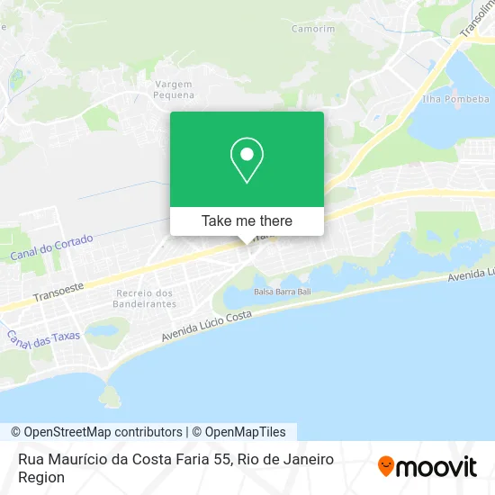
See Rua Maurício da Costa Faria 55, Recreio Dos Bandeirantes, on the map
Public Transit to Rua Maurício da Costa Faria 55 in Recreio Dos Bandeirantes
Wondering how to get to Rua Maurício da Costa Faria 55 in Recreio Dos Bandeirantes? Moovit helps you find the best way to get to Rua Maurício da Costa Faria 55 with step-by-step directions from the nearest public transit station.
Moovit provides free maps and live directions to help you navigate through your city. View schedules, routes, timetables, and find out how long does it take to get to Rua Maurício da Costa Faria 55 in real time.
Looking for the nearest stop or station to Rua Maurício da Costa Faria 55? Check out this list of stops closest to your destination: Salvador Allende; Avenida Das Américas | Mega Box / Habib´S; Avenida Alfredo Balthazar Da Silveira; Terminal Do Recreio; Mundial Recreio.
Bus: 25, 2803, 361, 10, 11, 12, 13, 14, 315, 407T, 460S (EXECUTIVO), 553, 961, 41, 51, 880, 2804.
Want to see if there’s another route that gets you there at an earlier time? Moovit helps you find alternative routes or times. Get directions from and directions to Rua Maurício da Costa Faria 55 easily from the Moovit App or Website.
We make riding to Rua Maurício da Costa Faria 55 easy, which is why over 1.5 million users, including users in Recreio Dos Bandeirantes, trust Moovit as the best app for public transit. You don’t need to download an individual bus app or train app, Moovit is your all-in-one transit app that helps you find the best bus time or train time available.
For information on prices of bus, costs and ride fares to Rua Maurício da Costa Faria 55, please check the Moovit app.
Use the app to navigate to popular places including to the airport, hospital, stadium, grocery store, mall, coffee shop, school, college, and university.
Rua Maurício da Costa Faria 55 Address: R. Maurício da Costa Faria, 55 - Recreio dos Bandeirantes, Rio de Janeiro - RJ, 22790-285, Brasil street in Recreio Dos Bandeirantes
- Consultório Dra. Patrícia Benevides,
- Laboratório Richet Recreio,
- Mercado Mundial,
- Ponto De taxi do Mundial,
- Intercontinental Central,
- Bicicletário Barra World,
- Academia X Gym Barra World,
- Avenida das Américas 13.701,
- Avenida das Américas / Rua Antônio Maroun,
- Supermercado Mundial,
- Barra World Shopping - Recreio dos Bandeirantes,
- Bali Lounge Bar & Drinkeria,
- Itaú,
- Prosper Distribuidora,
- Universidade Estácio De Sá - Campus Recreio Dos Bandeirantes,
- Barra World Shopping & Park,
- Centro Cultural Barra World,
- Shopping Barra World,
- Bradesco,
- Shopping Barra World Shopping
Places Near Rua Maurício da Costa Faria 55 (Recreio Dos Bandeirantes)
- Hospital Federal Do Andaraí, Andaraí,
- Feira Livre da Gloria, Glória,
- Shopping Downtown, Barra Da Tijuca,
- Rua Ulysses Guimarães 16, Cidade Nova,
- Shopping RioSul, Botafogo,
- Avenida Venezuela 134, Saúde,
- Feirão De Malhas, Duque De Caxias,
- Hospital Federal Cardoso Fontes, Jacarepaguá,
- Shopping Nova América, Del Castilho,
- Rio De Janeiro,
- Rodoviária Novo Rio (Rodoviária do Rio de Janeiro), Santo Cristo,
- Museu Do Amanhã, Centro,
- Niterói, Niterói,
- Praia do Arpoador, Ipanema,
- Norte Shopping, Cachambi,
- Shopping Rio Sul, Botafogo,
- Avenida Rio Branco, Centro,
- Hospital Pedro Ernesto, Vila Isabel,
- Rua Licínio Cardoso, São Francisco Xavier,
- Hospital Municipal Ronaldo Gazolla, Acari
How to get to popular places in Rio de Janeiro Region with public transit
Get around Recreio Dos Bandeirantes by public transit!
Traveling around Recreio Dos Bandeirantes has never been so easy. See step by step directions as you travel to any attraction, street or major public transit station. View bus and train schedules, arrival times, service alerts and detailed routes on a map, so you know exactly how to get to anywhere in Recreio Dos Bandeirantes.
When traveling to any destination around Recreio Dos Bandeirantes use Moovit's Live Directions with Get Off Notifications to know exactly where and how far to walk, how long to wait for your line, and how many stops are left. Moovit will alert you when it's time to get off — no need to constantly re-check whether yours is the next stop.
Wondering how to use public transit in Recreio Dos Bandeirantes or how to pay for public transit in Recreio Dos Bandeirantes? Moovit public transit app can help you navigate your way with public transit easily, and at minimum cost. It includes public transit fees, ticket prices, and costs. Looking for a map of Recreio Dos Bandeirantes public transit lines? Moovit public transit app shows all public transit maps in Recreio Dos Bandeirantes with all Bus, Train, Metro, Light Rail, Ferry, Cable Car, Gondola and Funicular routes and stops on an interactive map.
Rio de Janeiro Region has 8 transit type(s), including: Bus, Train, Metro, Light Rail, Ferry, Cable Car, Gondola and Funicular, operated by several transit agencies, including TrensRJ, Metrô Rio, VLT Carioca, Barcas Rio, BRT MOBI-Rio, Auto Viação Alpha, Auto Viação Tijuca, Gire Transportes, Transurb, Viação Nossa Senhora das Graças, Consórcio INTERSUL, Braso Lisboa (Municipal), Caprichosa Auto Ônibus, Auto Viação Três Amigos and Rodoviária Âncora Matias