How to get to Rua Prudente de Morais Neto by bus?
Click on the bus route to see step by step directions with maps, line arrival times and updated time schedules.
From Aerotown Power Center, Barra Da Tijuca
41 minFrom Av. das Americas, 3443, Jacarepaguá
50 minFrom Parque Olímpico Da Barra, Barra Da Tijuca
49 minFrom BRT - Estação Aeroporto de Jacarepaguá, Barra Da Tijuca
43 minFrom Avenida Ayrton Senna 2541, Barra Da Tijuca
40 minFrom Hospital Barra D'or, Barra Da Tijuca
42 minFrom BRT - Estação Leila Diniz, Curicica
31 minFrom BRT - Estação Pontal, Recreio Dos Bandeirantes
20 minFrom Projac - Rede Globo, Jacarepaguá
39 minFrom Terminal Alvorada - BRT, Barra Da Tijuca
26 min
Bus stops near Rua Prudente de Morais Neto in Recreio Dos Bandeirantes
Bus lines to Rua Prudente de Morais Neto in Recreio Dos Bandeirantes
- 10, Santa Cruz,VIEW
- 11, Santa Cruz (Parador),VIEW
- 12, Alvorada,VIEW
- 13, Alvorada (Expresso),VIEW
- 14, Santa Eugênia (Expresso),VIEW
- 15, Terminal Curral Falso ,VIEW
- 16, Magarça ,VIEW
- 18, Jardim Oceânico,VIEW
- 20, Santa Cruz (Expresso),VIEW
- 25, Mato Alto (Parador),VIEW
- 315, Recreio - Central (BRS 5 - via Linha Amarela),VIEW
- 361, Recreio - Castelo (Brs 5 - Via Linha Amarela),VIEW
- 407T, Nova Iguaçu - Recreio (via CEASA / Transolímpica),VIEW
- 460S (EXECUTIVO), Itaguaí - Barra da Tijuca,VIEW
- 553, Recreio - Rio Sul (Brs 3 - Via Av. das Américas / Copacabana),VIEW
- 554, Piabas - Rio Sul (Brs 3 - Via Vargem Grande / Copacabana),VIEW
- SN 554, Piabas - Metrô Botafogo (Brs 3 - Via Vargem Grande / Copacabana),VIEW
- 880, Rio das Pedras - Alvorada,VIEW
- 899, Barra de Guaratiba - Recreio (Via Túnel),VIEW
- SV 899, Barra de Guaratiba - Recreio (Via Grota Funda),VIEW
What are the closest stations to Rua Prudente de Morais Neto?
The closest stations to Rua Prudente de Morais Neto are:
- Gláucio Gil is 6 meters away, 1 min walk.
- Avenida Das Américas | Posto Ipiranga Recreio is 57 meters away, 1 min walk.
- Avenida Alfredo Balthazar Da Silveira, 2100 is 884 meters away, 12 min walk.
Which bus lines stop near Rua Prudente de Morais Neto?
These bus lines stop near Rua Prudente de Morais Neto: 10, 13, 2803, 315, 361, 954.
What’s the nearest bus station to Rua Prudente de Morais Neto in Recreio Dos Bandeirantes?
The nearest bus stations to Rua Prudente de Morais Neto in Recreio Dos Bandeirantes are Gláucio Gil and Avenida Das Américas | Posto Ipiranga Recreio. The closest one is a 1 min walk away.
What time is the first bus to Rua Prudente de Morais Neto in Recreio Dos Bandeirantes?
The 11 is the first bus that goes to Rua Prudente de Morais Neto in Recreio Dos Bandeirantes. It stops nearby at 3:16 AM.
What time is the last bus to Rua Prudente de Morais Neto in Recreio Dos Bandeirantes?
The SN 554 is the last bus that goes to Rua Prudente de Morais Neto in Recreio Dos Bandeirantes. It stops nearby at 3:43 AM.
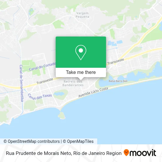
See Rua Prudente de Morais Neto, Recreio Dos Bandeirantes, on the map
Public Transit to Rua Prudente de Morais Neto in Recreio Dos Bandeirantes
Wondering how to get to Rua Prudente de Morais Neto in Recreio Dos Bandeirantes? Moovit helps you find the best way to get to Rua Prudente de Morais Neto with step-by-step directions from the nearest public transit station.
Moovit provides free maps and live directions to help you navigate through your city. View schedules, routes, timetables, and find out how long does it take to get to Rua Prudente de Morais Neto in real time.
Looking for the nearest stop or station to Rua Prudente de Morais Neto? Check out this list of stops closest to your destination: Gláucio Gil; Avenida Das Américas | Posto Ipiranga Recreio; Avenida Alfredo Balthazar Da Silveira.
Bus: 10, 13, 2803, 315, 361, 954, 11, 12, 14, 407T, 460S (EXECUTIVO), 553, 961.
Want to see if there’s another route that gets you there at an earlier time? Moovit helps you find alternative routes or times. Get directions from and directions to Rua Prudente de Morais Neto easily from the Moovit App or Website.
We make riding to Rua Prudente de Morais Neto easy, which is why over 1.5 million users, including users in Recreio Dos Bandeirantes, trust Moovit as the best app for public transit. You don’t need to download an individual bus app or train app, Moovit is your all-in-one transit app that helps you find the best bus time or train time available.
For information on prices of bus, costs and ride fares to Rua Prudente de Morais Neto, please check the Moovit app.
Use the app to navigate to popular places including to the airport, hospital, stadium, grocery store, mall, coffee shop, school, college, and university.
Rua Prudente de Morais Neto Address: R. Prudente de Morais Neto street in Recreio Dos Bandeirantes
- Recreio Brasa,
- RTO Recreio Trauma Ortopedia,
- Spaço Zen Estética e Saúde,
- Consultório De Dermatologia Dra Ana Maria Rabello,
- Asa Rio Restaurante,
- Colégio Recanto,
- CNA Ingles Definitivo,
- NEAM - Núcleo Espírita Alan de Mello,
- Praticità,
- Climapoint - Ar Condicionado e Exaustão,
- Creche Sinha Marreca,
- Rua Octávio de Faria 41,
- Zona 9 Seção 305,
- Rua Roberval Cordeiro de Farias / Rua Octávio de Faria,
- Centro de Quiropraxia Casa da Coluna,
- Casa Da Coluna,
- Creche Casa na Árvore,
- Avenida Genaro de Carvalho 1209,
- Academia Orange Wellness And Fitness,
- Padaria Nobreza
Places Near Rua Prudente de Morais Neto (Recreio Dos Bandeirantes)
- Shopping Downtown, Barra Da Tijuca,
- Niterói, Niterói,
- Rua Licínio Cardoso, São Francisco Xavier,
- Praia do Arpoador, Ipanema,
- Shopping Nova América, Del Castilho,
- Museu Do Amanhã, Centro,
- Rua Ulysses Guimarães 16, Cidade Nova,
- Hospital Federal Do Andaraí, Andaraí,
- Hospital Federal Cardoso Fontes, Jacarepaguá,
- Hospital Pedro Ernesto, Vila Isabel,
- Shopping RioSul, Botafogo,
- Feirão De Malhas, Duque De Caxias,
- Hospital Municipal Ronaldo Gazolla, Acari,
- Feira Livre da Gloria, Glória,
- Avenida Venezuela 134, Saúde,
- Norte Shopping, Cachambi,
- Shopping Rio Sul, Botafogo,
- Avenida Rio Branco, Centro,
- Rodoviária Novo Rio (Rodoviária do Rio de Janeiro), Santo Cristo,
- Rio De Janeiro
How to get to popular places in Rio de Janeiro Region with public transit
Get around Recreio Dos Bandeirantes by public transit!
Traveling around Recreio Dos Bandeirantes has never been so easy. See step by step directions as you travel to any attraction, street or major public transit station. View bus and train schedules, arrival times, service alerts and detailed routes on a map, so you know exactly how to get to anywhere in Recreio Dos Bandeirantes.
When traveling to any destination around Recreio Dos Bandeirantes use Moovit's Live Directions with Get Off Notifications to know exactly where and how far to walk, how long to wait for your line, and how many stops are left. Moovit will alert you when it's time to get off — no need to constantly re-check whether yours is the next stop.
Wondering how to use public transit in Recreio Dos Bandeirantes or how to pay for public transit in Recreio Dos Bandeirantes? Moovit public transit app can help you navigate your way with public transit easily, and at minimum cost. It includes public transit fees, ticket prices, and costs. Looking for a map of Recreio Dos Bandeirantes public transit lines? Moovit public transit app shows all public transit maps in Recreio Dos Bandeirantes with all Bus, Train, Metro, Light Rail, Ferry, Cable Car, Gondola and Funicular routes and stops on an interactive map.
Rio de Janeiro Region has 8 transit type(s), including: Bus, Train, Metro, Light Rail, Ferry, Cable Car, Gondola and Funicular, operated by several transit agencies, including TrensRJ, Metrô Rio, VLT Carioca, Barcas Rio, BRT MOBI-Rio, Auto Viação Alpha, Auto Viação Tijuca, Gire Transportes, Transurb, Viação Nossa Senhora das Graças, Consórcio INTERSUL, Braso Lisboa (Municipal), Caprichosa Auto Ônibus, Auto Viação Três Amigos and Rodoviária Âncora Matias