Directions to Rucks Unltd. (Boston) with public transportation
The following transit lines have routes that pass near Rucks Unltd.
 Bus: 34, 34E, 35, 37, 39.
- Train: FRANKLIN/FOXBORO, NEEDHAM, PROVIDENCE/STOUGHTON.
- Subway: ORANGE LINE.
How to get to Rucks Unltd. by bus?
Click on the bus route to see step by step directions with maps, line arrival times and updated time schedules.
From USS Constitution (USS Constitution Museum), Boston
91 minFrom Seimans CT Scanner - Blake Building (MGH), Boston
62 minFrom Fort Independence, Boston
84 minFrom Inman Square, Cambridge
82 minFrom Uss Constitution, Boston
92 minFrom Huntington Theatre Company, Boston
36 minFrom Warren Tavern, Boston
89 minFrom Costco, Dedham
42 minFrom Wentworth Institute Of Technology, Boston
31 minFrom The Tall Ship, Boston
96 min
How to get to Rucks Unltd. by train?
Click on the train route to see step by step directions with maps, line arrival times and updated time schedules.
How to get to Rucks Unltd. by subway?
Click on the subway route to see step by step directions with maps, line arrival times and updated time schedules.
From USS Constitution (USS Constitution Museum), Boston
57 minFrom Seimans CT Scanner - Blake Building (MGH), Boston
48 minFrom Inman Square, Cambridge
63 minFrom Uss Constitution, Boston
58 minFrom Huntington Theatre Company, Boston
31 minFrom Warren Tavern, Boston
47 minFrom Wentworth Institute Of Technology, Boston
35 minFrom The Tall Ship, Boston
49 min
Bus stops near Rucks Unltd. in Boston
Subway station near Rucks Unltd. in Boston
- Green Street, 18 min walk,VIEW
Train stations near Rucks Unltd. in Boston
Bus lines to Rucks Unltd. in Boston
- 30, Forest Hills - Mattapan,VIEW
- 34, Forest Hills - Dedham Mall,VIEW
- 35, Forest Hills - Dedham Mall,VIEW
- 36, Forest Hills - VA Hospital,VIEW
- 37, Forest Hills - Baker & Vermont St,VIEW
- 40, Forest Hills - Georgetowne,VIEW
- 50, Forest Hills - Cleary Square,VIEW
- 51, Forest Hills - Reservoir,VIEW
- 34E, Forest Hills - Walpole Center via Washington St,VIEW
- 39, Haymarket Via Forest Hills,VIEW
- 32, Cleary Square,VIEW
- 33, River & Milton Via Cleary Square,VIEW
What are the closest stations to Rucks Unltd.?
The closest stations to Rucks Unltd. are:
- 3867 Washington St Opp Tollgate Way is 133 yards away, 2 min walk.
- Washington St @ Tollgate Way is 159 yards away, 2 min walk.
- Hyde Park Ave Opp Walk Hill St is 746 yards away, 9 min walk.
- Green Street is 1446 yards away, 18 min walk.
- Roslindale Village is 1668 yards away, 20 min walk.
- Forest Hills is 2813 yards away, 33 min walk.
Which bus lines stop near Rucks Unltd.?
These bus lines stop near Rucks Unltd.: 34, 34E, 35, 37, 39, 40, 50, 51.
Which train lines stop near Rucks Unltd.?
These train lines stop near Rucks Unltd.: FRANKLIN/FOXBORO, NEEDHAM.
Which subway line stops near Rucks Unltd.?
ORANGE LINE (Forest Hills)
What’s the nearest subway station to Rucks Unltd. in Boston?
The nearest subway station to Rucks Unltd. in Boston is Green Street. It’s a 18 min walk away.
What’s the nearest train station to Rucks Unltd. in Boston?
The nearest train station to Rucks Unltd. in Boston is Roslindale Village. It’s a 20 min walk away.
What’s the nearest bus station to Rucks Unltd. in Boston?
The nearest bus stations to Rucks Unltd. in Boston are 3867 Washington St Opp Tollgate Way and Washington St @ Tollgate Way. The closest one is a 2 min walk away.
What time is the first subway to Rucks Unltd. in Boston?
The ORANGE LINE is the first subway that goes to Rucks Unltd. in Boston. It stops nearby at 5:15 AM.
What time is the last subway to Rucks Unltd. in Boston?
The ORANGE LINE is the last subway that goes to Rucks Unltd. in Boston. It stops nearby at 1:58 AM.
What time is the first train to Rucks Unltd. in Boston?
The NEEDHAM is the first train that goes to Rucks Unltd. in Boston. It stops nearby at 7:27 AM.
What time is the last train to Rucks Unltd. in Boston?
The PROVIDENCE/STOUGHTON is the last train that goes to Rucks Unltd. in Boston. It stops nearby at 12:08 AM.
What time is the first bus to Rucks Unltd. in Boston?
The 39 is the first bus that goes to Rucks Unltd. in Boston. It stops nearby at 4:35 AM.
What time is the last bus to Rucks Unltd. in Boston?
The 36 is the last bus that goes to Rucks Unltd. in Boston. It stops nearby at 1:42 AM.
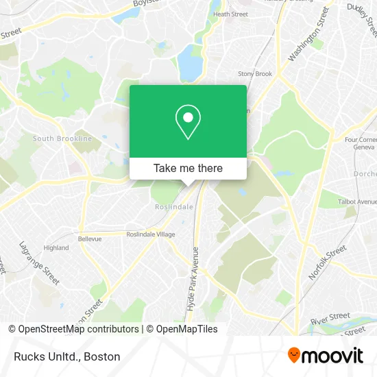
See Rucks Unltd., Boston, on the map
Public Transit to Rucks Unltd. in Boston
Wondering how to get to Rucks Unltd. in Boston? Moovit helps you find the best way to get to Rucks Unltd. with step-by-step directions from the nearest public transit station.
Moovit provides free maps and live directions to help you navigate through your city. View schedules, routes, timetables, and find out how long does it take to get to Rucks Unltd. in real time.
Looking for the nearest stop or station to Rucks Unltd.? Check out this list of stops closest to your destination: 3867 Washington St Opp Tollgate Way; Washington St @ Tollgate Way; Hyde Park Ave Opp Walk Hill St; Green Street; Roslindale Village; Forest Hills.
Bus: 34, 34E, 35, 37, 39, 40, 50, 51, 30, 36, 32, 33.Train: FRANKLIN/FOXBORO, NEEDHAM, PROVIDENCE/STOUGHTON.Subway: ORANGE LINE.
Want to see if there’s another route that gets you there at an earlier time? Moovit helps you find alternative routes or times. Get directions from and directions to Rucks Unltd. easily from the Moovit App or Website.
We make riding to Rucks Unltd. easy, which is why over 1.7 million users, including users in Boston, trust Moovit as the best app for public transit. You don’t need to download an individual bus app or train app, Moovit is your all-in-one transit app that helps you find the best bus time or train time available.
For information on prices of bus, subway and train, costs and ride fares to Rucks Unltd., please check the Moovit app.
Use the app to navigate to popular places including to the airport, hospital, stadium, grocery store, mall, coffee shop, school, college, and university.
Rucks Unltd. Address: 44 Lochdale Rd street in Boston
- Extra Space Storage,
- La Nueva Magia Barbershop,
- Finishing Trades Inst of New Englnd,
- Iupat Dc35,
- Danerys Beauty Salon,
- Corporate Consultants 2c,
- Foundation for A Green Future,
- Boston Greenfest,
- Boston Electronics,
- BF's,
- Little Luff Childcare,
- Montello,
- Doherty Lumber,
- Guira Y Tambora,
- Awaken City Church,
- D & R Supermarkets,
- El Fogon Tipico Dominicano,
- 4040 Washington St Condos,
- Young Achievers School,
- PP*Btu Family Council
Places Near Rucks Unltd. (Boston)
- Quincy Market, Boston,
- Museum Of Science, Boston,
- Cheers, Boston,
- North End, Boston,
- Castle Island, Boston,
- Seaport District, Boston,
- Wilbur Theatre, Boston,
- Td Garden, Boston,
- Mgm Music Hall, Boston,
- Isabella Stewart Gardner Museum, Boston,
- Boston Children's Hospital, Boston,
- Boston Medical Center, Boston,
- Wang Theater, Boston,
- House Of Blues, Boston,
- Prudential Center, Boston,
- Faneuil Hall, Boston,
- Leader Bank Pavilion (Leader Bank Pavillion), Boston,
- Boston Common, Boston,
- Massachusetts General Hospital, Boston,
- Boston Convention & Exhibition Center, Boston
How to get to popular places in Boston with public transit
Get around Boston by public transit!
Traveling around Boston has never been so easy. See step by step directions as you travel to any attraction, street or major public transit station. View bus and train schedules, arrival times, service alerts and detailed routes on a map, so you know exactly how to get to anywhere in Boston.
When traveling to any destination around Boston use Moovit's Live Directions with Get Off Notifications to know exactly where and how far to walk, how long to wait for your line, and how many stops are left. Moovit will alert you when it's time to get off — no need to constantly re-check whether yours is the next stop.
Wondering how to use public transit in Boston or how to pay for public transit in Boston? Moovit public transit app can help you navigate your way with public transit easily, and at minimum cost. It includes public transit fees, ticket prices, and costs. Looking for a map of Boston public transit lines? Moovit public transit app shows all public transit maps in Boston with all Bus, Train, Subway and Ferry routes and stops on an interactive map.
Boston has 4 transit type(s), including: Bus, Train, Subway and Ferry, operated by several transit agencies, including MBTA, Southeastern Regional Transit Authority, MetroWest Regional Transit Authority, Rhode Island Public Transit Authority, WRTA, Lowell Regional Transit Authority, Merrimack Valley Transit, Montachusett Regional Transit Authority, Cape Cod Regional Transit Authority, Brockton Area Transit Authority, Martha's Vineyard Transit Authority, the WAVE - Nantucket Regional Transit Authority, GATRA, Cape Ann Transportation Authority and Massport