How to get to Salem Five Bank by bus?
Click on the bus route to see step by step directions with maps, line arrival times and updated time schedules.
From Assembly Square, Somerville
85 minFrom Lynn, MA, Lynn
51 minFrom Wegmans, Medford
66 minFrom Nahant Beach, Nahant
73 minFrom DoubleTree by Hilton Boston Logan Airport Chelsea, Chelsea
69 minFrom La Quinta, Somerville
83 minFrom La Quinta Inn & Suites Boston Somerville, Somerville
83 minFrom Assembly Square Mall Shopping Center, Somerville
93 minFrom Constitution Beach, Boston
118 minFrom Malden Catholic High School, Malden
38 min
Bus stop near Salem Five Bank in Saugus
- 190 Main St, 9 min walk,VIEW
Bus lines to Salem Five Bank in Saugus
- 428, Oaklandvale Via Cliftondale (Express),VIEW
What are the closest stations to Salem Five Bank?
The closest stations to Salem Five Bank are:
- 190 Main St is 674 yards away, 9 min walk.
Which bus lines stop near Salem Five Bank?
These bus lines stop near Salem Five Bank: 429, 430.
What’s the nearest bus station to Salem Five Bank in Saugus?
The nearest bus station to Salem Five Bank in Saugus is 190 Main St. It’s a 9 min walk away.
What time is the first bus to Salem Five Bank in Saugus?
The 428 is the first bus that goes to Salem Five Bank in Saugus. It stops nearby at 6:00 AM.
What time is the last bus to Salem Five Bank in Saugus?
The 428 is the last bus that goes to Salem Five Bank in Saugus. It stops nearby at 6:58 PM.
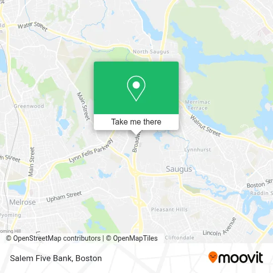
See Salem Five Bank, Saugus, on the map
Public Transit to Salem Five Bank in Saugus
Wondering how to get to Salem Five Bank in Saugus? Moovit helps you find the best way to get to Salem Five Bank with step-by-step directions from the nearest public transit station.
Moovit provides free maps and live directions to help you navigate through your city. View schedules, routes, timetables, and find out how long does it take to get to Salem Five Bank in real time.
Looking for the nearest stop or station to Salem Five Bank? Check out this list of stops closest to your destination: 190 Main St.
Bus: 429, 430, 428.
Want to see if there’s another route that gets you there at an earlier time? Moovit helps you find alternative routes or times. Get directions from and directions to Salem Five Bank easily from the Moovit App or Website.
We make riding to Salem Five Bank easy, which is why over 1.7 million users, including users in Saugus, trust Moovit as the best app for public transit. You don’t need to download an individual bus app or train app, Moovit is your all-in-one transit app that helps you find the best bus time or train time available.
For information on prices of bus and subway, costs and ride fares to Salem Five Bank, please check the Moovit app.
Use the app to navigate to popular places including to the airport, hospital, stadium, grocery store, mall, coffee shop, school, college, and university.
Salem Five Bank Address: 855 Broadway street in Saugus
- Budget Services,
- Asurion Tech Repair & Solutions,
- Aspen Dental,
- Sunflower Cleaning,
- Sunoco,
- Coinbridge Bitcoin Atm,
- Burger King,
- Sullivan Tire & Auto Service,
- Nickole Auto Body,
- Route 1 Grill House,
- Harbor Freight,
- Avalon Saugus,
- Five Guys,
- Raising Cane's,
- Avalon Saugus,
- Airport Parking Boston 1,
- Cabot House Furniture & Design,
- Alto Decor Llc,
- Walmart,
- Western Union
Places Near Salem Five Bank (Saugus)
- Wang Theater, Boston,
- Isabella Stewart Gardner Museum, Boston,
- Leader Bank Pavilion (Leader Bank Pavillion), Boston,
- North End, Boston,
- Castle Island, Boston,
- Quincy Market, Boston,
- Boston Common, Boston,
- Boston Children's Hospital, Boston,
- Prudential Center, Boston,
- Faneuil Hall, Boston,
- Seaport District, Boston,
- House Of Blues, Boston,
- Boston Medical Center, Boston,
- Museum Of Science, Boston,
- Cheers, Boston,
- Mgm Music Hall, Boston,
- Boston Convention & Exhibition Center, Boston,
- Wilbur Theatre, Boston,
- Td Garden, Boston,
- Massachusetts General Hospital, Boston
How to get to popular places in Boston with public transit
Get around Saugus by public transit!
Traveling around Saugus has never been so easy. See step by step directions as you travel to any attraction, street or major public transit station. View bus and train schedules, arrival times, service alerts and detailed routes on a map, so you know exactly how to get to anywhere in Saugus.
When traveling to any destination around Saugus use Moovit's Live Directions with Get Off Notifications to know exactly where and how far to walk, how long to wait for your line, and how many stops are left. Moovit will alert you when it's time to get off — no need to constantly re-check whether yours is the next stop.
Wondering how to use public transit in Saugus or how to pay for public transit in Saugus? Moovit public transit app can help you navigate your way with public transit easily, and at minimum cost. It includes public transit fees, ticket prices, and costs. Looking for a map of Saugus public transit lines? Moovit public transit app shows all public transit maps in Saugus with all Bus, Train, Subway and Ferry routes and stops on an interactive map.
Boston has 4 transit type(s), including: Bus, Train, Subway and Ferry, operated by several transit agencies, including MBTA, Southeastern Regional Transit Authority, MetroWest Regional Transit Authority, Rhode Island Public Transit Authority, WRTA, Lowell Regional Transit Authority, Merrimack Valley Transit, Montachusett Regional Transit Authority, Cape Cod Regional Transit Authority, Brockton Area Transit Authority, Martha's Vineyard Transit Authority, the WAVE - Nantucket Regional Transit Authority, GATRA, Cape Ann Transportation Authority and Massport